JD is working his way through dayhiking the SPS list and has a few long days to go. He originally wanted to do a huge day with me, but I probably wisely chose for a slightly lesser day - Arrow and Pyramid peaks. I had admired Arrow from the top of Ruskin and other peaks around there so it was on my radar, but was far enough back that it seemed more of a backpacking peak than a dayhike peak, especially combined with Pyramid - even farther out there.
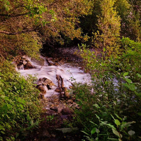
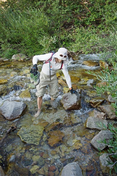
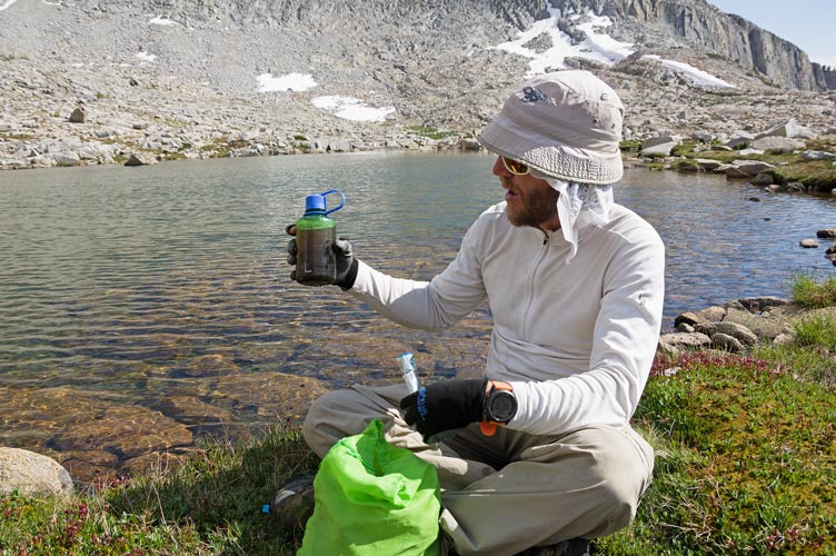
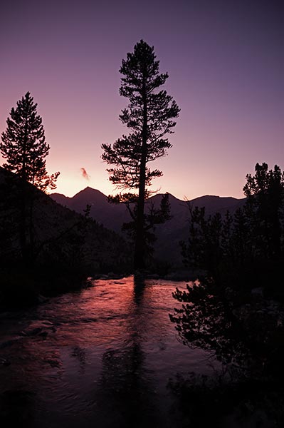
08-24-2019 As usual we weren't exactly well rested. Sure I had probably recovered from the Sierra Challenge, but the day before we carried climbing gear up to the Fishhook Arete on Mt Russell and climbed that - an enjoyable outing, but still a bit of a legs day. Combined with very little sleep for the previous 2 nights for JD and not so much sleep for me the night before and things weren't feeling quite so great. Still we had some stoke and started off at 4:11 am. The Taboose Pass trail starts down in the desert and would be extremely hot once the sun was up, but it was cool enough in the dark. We trundled up the trail at what seemed like a decent but not fast pace for nearly 2 hours to the first stream crossing. The trail seemed steeper and covered with more loose rocks than I remembered. It probably wasn't steeper, but the loose rocks and overgrowing plants probably were worse. At the crossing we discovered fairly high water over the logs and rocks so that we would have to wade. Off came the shoes and the foot and ankle pain began. I was glad to have trekking poles. At this point it was starting to get light so we were able to turn off the headlights even though we were in the trees. At the next stream crossing I was able to balance and use my poles to get across with dry feet but after getting stung by a slippery rock in a recent hike JD opted for another wade. This happened at a number of the stream crossings that day and gave me short rests and a chance to eat gooseberries.
| |
|---|
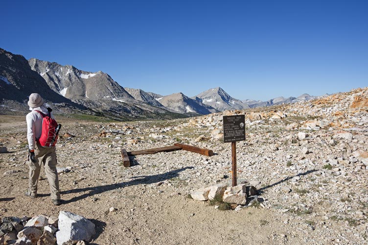
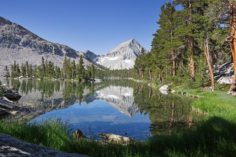
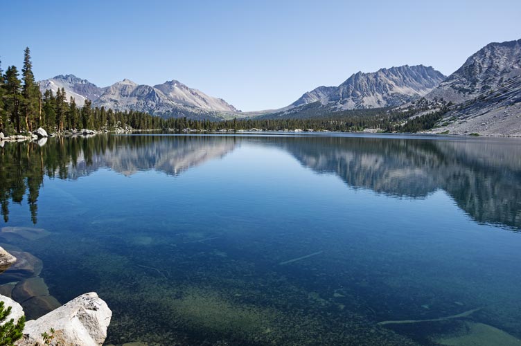
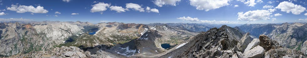
We continued on up the fairly relentless trail passing a few campers and a snowpatch on up to the pass at about 8:35. This was not a particularly fast pace, but we were in for the long haul and were glad to be finished with the first big uphill push. We also got our first view of the peak - so far away. After a short snack we headed on down the trail even trotting a few of the downhills. When we hit the PCT/JMT there was a group of people there and they pointed us in the correct direction (we had to head south on the trail a little bit as opposed to north as some online direction or report had said). We headed up the trail passing another party before a stream crossing and the trail to Bench Lake. This trail headed downhill which felt nice at the time but I knew meant uphill on the return. As expected Bench Lake was gorgeous, but there was enough wind to keep the iconic reflection pic from being quite perfect and enough mosquitoes to discourage lingering or swimming.
 |
|---|
 |
|---|
 |
|---|
 |
|---|
 |
|---|
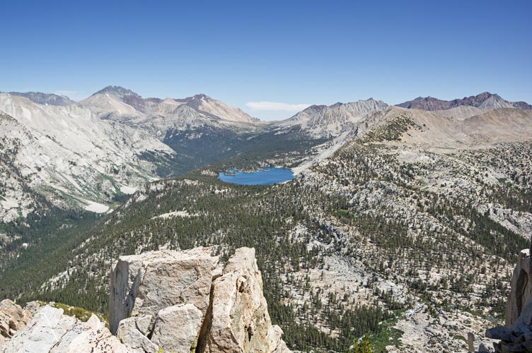
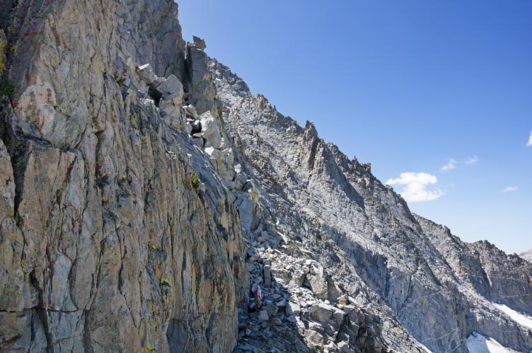
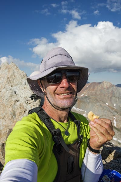
For some reason I had the impression that the climb up Arrow started shortly after the lake. This is not true, first you have go a ways and drop down into a stream valley and then you get to start up the ridge. The stream had a lot of deposits along the banks - perhaps it comes from a hot spring? The water wasn't very cold either. When we stopped to get water, the mosquitoes swarmed. It might not have been the worst I've seen them, but it was close and I was hot and stuck there getting water. I can only imagine how much worse it would be with shorts and just a t-shirt. I was routinely swatting at 5-10 on each shoulder and my glove palms had red streaks from the blood. As soon as we could we left for the refuge of sunny rock slabs, sadly the blood suckers followed us there and up the climb to the ridge for hundreds of feet. Finally we found a little relief much higher away from the water with a slight breeze. At this point we were 7 hours in and finally starting up our objective. The ridge had some nice scrambling but it was hard to tell if we should have stayed on the ridge itself (mostly yes) or dodge to the side to avoid the more technical scrambling (probably easier). I was no longer moving particularly fast and the pep had left my step. Still I was able to keep moving, especially when it was steep enough to use my hands. I ate a bit and drank some energy shot, but it didn't seem to help much. We kept moving up slowly and then JD answered natures call and ate some food and caffeine and quickly caught up and passed me. We also saw some people ahead on the ridge (which would explain the voices JD kept hearing) and soon passed them, a group of 3 that were part of a Sierra Club outing. JD was moving fast now, I was still moving. He made it to the summit well before me, but I still made it to the 12959 ft summit around 2 pm before the trail runners JD had talked to at the trailhead the night before - one of them I had seen last year when I was out backpacking and they didn't get an early enough start and only ran out to Bench Lake. This year they started at 6:30 and almost beat us to the summit. At one point there were 9 people on this remote peak - and it wasn't even a Sierra Challenge day. I was very relieved to have made it, although Pyramid still looked very far away.
 |
|---|
 |
|---|
 |
|---|
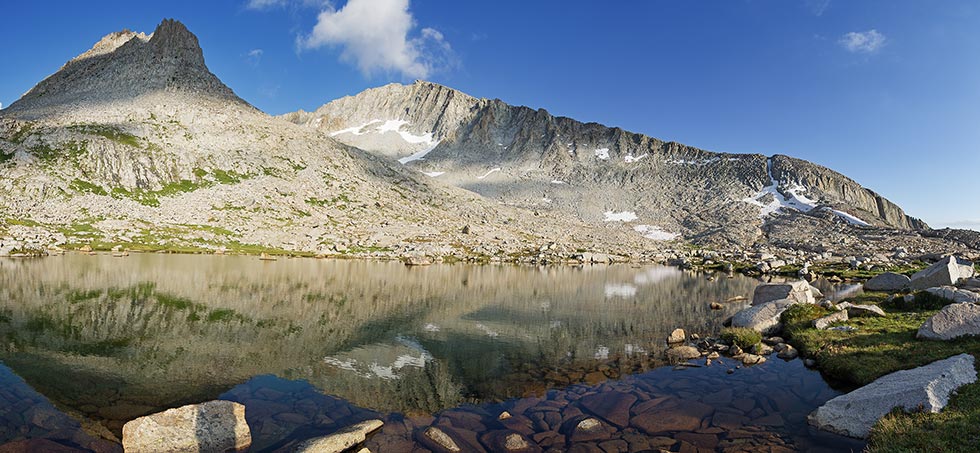
I ate some much needed food including the requisite summit cookie before we headed off towards Pyramid. We hadn't gone far when yelling from the summit made us realize JD had forgotten his satellite communicator - fortunately we hadn't gone so very far, and one of the trail runners met JD with it as he returned to pick it up. We dropped down to Arrow Pass to inspect it - it looked loose and dirty, before continuing down to the lake in the basin below. It was fairly easy cross country travel across the basin and up to some lakes below Pyramid. Here JD was starting to worry about making it back in his 24 hour time window since we had been going about 12 hours and we were still going away from the trailhead. It looked like a long ways to go and we did not make good time on the way up Arrow. We sized things up and did some mental calculations and ate and drank some more. We decided to go for it. We were getting back a little more energy and stoke and made good time up the slope to the ridge down from Pyramid. We seemed to be making good time up that, but then after a while the summit seemed to be receding - it turns out there is a long section of ridge that isn't visible when you first get onto it. We slogged up that gradually running out of stoke and energy, but at least now we were seeing footprints and the top seemed closer. Finally we made it just after 5 pm. Sadly we only spotted the lid of the summit register, but the views were quite spectacular and I finished up my summit cookie crumbs and my last sandwich as well as some bites of leftover pizza. At least now we felt like we were going to make the 24 hour cutoff, although we probably wouldn't make my wish of getting back to a trail before dark.
 |
|---|
 |
|---|
We made pretty good time heading down the ridge and soon were back at the tarn below Pyramid Peak. There JD stopped for water and I continued on cutting below the cliff on some talus. Once back on the grass. I stopped to put away my sunglasses and stand on my head for a while in the hopes of reviving my tired legs. This actually seemed to work, but I could no longer see JD behind me. I moved to a better spot to see, but couldn't spot him. Eventually I yelled and heard his answer from ahead of me, somehow he had passed by. I needed to hurry to try to catch up, but although I was steady I wasn't fast. Finally I saw him near Arrow Pass. There we dropped down the very loose sand and gravel on rocks following some footprints. As soon as I could I got onto the snow which was a little scary without an ice axe, but I was able to slide from shallow sun cup to shallow sun cup or rock hole until the angle eased a bit. As I passed JD he joined me on the snow. Once this snowfield ran out we traversed to another and from there to a steep slab. We continued down this to a level bench which we easily walked along to the creek crossing. I managed a heroic (actually not that far) trekking pole jump while JD waded - he said the water was not cold - more evidence of at least a warm spring? Then we both fed the mosquitoes while he put his shoes back on and I put away my camera and hat and got out my headlamp.
 |
|---|
 |
|---|
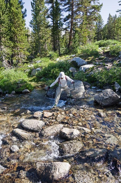
The next bit was much easier than we expected as we walked along slabs and open forest. We even saw a few cairns. Unfortunately we were lulled into complacency and ended up going too far north and down crossing our approach route at 90 degrees. Once we looked at the gps and map we realized our mistake and backtracked and diagonalled back up onto our track. JD led the way through the woods and eventually to Bench Lake. We were mighty glad to see the path there. By now I was feeling fairly strong so I put the trekking poles to work and started powering up the trail. JD stopped at a stream crossing to take off his shoes while I side-tracked to some rocks and a log. We continued on uphill and finally to the open meadow by the JMT/PCT junction. This was by a creek and most of the leaves were covered with little water drops that reflected the headlamp light making it look silvery. The rocks I think we used to cross in the morning were underwater but I found another spot to make a pole assisted leap. JD waded. Then we took a break for some more food and I drank the last 2 hours worth of the "maximum energy shot" that Iris had given me. It seemed to work, as I was able to lead the uphill 3 miles to the pass in under an hour arriving just before 11 pm. JD was sort of hurting here, but he wasn't far behind. I did a short headstand but when JD arrived we continued over to get to the creek crossing for more water. JD mentioned that we had time for a swim if we wanted, but it was cold and I figured that even if in the long run I'd appreciate it in the short run it would be too traumatic. Plus it would take time.
After getting a bit more water we headed down. I was still in the lead and tried to go quickly, although I was slower than jogging I was moving fairly well. The poles saved me from falling many times. The trail passed in a blur of rocks in the circle of the headlamp as well as pain in my feet and legs and stumbling along as fast as felt safe. Finally we made it to the last stream crossing. This one we both had to wade. When I started walking again the balls of my feet really hurt. Here JD took the lead jogging most of the way unless it was particularly steep and rocky or uphill. I just tried to keep up. The last bit in the desert seemed to go on forever, but finally we finished up at 1:53 am. 3 hours for the descent from the pass and a total time of 21:42. Some of the time splits were pretty weak, but we kept moving and managed the peaks we wanted and made it back within the 24 hour limit. I hope that the road and the trail to Taboose Pass both get some work before I see them again.