experimenting with getting trip reports done even if I don't have that many photos or words written in the belief that something is better than nothing, we shall see how this works out.
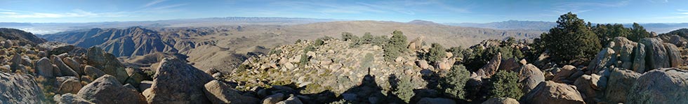
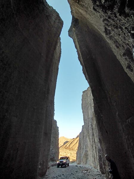
For the long weekend of Jan 15-18, 2021 we drove down on Wednesday evening (the 14th) to the Ruth Mine, Thursday the 15th we got up early and hiked up Argus Peak. We were driving the Malibu so weren't able to get as far up the dirt road as we might have with my truck let alone with a 4 wheel drive vehicle. The first part of the hike was up the road over a hill. From the end of the road we headed across a wash and then steeply uphill. We followed a lumpy ridge up and around and finally took an interesting detour through a bunch of large boulders before a final shallow saddle (that had burned fairly recently) and then up to the summit. This last saddle looks like it has some good bouldering, but the approach is pretty serious. The way up to the summit wasn't obvious, I managed to find a better line than Iris did. After signing the summit register we went a short distance to what appeared to be the actual high point - a large boulder. After scrambling to the top of this boulder we were rewarded with very nice views to the west.
We made better time on the descent both by taking a more direct line and skipping the scenic detour and because downhill travel is a lot faster. On the last steep descent to the wash and the road Iris slipped a number of times. One of them landed her thigh on a sharp rock which punched through her pants and leg in a rather painful fashion. Weeks later it is still a bruised wound. Then we walked the rest of the way down the road and drove south.
| |
|---|
After a rather long drive we left the paved road and made our way slowly up the washboarded dirt road with a number of large trucks, trailers, and ORVs. We parked on the side of the road and headed cross country to follow a faint road up toward East Ord Mountain. I was moving relatively slowly and we only made it up to the summit just after sunset. I wanted to get some drone pics and video, but decided it was too windy. We didn't linger long on the summit before heading down the ridge. It was easier travel than the gully we came up. Back at the road I took a tiny detour to an open mine. I opted not to crawl through the narrow entrance, but did enjoy seeing a few bats flying out. It was rather cold when we made it back to the car, so we just drove off slowly on the dirt road. We washed up a bit at a gas station before driving on to meet Bob near the I-15 and Mojave Trail road.
 |
|---|
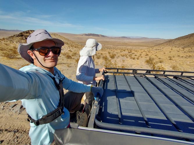
1-16-2021 We packed up and drove to I-15 to meet up with Tom who drove up that morning and leave Iris' car. Then we headed off in 2 jeeps to drive up the Mojave Trail - almost immediately we were stopped by a gate and no trespassing sign. After consulting various electronic maps we re-routed around to another way to get to where we wanted to go. We could almost drive to the first bump - "The Knob" - with all of 20 feet of prominence. We walked over to that bump before dropping into the sandy Mojave River bed to head to the next destination - "Buwalda Ridge", this took a bit more effort to get up, but was far from spectacular. Then on to some more - requiring a bit more Jeeping and walking. Peak 2503 and Peak 2805. There was a bunch of trash and mining stuff at the start for the 2805. These included a number of vehicle carcasses.
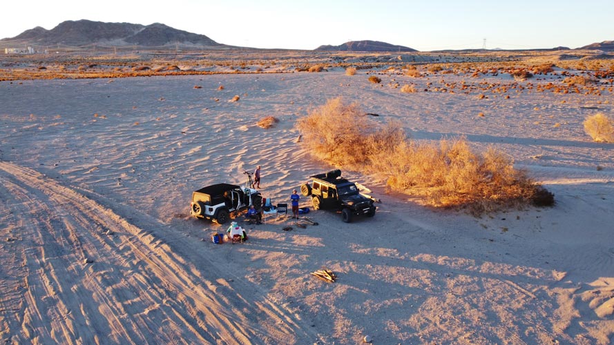
Next up were 2 more peaks which required more Jeeping. Bob's jeep failed to make it up a long sandy hill but Tom's did, so Bob and I jumped on the back to make it up to the next start. This hike was a bit longer than the previous 2. Still not that far, but it was something around 2.8 miles and 1600 feet of elevation gain. The peaks were 3147 and 3011. Tom's hurt ankle/foot kept him from making the hike, so he found a way to get closer to the second peak and rearranged our gear so we could all fit in. Fortunately it was pretty easy to get back down the sandy hill and we went back to the Mojave River bed where we set up camp for the night. One advantage of camping in the river bed was a lot of sandy space as well as plenty of firewood - you just had to avoid burning the treated lumber pieces.
 |
|---|
 |
|---|
Tom had brought one of his telescopes, so we observed some things with that until it's gearbox stripped. The sky wasn't actually all that dark here - with Vegas and LA off in opposite directions not to mention I-15 not that far apart.
1-17-2021 We packed up and drove through Afton Canyon - this is a section of the Mojave River where bedrock brings the water to the surface - not a lot of water, but it doesn't take much to make a difference in the desert. There is also a train line through the canyon as well as some interesting steep eroded cliffs. We made a few stops to check out some of these before stopping to make another peak (2140). We didn't take the quickest way up to the peak, but it was a nice sort of loop route up the rounded ridge. Once again Tom was able to drive to where we descended saving us some extra walking.
 |
|---|
The next peak was on the other side of the river, we had some navigational issues because a mine had closed off some roads, but then we managed to get to where we could hike up peak 1620 - this had a lot of limestone and marble making for prickly but good traction.
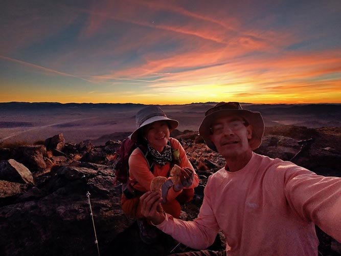
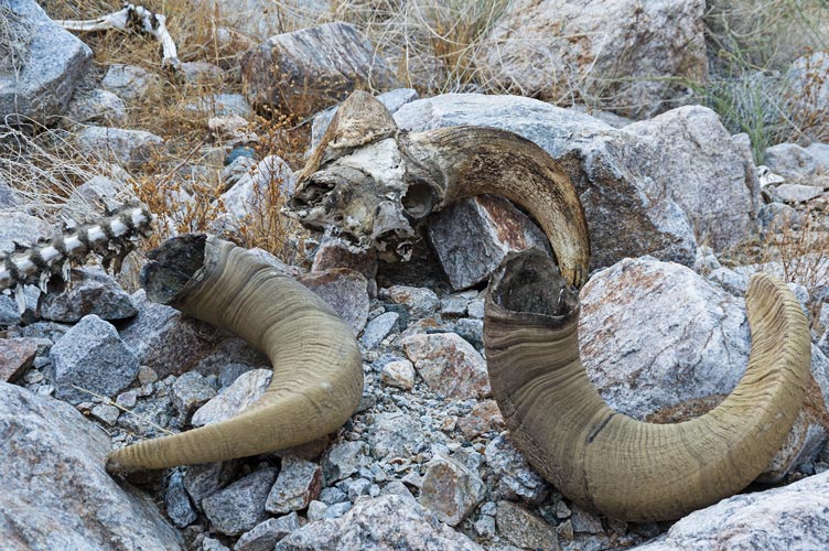
My Strava page for Peak 1620The plan after this was to climb some more bumps farther east, but we were right next to Cave Mountain which is a much more significant peak. Iris and I opted to climb that, so Bob dropped us off and we headed up. We weren't very far from the summit, but it was steep, hot, and rather loose on the way up. We did manage to find some relief in the shade of a canyon, but it was still pretty slow going. We also found a bighorn sheep skeleton - it was still a little fresh - the skull definitely had an odor. Tom and Bob finished their objectives before we made it to the summit, but we did get to the top soon after that. The views were pretty good, with I-15 way below. We descended down to the South and towards a more sandy descent. This mostly worked well, but there was a lot of steep and loose rock to descend too. Once we got to the sandy road we were able to make quick time jogging down the steep sandy road.
 |
|---|
Now we had another decision to make - Tom was heading back so we could get a ride back to the car from him, but then do we drive back away from home for another peak with Bob or head back towards home to do peaks on the way. We opted for the latter and drove to a dirt road N of Red Mountain and camped there.
1-18-2021 We got up and hiked up the road (we didn't drive very far up the road the night before) and then into the wilderness area. Then we had to gain a lot of elevation up to Klinker Mountain. It was windy up on the ridge - quite cold in the wind and quite warm when sheltered and in the sun. I had brought a little device that told me the wind speed, and it was pretty continuously in the 30 mph range with gusts up to 40 mph. From this peak we could see Dome Mountain off in the distance - a long way off, but without too much more elevation gain. We headed off down and up over some bumps and ridges and up to Dome Mountain. Here it was even windier, but we could shelter in the lee of the summit. I stood on the top for a few minutes with the Windoo wind meter and recorded a gust of 51.8 mph. There were plenty of gusts in the mid 40s. That was strong enough to force me to move my feet to hold my balance. From the short perusal of the summit register it seemed like the usual cast of peak bagging characters, people from Ridgecrest, and hunters (for Chuckar) were the main visitors to this peak. Then we headed back down. We were able to avoid the actual summit of Klinker, but mostly we just retraced our route with a few detours to try to find the easiest travel. Then we headed home to Bishop - still far away, but a lot closer than if we had opted for Old Dad Mountain.