Some other plans fell through and it was Bob's 60th birthday weekend coming up, so we stayed down in Orange County before driving out to the desert Thursday night (12-03-2020).
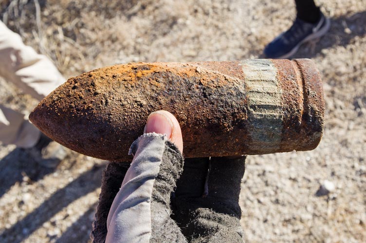
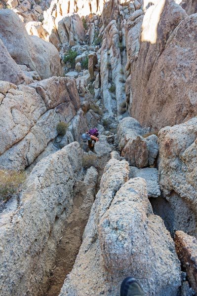
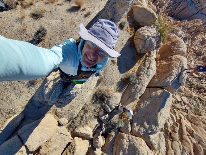
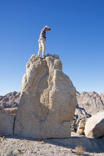
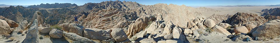
12-04-2020 we got up at 6 to depart at 7, driving down the road from where we camped to the trailhead (a pullout on the side of the road). There we parked facing into the sun and set our water in the windshield to warm and set off across the desert. It was pretty easy going across anastomosing flat washes other than the sparse hostile plant life (cholla mostly) and landmine dirt that would collapse under your foot where some creature had dug a hole. We did find a rather large bullet - maybe a tank round - this area was used for practice before the WWII N Africa campaign. Then we dropped down into the wash and headed up that scrambling over boulders and dry falls and dodging catclaw acacia trees. Then we headed up out of the wash up another drainage towards a saddle and finally up to another saddle and the ridge to the first peak. This was pretty convoluted territory with some less than solid rock. Bob headed up the sketchy ridge and I opted for a slightly easier looking and maybe more secure notch. I passed Bob and could see that he had a healthy looking catclaw blocking his ridge. He was able to traverse into my notch and head up that way. Karl opted to go back to the first saddle - he is maybe the smartest of us. The actual summit of Peak 3297 ft (there are plenty of little peaks out here designated only by their elevation) was a 8 foot or so tall fin of crumbly granite. I managed to rip off a few holds before commiting to making the move up to the top. Bob and Iris took their turns scrambling up and down too.
| |
|---|
 |
|---|
 |
|---|
 |
|---|
 |
|---|
Our next objective was Peak 4251 Ft across a wash to the SE. Bob and Ryan headed back down the way we came on the N side and while we were waiting for them to clear the drop zone from the chute Iris and I explored the possibility of scrambling down to the S or W. I think it might have gone, but it was hard to tell from above and with plenty of rounded and overhanging crumbly granite with spiky plants in the cracks we opted to take the sure way down. Then we cut back towards the Saddle where Karl was, but he hadn't seen them. A close inspection revealed a footprint dropping down to the west and then cutting south under the cliff we had investigated from above. It was probably just as well we went the way we did, although it might have gone. Another footprint led us down another gully to the SE but a steep overhang sent us back to the next gully heading S and then SE to go down. At this point we saw Bob and Ryan in the wash down below and ahead of us. It would have been easier and quicker to just go back to the saddle where Karl was and head S from there. We followed them up the wash, and up a slope to another saddle before dropping down again and then following the slope and ridge up to the next peak. We finally caught up to them on the summit and Iris got cell reception where we learned Karl had headed back the way we went up.
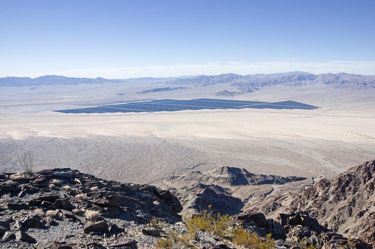
The way to the next planned peak looked even more convoluted, so we opted to head down into the wash and out and back. Back at the vehicles we packed up and drove around to the SE side of the range to a huge spoil pile left over from an aqueduct tunnel. This area had been used for camping, parties, and a lot of shooting. We washed up and then set up camp there.
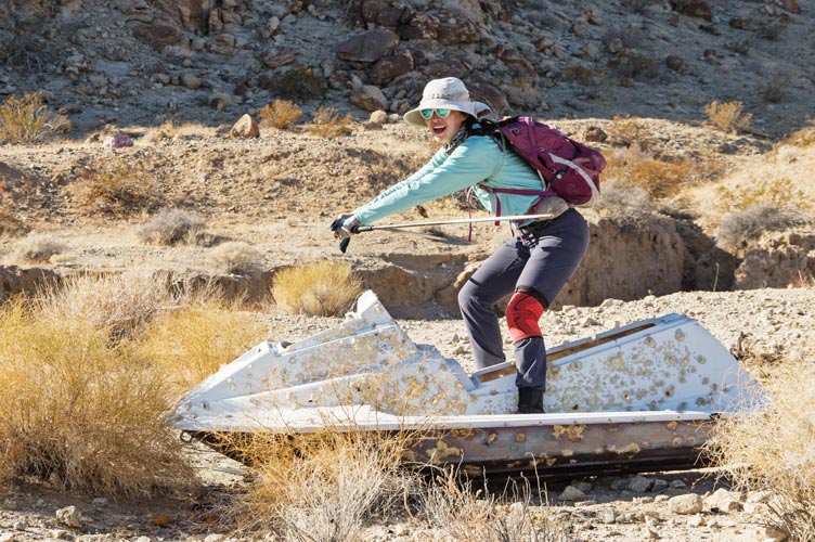
12-05-2020 We got up at 6 again and then started hiking about 7. First stop was passing lots of things that had been shot - including a jet ski. Once again things started pretty mellow with a big wash before we started uphill. Most of the rock today was slaty shale or shaly slate. It made for nice walking when it was all flat, but treacherous when the plates were all normal to a steep slope. We made it up to the first peak (Coxcomb Benchmark) around 10:00. From there we headed towards the next peak which had been dubbed "Coxbrush peak". There was a bit of a trail for some of the way, but at other times you could choose your own adventure - over the ridge, cut around to the left or right, etc. We all took whatever path seemed to make the most sense and hurried without seeming to rush in the hopes that our path would put us in the lead. This peak had over 1000 feet of prominence (you would have to drop down at least 1000 feet to head up to a higher peak). Bob had climbed it earlier, but it was on the way between the other 2 peaks he wanted to do, and the rest of us had not been there.
 |
|---|
 |
|---|
 |
|---|
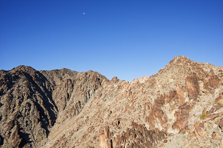
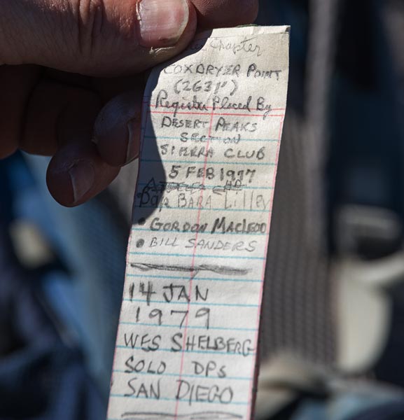
The last peak was quite a distance away, with a number of ridges and bumps to go over or around. Once again we each opted for what seemed like the best path - sometimes the gamble worked and sometimes it didn't. This last peak dubbed "Coxdryer Point" had a summit register made from an old film can with an aluminum body and plastic lid. This had been shoved into a beer can for protection. The last entry was from 1979 over 40 years ago - truly the sign of a classic desert peak.
 |
|---|
 |
|---|
For the descent Bob opted for the more interesting and spicy descent down a steep arete. This was probably not the fastest option, but it was interesting. So interesting Karl opted to drop down into the neighboring gully. We re-convened at the bottom of the arete to head down the wash to a much larger wash before the last push up over another saddle and across the last wash. I miscalculated the footing descending a near vertical slope into this last wash and my feet slid out and I slid down on my butt. Fortunately there were not spiky plants or dropoffs on the way and I ended up on my feet quite dusty but the only damage was to my ego.
 |
|---|
 |
|---|
Back at camp we briefly considered trying to drive to another objective but that crazy talk soon gave way to sitting in chairs drinking cold beverages and showering in the sun-warmed water. That night we had a birthday celebration of sorts for Bob around a campfire. The stars were pretty nice with a surprising number of meteors.
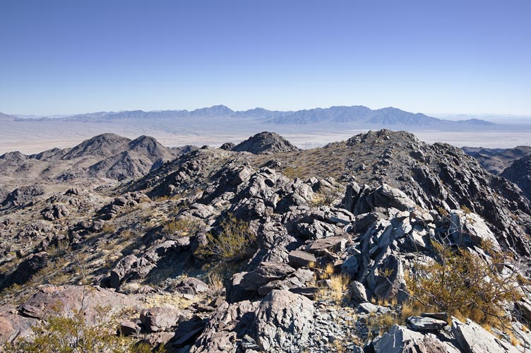
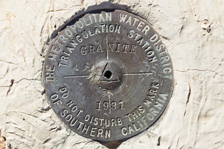
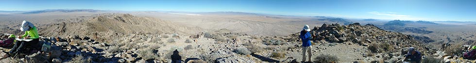
12-06-2020 We got up early (5 am) because we had a long drive to get to the trailhead and some of us had long drives to get home (especially Bob). We drove in Jeeps up beyond Palen Pass and then hiked from there. Soon Bob split off to do some little bumps that he had yet to summit while the rest of us headed up towards Granite Mountain a P3K (over 300 feet of prominence) and also on the DPS list (desert peak section of the Sierra Club). There are all sorts of lists of interest (or not) if you are a peakbagger. The DPS and SPS (Sierra Peak Section) lists are particularly well known, but there is also the rather poorly named 281 peaks of the Hundred Peaks Section list. I have recently been trying to put my ascents onto Peakbagger, so I have been looking at various lists and indexes and so on. In any case, this is a big mountain and the sort of thing a peak bagger would want to climb up. It was fairly hot in the sun so we opted to head up the ridge in the hope of more of a breeze. This might have worked a bit. In any case it was a decent but not hard scramble up for a long way up to the final 4333 foot summit - just a little bit higher than my backyard, although we had started a lot lower. We relaxed on the summit for quite a bit and then opted to return on the ridge since we knew it and hoped for some breezes. The descent seemed to go faster, but we really didn't save a lot of time. The last bit down the road seemed to take a lot longer.
 |
|---|
 |
|---|
 |
|---|
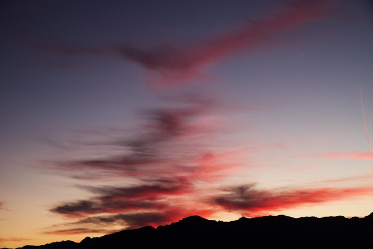
Unfortunately Iris forgot to retrieve her phone from the front wheel fender and didn't realize it until we had bumped quite a way down the 4WD road. Fortunately she did notice it before we were all the way out and we found it unharmed when we went back to get it. There was a nice sunset and a long drive back to Bishop that evening.
 |
|---|
Iris' Strava page for day 1, Coxcomb Peaks - map and pics
Iris' Strava page for day 2, Coxcomb BM + - map and pics
Iris' Strava page for day 3, Granite Mtn - map and pics