Tom Grundy's Crater Mountain Ebike and Hike Page Plus
For a while I have been trying to do no new carbon pollution adventures - or something like that. I need to come up with a catchy name and am open to suggestions. Most of these have been on foot or bicycle, but with an e-bike it opens things up a bit more. You could argue that since I don't have solar electric panels on my house yet that it isn't really carbon pollution free, but I think all the electricity here comes from either solar or hydro power, so maybe it still qualifies - anyway, I am not burning gasoline or diesel.
On 5-11-23 I got up early and headed out around 6 am heading south on 395. It has pretty wide margins so isn't so bad on a bicycle, but I turned off at Keogh's Hot Spring to get away from the traffic. This wasn't faster or easier, but it was more fun and I got to explore some new territory. I continued south on old roads and along a canal with a few muddy bits and one really sandy section I ended up walking. It was a bit chilly at first, but warmed up nicely once the sun cleared the mountains. There were a lot of signs of washouts, repairs, and clearing of various ditches, drains, and canals. They are definitely recovering from the winter storms and preparing for major snowmelt. Things were pretty green and there were more flowers, swamps, lakes, and little streams than normal. Once I passed Big Pine I headed uphill gaining a thousand feet or so up McMurray Meadow Road. The sandy uphill was hitting my smaller battery pretty hard, but I managed to get up to the "trailhead" with it. There wasn't a trailhead, just a spot I decided was as close as I'd get. Strava said I had gone 21.5 miles and my e-bike said 20.4. I think the e-bike is a little low but maybe not 5%.
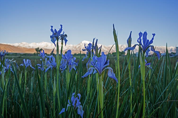
wild irises
 |
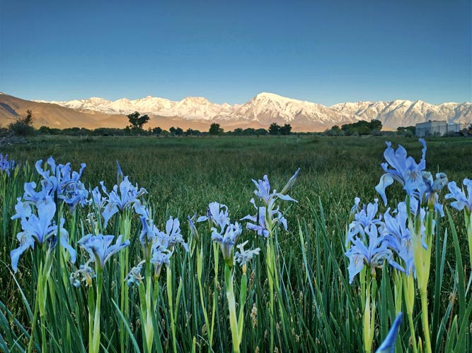
more wild irises
 |
I stashed the bike and helmet and spare battery behind some rocks and headed off eating a snack. From a distance it looked like pretty easy terrain, but in reality it was an old aa lava flow so it wasn't all that friendly - not too bad, but I had to pay attention to where I was sticking my feet most of the way. When I started up the steeper cinder cone I found a trail and followed that up to the rounded summit on the N side of the crater. The views were pretty nice. The register was in an ammo can and featured some of the usual suspects as well as a lot of kids from school groups. I took pics and remembered I had a now broken summit cookie before heading back down - jogging a bit when the footing was clear.
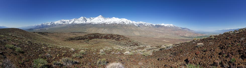
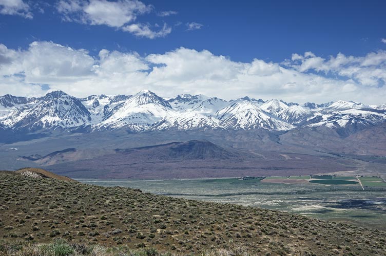
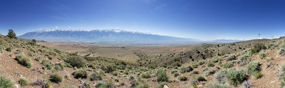
panorama of the Sierra from Crater Mountain
 |
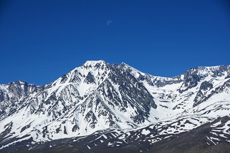
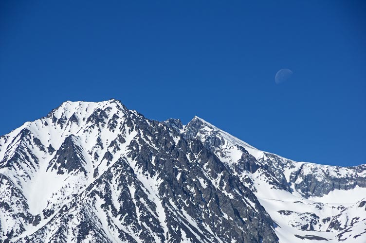
moon over the mountains - Cardinal is on the left
 |
moon over Split Mountain, with Tinnemaha to the left (much lower and closer)
 |
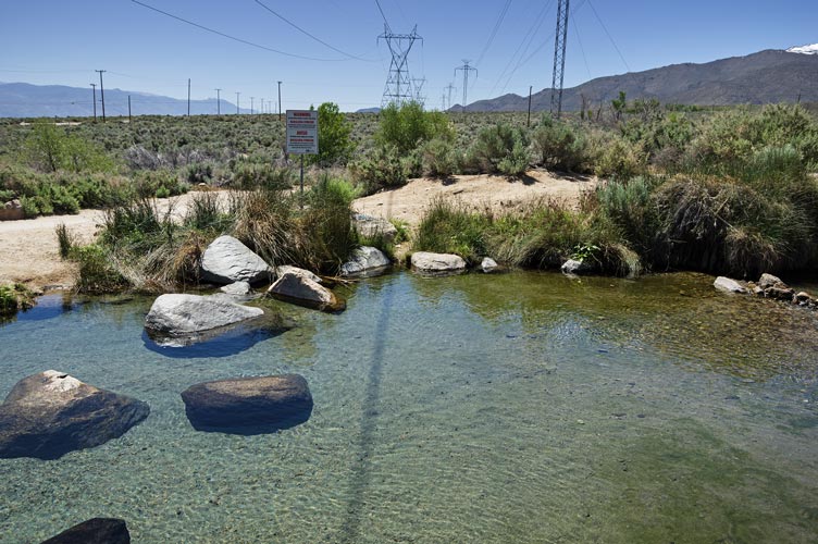
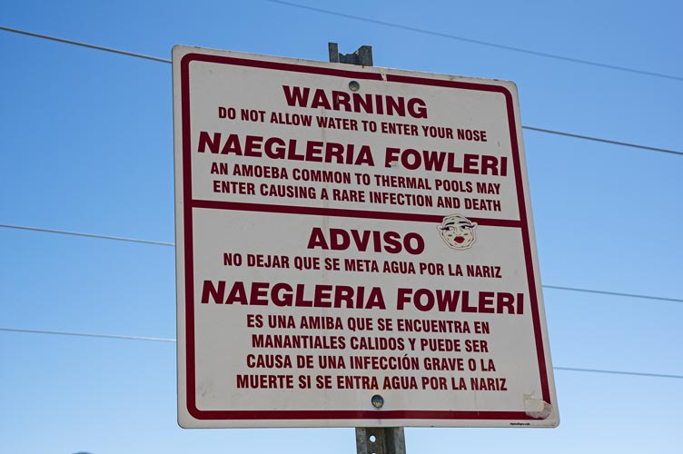
Back at the bicycle I swapped out my battery and then headed down the road. I probably should have swapped out 3/4 of the way up the hill since the first part was mostly downhill and I got at least a little battery regeneration during that. On the return I took a better road towards the hot spring avoiding the mud and sand. I stopped at the hot ditch since I hadn't been there in ages - they now have Naegleria Fowleri warning signs all over - the usually fatal brain eating amoeba that you don't want to get up your nose. I hadn't heard of any instances in the hot ditch, and definitely have submerged my head there in the past (internet says a boy contracted it there in 2018, and shortly after that a girl got it from swimming in the Brazos River - another thing I have done in the past - great more things to be paranoid about). I got back home just before noon - a 6 hour tour.
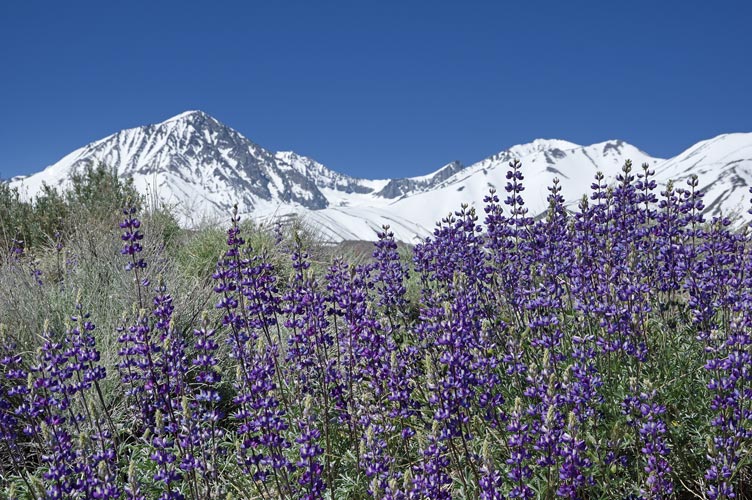
Lupines and Birch Mountain and The Thumb
 |
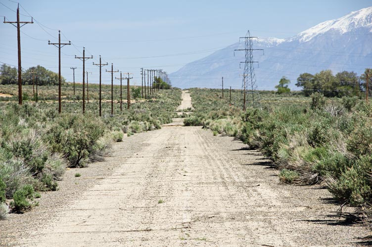
the hot ditch below Keogh's, Crater Mtn is just left of the power pylon in the center
 |
hot ditch warning sign
 |
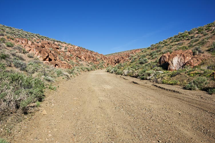
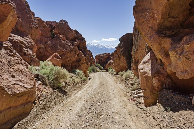
abandoned old road
 |
Strava link for Crater Mountain ebike and hike
5-14-2023 E-bike to Peak 6540
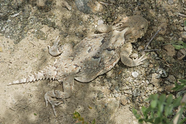
I went on another e-bike excursion on Sunday. Once again I took 2 batteries, but about 6 miles in I realized I had forgotten the key to swap out the batteries, so it would be a one battery mission - with the smaller battery on the bike and the larger battery in my pack as dead weight. On the plus side I learned this before running my battery dead and preparing to swap and I also had done a better job of nearly fully charging the battery on the bike. I also decided to mostly stick to the pavement rather than return along the dirt roads at the base of the White Mountains. Fortunately for most of the way to Big Pine I was heading downhill with a bit of a tailwind so I was able to cruise along at about 17 mph without really using a lot of electricity. That changed once I started up the Death Valley Road. The grade was low enough I was able to keep it at level one and pedal hard. I made it to within about 1/2 a mile of my parking spot 22.3 miles in before the battery indicator dropped a bar. Surprisingly there was a couple where I parked my bike. They told me about a bubbler up the canyon (a device to catch rainwater and store it for wildlife) so I headed up the canyon instead of straight up the ridge. After hiking a bit I gave up on the bubbler and headed up the slope - once I got up a bit I could see it a little farther up the canyon and up a side canyon on the other side. Oh well. There were quite a few wildflowers out - mostly little clumps or individual flowers all over - not really spectacular, but nice to see. Also plenty of lizards zipping about. I even saw 3 horned lizards this day.
I hiked up the ridge gaining a little over 1000 feet past some false summits before I got to the top. As usual the views were excellent across the valley to the Sierra. I could really see the cinder cone and lava field from Crater Mountain. I took pics, I ate a summit cookie, and I called my mom as one does. Then I headed back down - a little more directly down the ridge back to the bicycle. By now it was pretty hot, but I was able to cool off a bit coasting down the hill and recharging my battery (I opted to use the regenerative braking to recharge rather than just bombing down the hill at top speed as I was a little worried about running out of battery). I took a little detour to McMurry benchmark - I'd have ridden the bike all the way up if I wasn't worried about battery life, but I was, so I walked the last bit. Once again nice views overlooking the Owens Valley and Big Pine.
looking across the valley - note the lava flows from Crater Mountain
 |
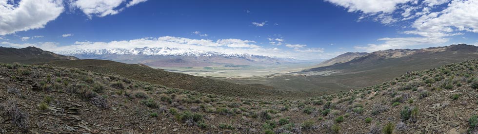
panorama of the Sierra and Owens Valley from 6540
 |
panorama of the Sierra from 6540
 |
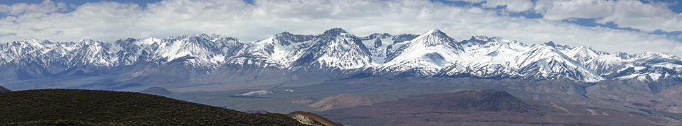
cropped in a bit on the panorama of the Sierra from 6540
Indian Rock on the far left and Sky Haven? on the far right
 |
horned lizard
 |
I biked back with a stop for some water at the Glacier View Campground. Fortunately the wind had swung around and I mostly had a tailwind on the way back up 395. When I had about 8 miles left and still was only one bar down on the battery I switched to a higher setting for the remainder of the ride - getting about 45 miles with the little battery wasn't bad - although I am not entirely sure that it was much less effort than I would have used with just a normal pedal bike. My legs were tired and I was sweaty. Fortunately the church is still pretty cool inside.
Strava link for Peak 6540 ebike and hike
5-16-2023 E-bike to Crumbe Crag and some mines in the Tungsten Hills
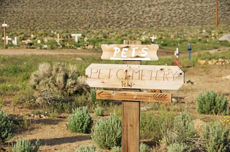
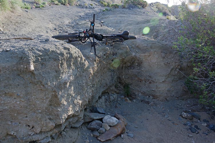
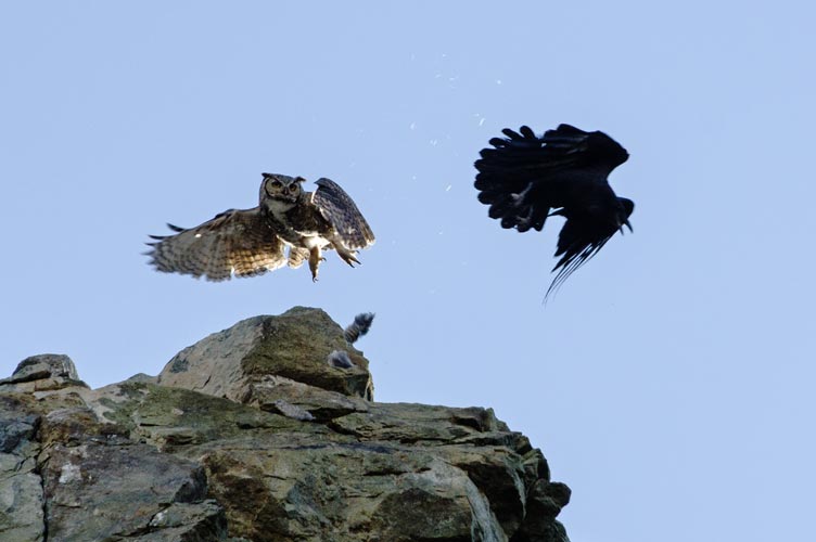
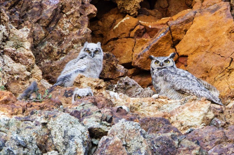
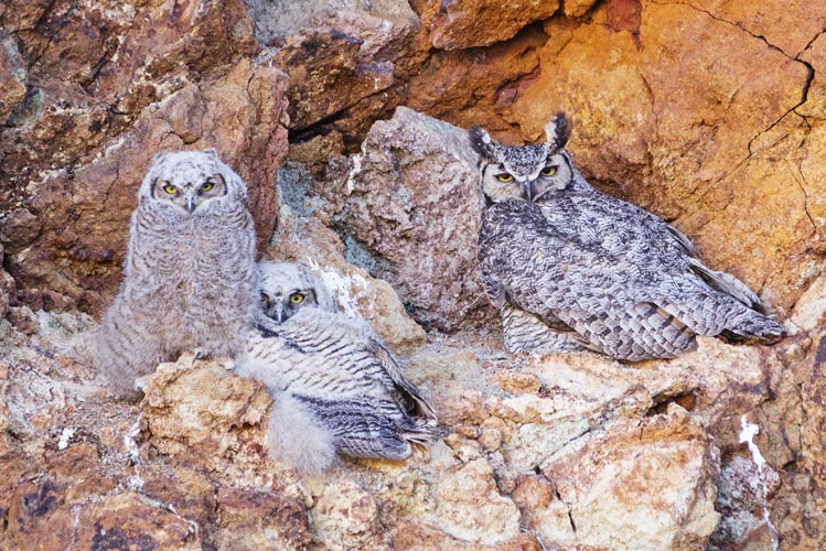
I left about 6:30 am to take advantage of the cooler morning. My first stop was the pet cemetary - this is remarkably extensive with quite a variety of monuments and not very Steven Kingish during the day. Then I continued on up the closed road into the Tungsten Hills. There were a few washed out gully or stream crossings that I had to walk the bike across and one that featured a 4 foot cliff. Then I explored the Tungsten Blue Mine a bit - it featured some nice minerals (epidote, quartz, garnet, and who knows what else - maybe huebnerite? and probably scheelite.) There were also some owls that were getting harrassed by a raven. I wish I had my good telephoto setup for that. Inspection of the pics later revealed 2 young owls and at least one adult - and one mean raven.
pet cemetary sign
 |
lifting my bike up the edge of a wash
 |
owl and raven
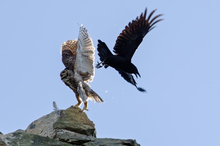 |
owl 0, raven 1 - note feathers flying
 |
owls in happier times
 |
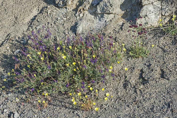
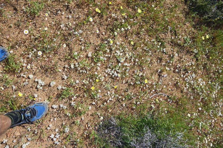
I continued on up the road and then parked at the nearest likely spot I could ride to Crumbe Crag (a relatively insignificant bump someone added to Peakbagger, but it is in my front yard within 10 miles of my house, so I needed to turn the red dot green). I hiked and jogged across the flowery desert and up to the summit (Basalt). There were nice views of the Eastern Sierra. Then I headed back - jogging most of the way. I got a fair bit of sand in my shoes.
wildflowers - including desert indigo and chia
 |
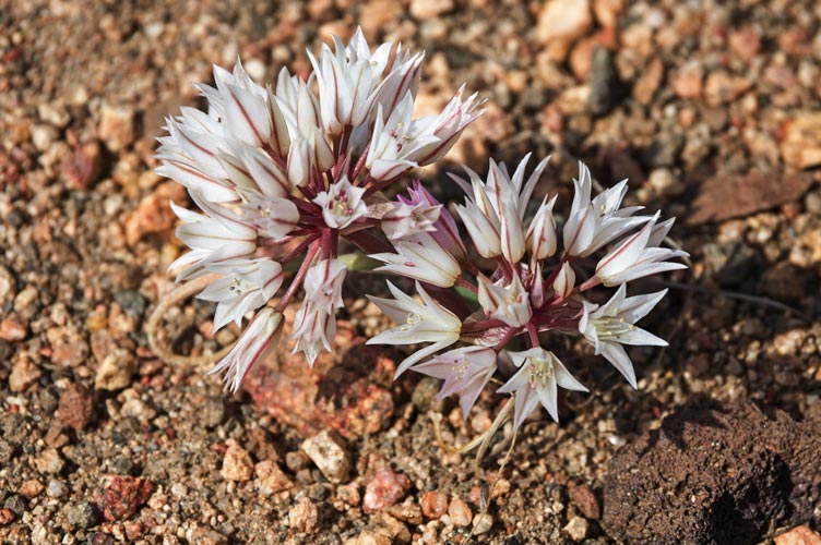
belly flowers
 |
more wildflowers with feet for scale
 |
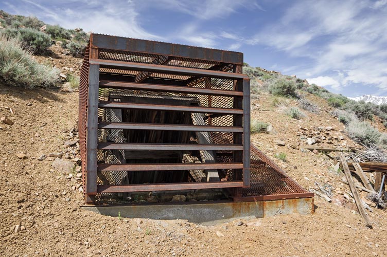
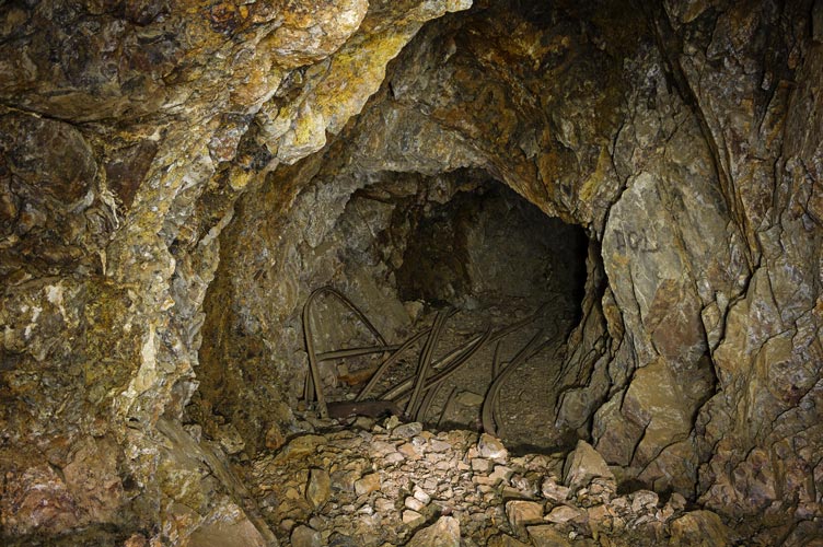
I headed back to the main dirt road and headed west passing a couple out exploring in their truck. Then I stopped to check out the upper workings of the Western Mine (I think). These were more extensive, but also had been closed with a welded metal cage good enough to keep velociraptors out (or in). Then down the steep and rocky hill to check out some more mine workings at the base (also caged off) and then back past the prison work camp (for firefighters) and to pavement and back to Bishop by noon. I only brought the one battery for this ~ 26 mile on bike trip, but it was the bigger one. The steep sandy road did use up a fair bit of electrons. I saw a number of scampering lizards as well as a horned toad and probably a gopher snake. The latter 2 zipped into brushy cover before I could get a pic.
velociraptor proof mine shaft
 |
mine adit
 |
Strava link for Crumbe Crag plus mines ebike and hike
I went back the next day with the telephoto to get better pics of the owls - which I did, but they mostly just sat there so it wasn't all that exciting.
the owls - taken with better equipment
 |
5-19-2023 E-bike to 6978 and a WSA highpoint
I got up early again and was off by 5:35 or so. It was still pretty cool and my fingers got cold. The N fork of Bishop Creek and the Owens River were running high. I headed north on Fish Slough Rd enjoying the wildflowers and solitude and not enjoying the loose sand and washboards. In fact it was easy to see and feel how much harder it was to bicycle on this road compared to pavement. I was down a few bars by 10 miles in so I eased back on the electric boost and pedalled harder. I stopped at a few petroglyph sites to look at them and take some pics. There were quite a few flowers including lupines, a few different yellow ones, and desert indigo. Also lots of grasshoppers all over plus lizards as things warmed up.
After an extensive petroglyph site I turned left onto the Chidago Canyon Rd and started uphill in a more serious fashion. I was down to one bar on the battery and after a mile or so switched to the new battery. The grade was mostly low enough that I was able to maintain about 8-10 mph with a few steeper or looser bits that slowed me down and had me pedalling harder. There were a few sections where the road went up a single lane wide canyon of eroded volcanic tuff. Once I got out of the canyon I hooked around the point I was heading to and the road was less steep. There were some spectacular flowering desert peach plants here and then I headed up to the end of a little power line road where I stashed the bike. I went uphill first to the bump - peak 6,978 complete with a register placed by Barbara Lilley in 2021. I enjoyed the views and ate an alliterative savory spicy sausage summit sandwich.
heading up Chidago Canyon Rd
 |
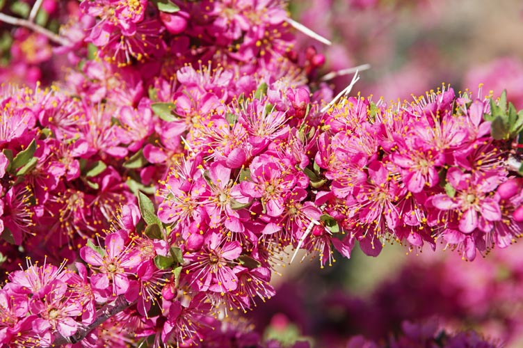
desert peach (Prunus andersonii) flowers
 |
Then I headed down to the SE past a power line and down the hill to a completely gratuitous LOJ point - the Chidago Canyon Wilderness Study Area high point - just a spot on the edge of a hill - but not too far out of the way and another red dot to turn green. then I headed back up over the hill and back down to my bicycle.
panorama of Hammil Valley down to the Owens Valley and the White Mtns from the WSA highpoint
 |
As usual heading downhill was a lot easier and more fun than going uphill - I even recharged the battery a fair bit using the regenerative braking. I did have to use the actual brakes a few times where there were tight loose turns and to stop to take pics of the canyon or lizards. I saw long nosed leopard lizards and horned lizards among others. Also really large amounts of grasshoppers hopping out of the way as I went down the road, sometimes bonking into me or my bike. Rather than returning via Fish Slough road I opted to continue on Chidago Canyon Road all the way to highway 6. This way I could go faster and was much less likely to run out of battery before I got home. It did mean occasional high speed traffic, but there was a decent margin that got wider after Chalfant, and there was not very much traffic going my direction. It was hot though. I stopped at a park in Chalfant to sit in the shade a bit and to wet down my head and arms and legs. This cooled me off for a bit, but I dried off quite quickly. There were a few little creeks full of water running out of the White Mountains and some canals full of water going the other way and once again the Owens R was running full. Near the end of the ride I saw a hawk take off on the far side of the road carrying a stick - then I saw the stick was twitching - it was a snake. I quickly stopped and pulled off my camera to take some photos - once again I wish I had my big telephoto, except I wouldn't have been carrying that on my Cotton Carrier chest harness for quick deployment. I was glad to make it back home and get off my bike - this was probably my longest e-bike ride - around 55 miles. I think on flattish pavement without too much wind I could probably make 80 or more miles at about 16-18 mph and even more with a tailwind or more pedalling and less electric motor.
heading down Chidago Canyon
 |
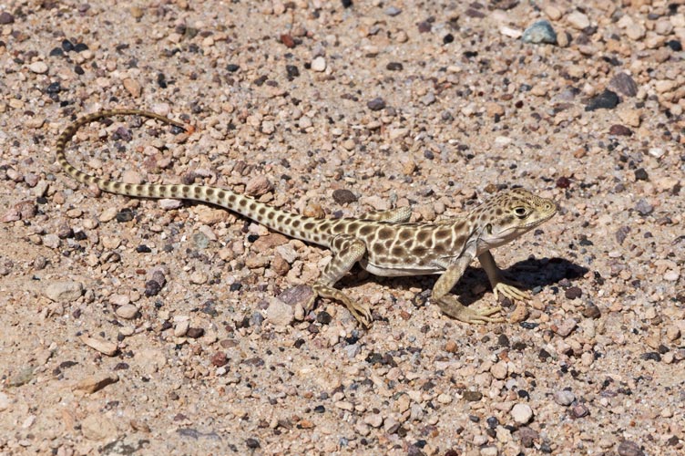
long-nosed leopard lizard
 |
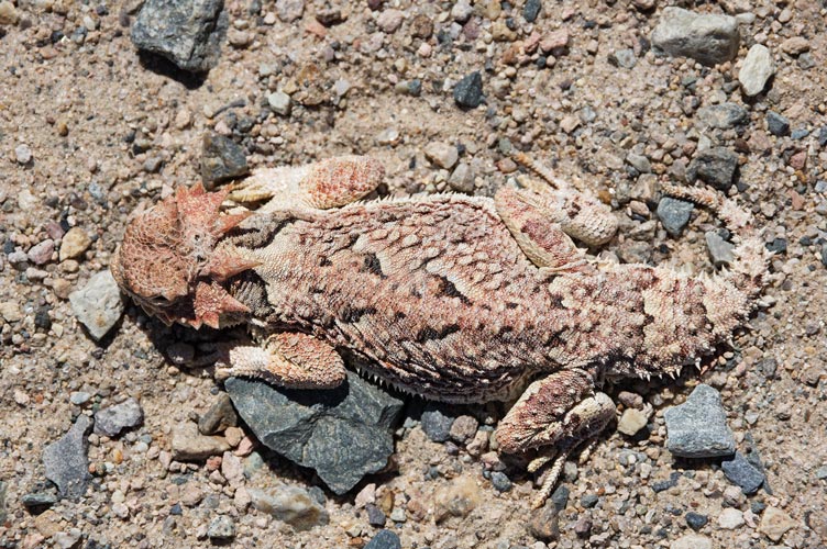
southern desert horned lizard
 |
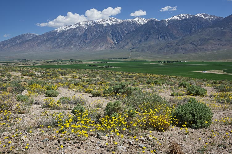
wildflowers, Hammil Valley farms, and the northern White Mountains
 |
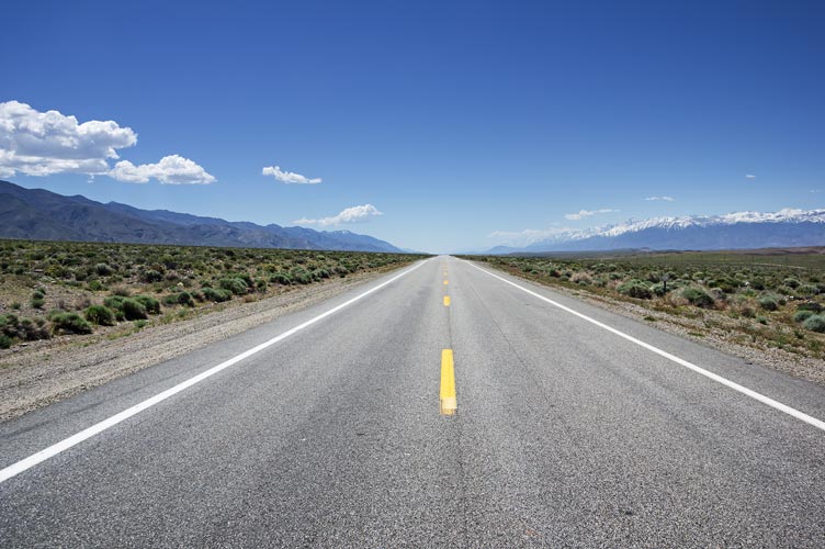
heading south on highway 6 - the Grand Army of the Republic Highway
 |
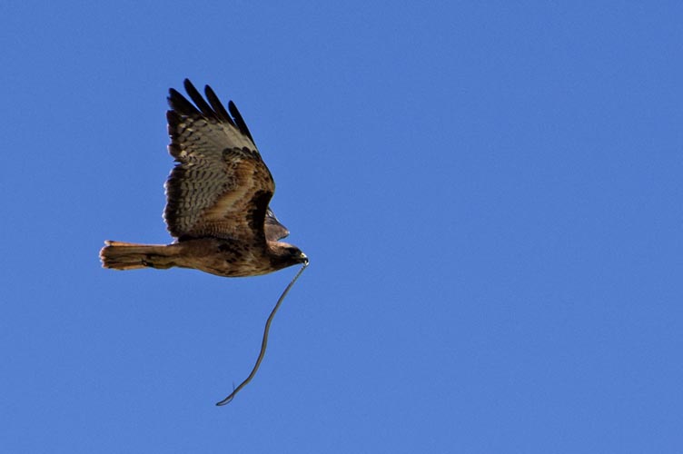
a red-tailed hawk with probably a gopher snake
 |
Strava link for peak 6978 plus WSA highpoint ebike and hike
No material on this page may be copied or used without permission.