Tom Grundy's Dec 2023 Desert Trip Page
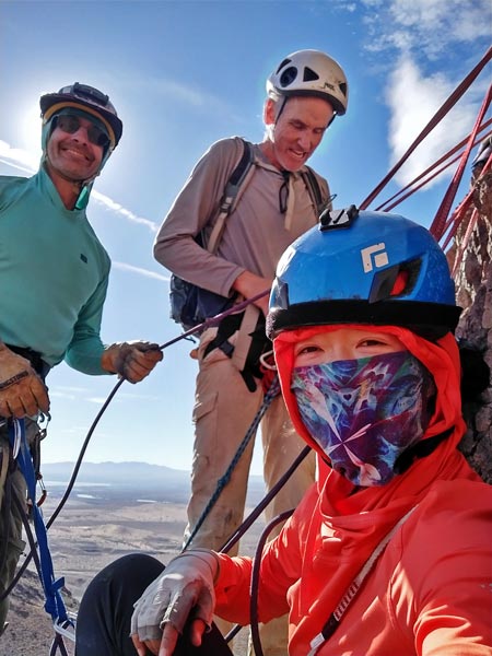
Iris finished up a big milestone for work and had heaps of time saved up and it was Bob's birthday week, so we headed out to the desert to climb peaks.
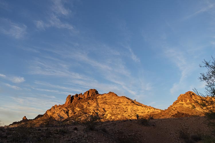
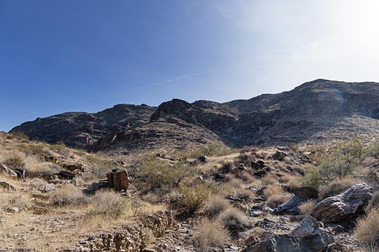
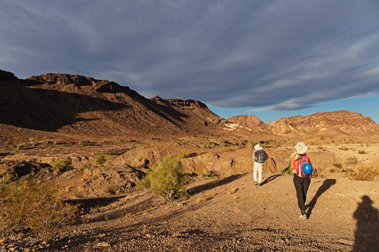
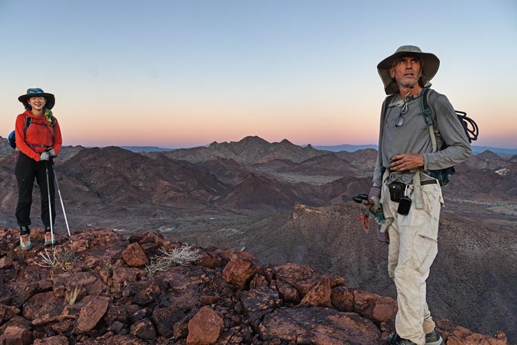
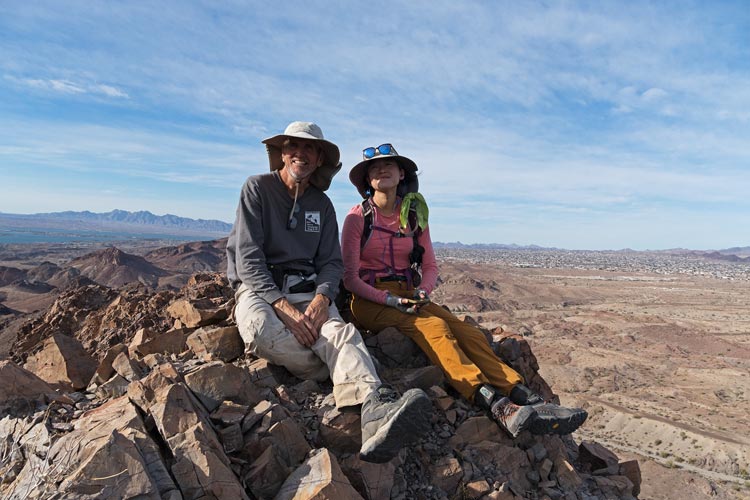
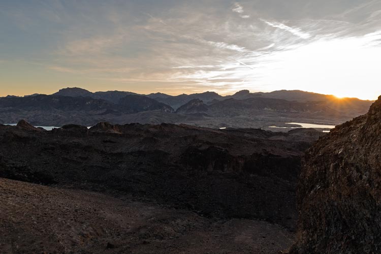
Dec 1, 2023 Iris tried to finish up some last work stuff with rather poor tech succes while I packed up things as best I could forgetting (or not realizing they existed) a few things but mostly getting everything we needed. We left a little later than hoped and planned and thus got a little more traffic as we headed east out of town. We stopped at a Wal Mart and Iris finally mostly finished up her work stuff and I quickly ran up Pettit Hill to get a new p300 green square for Dec 1. Then we headed on east cutting north of Joshua Tree NP and across the desert into Parker for cheaper gas before returning to Bowman Wash to meet up with Bob and Eric who had a nice fire going. (a theme for the week as it wasn't very windy at night and we mostly camped in washes which featured plenty of dead branches and trees to burn).
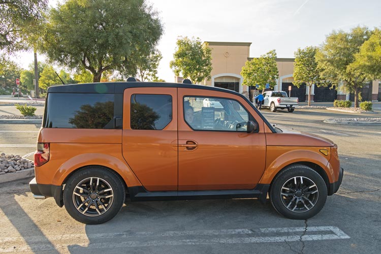
Iris worked in the Element while I climbed Pettit Hill
 |
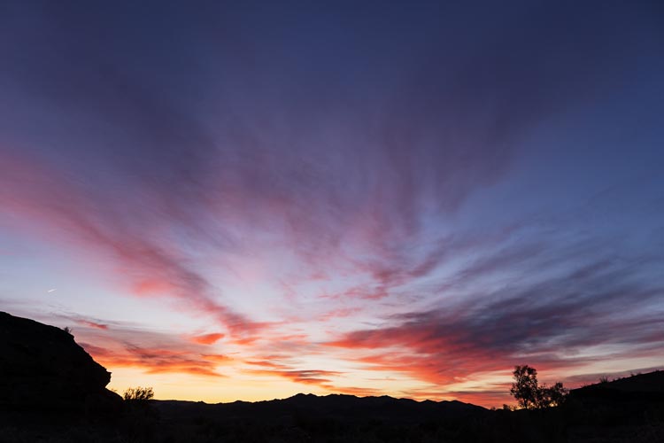
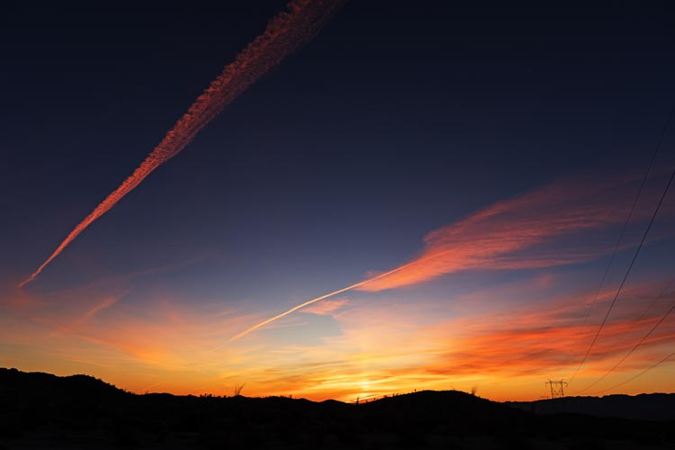
nice sunrise from Bowman Wash
 |
Strava Page for Pettit Hill. 12-01-2023
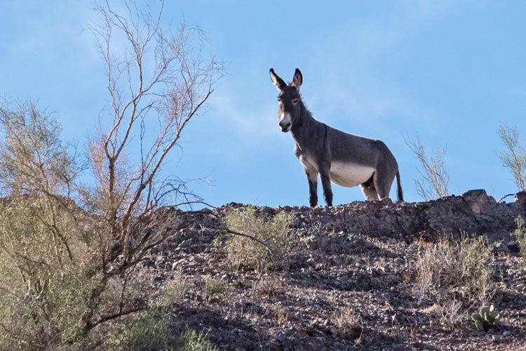
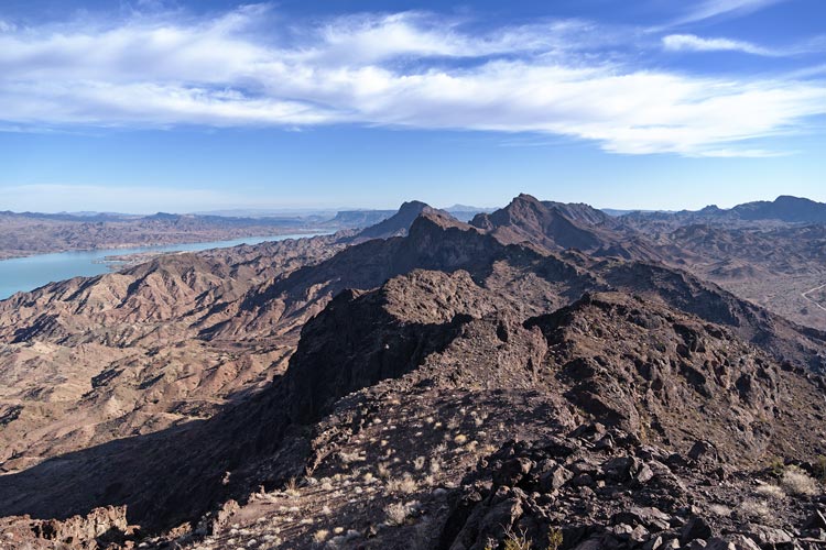
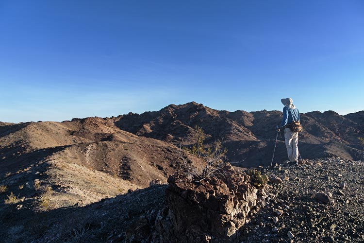
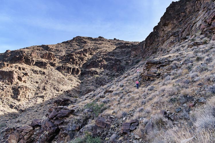
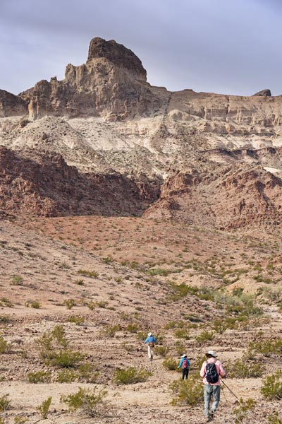
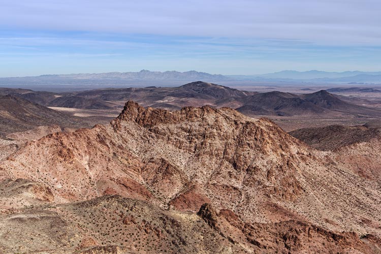
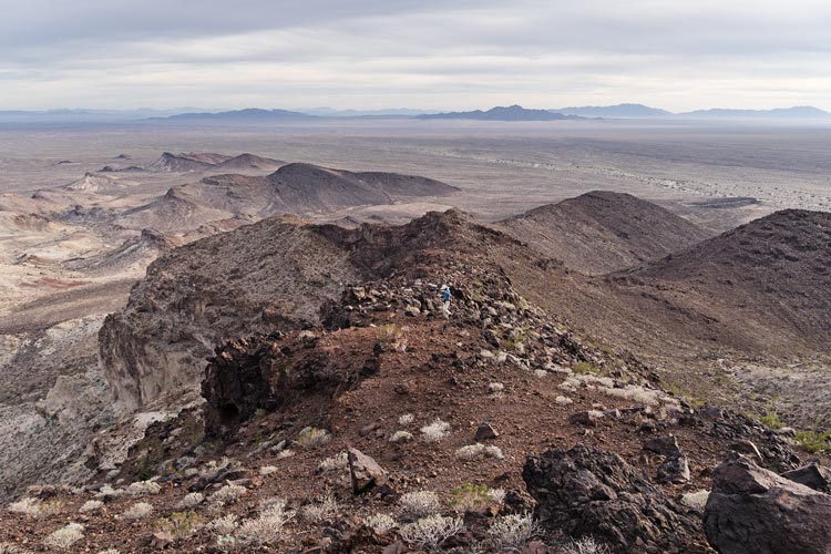
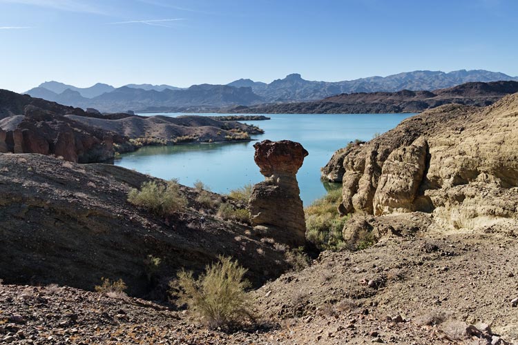
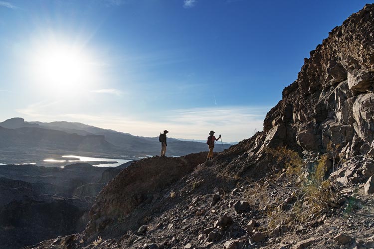
Dec 2, 2023 We drove down the powerline road a bit and then parked and hiked up Peak 1713, this was fairly straightforward with gorgeous views of Lake Havasu down below when we got to the summit. The eastern face was a big drop off, so we had to detour north quite a bit to find a path down and then down a wash and up and over some intervening ridges and down another wash before we could head up the next peak - Peak 1,137. We saw a number of burros along the way and happily followed their trails wherever we could. We also saw a bald eagle far above this peak and some vultures - much less exciting. Then we backtracked and continued farther north to a different weakness in the cliff to get up Peak 1715. I stayed in a wash a little longer and followed the ridge up while the others cut the corner but maybe had slightly worse footing. I beat them up to the ridge by a little, then we scrambled the last of the way up the cliff - or walked a little farther to a much less scrambly gully up.
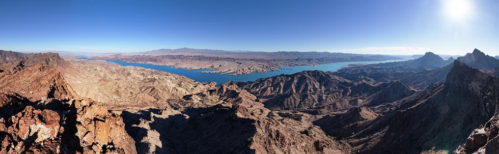
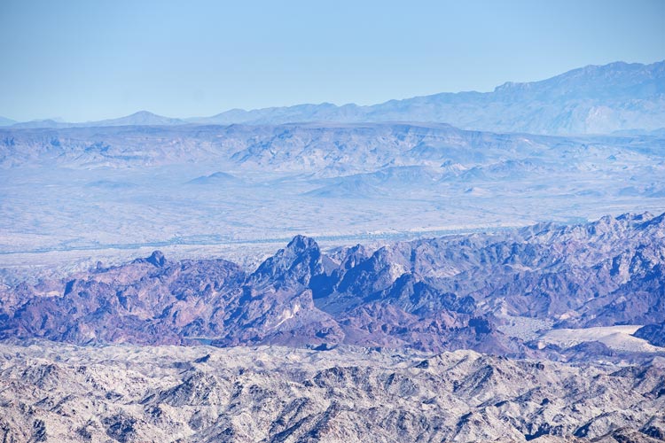
panoramic view from Peak 1713 - peak 1137 is in front of the lake right of center
 |
descending the ridge to a point we could drop east
Point 1715 is below the horizon on the left
 |
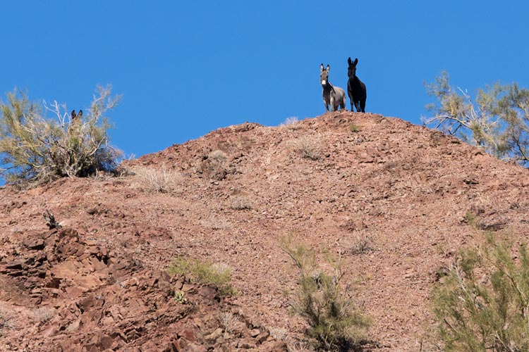
burros keeping an eye on us from a ridge
 |
another burro keeping an eye on us from a ridge
 |
view southish from Peak 1715
Peak 1713 is just below the horizon near the center
 |
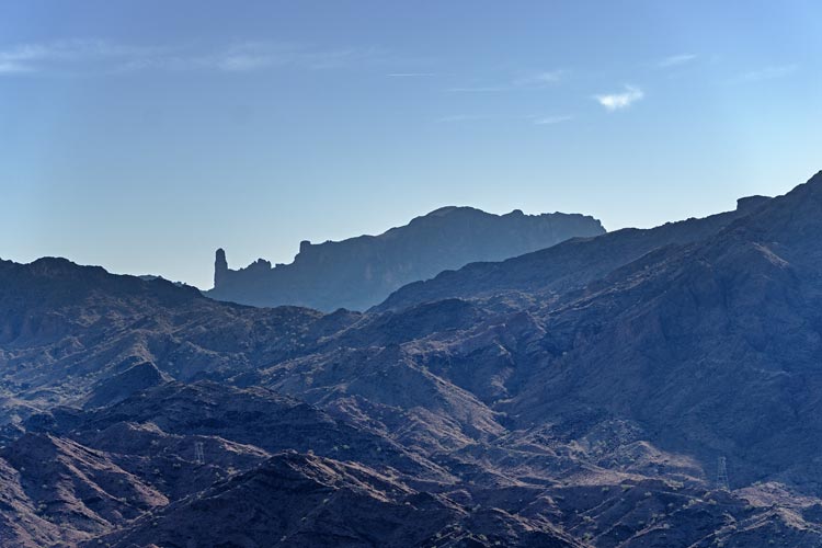
Monument Peak (the tower on the left) and Monument Peak High Point
(or Copper Mtn) that we climbed in 2021 in the distance
 |
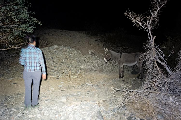
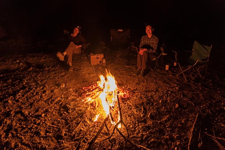
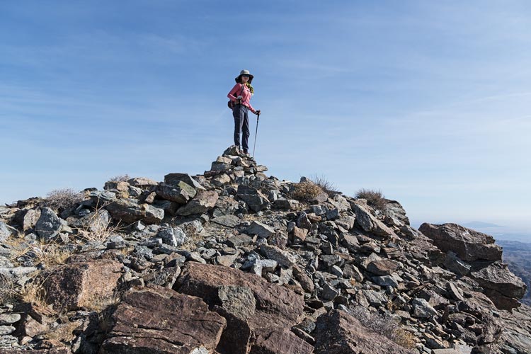
After this peak we headed down a drainage towards the vehicles. This went pretty well although there was some brush in the bottom and a dryfall which we were able to bypass to the right while descending. Then we decided to try for one more peak out the direction we would be driving the next day anyway. The powerline road was pretty convoluted and our enjoyment of the drive was proportional the the clearance and off-road capability of the vehicles we were driving. The AWD Element did pretty well, but still high-center scraped a bit on the steeper water bars and required dodging the occasional bigger rock. The road was in pretty good shape though and other than being blinded by the sun coming around a few corners and the aforementioned water bars it went well, although a bit stressful. We parked on the side of the road and hurried up one last peak (1260) just after sunset. It had a nice scramble to the summit. Then we found a wash to camp in complete with plenty of firewood and a burro.
cliff to go down on the descent
(Iris and Eric are barely visible above the cliff)
 |
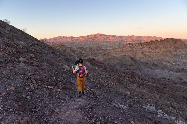
Iris on the way to Peak 1260
 |
Iris and Bob on top of Peak 1260
 |
Iris tries to make friends with a burro
 |
Iris and Bob enjoy the fire
 |
Strava Page for Whipple Mtns bumps. 12-02-2023
Bob's trip report for Dec 2, 2023
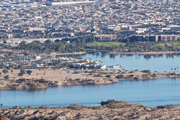
Dec 3, 2023, The plan for the day was the Whipple Mountains High Point, a DPS peak that only Bob had done before. I joined Bob in doing another peak (1380) while Eric and Iris went on to start up the main peak. This peak ended up being pretty nice with a chilly start in some washes and then up ridges in the sun. It had a nice view of Lake Havasu City across the lake and we could see London Bridge, especially with a zoomed in photo. Then we returned and drove off to the start for the Whipple Mountains High Point. I headed off after the others while Bob went after some lower peaks he hadn't been up yet.
Bob on the way up to 1380 (in the center)
 |
Lake Havasu City and London Bridge
 |
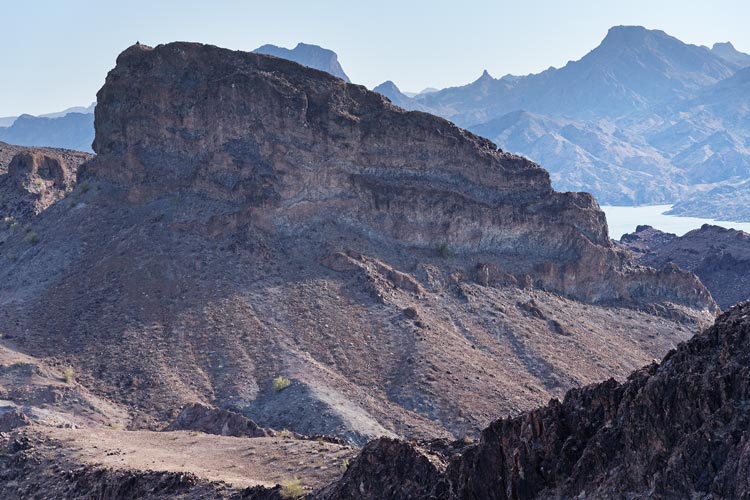
Needles Mountains - we visited these in 2022 and later this trip
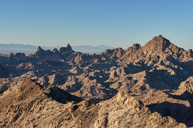
Havasuper, South, Gold Dome in the center and Tumarion on the right
 |
panoramic view from Peak 1380
 |
I figured the others were about an hour ahead of me so tried to go fast to catch up. I started out on the roads west of the wash but eventually realized I was going too far west and then cut back and into the wash trying to follow burro trails on the side of the wash where I could since those were generally more direct and faster walking. This wasn't always possible. As I got higher in the wash it got a little more interesting with some slickrock and rock jumbles to go up as well as part of a snake skeleton and most of a desert bighorn sheep skeleton with a leg and skull that still had a fair bit of skin and hair on it.
I first saw Iris and Eric on the slope on the center left
 |
As I got out of the canyon into a wider bowl I heard Eric and Iris holloring down at me and eventually located them partway up the slope ahead of me. I tried to pick up the pace and caught up to Eric around the corner at the weakness through the cliff band about 15 minutes later. Iris was forging ahead and it would be quite a while before I caught up to her on the final summit ridge. The bit of shade here was welcome as was the breeze on the summit ridge. We relaxed on the 4130 ft summit for nearly an hour before heading down and then taking a variation on the N ridge past some minor peaks to descend. This had nice views and a breeze plus some burros near the bottom so made for a nice loop. It also meant we had a lot less distance to hike in the wash once we got off the ridge. Bob had climbed 2 peaks and then returned to the trailhead to wait for us. Iris went back with Bob quickly in the jeep to where the element was parked and I came back more slowly and carefully with Eric in his Rav4. We rinsed when we got back to the powerline road and then drove a bit to another wash to camp in complete with firewood, but no burro this time.
Iris on the summit cairn
 |
Iris and Eric come down below the cliff
 |
looking back at the Whipple Mountains High Point
 |
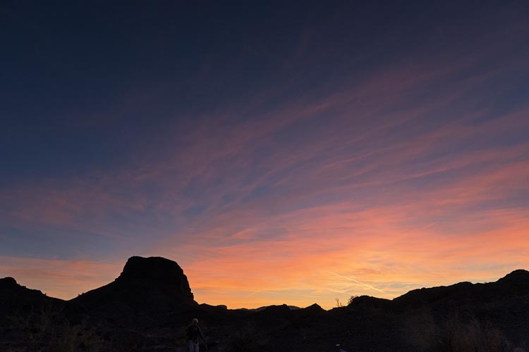
another nice sunset
 |
Strava Page for Whipple Mtns High Point plus. 12-03-2023
Bob's trip report for Dec 3, 2023
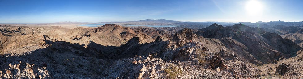
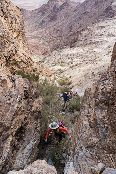
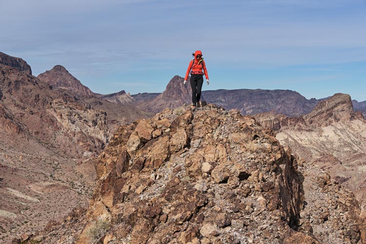
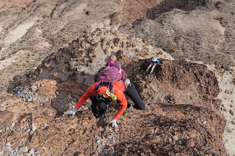
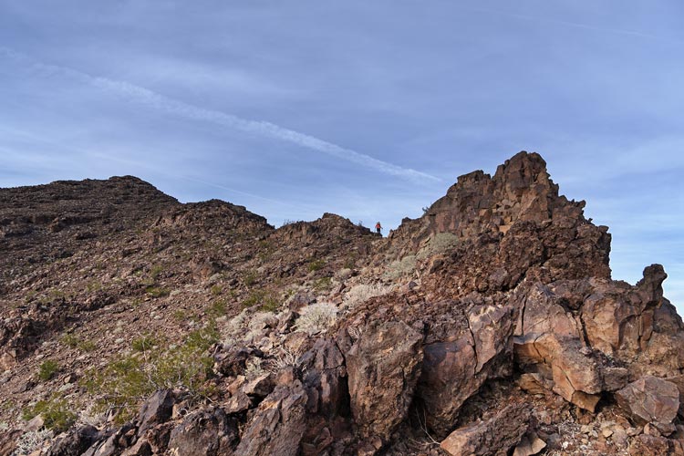
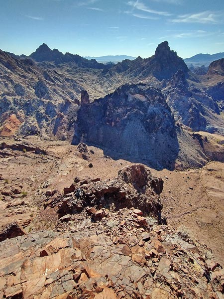
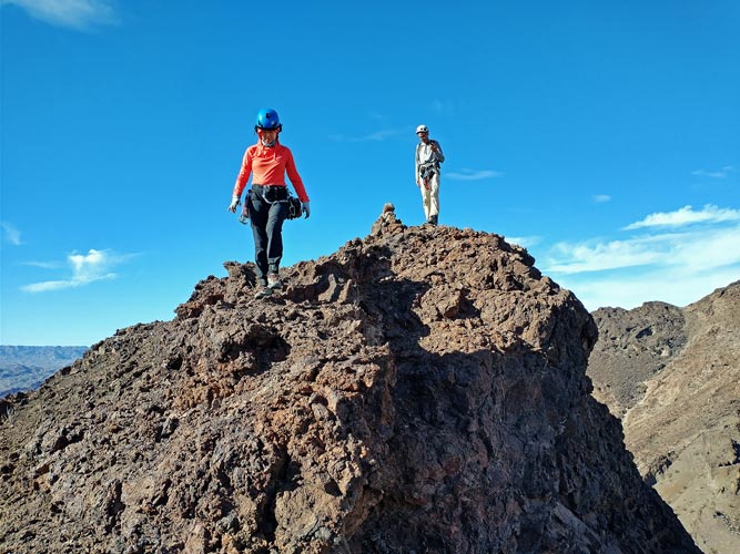
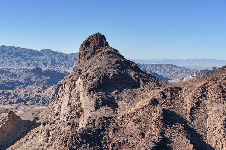
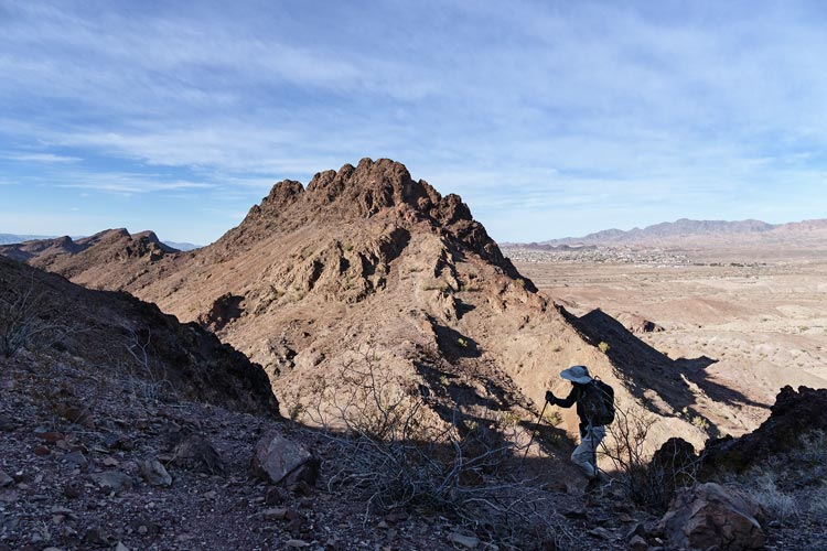
Dec 4, 2023. We drove out to the paved road and then parked the Element and Rav4 at the junction with 95 and piled into the Jeep to head off to the next objective, some peaks in the Turtle Mountains. We parked just before the wilderness boundary and headed off towards the first peak. This looked pretty formidable and we weren't sure it was possible without technical gear. In fact the one trip report we found basically said that it was technical and they went on to climb some other peak. Well, you never know until you check it out yourself, so up we went. As we started up a steep scrambly gully Eric decided he would sit this one out and he went back down and around the E face. We headed up what we were now calling "Ma's Maw" and were able to get up to a bench on the SE corner. It looked at least possible, so we scrambled up a notch, and then looked at the face above - not too steep and there were at least some holds. I headed up and made it look good enough for the others to follow. It was solid 4th class or maybe easy 5th with the main difficulty being not really fully trusting any of the holds so a lot of the effort was in evenly distributing weight and pushing down and squeezing rocks into the cliff instead of pulling out on them. Soon we were on the summit of Peak 2498. We sat out of the wind near the summit.
hiking towards Peak 2498
 |
Iris, Bob, and Eric getting into "Ma's Maw"
 |
Iris on the final scramble up
 |
Iris on top of Pk 2498
Mopah Point behind her and Umpah Peak is the pyramid on the left
 |
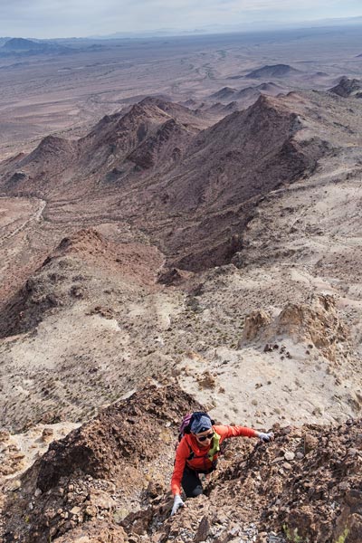
The descent was a little harder, especially for Iris who managed to rip off a hold just as she was starting down. Back at the bench we retrieved our trekking poles and traversed under the NE face and went down to join Eric. Then we headed towards the next peak - 2140. This involved heading N enough to get down past a cliff and then traversing around some sub peaks. The summit was marked at the SE end of the ridge but it looked like it was actually the NW end. We headed up that first - some 3rd class scrambling and the NW end was in fact the high point. We descended to the NE back to a wash where I saw a deer running away and then followed the wash around E and then S back to the Jeep.
Iris descending Pk 2498 with Bob below
 |
view to Peak 2140 with Chemehuevi High Point on the horizon
 |
on the summit of Pk 2448 - Iris is the "king of the world"
 |
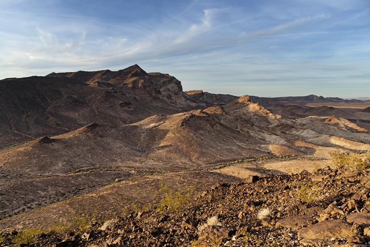
We drove back to 95 and headed S a little bit before heading up another faint road to the wilderness boundary. There Eric stayed with the Jeep and the rest of us headed off across the desert towards Negro Peak. Eventually we had to head up a steep slope to get past a cliff and then followed the S ridge up to the 2532 ft summit. We were debating if we would do the last peak or head down but eventually decided to go for it (partly because the steep slope would be a pain to descend). As we headed for this last peak the low golden light was quite nice. Fortunately much of the way was on pretty mellow desert pavement. Then up the talus slope to the summit of Peak 1830. Then we opted to head down and over some low saddles for a more direct return to the jeep rather than doing an end run around the peaks to meet up with the continuation of the road into the wilderness. This was probably faster if not easier and we were able to make it back to the Jeep before needing headlamps. We were parked 20 or so feet off of the pavement of the busy 95, but we had a warning sticker stuck on the Element, fortunately the window was dusty enough that it came off without much trouble. We rinsed up across 95 from where we parked and then headed down the powerline road to find a camping spot near the start of the next day's hike. The washes were too small to drive into with our vehicles so we were not able to have the vast amounts of firewood we were used to. Still we found out that old dead cholla burn as do dead ocotillo and that they have pretty big solid root balls.
Peak 2498 (center) from Negro Peak
 |
Bob descending from Negro Peak - peak 1830 is well below the horizon mid left
 |
Iris descending the ridge on Negro Peak
 |
Negro Peak from Peak 1830
 |
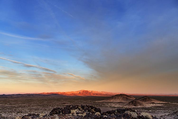
last light on the Whipple Mountains High Point
 |
Strava Page for Negro Mountain plus. 12-04-2023
Bob's trip report for Dec 4, 2023
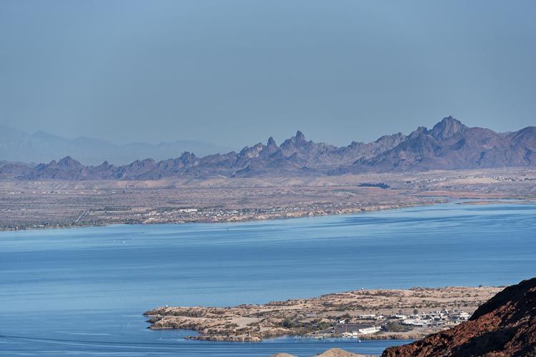
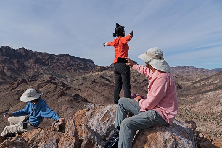
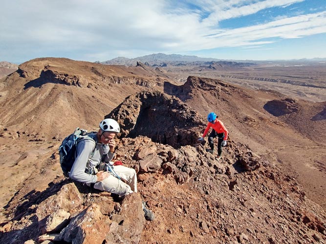
Dec 5, 2023 For most of us the day's goal was Chemehuevi Mountains High Point - another DPS peak. Bob had already done it so he had his eye on a few other peaks. We started off up a wash and at some point Bob turned off to the right, eventually it was obvious we were heading too far N and needed to head east too. On this long hike across the flats Iris was losing motivation and steam so she put in her earphones and turned on her music and sang along. Sometimes we were close enough to hear her. As we got closer to the peak the hazy clouds started to burn off and we became sheltered from whatever north breeze there was. It got hot. We headed up a long gully towards the NW ridge of the mountain lingering in the shade when it was available and enjoying our troubador's serenade. Once we got onto the ridge it was a little cooler and we made our way up to the 3694 ft summit. This was much higher than anything to the north for quite a distance and also clearly higher than anything else in the range. Bob had already summited his first peak hours earlier, but we were in no great rush.
powerline road sunrise
 |
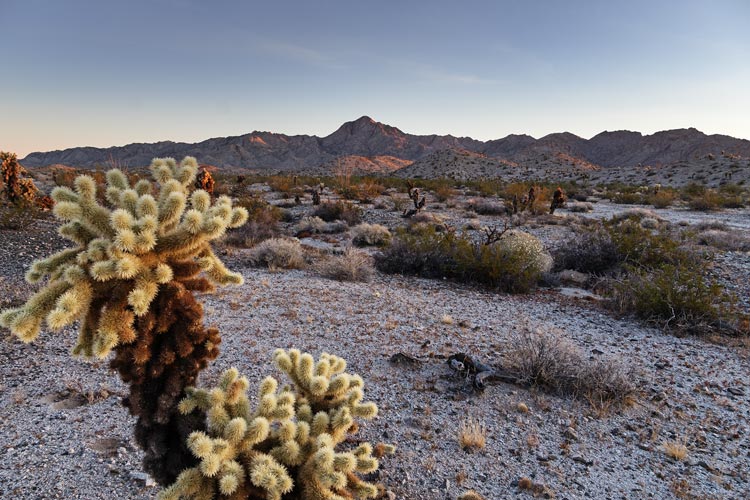
cholla and distant Chemehuevi
 |
Chemehuevi Peak - we went behind the ridge and up to the saddle on the left
 |
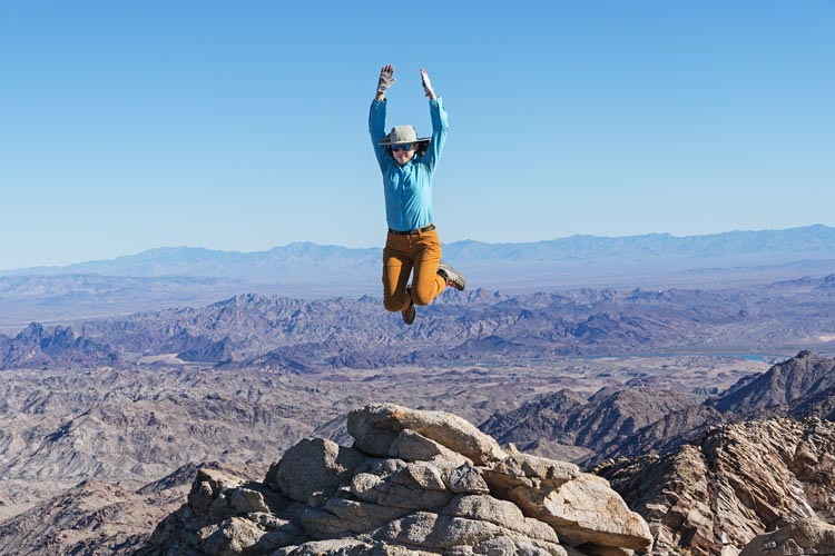
Iris jumps on the summit
 |
the distant Needles
 |
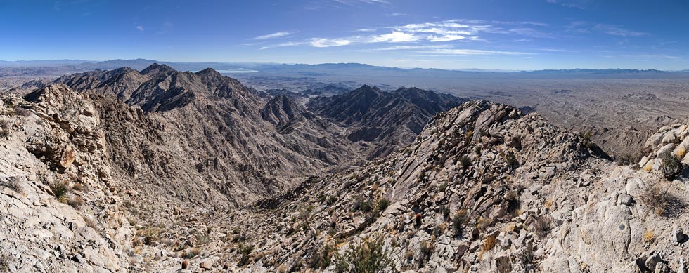
panoramic view from Chemehuevi Peak looking southish
Whipple Mountains in the center horizon and Turtle Mountains far right horizon
 |
The descent went a little bit better - there was slightly more of a breeze and going downhill is faster and less hot than uphill, still it was warmer than we wanted, especially down in the desert before we got out of the canyon into a little bit of a breeze. We stopped for lunch in what little bit of shade there was under on ocotillo and then made our way back to the car for a very nice and warm rinse. Bob was already long gone having just done one peak. We headed on into Needles to get water from the city park and then Indian food from a place that seemed to mostly cater to truckers passing by on I-40. That night we camped at a spot with a few other campers in vans and trailers - the wood was a bit sparse, but Iris found a stump we yanked out with the jeep and we all had a few bits of firewood we had saved up.
Strava Page for Chemehuevi. 12-05-2023
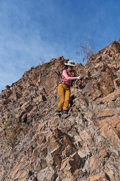
Dec 6, 2023. Eric headed back home this morning leaving just the 3 of us. Our plan for the day was to investigate a peak (1431) we had seen on an earlier hike that might require technical climbing - we had no other information about it other than no reported ascents online. My pack was a bit heavy with all the gear, but I didn't know what we would need, so up we went. At least Bob carried the rope. We came in from the NW and that side looked pretty impenetrable. We headed up to the shoulder in the E side and nothing looked too good, but maybe a path up the E side of the south ridge, so we headed down there to check it out. The first part looked scramble-able, but maybe a bit exciting, especially if it was loose. I headed up with the rope and after a climb up and a traverse over to a corner found at least a bit of solid pro and then carefully stemmed and mantled my way up to a big ledge. I checked to see that we could likely go up from here and then I was able to sling a large block that might have even been bedrock. I carefully covered a dead cactus with rocks so I could set up an anchor and bring the others up. Bob decided to try to climb directly up the initial slab towards me but soon slid down onto the belay before following the path of least resistance.
Iris and Bob on the E side of Pk 1431
 |
the south end of the E side of Pk 1431
we started up by the leftmost bush and up right on the slab and up the corner to the leftmost
ramped bench on the horizon, then up behind the horizon
 |
Bob investigates one way up on the s side of Pk 1431
the block on the ledge in front of him blocked this approach
we went up from the lower left corner and left of the little tree
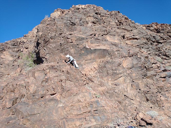 |
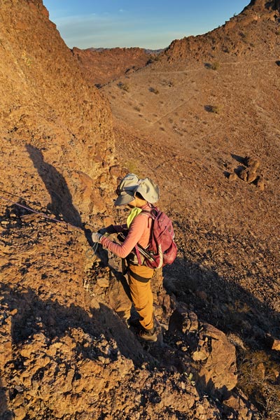
We scrambled up a bit more and then had to decide how best to proceed at the next cliff. The easiest way looked to be a delicate traverse out over the abyss and then up on questionable rock that all sloped the wrong way. There was also a reasonable looking ramp that had a big block in the way of a crawl on a ledge. I opted to head up on the left where it looked not too bad - with the steepest part being at least in a shallow dihedral. The protection was sparse and somewhat questionable, but I was able to carefully work my way up to where the angle eased on the way to the summit. It took some looking to find protection for an anchor, but at least some of what I found seemed pretty solid and I engineered it all together. Then I brought up the others, leaving the pro in so that I could use it for later downclimbing. We didn't find a summit register on Peak 1431, but it did look like there was a cairn on the top. I later saw a report of someone coming up the NW ridge with some 4th class up the ridge and 5.7 climbing up to the summit.
Bob on the bench below the upper rappel
Tumarion Pk on left, Gold dome on rt
 |
Iris starts down the upper rappel
 |
Iris hiking back - almost done. Pk 1431 is on the left
the other peak looks interesting but doesn't have much prominence
 |
The other 2 rappelled down with Iris going second and clipping the gear as she went down. I cleaned up the anchor and gingerly downclimbed on belay. Then we scrambled to the next belay and once again the other 2 rapped down. This time Iris placed some gear as she went down. Then I carefully downclimbed cleaning as I went. Fortunately I was able to clean the last good piece after I downclimbed the crux. Success, although it had taken much of the day.
We headed back to the Element and drove east then pulled off of I-40 through a little gate and left the Element and then Jeeped to the last objective of the day. We started near the goldspeck mine which seems to be at least fairly recently worked on. There was a path up part of the way and then we traversed on sheep trails and wherever looked good up to the summit of Peak 1900. Once again the evening light was pretty nice. We headed back to the Jeep and then back to the Element arriving shortly after the sun set behind the hill here. At least the water was warm and we had plenty of it. Then we drove around to the east side of this range with a stop at the gas station and then down a wash off of 95 in Arizona and up onto a plateau. It was a little sketchy getting up out of the wash, but we made it. Once again the wood supply looked a bit sparse, but soon we found some dead branches and even whole trees. We had to carry them a bit, but not too far. By the time we were done collecting we had a pretty big pile to burn. That night a few fairly large (military transport?) airplanes flew low overhead on approach to the nearby Lake Havasu Airport. There were a number of airplanes flying over these mountains over the course of our time here.
Strava Page for climbing and hiking bumps. 12-06-2023
Bob's trip report for Dec 6, 2023
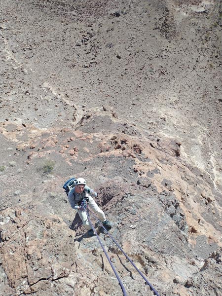
Dec 7, 2023. We had an ambitious plan today including 2 potential technical peaks and 4 others. We started out on the Jeep going to near the wilderness boundary and then hiking up Peak 1520. Then we dropped down across a wash and up the ridge to Monolith Rock. This one we had a little bit of beta for - unfortunately Bob didn't read out what he had until we were on our way. I knew about the high first bolt and some bolt ladder aid climbing, but hadn't heard about the 12 slings and 1 to 3 inch cams and "interesting" climbing for the second pitch. I had aiders, ascenders, and about 10 slings and draws but only a handful of nuts and some tricams for pro. I also only had my approach shoes instead of actual climbing shoes. I was a bit nervous about what we would find.
starting off in the morning - Pk 1520 is in the center
 |
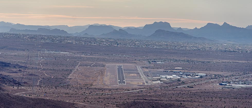
view down towards the Lake Havasu Airport
the first line of peaks behind it are in AZ - the Aubrey Hills, farther back are the Whipple Mountains in CA
 |
Bob about to drop down off the plateau of Pk 1520
Peak 1440 is right of center with the Monolith hiding in front of it
 |
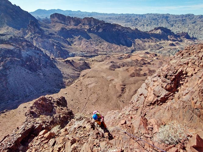
We went up the ridge to the E ridge base and were able to spot a number of bolts - enough to be pretty confident I could get to the first anchor. I walked quite a way back down the ridge and took some zoom pics with my camera. I carefully looked at these and was able to spot at least 3 more bolts up high going into a dihedral and right before the steepest part. This was enough to inspire me to give it a go, although I was still pretty nervous if that was all the bolts there were. Stick clipping the first bolt took a bit of work because I only had wiregate 'biners which don't work as well with my stick clip and the hanger was a chain link welded onto a plate that had a pretty small opening to clip. I borrowed a solid gate 'biner from Bob and was able to clip my 2 aiders clipped together to the first bolt. Then I tied in and headed up. I was able to aid through about 80% of the first pitch with only a few free climbing mostly mantle moves where the bolts were spaced a bit farther than I could reach. I climbed past a 2 bolt anchor in a small hole that I hadn't seen from the ground and up to the anchor I had seen from below. The webbing was completely bleached and tattered from the sun. I set up an anchor and then lowered down one end of the rope so that the others could ascend one side of the rope while being belayed with the other strand. Iris came up first cleaning the slings and then Bob came up.
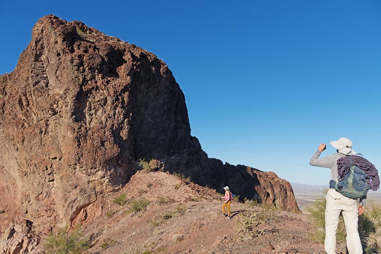
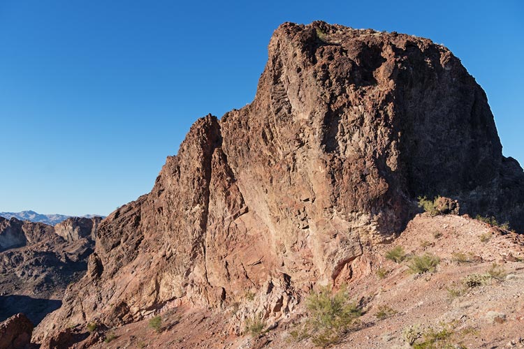
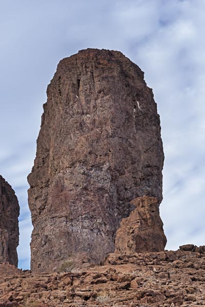
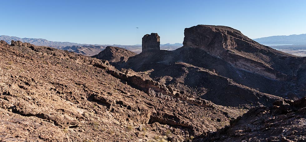
The Monolith as we come up the ridge
this is the side we climbed
 |
Iris and Bob at the base of the climbing on the Monolith
 |
Bob ascending the rope up the Monolith
 |
at the top of the first pitch
 |
The second pitch was a lot scarier. The first bolt was a bit of a traverse off to the right. I delicately climbed up to that and then saw there was another bolt just above it - yay. I clipped that one and unclipped the first bolt as there would be less rope drag and headed on up. There was a lot of bird droppings from above and I carefully eased my way up expending a lot more energy than I would if I fully trusted the holds. Fortunately there were more bolts that I hadn't seen from below and with a combination of free climbing and "french" freeing (pulling on the slings) I got up to the last bolt. Then I had to cast off back to free climbing up and right and then back left where I found a 3 bolt anchor at the top. Once again I set up an anchor and then lowered one end of the rope to belay while the others ascended. There were a few places above the bolts where I could have placed some gear, but it would have been of dubious quality if I fell as the rock did not inspire confidence. I don't know how hard the mandatory free climbing was - maybe 5.7 or so, but it felt harder because I didn't really trust any of the holds. We headed up to the summit where there was a cairn - but no register. Then Bob got a call from Joel Dugdale (I think) who had heard we were climbing from Tim and found Bob's number on his web page. Tim O'Conner (the other first ascentionist) had heard from Bob we would be trying to go up and had seen us climbing up from the 4wd road. Bob got Tim's number from him and called him - and he said the register was in the lower cairn near the top of the climb. We found it there behind a white rock. Leaping Lizard Summit #6. First ascended 1992, last ascent before us 2002. We signed the register and replaced it and then I set up a rappel with some webbing and an old 'biner and rappeled down to the previous anchor. I tossed the rope ends off the ledge from there but could see they were a few feet short of the ground - maybe only 10 feet or so, so an 80M rope might make it. Iris and Bob rapped down and I set up another sling rappel station using the chain link that was on the frayed old webbing (and cleaning the old webbing). Back on the ground I took the ends of the rope around the corner out of the way of potential rockfall and the others came down.
Bob on the summit and Iris coming up
 |
Bob on the summit and Iris coming back down
 |
Bob Rappels
 |
Next up was Peak 1440 just uphill from the Monolith Rock. We left our packs at the saddle and walked around and up to this summit and a little down on the NE side to the overlook above the Monolith. Then back to pick up our packs and head down to the saddle and then up and around to the west towards Kongs Head. We had heard this was a scramble that you might want a rope for so we hemmed and hawed about leaving all or some of our gear here where we would return. We ended up taking a few slings and cordalettes and then hiking down across the saddle and up to Kong's Head. It did have a scramble with a few thinner moves with consequences if you fell, but the rock felt fairly solid and we didn't need any of the gear. The summit was 1557 feet and had a nice view over the Colorado River and Lake Havasu as well as the Gold Dome and Tumarion Peak areas. We did not linger as the sun was low. We headed back to our stuff and then up around a cliff and to the summit of Peak 1640 From there we scrambled down to the saddle and then up 1665 - the last peak for the day. We tried to beat the sunset to the summit but failed.
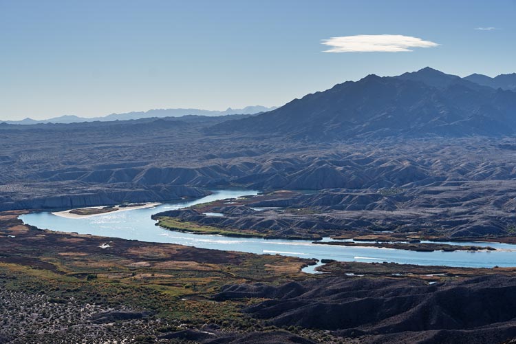
The Colorado River and the Chemehuevi Mountains
 |
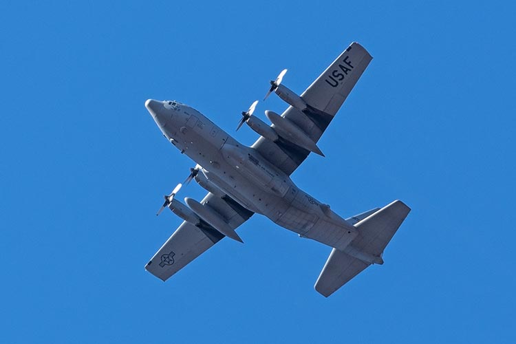
the Montana Air Guard flying into hii
 |
view down towards the Monolith from Peak 1440, Kongs Head is on the left, then 1640 and 1665, Peak 1520 is above the Monolith
 |
Kongs Head
 |
the Monolith and Peak 1440, The Montana plane took off and is above and left of The Monolith
 |
Bob and Iris descend from Kongs Head - Pk 1440 near the center
 |
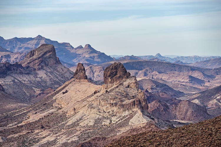
South Dome, Gold Dome, and Tumarion Peak
 |
We were unsure of how to descend and opted to follow some tracks we had that might not have been the most direct or quickest but was a sure thing and maybe the easiest to follow once it got dark - especially as Bob was unsure how much life his headlamp batteries had. Sure enough it got dark and we needed headlamps. A litte later Bob's died. After he stubbornly stubbed his toes a few times we put him in between us so that he would get a little light and we were much less likely to just leave him behind. Fortunately by now we were on a pretty good burro? trail that was headed almost back to the wash we dropped into at the start of the day. Thank goodness for GPS or we would have been a lot less sure of ourselves as well as have to pay a whole lot more attention. We took the Jeep back to where we had camped the night before and after a quick rinse collected some more firewood and cooked up dinner. It was a good day with success on an ambitious agenda as well as on somewhat unknown difficulty of objectives.
Iris and Bob on the last peak
Bob appears a bit more concerned, maybe because it is after sunset and his headlamp batteries are almost dead
 |
Iris' Strava for the Monolith plus. 12-07-2023
Bob's trip report for Dec 7, 2023
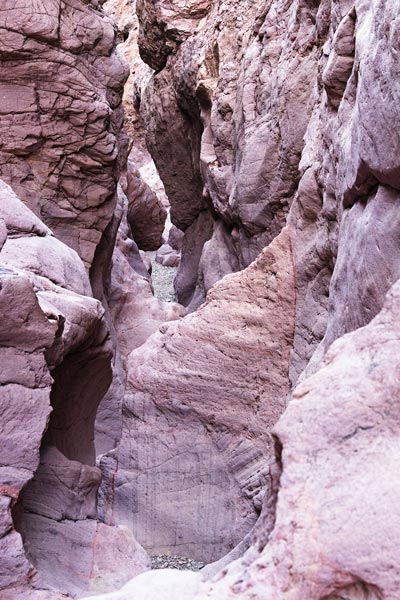
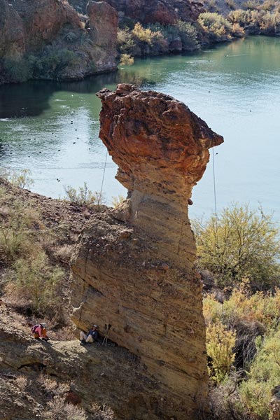
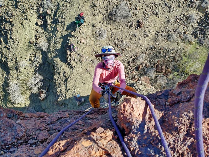
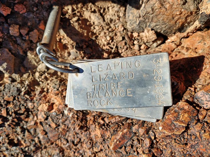
Dec 8, 2023, This was our last day and we planned to do Balance Rock - another Leaping Lizard Peak we had failed on in November 2022 as well as some peaks in the Aubrey Hills. Bob was out of breakfasts so he headed into town early for coffee and breakfast and we reconvened at Sara Park later. There we loaded up with gear and hiked down through the crack to Balance Rock. Here we didn't waste any time looking for bolts or cracks for pro like last time and instead employed the Leaping Lizard technique that Tim had told Bob after we failed. This worked surprisingly well and soon I was anchoring one end of the rope in the trees near the water and then ascending the other side of the rope. There I used the fixed rope as an anchor and belayed the other 2 while they ascended the rope. We didn't find any summit register but there was a stake pounded into a crack with a number of aluminum dog tags labeled with ascentionists from 1994 and 2015. Sadly we had not brought our own to add to the collection. Then we rappeled down, untied the rope, and pulled it over. We took the blue trail back for variety.
Iris about to head down a dryfall in the crack
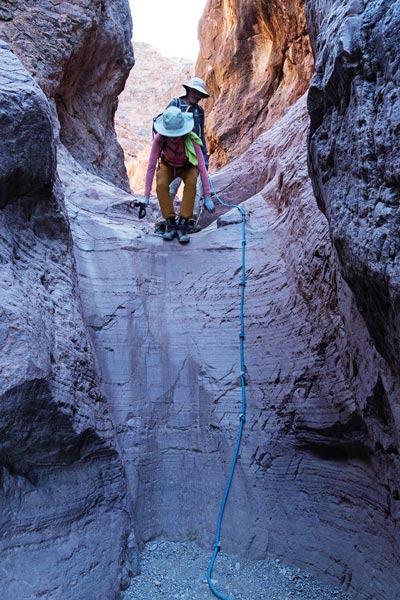 |
the crack
 |
Balance Rock - Bob for scale left of the base
 |
Balance Rock with the rope over it
 |
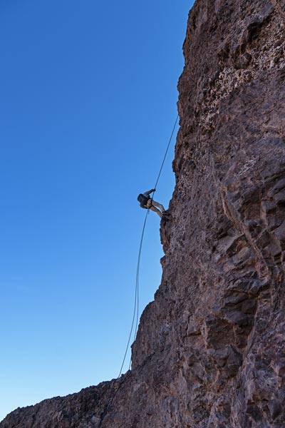
Iris ascends up in rainbow ninja mode
 |
Bob comes up
 |
Leaping Lizard summit tags
 |
Next up we parked the Element closer to 95 and then drove the Jeep on 4wd roads closer to our objectives. First up was Peak 1260. It involved some scrambling. I looped around to the SW side while Iris and Bob went up more on the S side. They beat me up but only because I went up to a notch slightly N of the marked summit which was in fact N of the actual summit. The hardest scrambling I did on this peak was dropping down and climbing up to the high point. Then we headed down to the SW and across a saddle and up another ridge towards the next peak.
Bob on the summit of Peak 1260
 |
Bob and Iris on the summit of Peak 1260
 |
Iris carefully descends Pk 1260
 |
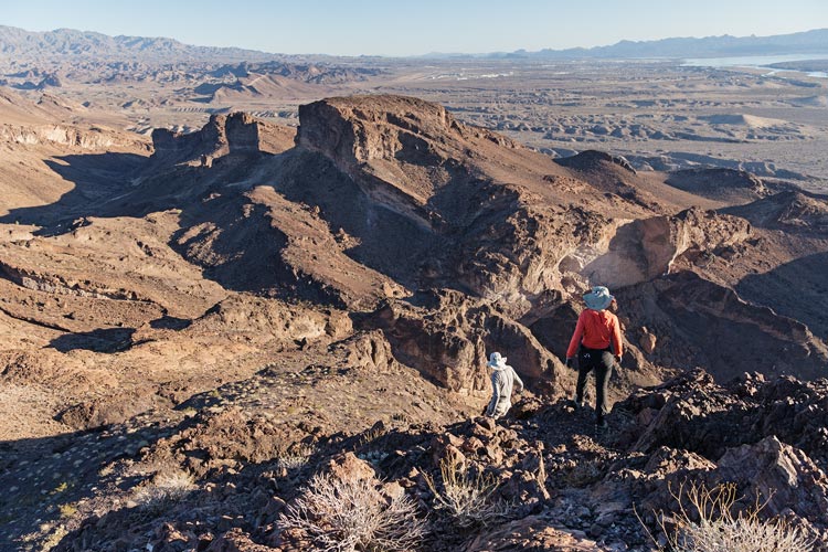
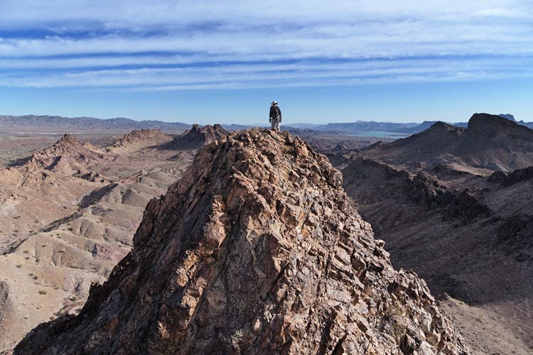
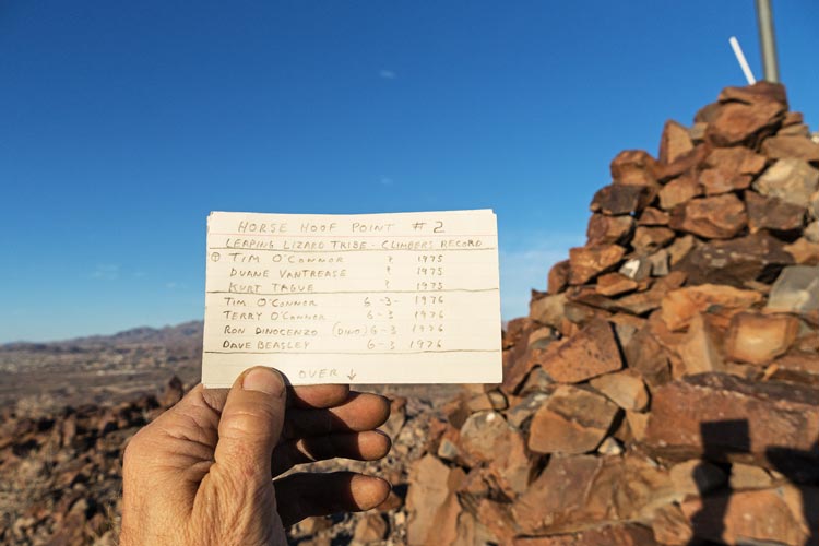
There was another wash to cross but the descent was fairly painless and then we were able to follow mountain bike paths most of the way up to the saddle on the south side of the next peak. We could see a large cairn on top of this but the only trip report we had (from Stav) did not figure out a way up. We traversed around to the SW side where there was a large pile of rocks up against a short overhanging wall. The pile of rocks helped get past the overhang and I climbed up spotted by Bob and then anchored the short (30M) skinny rope we had quite a bit above that. I set up a belay just above the scramble and the others came up. While Iris was coming up Bob scouted out above - and to the left. He found a way and we traversed left into a large semicircular amphitheater which we traversed all the way around the inside of and then up onto the summit ridge from the NW arm. This worked out well and soon we were at the massive summit cairn. There was a white rock and a number of the stones in the cairn had been signed by various Leaping Lizards or members of the O'Connor family and the register dating back to 1975. It turns out this was Leaping Lizard #2 - a nice surprise. We are slowly working on getting all the Leaping Lizard Peaks - except we don't know what they all are, and Iris and Bob have already climbed Monument Peak - an impressive but horribly loose spire that I am unlikely to convince them to go back for. We enjoyed the evening light, but not for long as Bob didn't have even a dead headlamp. We reversed our course with Iris and Bob rapping before I downclimbed with a spot. Then we headed back to the saddle and mostly followed bike paths revealed on the Strava heat map back to our previous path and the Jeep. We made it just about when it was time to start using headlamps.
distant view of Horse Hoof Point - summit cairn visible
 |
view back to Peak 1260 as Bob hikes up
 |
Bob and Iris prepare to traverse left on Horse Hoof Point
 |
Horse Hoof Point summit register card
 |
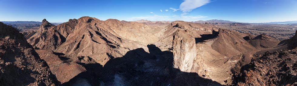
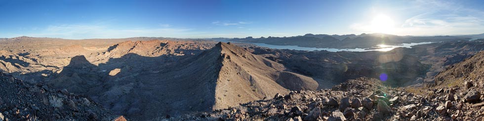
panorama from the top of Horse Hoof Point
 |
Iris prepares to rappel down the short overhang
 |
sunset over the Whipple Mountains
 |
Iris and Bob hike back
 |
Aubrey Hills sunset
 |
Strava Page for Balance Rock, Horse Hoof Peak, plus. 12-08-2023
Bob's trip report for Dec 8, 2023
After grabbing some food from the back of the Element and changing our clothes we started the long drive back home arriving later than I would like and compounding it by staying up long enough to wash the clothes that shouldn't be put in the dryer. All in all a very good way to start December.
No material on this page may be copied or used without permission.