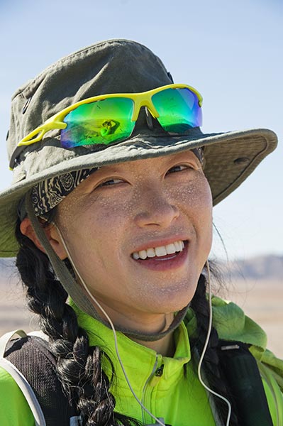
Iris wanted to do some desert peak bagging for her birthday weekend along with Bob Burd and Tom Becht, so I elected to join in on the "fun". This started a few days early on November 14 when I drove down to meet Bob at Giant Rock - a really big boulder near Lander, Ca (something like 70 feet tall). It has been argued that this is the largest rock in the world, although maybe not now that a big chunk has broken off. There is all sorts of interesting history with this area including a guy who lived under it for years. Also lots of spray paint, glass, etc, although it seems the worst of the trash has been cleaned up. While we were there a few vehicles pulled up and people got out to look around and take pics for a few minutes before they left.
I was running a bit late which gave Bob time to climb another little peak in the area before we met up. We walked around the rock and I decided some sport routes on the SW side would offer the best route up - I stick clipped my way up and then Bob followed by prussiking the line. We took some pics on top and then rapped off the drill bit stuck into the top (by drill bit, I mean the sort that would fit in a jackhammer). Then we walked over to a little bump that supposedly had quartz crystals - but it was just a lot of broken up quartz rock.
Next we headed a little way up a dirt road where I parked my truck and joined Bob in his Jeep to bump our way nearer another little peak (peak 5330ft (these peaks are obscure enough they don't get a name - just designated by their elevation or an approximation of it)) (this was the theme of the trip - lots of little peaks and bumps and a few more substantial ones). We parked and hiked a short way up to a peak in the near distance. The sun set on the way back. Bob was taking a jug "shower" when I was getting ready to drive off and noticed a note on the window - private property no parking. oops. Then a woman drove up and told me that, and told me to tell Bob (I was tempted to send her over to surprise them both, but decided against it. We had Mexican food in Yucca Valley and then drove up towards Rimrock where we slept at a wide turnout.
| |
|---|
11-15-19 I loaded into the Jeep and we headed into the San Bernardino Mountains (I think). Our first objective was Tip Top Mountain. This is quite a high point and it took a lot of jeep driving to get close. Then we hiked the rest of the way to the top. There was a road most of the way and old mining evidence as well as radio repeaters (I think) on the summit. We signed the register and then set about finding the real reason we were here - the wilderness area high point that Bob had neglected to visit the last time he was here in 2010. This is actually almost on the summit, but not quite. We found another recent register for it on the side of the trail. I mostly know Bob from doing the Sierra Challenge and also his extensive trip reports providing beta for all sorts of objectives. He has worked his way through various lists of Sierra peaks, desert peaks, mountain range high points, county high points, and so on getting more and more piddly and obscure as he goes (when he isn't traveling farther afield for new peaks). It is a good excuse to get out and explore new places, but it is also good fodder for ribbing him, especially when you can't even tell which of many little bumps might be the high point.
Next up was Heartbreak Ridge - this was somewhat marred by the fact that there were no trespassing signs up on the side of the road approaching it. It wasn't clear where the boundary actually was, but they did say "gate ahead - no turnaround" among other things. We poked around a few other spur roads and then just parked and hiked. We ended back on the first road and eventually got to the gate. There we cut cross country before the fence (and the "no warning shots fired" sign). This area had burned fairly recently and was pretty mellow cross country travel. We did an end run around the fence and headed up the ridge with a little fun scrambling. On the return we headed more or less straight back to the jeep. 2 or 3 down - a few more to go.
The next 2 summits were on either side of the road. Both fairly short jaunts to the high point with the second one passing more mining areas and a mining claim for "placer mining". These were peaks 6250 and 6460ft
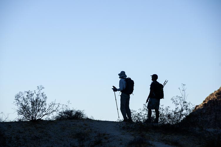
Next up were 2 summmits that probably would have been more easily accessed from farther up the road we were on the day before. Oh well, we were here now. The Jeep road got us close but then became rather rough - we could probably make it, but at about a walking pace and with serious wear and tear on the tires and the rest of the jeep and no guarantee we wouldn't run into something that would stop us. So we parked and started walking. We were on the jeep road for quite a way but then cut cross country up to the first peak (Pk 6,093 ft - that might have been the highpoint of the Bighorn Mountains). From there we cut down the ridge to the NW to another maybe highpoint. There was a lot of up and down but nothing too frustrating up to Pk 5940 ft. Maybe this is the highpoint. Best to tag them both to save a return trip. Then we dropped down to the west into a wash/canyon and back to the jeep road for the return. We got back around 3:30 with plenty of daylight but not enough to try for more peaks. We headed back to my truck and then through Yucca Valley, J Tree, and 29 palms to an elevated pullout off of the 62. There I took a jug shower and ate some leftovers. When Bob got there we had a little fire and watched the moon rise before going to sleep. Iris was supposed to show up that evening but was running late getting out of the LA area and was too sleepy to keep driving so she stopped for a nap on the way. Tom Becht would head out early early the next morning to join us.
 |
|---|
 |
|---|
 |
|---|
 |
|---|
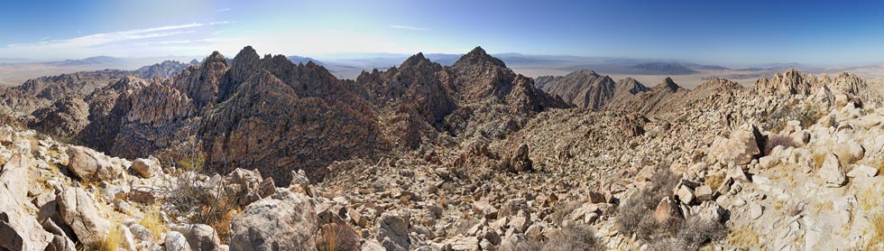
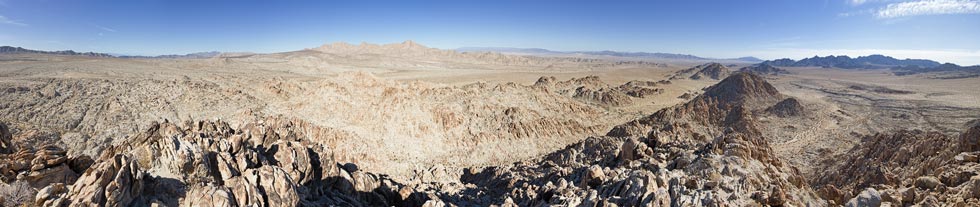
11-16-19 We weren't the fastest in getting ready this morning, but we did get packed up and drove to the trailhead (a pullout on the side of the road) a little before 7 and soon we were walking along the old closed road/washes towards the Coxcomb mountains. It was lovely cool hiking for a while, but then the sun began to have an effect and things heated up. We passed a group of 3 camping in the shade and then began heading uphill towards a col that would bring us closer to the day's objective - 3 remote peaks including the highpoint of the range. Summitpost says "Climbing Spectre Peak in a day is a huge undertaking. Make sure you start before dawn. Most parties will prefer to camp somewhere for a more pleasant 2 day trip. Doing all three peaks in a day borders on super-human. Special considerations include sturdy footwear, optional scramble gloves, and plenty of water."
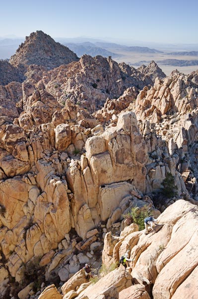
We were fortunate to mostly be in the shade as we worked our way up to the saddle. There Tom discovered he had lost a glove. We continued down and then up another wash for a bit before heading up towards the first peak Tensor - also referred to as Aqua as there is a benchmark with that name near the summit. This peak was pretty mellow (once we got there), but the views were nice.
 |
|---|
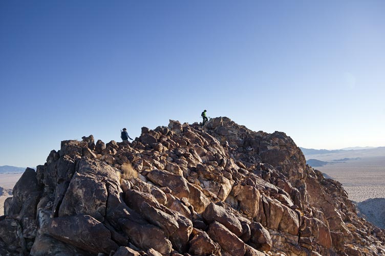
Next up was Spectre peak - the highpoint of the range. First we had to drop down and then scramble up the slope. It was pretty mellow scrambling but I spiced it up by trying to head up more directly. This summit was just a few big blocks with pretty good slopes down to the sides.
The last but by no means the least peak was Dyadic (or maybe Diadic). Only a few feet lower than Spectre but with no really easy way to get up. We headed down the wash a for a while to try to avoid climbing over multiple false summits on the way up the ridge. Unfortunately it was marked wrong on Bob's GPS so we headed up one summit too early. It wasn't hard to get to the base of the actual peak and with a little scrambling and circuitous route finding we made it up. The descent was fairly tedious down talus and steep watercourses. Eventually we cut the corner of the washes and then headed down a big flat wash. We detoured to look for Tom's glove and it turns out the people camped there had found it. The hike back to the vehicles seemed extra long and the sun set before we returned but we were able to make it without headlamps. After rinsing off we had a barbecue and celebrated Iris' birthday with a cake (it was actually the day before but she wasn't there then).
 |
|---|
 |
|---|
On Sunday we drove around to the other side of the range driving along the aqueduct for a good distance. It looked invitingly cool and clear but there was a fence and a lot of warning signs. We hoped to drive a bit closer but the road was gated at the park boundary. Sadly in my packing I forgot both my SLR and my phone so I took no pics (but my pack was lighter). We hiked up the road to an old pumping station (pumping groundwater to add to the aqueduct? or for a mine?). Then headed cross country towards our destination peak off in the distance. By the time we got to the base of the peaks it was hot. It got worse as we got into the canyon and started up in earnest. There was a little bit of shade for relief but we were all sweating on the way up. The rock here also could be very poor quality - crumbling granite - which could break or slip and drop you to a spiky doom (or at least some scrapes and cuts). Finally we made it up to the top of peak 3580ft. The next peak on the list (we originally wanted to do 4, but with the added walking, short days, and ruggedness of the range we realized that was not in the cards) was not far away, but it looked very intimidating. We hoped the other side was a little mellower.
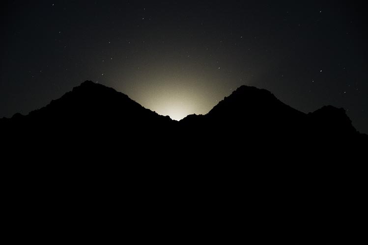
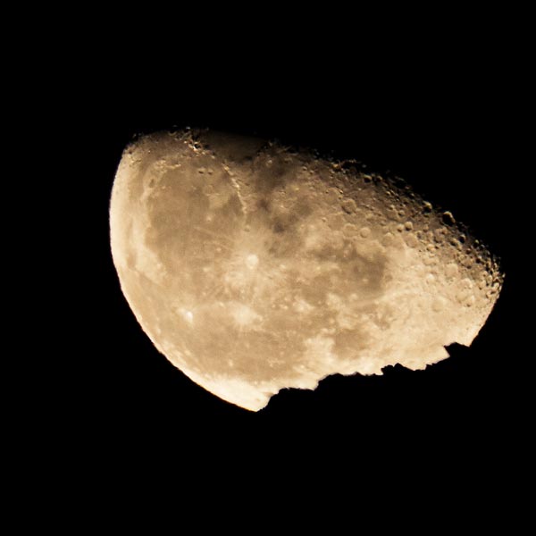
Tom B opted to head back and the rest of us headed down and up towards the next peak. Iris missed Bob and I's discussion of which way to go and ended up heading in a more direct way - until it cliffed out above her. We split up to try to find her (we heard a faint call). and eventually we were back on track. I had headed up to see if she went up a higher gulley and that gave me time to scout out what I hoped was a way up. It turns out it worked as when we got around the corner there was a ramp up to near the summit. It was pretty easy scrambling with a little more excitement (up to 4th class?) at the top. Then we were treated to a nice breezy summit with excellent views. For the descent we ended up going down a different gulley that met up with our route up. Then we headed more directly across the desert hitting the road closer to where we were parked. Once again we returned after sunset but before we needed our headlamps. Then we had a fairly long drive back to our "home". That night I was able to get some moonrise photos.
11-18-19 Iris had Monday off, so we were able to climb a few more bumps on the north side of the road (peaks 2191, 2322, 2362, and 2542). The rock quality was maybe even worse, so it was a little treacherous. Also things were heating up so we were cooking when we were heading uphill in the sun (we probably should have done them in the opposite order). Still they were some nice little peaks and probably very rarely visited. We left a register on the last and highest one.
 |
|---|
 |
|---|
 |
|---|
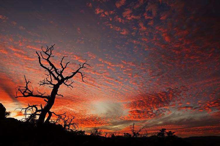
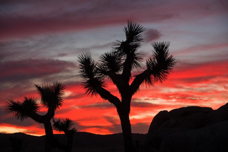
After Bob left Iris and I headed into JTNP where we had time to climb "Sail Away" and "Wild Wind". The rock was so much better than what we had been on. Bonus, we had a really nice sunset.
 |
|---|
Below are links to Bob Burd's trip reports for these days. I didn't bring my camera or phone for the 17th, so if you want to see pics, his report has them.
Bob's report on Nov 14, 2019