
| |
|---|
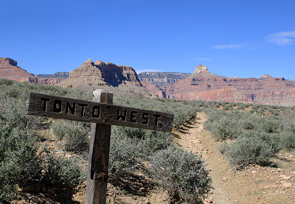
Once again spring is here and its time for self punishment, that's right, the annual Grand Canyon Deathmarch. This delightful little tradition is also known as a hell hike or as I have lately learned they would call it a mission in New Zealand. The National Park Service discourages people from hiking down to the river and back in one day as I have in past hikes in 2007, 2008, and 2010. This year I heeded their warning and instead hiked down the Hermit Trail, east on the Tonto Trail, out to Plateau Point, and finally up the Bright Angel Trail. This probably wasn't what they had in mind either. It ended up being around a marathons distance at 26.2 miles by my map with at least 3500 feet of elevation loss and gain. In reality I went a bit farther and the elevation loss and gain was most certainly more.
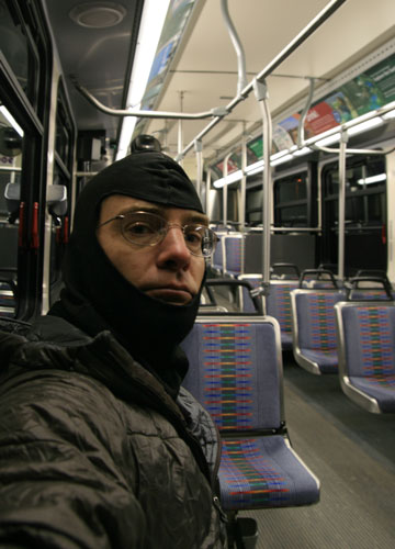
The alarm rang at 4 am on April 5, 2011. I had not gotten a lot of sleep despite crawling into my bag around 8:30 the night before. I hastily dressed and shoveled about 1/3 of an apple pie down my throat followed by a banana. I shoved 2 more bananas into my pocket and walked over to the shuttle bus stop to catch the 4:30 shuttle. It was dark and cold. I passed a few mules heading to the Bright Angel Trail (this was my only mule sighting all day!). Despite my puffy jacket, it was too cold to just sit waiting for the bus (the forecast was for 21, but it didn't seem that cold), so I walked around in circles. I was the only rider on the bus, so it was a little odd to stop at every stop, but as the driver said, it was to maintain the schedule, and the last thing I wanted to do was disturb the maintenance of the bus' daily operations. I was planning on eating my bananas on the bus, but the signs said "no food or drink", and as the only rider I could hardly hide. I got off at Hermit's Rest around 5 am and quickly finished the bananas and then wandered around in the dark a bit before I found the trailhead. At this point it was barely light enough to see, but was still much easier to use my headlamp to see the uneven footing of the trail.
 |
|---|
The birds weren't making much noise when I started, so other than my noise it was pretty quiet and in the dark I couldn't see much. I could smell something flowering from time to time though, and I could also detect changes in temperature and moisture content in the air. As I descended and it got lighter the birds started up. I could recognize the call of the canyon wren, but not much else.
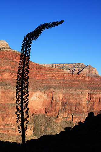
At one point the Hermit Trail was the best constructed trail in the canyon (or so I have read), but that is no longer the case. 80 or so years of neglect have taken their toll. In some places there are still stretches of cobblestones, but in others the trail is completely buried in rockfall or eroded away. Soon it was light enough to turn off the headlamp. This trail is on the east side of a large side canyon, so I didn't get much of a view of the sunrise. Things just got gradually lighter until finally there was some light on the cliffs on the far side. This also meant that things stayed pretty cool for quite a while, although I was able to remove the puffy fairly early I kept the long underwear top and leg warmers on all the way to the Tonto Trail.
 |
|---|
 |
|---|
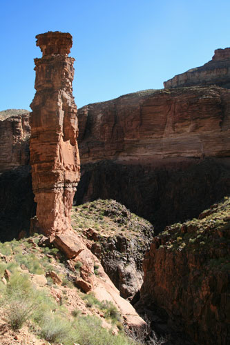
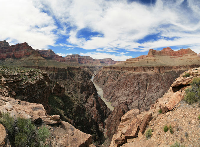
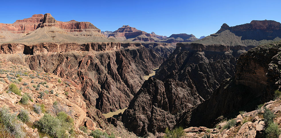
Once I got onto the Tonto Trail, things were not so steep. This trail follows the Tonto Platform on the Bright Angel Shale just above the Tapeats Sandstone. The trail occasionally went right along the edge above the Tapeats. This provided nice views, but also made for a more meandering path. Although the platform is fairly level, it is cut by deep canyons so that the trail has to contour very far to get around them. Sometimes a detour of a mile or more was required to get a few hundred feet across a narrow canyon. Often there was a bit of a drop into the head of the canyons too. At this time of the year most of the canyons had some water in them. I had a little over a gallon of water at the start and I could have easily made it with a half a gallon less, or brought a filter or iodine and carried much less at any one time. I suppose it was better to be safe, and without knowing I'd have wanted to carry some reserve anyway.
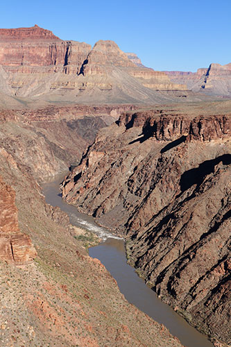
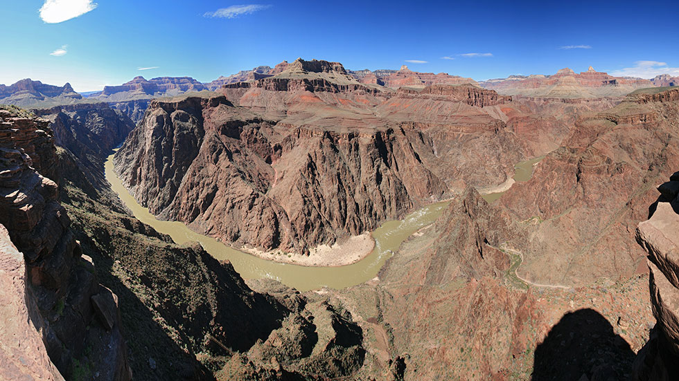
There is a rapid on the Colorado River at just about every side canyon (the side canyons bring material down to the Colorado and this makes a rapid). Conveniently enough, the side canyons also provide a good view down to the river. I was checking out the rapids for the possibility of a packraft descent and all of the ones I saw didn't look too bad until I got a glimpse of Granite. It looked big and scary. I think you could portage around most of the rapids, but where is the fun in that? Unfortunately I don't think the park service allows day boating without a permit in the same way they allow day hiking. It would be quite the mission to hike down the S Kaibab, inflate the rafts and head down to Hermit and then hike back out in a day...
 |
|---|
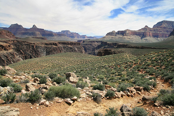
I didn't see anyone on the Hermit Trail and I only passed 4 or 5 people on the Tonto Trail. They were all going the other direction. I talked to one couple that was basically doing what I did in reverse and in 3 days. It would have been nice to take more time to explore some of the side canyons and to go all the way down to the Colorado. With the relatively mild temperatures in the canyon and fairly regular water at this time of year your pack weight could be quite light even for a few nights out (I am not talking about suffer-light either).
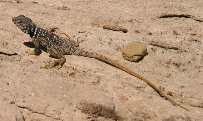
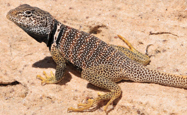
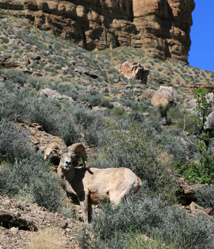
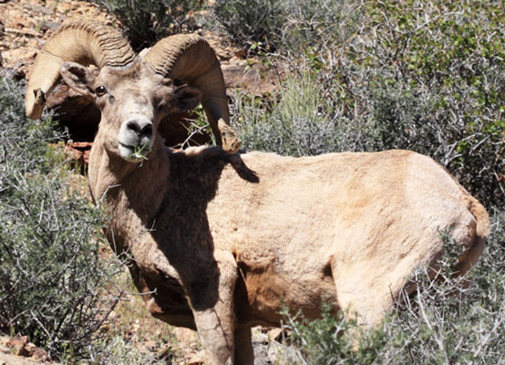
I saw a lot of lizards on this trip, most notably the spiny lizards and collared lizards. This is the first time I saw the latter running on their hind legs. I also saw one bighorn sheep that got up a few feet off the trail when I came around the bend. It walked a bit away from me but then stuck around long enough for me to change camera lenses and shoot a number of pics. Finally it got tired of me and took off down the trail behind me.
 |
|---|
 |
|---|
 |
|---|
 |
|---|
In the late morning a number of clouds formed. This was nice because it provided a bit of shade plus something to break up the boring blue skies (which really wasn't that bad of a problem to have). I know I said that things weren't so steep on the Tonto Trail, and they weren't, but the trail really wasn't level very much either. Compared to the other trails it was flat, but it still went up and down. Sometimes the trail veered out to the very rim of the Tapeats Sandstone cliffs which made for some awesome views.
 |
|---|
 |
|---|
 |
|---|
 |
|---|
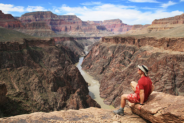
At Horn Creek I knew I was getting close which eased my mind a bit. I knew I was on the right track and I would get there eventually, but I didn't really know how far I had to go. Part of the reason I knew I was getting close was because I found a decent map here, the other was because I was starting to recognize landmarks you see from the Bright Angel Trail. I relaxed a bit and also decided that I would hike out to Plateau Point. (I even considered continuing on the Tonto Trail to the S Kaibab Trail, but decided the extra miles and shuttle bus wouldn't be worth it).
On previous trips there were a lot more people at Plateau Point, I think I was a bit later this year, so the day hikers were mostly gone. A lot of the people out there were camping at Indian Garden. Out at Plateau Point I took a heap of pics. I also set the camera up on a rock looking down onto a nice spur of rock. I climbed up onto the spur and tried to trigger the camera with the remote, but it didn't have the range. I had to climb back and forth a few times to reset the camera, but it still didn't work. At least I could tell it wasn't working, so I didn't waste time trying to pose.
 |
|---|
 |
|---|
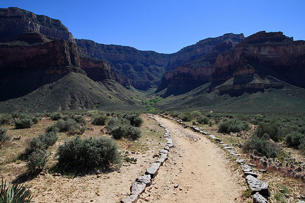
The hike back from Plateau Point to Indian Gardens was uneventful. There were a lot of people at Indian Gardens, but I realized many of them were camping there. I checked my water supply there (I didn't really need any more, in fact I still had more than I ended up needing). Then it was time to saddle up for the final push, only 4.8 miles to go. Unfortunately they were mostly up with around 3000 feet of elevation gain. At this point I think going uphill was easier than going downhill at the same angle would have been (although perhaps slower). I just had to keep the pistons pumping. Luckily the trail was almost all in the shade by now and it kept getting cooler as I went higher.
 |
|---|
I knew I was getting close when I saw people in cowboy boots, smoking, and could smell the perfume. I topped out just before 6 pm, so a total time of just under 13 hours. I figured it would be somewhere between 10 and 15 hours, so I was in the ballpark. It was pretty cold (I was in shorts and a t-shirt at this time), so I quickly hopped in my truck and headed back to Flagstaff.
Jason Henrie blogged about this as a run which in part gave me the idea to hike it. Thanks for the inspiration. His blog posts are here:
Grand Canyon: Hermit, Tonto, Bright Angel Trail Loop Run
Hermit/Tonto/Bright Angel Loop Revisited
The fact that he is cranking these out in less than half of my time is most impressive (although I blame that on carrying camera gear and stopping to take pics (ha))
 |
|---|