Iris had another long weekend, so we planned a Sierra trip. Somehow I didn't get the memo so I packed for 4 days despite the plan being for 5, so we were a little short on breakfast and dinner. Maybe we could supplement with trout.
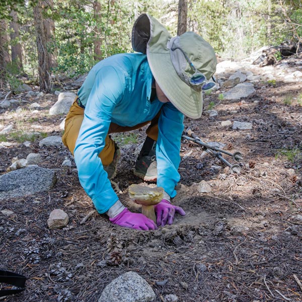
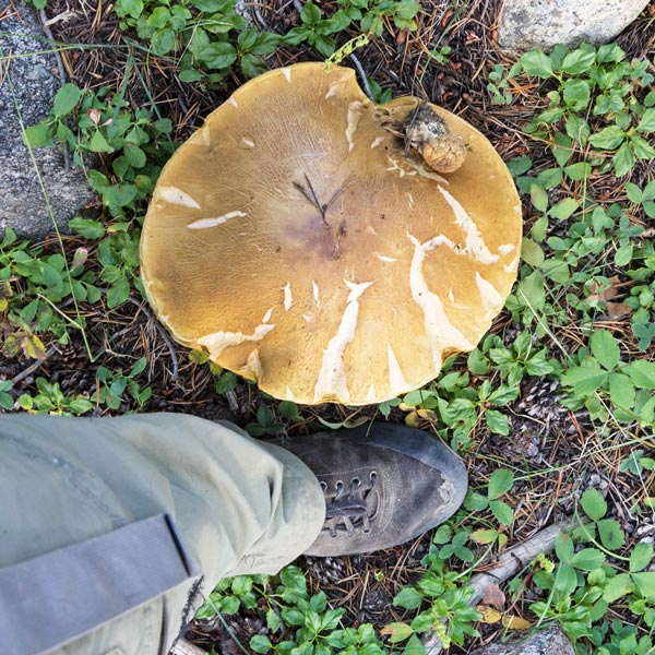
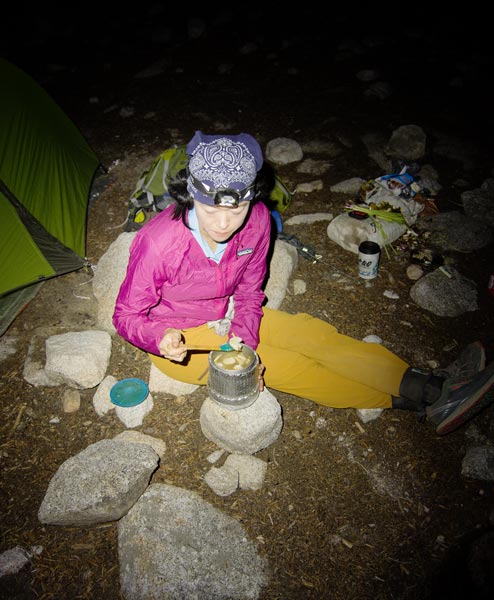
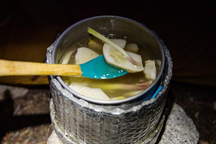
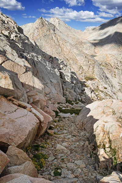
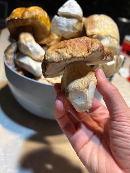
Sept. 2nd 2022 we hiked in with a not particularly early start. When I plotted out the distance it broke the hike into 2 segments, so I thought it was 5 miles shorter than it actually was. We stopped to pick a few wild onions plus we found lots of boletus mushrooms. There had been a fair bit of rain over the previous weeks so that probably boosted the mushroom crop. Some were slippery jack mushrooms, but others were King Boletus. Sadly many had lots of little wormy larva in them, but we made an effort to collect the ones with less bugs. All of these conspired to make us not make it all the way to Merriam Lake on day 1. That's ok, we camped near the turnoff from French Canyon and added a bunch of mushrooms to a ramen dinner to bulk it up.
| |
|---|
 |
|---|
 |
|---|
 |
|---|
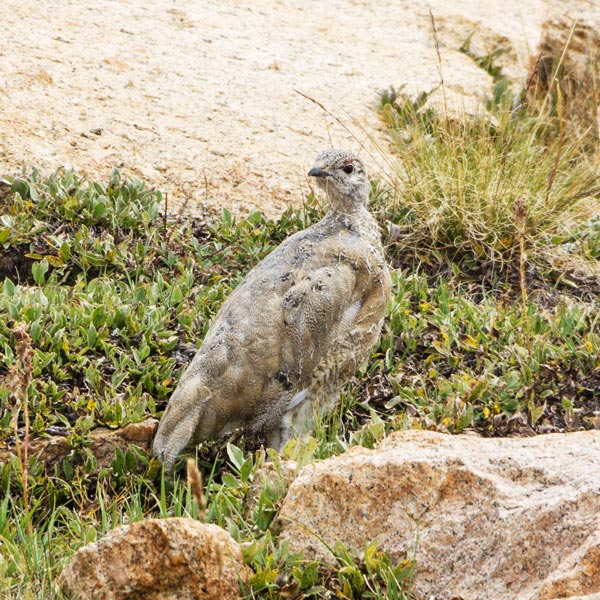
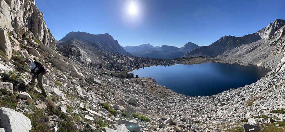
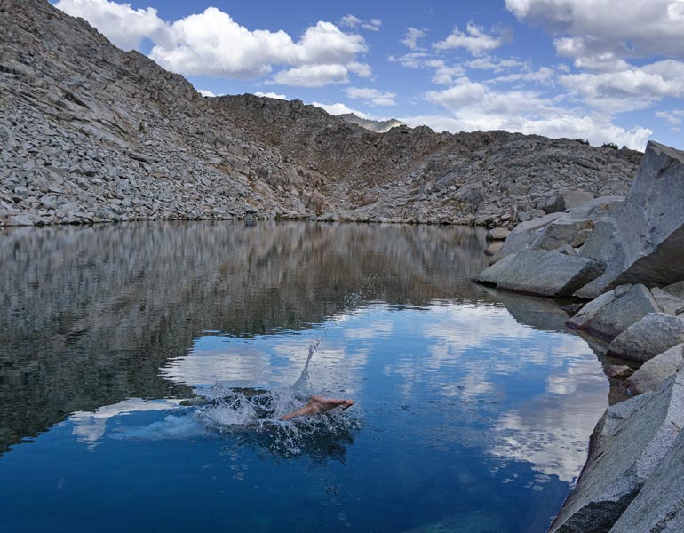
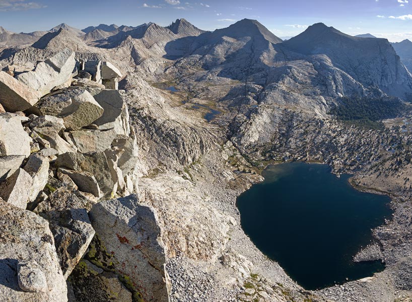
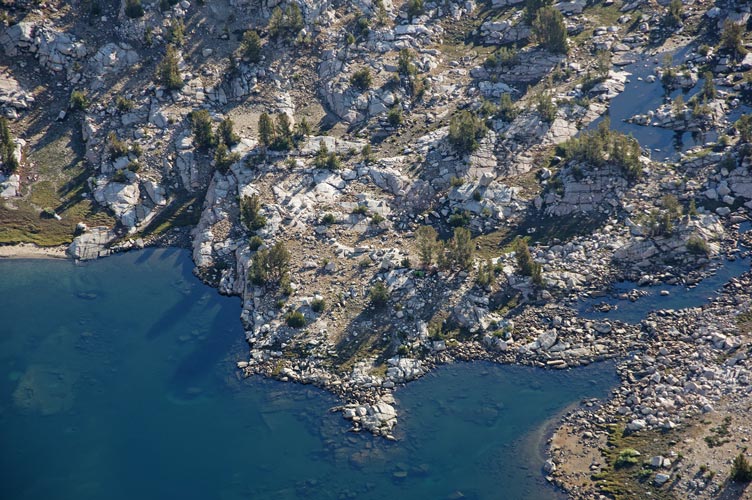
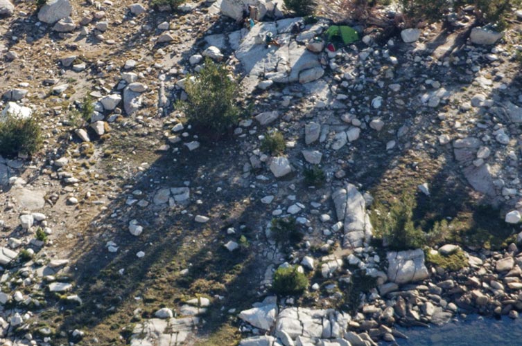
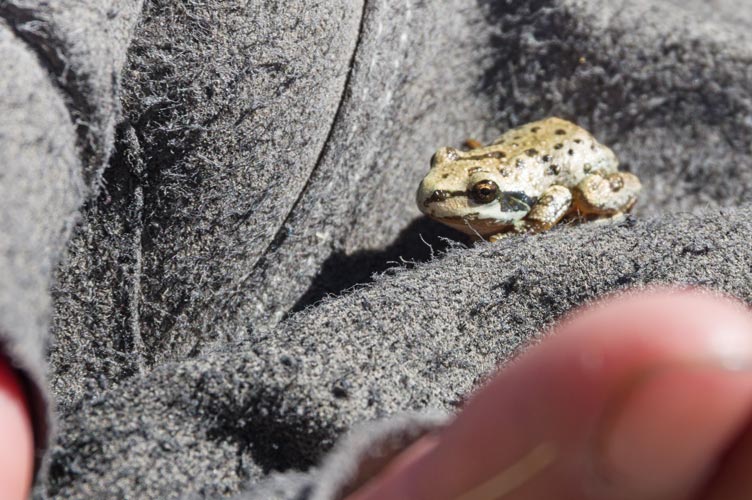
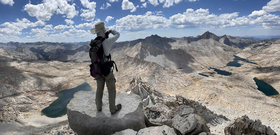
sept 3, We got up an after breakfast headed up the hill, noting a space we could have camped about 30 minutes up the trail. Then on as the trail got a bit harder to follow across a nice meadowy plateau and up the final slopes to Lake Merriam. We saw quite a few tiny frogs in the grass here and around the basin. We found a good place to camp nearish the lake with a few trees for shelter and dropped of my pack and the camping gear. Then we headed up towards Merriam Peak. I had climbed this in 2011, but Iris had not done it yet. We passed some well camoflaged ptarmigans as we worked our way up to the lake NW of the peak where I took a brief dip and then up to the SE ridge which we followed up to the summit with a detour to the N around some gendarmes. Some climbers came up the NE ridge rock climb at about the same time we arrived at the 13,103 foot summit - although we did check out another possible summit that we decided was lower. We also saw people summit while we were at the lake below and a number of people working their way up Royce Peak as we came up Merriam.
 |
|---|
 |
|---|
 |
|---|
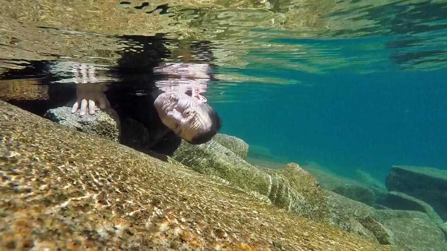
After the usual summit cookies and photos we descended towards the Merriam - Royce saddle and then decided it was too late and we were too tired to continue on to another peak we wanted to do. Instead we went back to set up camp. There we took a dip in the lake, tried to catch fish (with no luck), and cooked up some more mushroom heavy dinner.
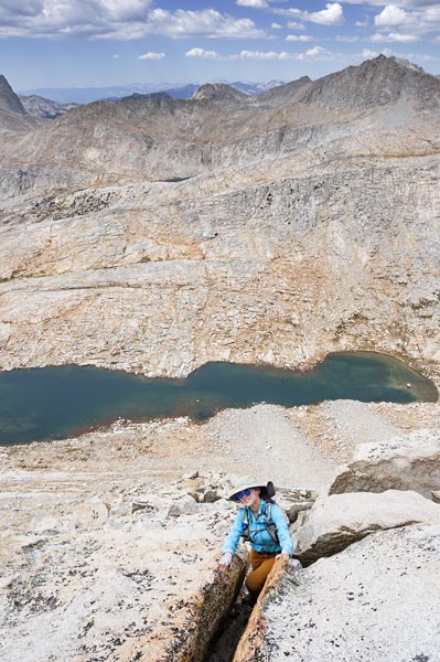
Sept 4, Iris had looked at the map and realized we were within shot of climbing Gemini Peak. I had already climbed Gemini in 2012 from the other side (sadly no trip report) so I was a little less enthusiastic. We started out hiking around the lake and scouting for maybe better places to fish (that weren't so shallow along the shore). We did at least see some fish so we knew there was a chance. Then we gained a lot of elevation heading up to a so called "pass". On the way we we went by a few nice looking lakes getting water at the last one. From the pass we cut left and scrambled up the ridge. The path we were following went up and over this ridge but we were able to avoid the top by cutting across on a ledge to the west. Then we dropped down to a saddle and up another ridge past a lake that was oddly perched almost on a pass. Then we chose our route up the steepest part of the peak - a likely looking gully. We stopped to collect snow from a patch on the way up. It was steep but mostly we were able to stick to slightly more stable terrain on either side of the gully. The top was particularly loose. Then we cut up some steep talus to the 12,880 foot summit.
 |
|---|
 |
|---|
 |
|---|
 |
|---|
 |
|---|
We descended the same way, except descending was a little scarier and quicker than going up. We stopped to collect some snow from the snowfield and continued on. Instead of reversing our course over the ridge we cut up towards the highpoint to the south. This was slow and tedious talus with a moment of terror when a big boulder I stepped on slid off of the even bigger boulder it was perched on. Fortunately Iris was not immediately below it and it bounced the opposite of the direction she dodged. We were still a bit adrenalized and shell shocked from the event. There is something about the deep growl of big rocks moving accompanied with the sharp smell of ozone.
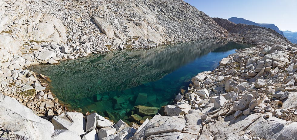
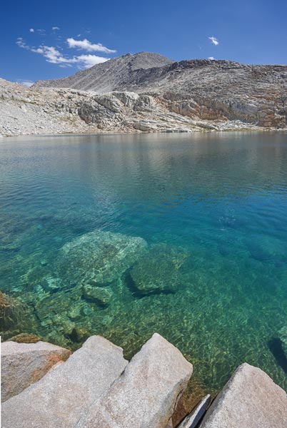
There was a little bit of scrambling to get to the high point at the end of the ridge. Then we descended down to the south where I spent a bit of time staring south trying to decide if it was worth trying to get some more peaks that way. I decided no and we dropped back east carefully picking our way down a gully and then the face to the side. We stopped to take a dip in a very nice lake. Sadly the sun was behind clouds, but the water wasn't all that cold, and it was clear and deep allowing me to dive off a rock.
 |
|---|
Refreshed we continued down back to Lake Merriam. We saw a guy fishing there and passed their camp on the way back to our camp. Once again we got no fish, but we did have extra mushrooms in dinner.
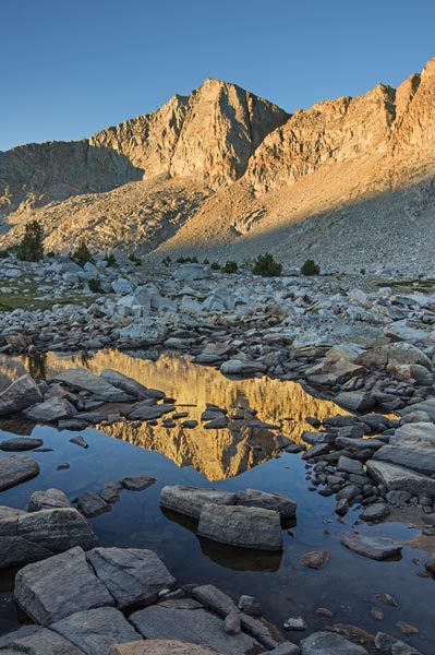
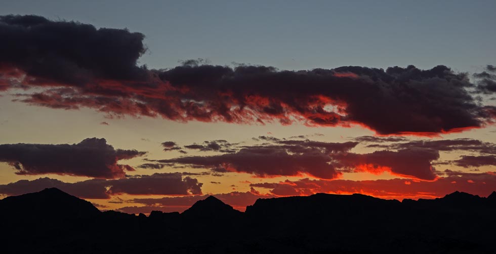
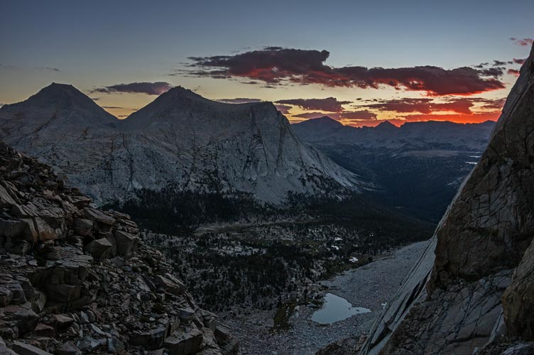
Sept 5. I got up really early in order to try to bag some peaks. I started in the dark and headed cross country and up the talus. It was starting to get light as I entered the gully below Mount Morrow. If I had the time and a tripod it would have been worth getting a good position for a most excellent sunrise. As it was I just tried to snap a few pics as I worked my way up. When I got to the top of the gully I saw some sort of creature running over the talus. Maybe a fisher or marten or something of that nature (I think a marten is most likely). Then I tried to power my way up the talus to the 12,402 foot summit of Mount Morrow. My goal was making it by 7 am, but I was a few minutes late. The summit register was in a big cook pot. I signed in and read some entries as well as taking pics in the interesting light. There was even a bit of a rainbow in some rain off in the distance. I also tried to scout my path up the next objective.
 |
|---|
 |
|---|
 |
|---|
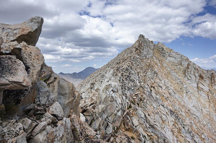
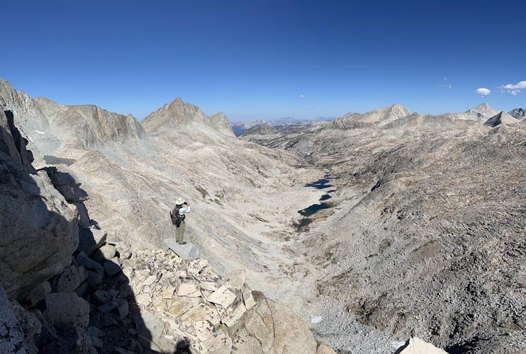
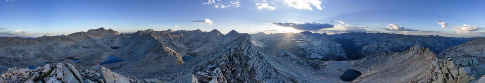
I made good time down the talus and across the saddle but things slowed down as the talus got steeper and looser. I think I still made pretty good time up to where there was some interesting scrambling before the final ridge to the summit of Peak 12,400. The west side wasn't all that interesting but the E side was a huge dropoff, possibly with an overhanging section on the NE ridge. The views down to Lake Merriam were pretty excellent as well as the views in pretty much all directions. I tried to wave down to Iris, but it turns out she didn't see me.
 |
|---|
 |
|---|
 |
|---|
I descended via the ridge for a while with one steep move down a short overhang before I was more or less back on the route I came up. I also dropped into the gully down a series of steep benches to the north. This was better than the way I came up. I stopped for a bit of food and to adjust my clothing when I got out of the bottom of the gully and then hurried down the talus and back to camp. I made it just before 9 am. Iris had packed up most of camp and cooked breakfast.
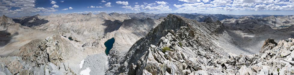
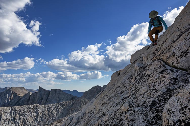
We ate some breakfast and then set off sort of following the Sierra High Route towards the pass west of Feather Peak. We stopped to admire LaSalle Lake and I stuck my head in to refresh myself without the delay a swim would have cost us. Then we headed around the N side of the lake and up towards the ridge. We aimed for a grassy bench and followed that up towards the W end of the ridge from Peak 12,860 - also called LaSalle Pyramid. We worked our way up the N side of the intimidating ridge to just below the summit. I climbed up a dihedral between solid rock and some real choss. It looked easier on the other side so I directed Iris around not realizing that it wasn't so easy to get around to the other side. She had one false start before she found a way up and we were on the most excellent summit. We ate some food, summit cookies, took pics, and generally relaxed but we didn't have much time, so we headed down.
 |
|---|
 |
|---|
 |
|---|
 |
|---|
We took a diagonal route from the saddle back to the continuation of the grassy ramp heading to the SW which we followed until it dropped off steeply. Then we cut to the next saddle before following a steep talus ramp up past the next peak until we cut back to the summit. This was peak 12,560 and the last on on the list of peaks we planned to do.
It looked like dropping off to the NW and walking around would be the best way down, but we hadn't gone far before I reconsidered. Back up and along the ridge to the SW until we saw a way down to the S. This joined up with a lovely flowered ramp that dropped back down to the E and then S to another ramp that went farther down before we were able to drop back south to the drainage we came up earlier. There was some treacherous wet grass, but also some nice wildflowers.
 |
|---|
 |
|---|
Then we sort of followed our route up back to our gear, repacked for backpacking, and headed back down the trail doing a slightly better job of following it back down. It was getting dark and we stopped to camp at the spot we scoped out on the way in. There we ate our last ramen packet along with mushrooms and dehydrated potatoes (I had brought a fair bit of dehydrated potatoes so that also helped bulk up our dinners).
Sept 6, We got up reasonably early and hiked out. This was slowed quite a bit by stopping to investigate mushrooms. We ended up collecting about 5 pounds. We tried to collect only bug free ones, but it could be hard to tell. As usual the trail seemed to go on forever, but we were making decent if a bit slow time, especially once we got above the elevation teeming with giant mushrooms. As we neared Piute Pass we started to see a lot more people and the relative crowds (still not very many) continued back to the trailhead. We saw and investigated a few more mushrooms as we descended past the proper elevation.
It took a while to process the mushrooms. We ate a fair bit of the best looking ones over a few days, the next best tier got cut up and dried and the least nice ones also got cut up and dewormed and dried. Those will probably get powdered to add to things. The dehydrator sure stunk up the room it was in.
 |
|---|