Tom Grundy's Lost Miner Trail Page
6-05-2020 We originally planned to hike in the Sierra, but the forecast low in the teens with precipitation and 40+ mph winds were a little alarming. So we decided to do a portion of the Lost Miner Trail in the Inyo Mountains. By the time we packed up our stuff and did the car shuttle it was pretty late (5:15 pm), but that meant it was a little cooler for starting near the valley floor and hiking up. There was also a good bit of moody cloudcover and even a threat of rain - although it never really hit us. We started up the Pat Keyes Trail and hiked uphill until it got dark (nearly 4000 feet in about 4 miles). Fortunately we found a flattish spot to pitch the tent. It sprinkled a little bit as we finished setting up camp, but not enough to actually get anything wet.
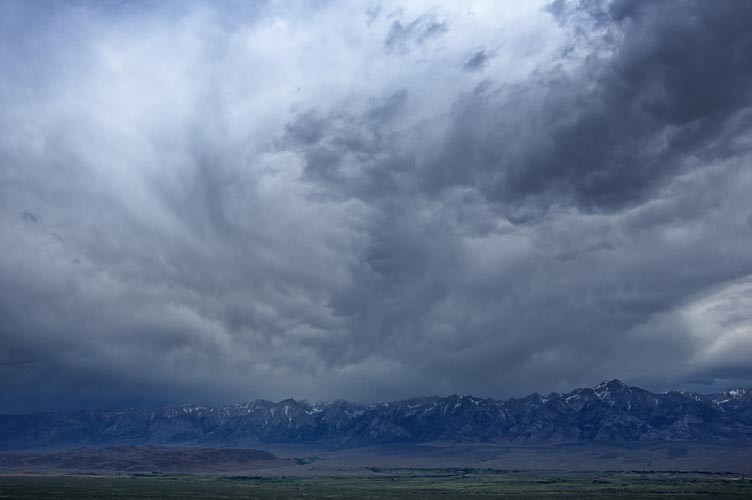
threatening sky over the Sierra
 |
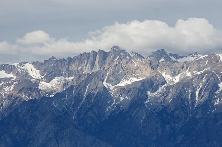
Mt Whitney
 |
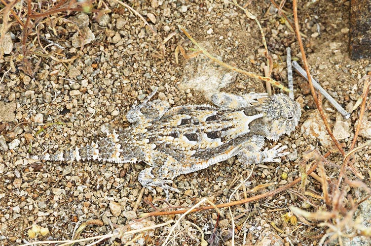
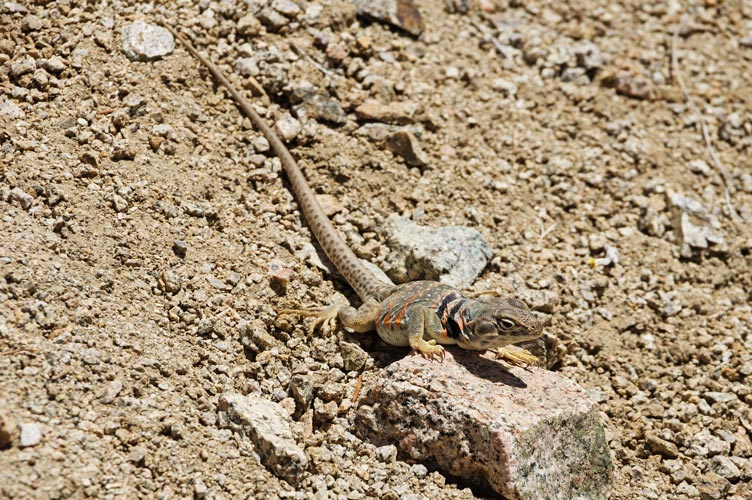
horned lizard
 |
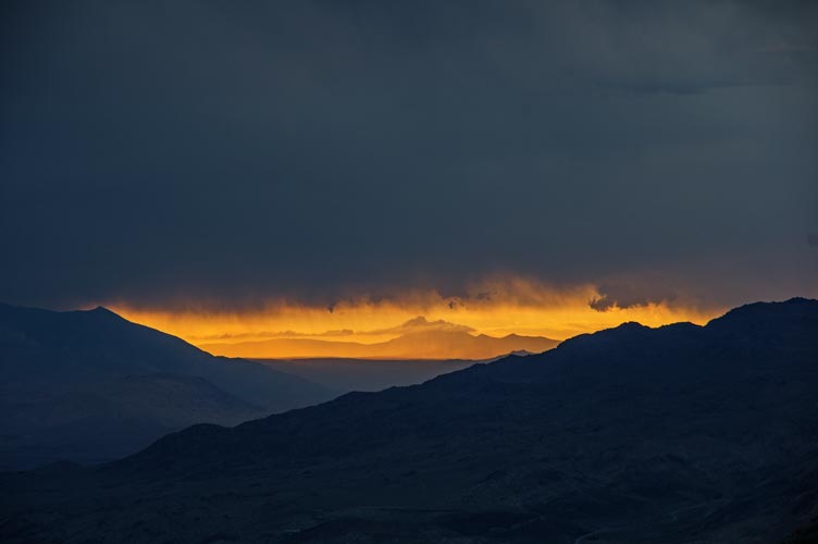
sliver of sunset up the Owens Valley
 |
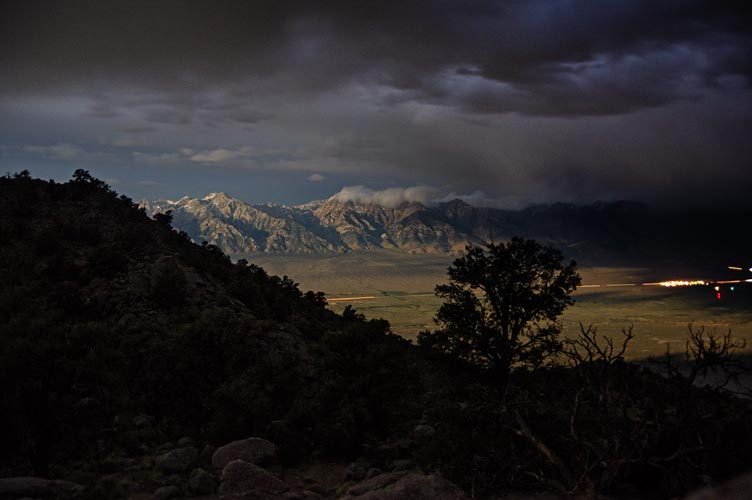
night view
 |
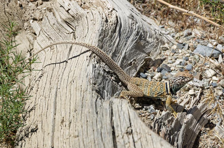
6-06-2020 We had been up fairly late the previous evening, so did not get a particularly early start. We headed uphill up over the crest of the Inyos mostly managing to stay on the trail. Then we headed down the other side, losing the trail where what remains of the Pat Keyes Trail sort of continues off to the NE and the LMT cuts south. We could tell we needed to turn, so we went cross country until we picked up the trail again. Then we dropped down into Pat Keyes Canyon where there were some ruins and artifacts such as a rastra. At many places along this hike were there were ruins where people had placed various artifacts on a wall or old table or other easy place to see them. Supposedly there was a lot more before some people from one of the nearby bases came in with helicopters and took things away (in the 70s?). There was also water flowing in the creek here, so we took a break in the shade and refilled our water supply. Then it was time to go up again - lots of up in the sun. This trail was sometimes easy to follow with an obvious wide flat path with good stone work on the side. Other times it was not so easy to follow where landslides or plants had obscured it. There were also other trails that went to various mines and pits or maybe were made by animals. We also saw a lot of lizards on this hike including horned lizards and collared lizards.
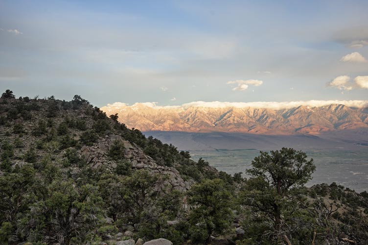
morning view from near camp
 |
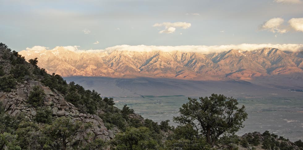
cropped in on the morning view across the Owens Valley
 |
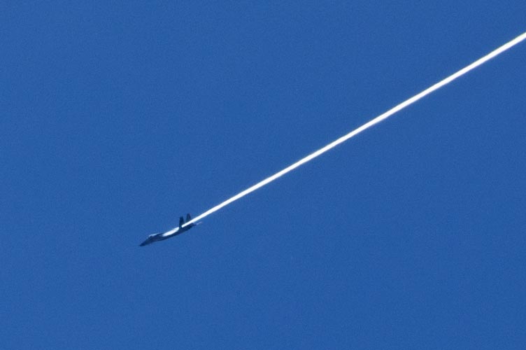
jet overhead
 |
collared lizard
 |
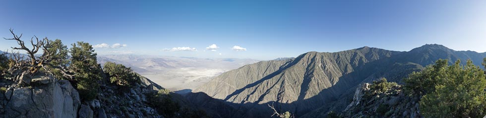
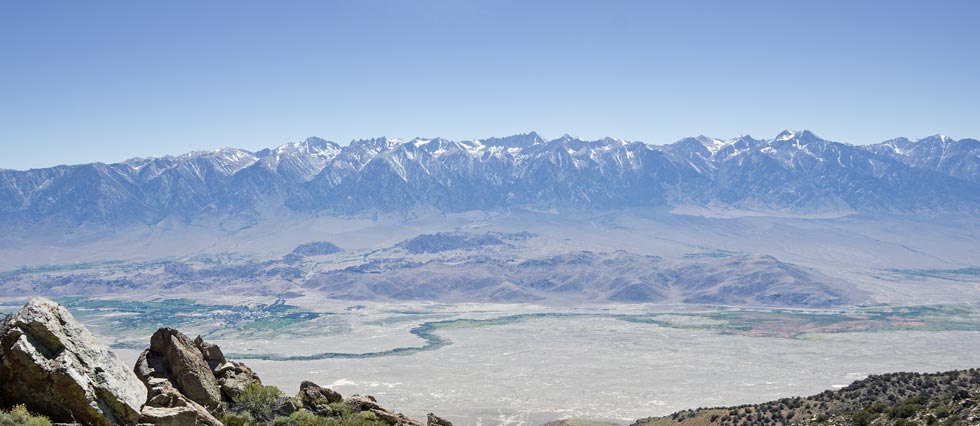
We continued on up and around to another ridge where we decided to traverse out to a little sub-peak. We dropped most of our stuff at a flattish area and then traversed along the edge of the ridge out to the peak - this was a lot more difficult than expected. On the summit of peak 8060 we found an old plastic film canister register that was literally falling apart in my hands, but we had found a much more substantial plastic case, so we signed the paper and put it in this case in a nice rock home to shield it from the sun. The views down into Saline Valley were pretty excellent. Then we headed back opting to stay on the ridge instead of traversing around. This was a much better way to go both for ease of travel and because there was an old cabin ruin.
panorama looking over Saline Valley and McElvoy Canyon
 |
That night the wind changed and picked up enough to buffet the tent a lot. Fortunately none of the stakes pulled out and the tent survived.
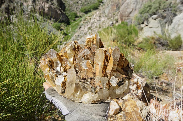
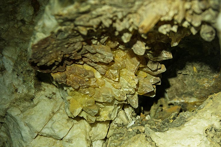
6-07-2020 We got up a little earlier but it was still a while before we had breakfast and packed up and headed down into McElvoy Canyon. This canyon had a bunch of interesting things to see. There were numerous mines and workings following some quartz veins which also featured some really good crystals. Then down at the bottom there were ruins and artifacts from the beekeeper who lived there for a while. We stopped at a place where the creek flowed over bedrock to wash up and have lunch as well as to wash some of our clothes. Putting on wet clothes in windy dry air is very bracing - but things dry quite quickly. Then we had to go up.
crystals
 |
another collared lizard
 |
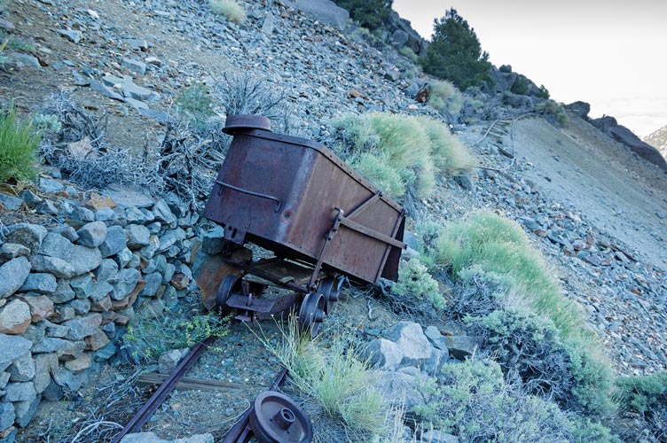
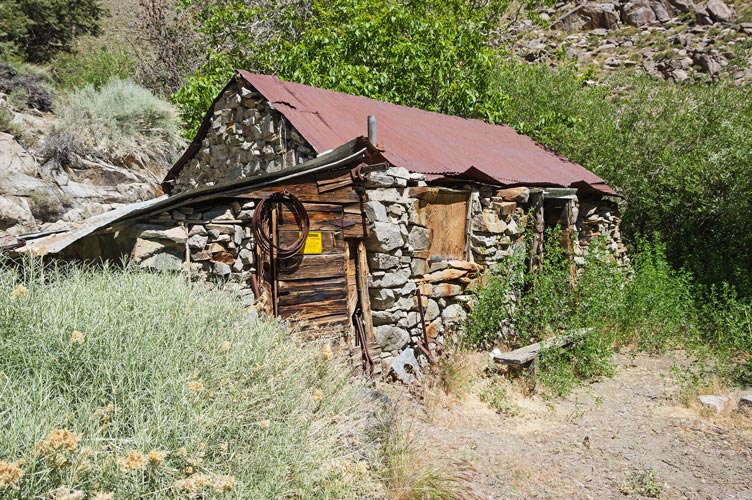
We switchbacked up the S side of the canyon and at some point I took the wrong trail, except it went to a mine with cool crystals, so it wasn't a total waste, but we had to backtrack to re-find the trail. I was sort of flagging with the uphill in the heat, but we eventually made it up around the ridge and to the Keynot Mine. This mine was found in 1878 and produced $500,000 worth of gold up to 1934 or so (at whatever the price of gold was then - around $20/oz in 1900) This had some more recent activity and I would have liked to poke around here more, but we were running low on time. We continued on up to the next ridge where the Beveridge Cabin was. We looked in here and considered camping in or near it, but hanta worries plus no nearby water (there was a bunch of stashed water though) led us to descend into Beveridge Canyon for the night. It was starting to get dark when we arrived, but it was warmer and more sheltered and there was plenty of water.
quartz crystal pocket in the mine
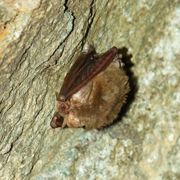
 |
bat in the mine - probably Townsend's big-eared
 |
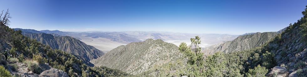
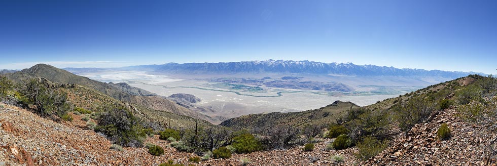
Lonesome Miners Trail panorama
 |
Keynot Mine cart
 |
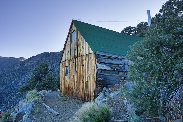
Beveridge Cabin
 |
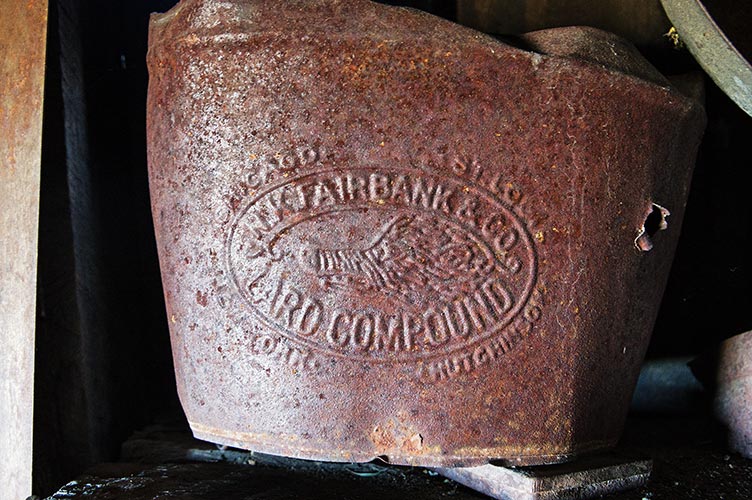
lard bucket
 |
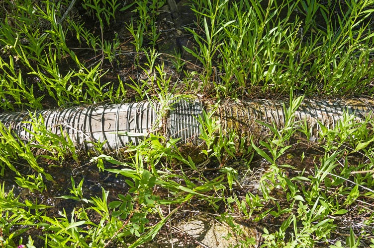
6-08-2020 I poked around the ruins here for a while in the morning. There was a boiler and a stamp mill. It looked like downstream there was a hydro plant and the workings of a tramway, but it was pretty choked with vegetion so I didn't go down there. After we packed up we headed up canyon past more ruins and up canyon. There were more mines up here, but not as spectacular as some we saw yesterday. We stopped at Frenchies Cabin where there was a spring and some shade, then we left the LMT and headed up towards Forgotten Pass.
old wooden penstock - to power an aerial tram
 |
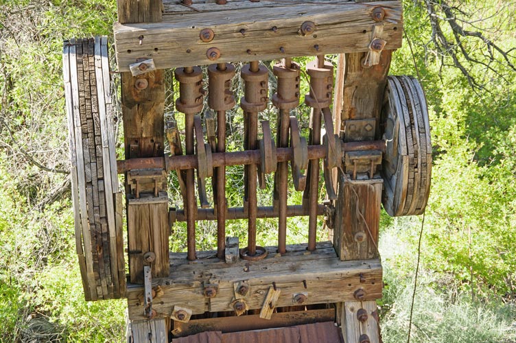
stamp mill - powered by a steam engine
 |
Frenchies Cabin
 |
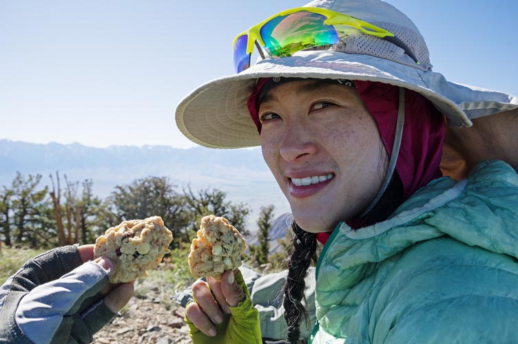
Sadly we missed a turnoff and hiked a lot of up before we realized it, so we headed cross country up the slope to the Inyo Crest. This was far from ideal, but we eventually got up to the ridge and traversed over to the two peaks we wanted to tag on the way (one was Voon Meng Leow) we enjoyed the breeze, views across to the Sierra and down into Saline Valley, and summit cookies... Then we dropped down to Forgotten Pass and followed the trail down down down. It was mostly pretty decent hiking although some of the trail in the canyon bottom had been washed out or buried by a relatively recent debris flow. This was particularly obvious once we reached the canyon bottom where we were just walking on the debris flow but had to watch out for deeply incised chanels. By now it was dark, so we headed more or less the way we thought we needed to go for a while and then looked at the phone GPS to see if we were on course. Finally we found the old road and soon Iris' car. Then we drove back following a different (and better) path to within a few hundred meters of my truck, and I walked up the road to get it. Then we headed back home for a much needed shower.
high sierra panorama
 |
panorama from the Inyo Mountains
 |
summit cookies
 |
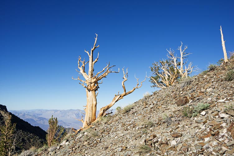
bristlecone pine trees
 |
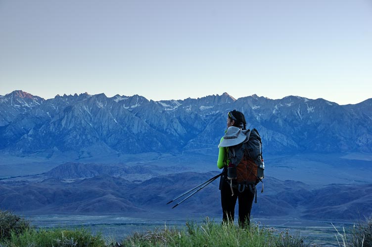
Iris heading down the Forgotten Pass Trail
 |
This was a pretty cool hike, but it would have been nice to be able to walk the entire LMT which would require a much longer car shuttle - possibly with 4wd or at least decent clearance or hiking at least some of it both ways. We would have liked to have more time to explore some of the things along the way, and it would also be good to camp where water was available to lighten the load. The trail was often not casual with loose rocks, plants, obscured or missing trail, plus a whole lot of up and down.
No material on this page may be copied or used without permission.