I hadn't really recovered from the Expedition Oregon adventure race when Jameson asked if I could do the Mammoth to Bishop Race. Originally we had planned to head down to Orange County for Iris' medical appointment, but it turns out if we headed down after the race she would only miss a PT session. So, here we go again. I didn't really do much extra training for this race - a few bike rides, a few jogs, a bike ride to jog the Druid Stones loop, and a few paddling sessions. I guess that isn't nothing, but it wasn't as much as the last minute panicked training for Expedition Oregon. I figured the training for that plus doing the race had to count for something.
It felt a lot more casual putting gear and food together for 36 hours instead of 100+ hours. I didn't have the use of a nice full suspension bike, instead I dusted off the Iron Lady (ok she didn't need to be dusted off, but I did change the pedals and add a second water bottle cage). This is a Laura Molnar's old Schwinn Mesa hardtail bike - from around 2000 I think, hardly the first choice I would have for a bike, but you race with the bike you have, and as Lance said, "it's not about the bike" but I also didn't have any performance enhancing drugs other than caffeine.
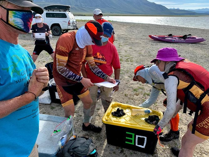
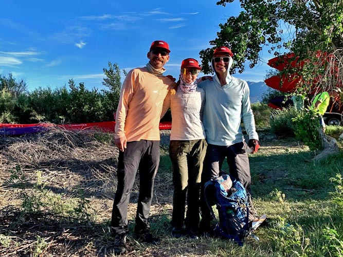
Friday 6-4-2021 T minus 1. I finished making sandwiches (bacon, barbecue sauce, and melted cheese). plus put together the rest of my food (6 6 hour food bags). Then we loaded it all up and drove to Mammoth to sign in and drop off our bikes and gear bins. I had a lot of uncertainty about what exactly to put in each bin, but I made best guesses and packed them up. Iris volunteered / got roped into becoming a volunteer, so Jameson and Kellee headed back to Bishop while she learned what she would be doing during the race.
We did a bit of last minute packing and strategizing - we would start out trying to get all the points, but see how that went, and try to go faster than we did during Expedition Oregon, both for transitions and for general travel speed. We went to bed and tried to get as much sleep as we could in the remaining time.
| |
|---|
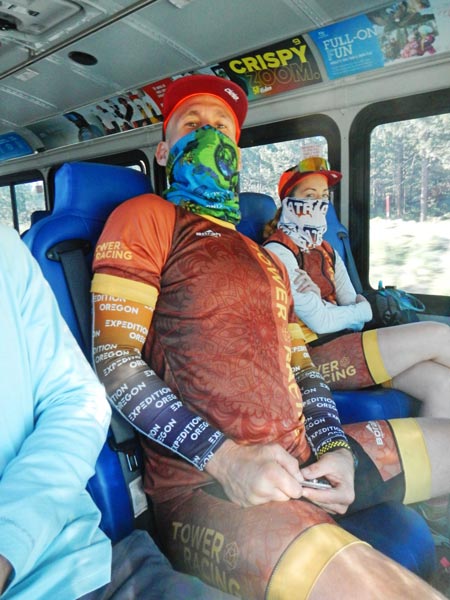
6-5-2021 We got up at 6 and ate some food and drank some coffee before heading to the buses that conveniently left from the end of the soccer pitches a few blocks from the Church. We waited on the buses for one last missing person (that didn't make it) before driving up to Mammoth.
 |
|---|
 |
|---|
 |
|---|
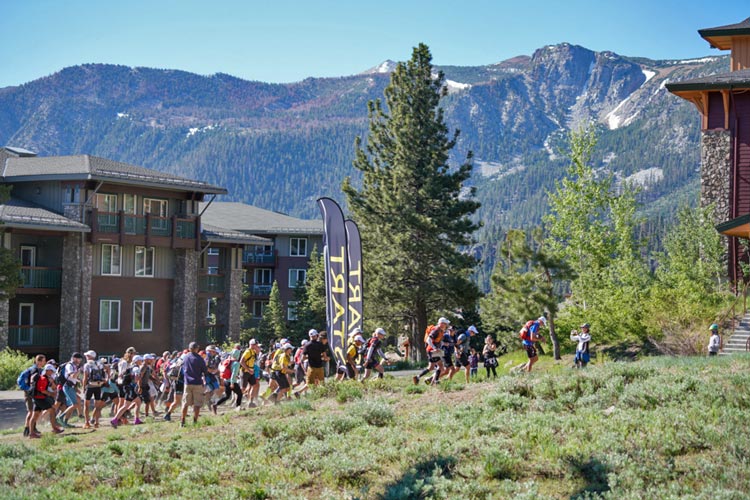
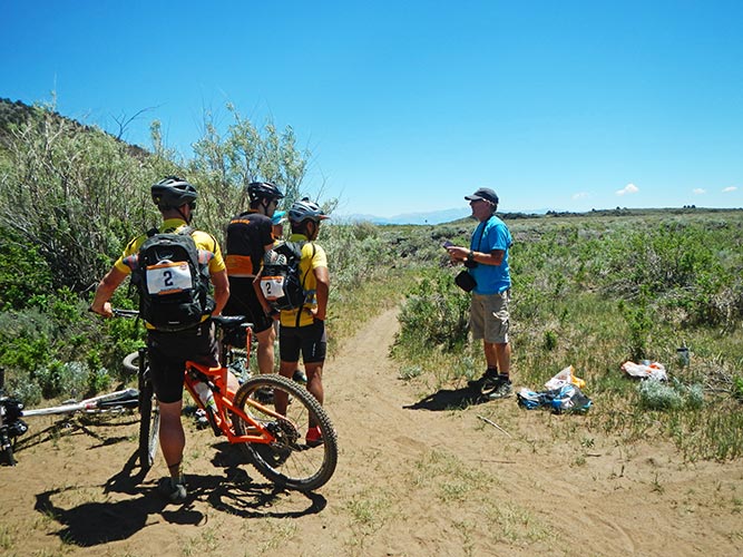
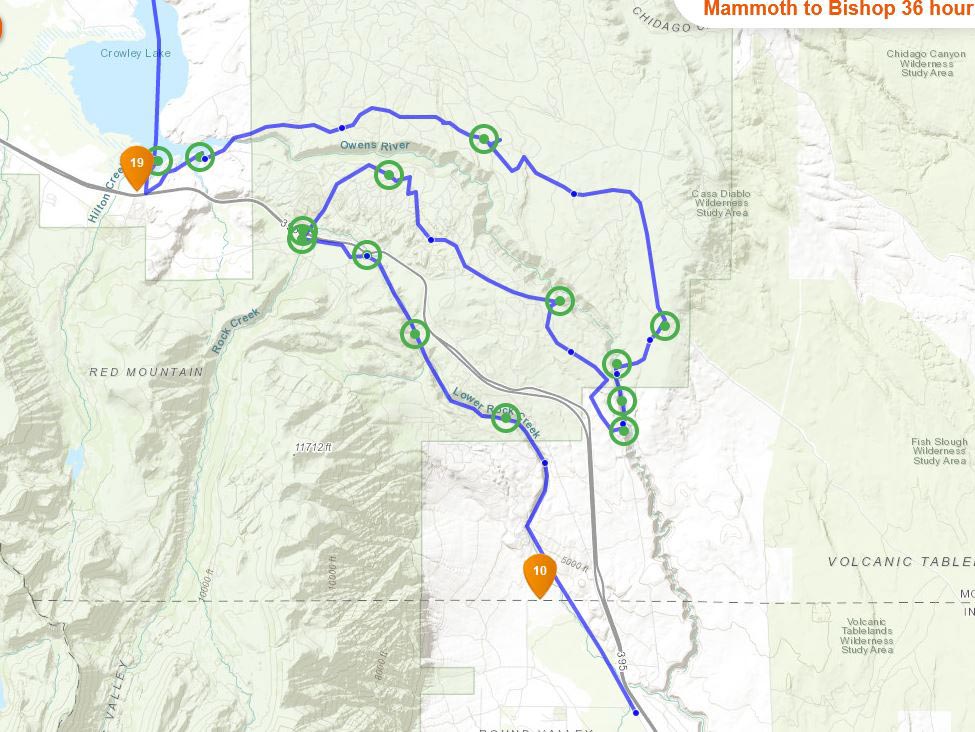
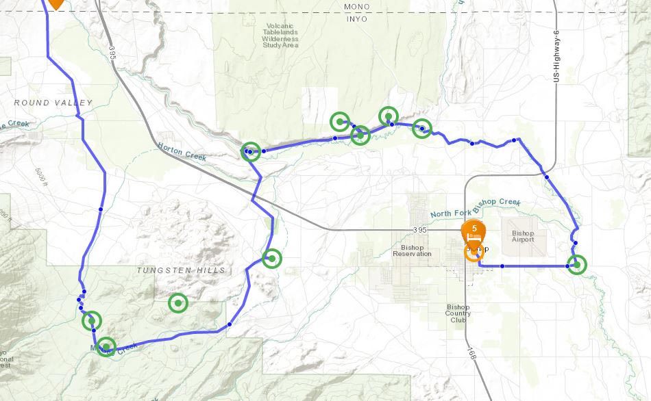
We unloaded at Eagle Lodge and there we picked up our maps and had a few minutes to look at them before the race start. Our maps were huge, so it took a bit of effort to fold them down into a manageable size that would fit in the map case. We were given a bit of last minute rules and advice, some of which was absorbed and then it was time to go. We started about 8:40 and immediately headed up a steep dirt road along a ski run. It didn't take long for everyone to drop from jogging to power walking. Soon we were in the lead pack with Bones, Altitude Junkies, and a few other teams. We went up the road a bit, then cut over on a connecting trail and then dropped down to the main lodge where our bikes were stashed.
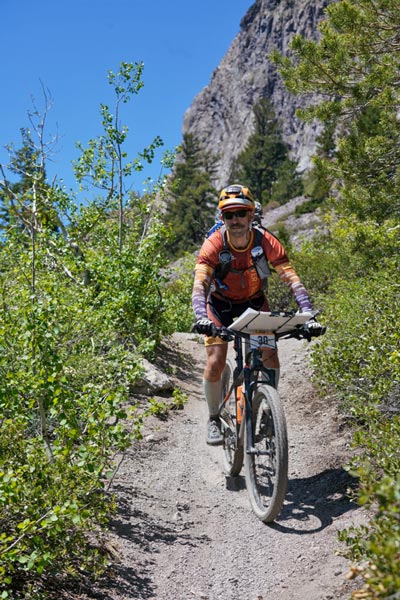
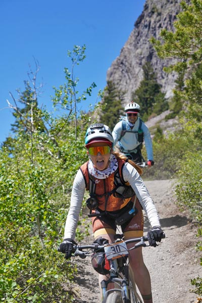
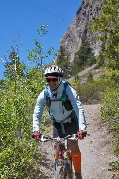
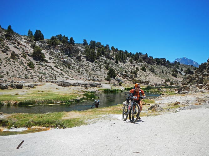
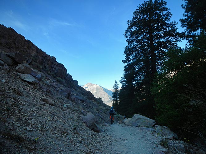
We planned on a quick transition - slowed slightly by my critical visit to the porta-pot but soon were off biking. For the next bit we were using the somewhat schematic Mammoth Mountain mountain biking trail map to navigate to various trail junctions. It wasn't always clear how steep various sections would be and I'm not entirely convinced the checkpoints were quite where they were advertized to be, but we found them all. After one checkpoint we headed up the hill incorrectly saying to the spectaters we were either really clever or stupid. A minute later as we headed back past them going downhill we said we just wanted to get full value. We were probably not going downhill quite as fast as I would have on my own - I tend to let gravity take over, although nowhere near as fast as serious downhill riders. I don't think this hurt us much compared to the competition, as we tended to either get to the checkpoints right before or right after the other lead teams, especially Altitude junkies - which were very recognizeable in their black and yellow "bumblebee" outfits. I suppose I shouldn't make fun since a few people thought we could be serving fast food, and the black and yellow looked pretty snazzy.
 |
|---|
 |
|---|
 |
|---|
 |
|---|
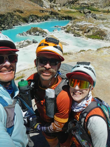
Soon we dropped out of the bike park and headed up the Lake Mary road briefly before turning downhill again. The next CP was at the start of a long singletrack trail, but it looked like it went up and down a lot and the road just went mostly downhill to the next CP, so we took it. That was maybe not as fun a route, but it was the quicker route and we saw the bumblebees coming down the trail as we left the CP. Then it was on to dirt and dust roads. Fortunately they were mostly not too washboarded and the dust pits were mostly avoidable. At the next checkpoint we were probably supposed to continue under 395 in a culvert, but we couldn't see the obvious path to take from there, so we stayed on the SW side and crossed later. We did have a little goof when the road turned around and seemed to be going the wrong way and we started heading cross country - and then saw another team riding a few hundred feet away on a road - so we headed over to that. We backtracked to a different road where they were hoisting their bikes over a barbed wire fence and ended up crossing 395 at about the same time. Then we headed to the hot creek where we were to take a selfie (although nobody asked us to show it to them later, maybe the tracker was good enough). The bridge was gone so we had to wade across hot creek to get there, which was interesting because the water was a swirling mix of hot and cold and there was hot water coming out of the creek bed. I was glad to be wearing shoes as I might have burned my feet or at least had to be more careful with my steps without them. Then we headed up the hill out of the canyon and north to get some far flung pro points. This is about where my left eye started hurting from a mix of sweat, sunscreen, sun, and wind. It pretty much was not happy all day or even the rest of the race, although it wasn't so bad on Sunday - or maybe everything else just hurt worse. Once again we were by ourselves for long periods of time and then suddenly there would be a bunch of teams around us (or we would all arrive at a CP at about the same time). I think we did a good job of navigating and picking our routes, since it seemed we were biking a little slower than some of the other teams but managed to get to the CPs before them. On the way from CP12 to CP13 Kellee hit a patch of soft sandy dust and went down hard - sort of a front dive superman landing, except the bicycle was still clipped in and then it scorpioned up over her back. I was quite concerned she might have really been broken. She was completely covered in dust, which of course stuck to the mix of sunscreen and sweat we were all covered in. She also ripped the sleeve of her long sleeve top as well as a good bit of skin on her forearm. She untangled herself from the bicycle and beat some of the dust off, smeared it around her face and sunglasses, and we headed back down the road. This wasn't her only time going down on the bicycle, but it was by far the most spectacular.
 |
|---|
 |
|---|
Once again we rolled up to CP13 with a group, but we barely stopped to punch it and then continued on the vague maze of roads heading to TA2. I remembered we weren't allowed back on the paved Benton Crossing road south of CP13, but I guess a bunch of the other teams didn't. We were moving slowly along a track next to Crowley Lake when a dog went after Jameson, then myself, then Kellee. It wasn't particularly aggressive in that once we stopped moving and got the bicycle between it and us it would stop, but then it would go after someone else. The fact that the owners were ineffectively yelling and running after it didn't really help. After quite some time - 4 or 5 minutes?- they finally caught it and we could get going again. By now the "road" was really sandy and it was hard to get moving once you stopped, and even hard to maintain forward progress sometimes. Jameson cleverly realized there was a cow path to our left and once we got onto that we were moving much more easily again.
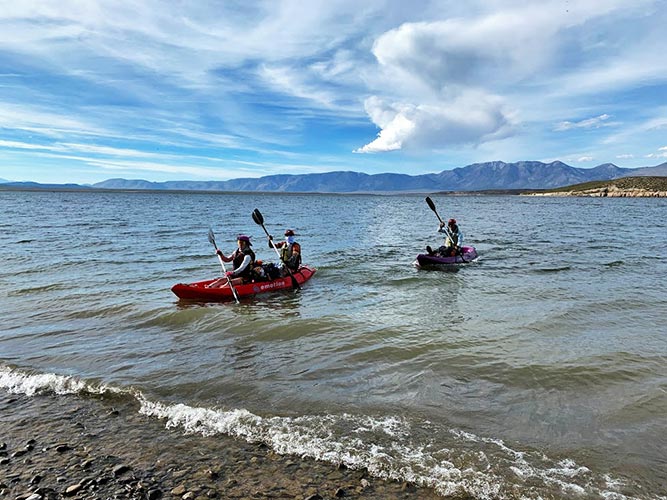
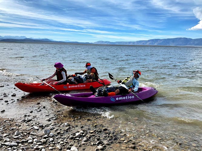
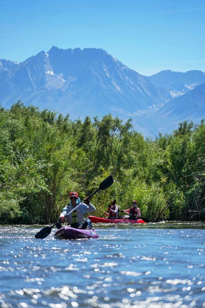
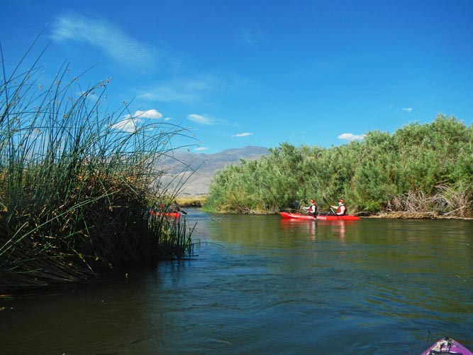
We got to TA2 just a little after most of the lead pack (taking the paved road was quicker). Bones left shortly after we arrived, but we had a pretty quick transition and soon set off with Kellee and Jameson on a double sit on top kayak and I was on a single. At first the wind and waves were coming from about 1:30 (front right) but after passing a headland it was more like 4 or 5 (back right). That meant that I was able to occasionally surf a larger wave for a short distance. That helped me catch up, since paddling a single is definitely slower than a double. I found that if I paddled 8 strokes to their 7 I could just keep up. We were a bit dehydrated when we got to the transition, so it was nice to drink 2 or 3 BeFree filter bags full on the way. We managed to pass a single kayak and kept pace with or gained on the 2 or 3 other groups ahead of us. The wind eased up a bit in the middle of the paddle, but by the end was a bit more of a headwind. We powered in to shore and tried for a fast transition. Since we had a swim coming up soon, we didn't bother changing out of most of our wet or damp clothes.
 |
|---|
 |
|---|
 |
|---|
 |
|---|
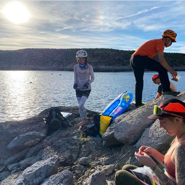
Once again we were just a few minutes behind Bones, they left the transition and went to look at maps a little bit away, and we headed off inland to dodge an arm of the lake (other teams just swam across this one too - maybe faster?). We hiked and did some hike - jogging along a road and then cut cross country to avoid a loop of the road. As we got to the second inlet to walk around we could see Bones walking along the shore slightly ahead of us. then we followed them up the road - and went a bit too far and had to backtrack along the rocky coast to the swim spot. Since the wind was up and the lake was choppy a number of boats were in this inlet to wake surf (or something). Having motor boats go back and forth when you are trying to swim with your pack is a little disconcerting. I stuffed most of my gear into a dry bag and blew air into my water bladder and then we started swimming. The water was cold, but not biting and almost immediately we were hit with a boat wake. Jameson was not very happy about the swim - especially as he was traumatized by a current in his last ocean swim. We slowly made our way across - I held my pack with one hand and kept my head on it and used my other arm and legs for propulsion. I need to be careful not to use the frog kick since that hurts my knee. I did switch to a modified side stroke with my head on the pack for some of the way. At least we had bright hats that would hopefully be seen by the boats (and none came near us). It probably didn't take long to get across, but it seemed like a long time. Bones had just stuck their entire packs into trash compactor bags - for both the kayak and the swim - good idea. It took a while to get moving again after the swim - we needed to drain our packs, change socks and / or shoes, filter water, and regain our mojo. Also the map case was no longer waterproof - one of the seams had split, so the maps and clue sheets were wet. Fortunately they were not very water soluble. There were a number of other teams there at the time, so we were able to chat and commiserate too. One person even used a pool toy to float across.
 |
|---|
 |
|---|
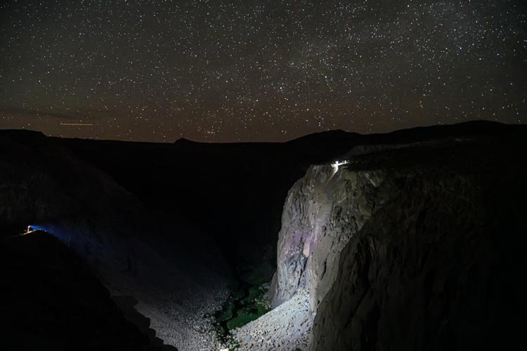
When we did leave my pack felt very heavy - I had over a gallon of water and other things were heavy from being wet. At least the sun was still up (although getting low). We made it to a dirt road and then the paved road and across the dam. Here we started doing jog walking - 30 paces of jog, 30 paces of walking. Repeat forever (or until someone was eating or navigating or the hill was too steep to jog or whatever). We traded lead with Toasted Turtles a few times, but then they pulled away when Jameson had a fashion crisis (chafing from his pants - so he put the bike shorts back on). As it got dark we caught up with the bumblebees of Altitude Junkies where we were to leave the road. We let them pull ahead (heading a different direction than we planned to go) while we got out our headlamps and prepared for night trekking. Then we headed cross country to another "road" that we followed to the next CP. From there we intended to follow another road, but it didn't exist, so we backtracked a bit and found another route. Here Toasted Turtles and another team caught up to us while we were looking at the map and planning our route. Then we had a long stretch of following dirt roads. We mostly kept up our jog-walk fast intervals and seemed to make pretty good time. We were startled and a little creeped out to see a dead bobcat on the road - it must have been pretty fresh, or maybe the wind was just blowing the smell away. Eventually we got to the turn in the road that marked our departure point and we headed cross country following a bearing. Soon we found a vehicle and the checkpoint. From here we took a bearing and set off. Unfortunately we thought we hit a side canyon to the gorge and turned off our bearing - but it was just a little drainage, and we should have kept going straight. After this we were off our bearing, so then headed back a little more north for a while. Eventually we got to the edge of the gorge, but weren't sure where the rappell was. I was able to see the gate and road down to the upper power plant across the gorge with my spotlight and then we knew the lights to our right were the place to go. There we saw at least on of the Bones team still had to descend. It was before midnight - the original cutoff for the rap that had been extended to 3 am.
 |
|---|
 |
|---|
 |
|---|
We had worked out a plan - I would rappell first with the map and then get out of the way and plot a pro point and filter water while the others came down. When I got to the bottom of the ~300' rap I could see that I was at the "Gotham City" climbing area. This section was the only part of the course that my local knowledge really helped, although it was also good for some other sections, it really made a difference here, especially in the middle of the night. The plan to send me down first worked out well, and I guessed that the point I had plotted was at the crossing to the "Great Wall of China" climbing area. The others came down and we crossed the gorge to the trail and set off. I have hiked the first part of this trail a lot to climb so I knew it well and had to keep stopping to let the others keep up. Past the inner gorge I didn't know it as well, but I still found the crossing before the bridge that LADWP made us take out. I thought they were right behind me when I took off down the trail again, but they didn't see the trail right by the river and went too high. My hurry wasted a few minutes, but soon we were all on the trail and heading down to the middle gorge. I saw the glowstick for the checkpoint from a distance, but when I went out on the log crossing to get it I didn't see it. Fortunately I was able to turn my headlamp off and see the faint glow a little up the other side. Then we continued down to the start of the trail up to the middle gorge parking. We loaded up on water before the hike out and then plodded our way up the steep trail to TA4.
 |
|---|
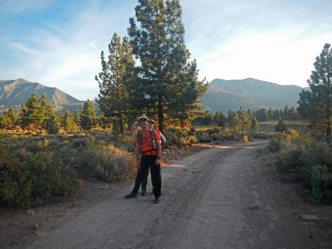
TA4 was a transition from trekking to biking and we also got a new map. Bones left shortly after we arrived and that was the last we saw of them until the finish line. We were not as fast at this transitionm but it was nice to drink a cup of hot coffee and eat some hot ramen. I think the thing that took the longest was plotting points on the map - which I did rather poorly in my tired state. Then we headed off on a long bike ride. First to the paved road and then slowly grinding our way uphill in the dark. I took the lead into the wind and we tried to draft. It was during this time that the inside of my upper lip dried out and then puffed up. It felt like sunburn, but that seems unlikely on the inside of my lip in the middle of the night. It was pretty annoying for a few hours, especially when I ate anything salty or spicy. Fortunately it got better through the day. Jameson navigated us right to the next CP on the canyon rim (we could see teams across the way going to the rappel). Then we cut more west and I mostly just followed while Jameson navigated. Things got a little more interesting in the maze of roads near the next CP, and my headlamp was also a bit on the fritz (it would turn itself off from time to time - I think one or more of the wires is a little rotten). Fortunately it never did it on a downhill. The crescent moon rose behind us and the sky started to get a little lighter around this checkpoint. It also was about as cold as it got - we put on most of our clothes, (I was in bike shorts, sun shirt and long sleeve thermal layer, Kellee wore my warmer gloves. Once we hit some pavement we went a lot faster, but maybe it was a tiny bit warmer? We went through a culvert under 395 to another CP and then rolled through Tom's Place as it got light enough to turn our lights off.
 |
|---|
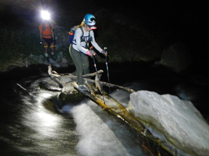
We found a way to the start of the Lower Rock Creek trail avoiding 395 and then set off down it. Originally we planned to bomb down the road, but then realized that was off route. The first segment of the trail was fun packed dirt and we made good time. The second segment was a little rocky, but we still moved right along with only a few stops to walk the bikes. The final segment was rough, especially for Kellee who had been traumatized the day before. I had only biked this trail once before - with a full suspension bike - and I remember the last segment having a lot of very rocky bits. They were still there, but in our tired and traumatized state we ended up walking even more of them. We were all ready for it to be over when we got to the end. I put a lot of sunscreen on my legs to avoid becoming neapolitan - chocolate tan knees, strawberry burned mid thigh and vanilla white upper thigh. The bike shorts I was wearing were shorter than the ones that matched my tan lines so this was a real risk. We reloaded with water and then discovered that we still had a bit more trail to ride. Then we hit the road. Here we bombed down towards the valley - possibly in contradiction to the rules - we weren't supposed to ride on lower rock creek road, which this might have been, or maybe it was Sherwin Grade Road here - in any case I didn't think about that - only where we needed to get to. Down the road, up Pine Creek road (to avoid the washed out bridge), and then turn at the school. We stopped there in the shade to contemplate our options.
 |
|---|
 |
|---|
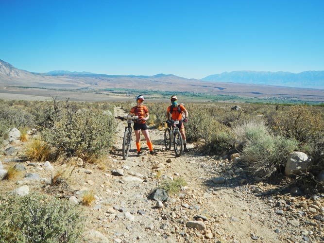
Unfortunately we didn't remember what the time cutoffs were, and the sheet that had them was turned into a soggy mess by the swim. The decision point was at the turnoff to Horton Creek - we could head up 1700 meters from there to the Buttermilks to get some pro points or stay down low and get just one pro point on the way to TA5. We stopped at the turnoff and looked at the map again. It didn't look like THAT much elevation gain, but I suspected the road was not great. Jameson then realized that this map was in feet (the previous map was in meters), so that clinched it - we were going up. So we went up, and up, and up. The first mile or so wasn't too bad since it was at a reasonable grade and paved. It was hot though. Very hot in the sun. Maybe mid 90s, plus sun, plus not much wind. Then we left the paved road. The grade still wasn't awful, but where there was loose sand or bigger rocks it was hard to ride. The temperature was climbing too, probably faster than we were. We turned off on what looked like the right road towards Horton Creek and continued up. We hit a side channel of the creek and stopped to soak our clothes (ah, sweet cool relief) and get some more water. Then on to cross the creek, except the road didn't cross the creek, it just kept getting worse and worse with more willows and prickly bushes until it just dead ended into rocks and brush. Now what? There were tracks pushing through, so we left the bikes and followed them until they ended. We tried crossing the creek under the trees - into a wall of brush, we back tracked and headed up on the west side of the creek over the rocks (this is what Bones did and eventually pushed through the brush), but we couldn't see a way that was guaranteed to work. We could see a road across the creek, and vowed to find a way there. I also put on my longer pants after getting plenty of leg scrapes and to further decrease the risk of neopolitan legs. If we didn't have bikes we could have painfully bashed our way through, but I don't think we could have even gotten the bikes through without a lot of work clearing branches. I had pretty much given up hope and it was nearing 11. We decided to head back if we couldn't find a way through by 11. At 10:50 Jameson said he found a way - sure enough back-tracking downhill there was a clear shot across the creek and into the sagebrush on the far side. YAY. We crossed and pushed our bikes to the road. This road wasn't exactly going the way we wanted to go, but we were desperate to go anywhere, and it did look like it made a big triangle back to CP22. We headed up startling a number of cows and calves that panicked in all directions, including towards us sometimes. Then we were past the cattle and biking and pushing our bikes up the road. There was a spur that headed off towards CP22 that wasn't on the map, but we took it and it did in fact wind itself over to the checkpoint. YAY, we were back on track. CP23 was at the Mandala Boulder, which wasn't where I had plotted it, so either I had plotted it wrong, or... In any case the place I had plotted it was on the way to where the boulder was, so we headed off up the hill, by now fully cooked in the 100 degree heat. It wasn't where I plotted it, but Jameson took a look at my plotting and realized it wasn't right - and the point was about where the boulder was, so we headed there. Sure enough there was CP 23. Now it was time to head to TA5 - hopefully the cutoff was not before 1, since I figured that was about when we would get there. CP24 was way up the Buttermilk road - miles and thousands of feet away, and CP25 was in the Tungsten Hills by a mine - I figured getting CP24 would add well over an hour and 25 would add about an hour to our time. We opted to get CP26 and head to TA5.
We biked down the Buttermilk Road - trying to stay off the worst of the washboards and loose sand and bigger rocks. Mostly this wasn't too bad, but when vehicles passed we were forced to the edge and sucked dust for a while. When we got back to pavement at 168 we just bombed down the hill and then turned N on Ed Powers road before turning back west on Tungsten Hills road to CP26 at the pet cemetary - a place that was a bit creepy. This might not have been the most direct route, but it was fast. I was hoping the creek there still had water in it, but it was dry. Then we took a 4wd road to the Mill Pond campground and then out to Pleasant Valley road - another place my local knowledge helped. Then we cruised across 395 and to TA5 at the Pleasant Valley CG. We got there about 12:50 - along with some other teams. We took advantage of the bit of shade from the outhouse and plotted 2 more pro points (at the Happy and Sad boulders) and drank more water and a warm pepsi. I also dunked my shirt in the river for some more cooling - it was even hotter down here.
 |
|---|
The next cutoff was at TA6 at 3:45. We headed up the hot Chalk Bluff road on foot with 30 paces jogging, 30 paces walking. We kept this up to the Happy Boulders where we punched CP27 before hiking up to the very top of the canyon for CP28. Then we climbed up out of the canyon to the road there and headed towards the sad boulders. I had a plan to cut cross country to near the top of the Sads and then go right down the middle to CP29 and then get onto the trail and back to the road. This pretty much worked as planned except we never found CP29. This meant we went back and forth up and down in the canyon a few times as the clock ticked down towards 3:45. At 3:10 we decided to call it quits and head down the trail back to Chalk Bluff Road. Then we jogged the rest of the way to TA6. We planned for a fast transition there.
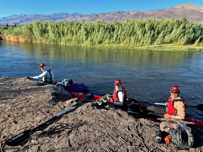
At TA6 we just jogged up, handed them our passport and said checking in and checking out. Then we grabbed our kayaks and slid them to the river, I shoved my clothes and the map and passport into my dry bag, pulled out the water filter, and we were ready to set off. Then Adrian came up to ask for the tracker - evidently ours had stopped working. I handed it over and we asked about cutoff times - this is where we found out the race ends at 9, and there was no penalty starting at 6:45 which is what we had heard at TA5. That was a relief, but also sort of took our rush away. We chatted a bit more before casting off. That is where I discovered my paddle was not feathered - and I was unable to push the button in to feather it, even if I banged it on the kayak. Sadly the other 2 paddles were not adjustable either, so I couldn't just trade. I guess if I had to choose between feathering my paddle on the lake or here I would take the lake, but it was still an annoyance. We paddled downstream at a decent pace passing one kayak, then Kellee and Jameson flipped - I am not sure what happened, but it probably involved the pushy current and willows. After that Jameson started flagging, I think the push for so long had worn off, and then just sitting in the boat didn't help. He took a caffeine pill and we hoped that would kick in. Meanwhile a few other kayaks caught up to us and we caught another kayak so we were travelling in a bit of a flotilla. Then he perked up and we started paddling steadily and pulled back ahead.
 |
|---|
 |
|---|
 |
|---|
The wind was somewhat gusty but mostly blocked by the willows. The sun was getting low to the west, but not blocked all that well. Fortunately we had sunglasses and the others had some sort of face covering. I had been slathered with sunscreen and dust for the last day, so I hoped that was providing some protection. I was able to keep applying lip block after I pulled it from my pack and put it in my zip pocket. I missed my pfd with pockets though. It seemed to take forever, but in reality it was more like 3 hours to pass the 3 bridges to the takeout. We were greeted by Iris. Yay. We pulled the boats out, took a picture, chatted a bit, got our passport signed, and headed off up the road with a brief stop for me to dunk my shirt in the artesian spring. The cool lasted about 15 minutes.
 |
|---|
 |
|---|
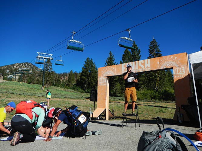
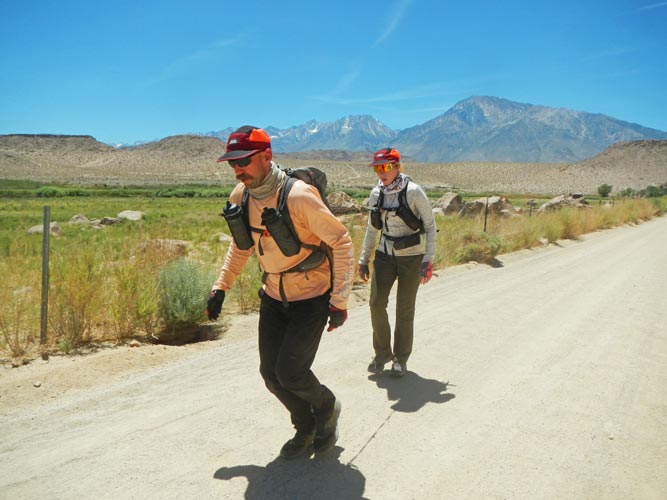
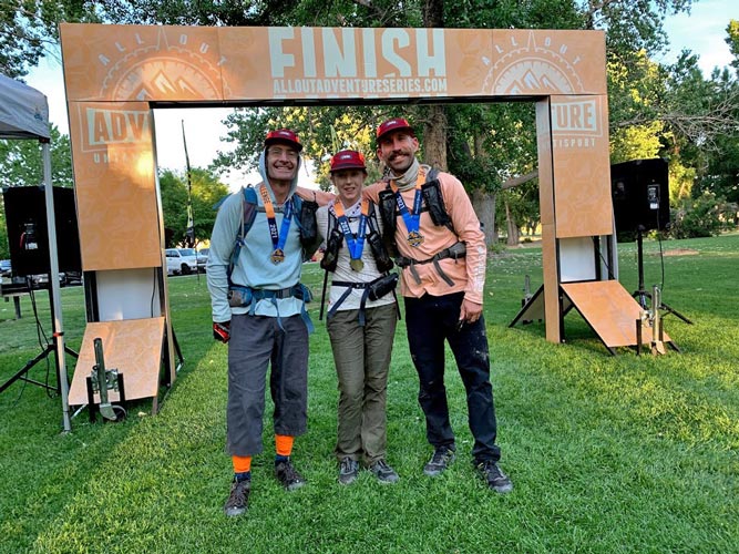
We headed up the road jogging intervals, and then started jogging longer and walking less. The end was near. We passed the airport, Johnston, the Canal, turned on Hanby, cut past the Church and across the field, and there it was, the finish line. We jogged across and embraced satisfied with a good hard effort, but a little disappointed with not finding CP29 or pushing hard through the end.
 |
|---|
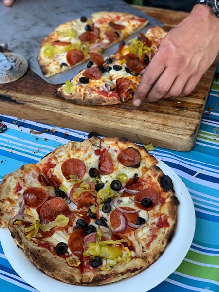
Iris had ordered pizzas for us (there was a guy making delicious wood-fired pizzas at the finish). I took off my shoes, sat down, drank cold liquids, ate pizza (once it came), and talked with the other racers. This is where we learned that Bones had a lot of trouble with the brushy Horton Creek and had hiked their bikes around on the right. Mary from that team said that part was harder than Expedition Oregon. We also learned that they had only tried for the CPs we did (although they found CP29- somewhat by luck they said). A few more teams came in, including Toasted Turtles and the Jackalopes. I biked back to the Church to grab a Tower Racing shirt to match the others, then they had the awards ceremony.
 |
|---|
 |
|---|
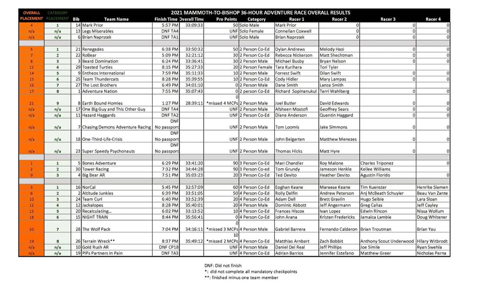
It turns out they gave the teams that went through the Sad boulders credit for CP29, so we were tied with Bones for the most points - 90, but they beat us by 1:03:08. The 3rd and 4th place teams both had 60 points, so we were much closer to 1st than 3rd. It was awesome to place second, but we were a little disappointed we didn't manage to push a little more to finish an hour and a few minutes faster - we certainly could have had we figured out how to cross Horton Creek earlier - of course Bones could have gone faster too... I also don't know if they applied any penalties for going on Benton Crossing Road (or Lower Rock Creek Road).
 |
|---|
Then we loaded our bins in Iris' car and biked back to the Church for showers and more hydration and Kellee and Jameson went to bed. I was going to do that but Sam and Raquel showed up so we ended up talking later than I should have. Early early in the Morning Jameson and Kellee got up to drive back to Fresno. I slept through this but Iris heard it and saw the headlamps and heard bicycles rolling and thought it was a team looking for the finish that got lost.
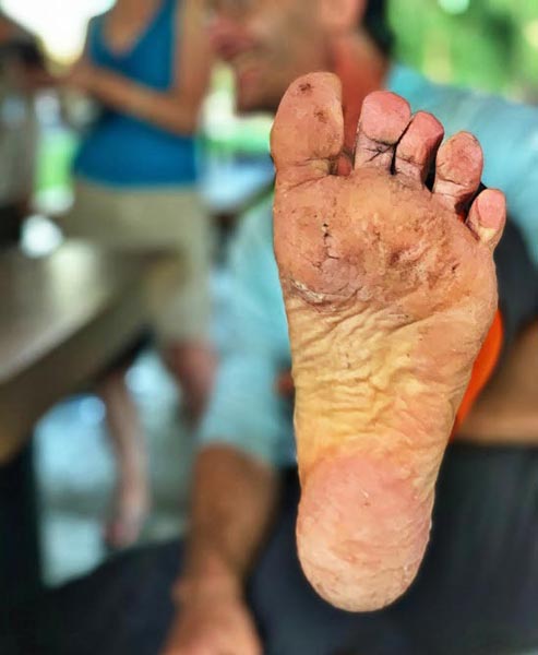
A few days later - I'm still a little beat, my eyes are tired, my legs are scraped and a bit sore, my lips are chapped, but I am quite pleased with how we did in the race. We felt much better about how we were doing on day one through the night, but I think there were just some rough sections plus extreme heat on day 2 that got to everyone. All in all we managed to push almost the entire time but not so much that we couldn't keep going. We also managed to deal with our setbacks and not let them stop us.
As far as gear goes, my stuff mostly worked well, although I do need to find my insoles and put them in my shoes (somehow I had one set of insoles for 2 pairs of shoes). The Columbia omni-freeze fishing sun shirt worked fairly well to keep the sun off me and at least when it was damp and there was a breeze it cooled me fairly well. There were a few more times I should have wet it for more cooling, but in general I think it helped. For water purification I used a BeFree squeeze filter. This worked well, but after just 30 hours or so it was noticeably slower and harder to filter. For food I didn't do a great job of keeping track of what I had and eating what I specifically wanted compared to what was in the available pockets. I wasn't hungry, but if I had more time or better organization I would have eaten different food. I had a bunch of bacon-cheese melt sandwiches that really hit the spot, but some were still uneaten at the end of the race. My old Fenix headlamp had some issues - I think the wire is a little rotten somewhere between the battery pack and the front of the headlamp. My maybe 20 year old Schwinn Mesa bicycle worked better than expected - good job Iron Lady (it has an "Iron Lady" sticker on it). I realized that the more you push the pace, the less you want to change anything - your clothes, where your food is, etc. So having a system dialed is more important. It would have been good to have a big plastic bag to just shove the pack in for the paddling and the swim.
Thanks to Yishai, Adrian, Gold Rush Adventure Racing, All Out Events and everyone that put on this race plus the volunteers as well as Inyo and Mono Counties and Bishop and Mammoth - this really is a good area for a race. Also Thanks to Jameson and Kellee for the opportunity to race, plus pushing me and letting me push them. Thanks to the people that took and posted photos. I carried my little camera with me, but didn't stop to pull it out very often (I tried not to do it if it would slow me down). Finally thanks also to Iris for changing her schedule to allow me to race, pushing me to train, and volunteering at the race. It was a delight to see her at the TAs and the finish line.