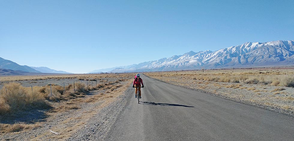
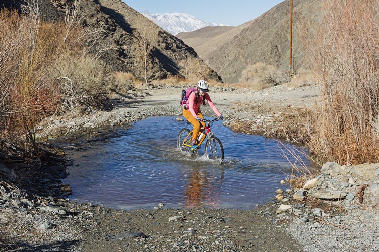
Iris only had a 2 day weekend and we were in Bishop so we decided to go for peak 8860. On Peakbagger the peaks that you have climbed are green and the ones that you haven't are red. Peak 8860 was the nearest red dot to my home, so obviously it needed to be turned green. Since it was close-ish, we opted to bike to the start of the hiking. We headed off across the Owens and up Silver Canyon. This road quickly turns to gravel, but it is mostly in decent shape - other than a string of stream crossings. The stream is actually small enough that you can just step over it in places, but where it crosses the road it is mostly 5 to 20 feet wide and up to about a foot deep because the cars and ATVs zip through it and make a pool in the road. For most of the crossings it was possible to keep our feet dry if you picked a shallow line with no big rocks underwater to stop you. We both managed to soak one foot each and get the other a little wet. We were biking uphill in the sun without much wind though, so it was plenty warm. We did go into the shade for one little stretch and the temperature dropped significantly. We ground our way uphill slowly and eventually got to a turn off towards a mine/prospect and parked the bikes there.
| |
|---|
 |
|---|
 |
|---|
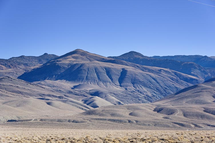
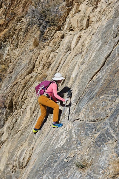
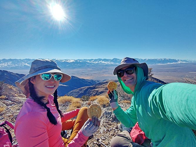
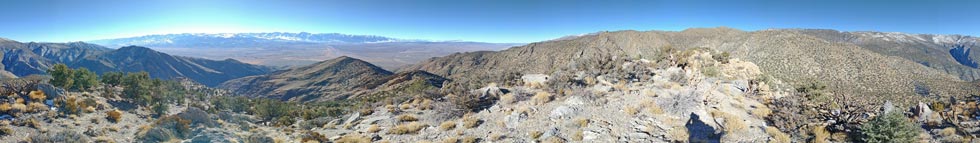
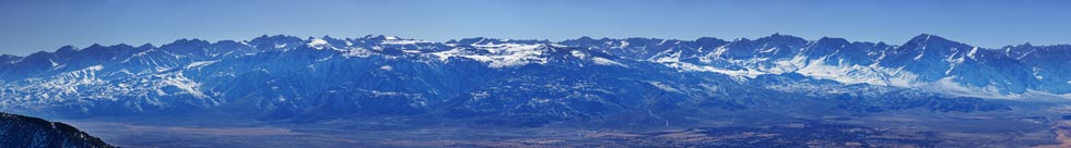
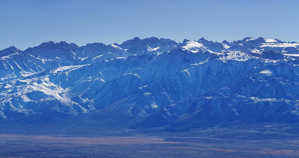
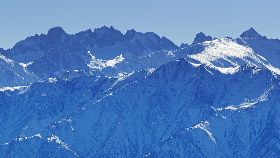
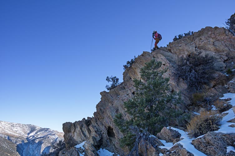
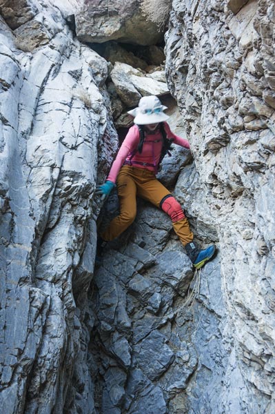
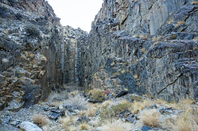
The first part of the side road had been aggressively decommissioned. This meant big rocks at the end plus moguls and then smaller rocks. After that it was much nicer walking although probably not very driveable by most vehicles. This road dead-ended where a large metal pipe brought material down the mountain side, so we skipped the last switchbacks up to that point and began bushwhacking up the drainage. Our pace slowed dramatically as the terrain got rougher and steeper. Nothing was impassible, but it wasn't very fast either. The ground was steep rocks, some quite solid and grippy, others shaly slate (or maybe slaty shale) piled up like busted crockery. We slowly worked our way up towards the peak as the views behind us of the Sierra and the Owens Valley grew more expansive. Finally near 2:30 we made it to the top. The views were pretty excellent. We had our second sandwich and summit cookie and enjoyed the view.
 |
|---|
 |
|---|
 |
|---|
 |
|---|
 |
|---|
 |
|---|
We opted to head down a different drainage for the descent. The way up worked, but wasn't all that great, and the other descent looked maybe a little less steep. Plus it is usually nice to see new territory. We dropped off to the NE down the ridge and then curved around to the S down the drainage. Most of this was pretty pleasant travel with nice views and the occasional patch of snow in the shade and a few boulders and dry falls to navigate. Then there was what looked like a dropoff ahead. We detoured out of the drainage to the west and were able to confirm it was a cliff. We detoured around west and south to the entrance to a dramatic box canyon before heading back down to the road. Then we walked down to the road and prepared to bicycle home.
 |
|---|
 |
|---|
 |
|---|
 |
|---|
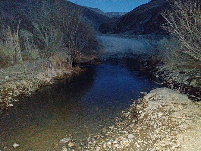
This road is pretty steep - within a few seconds of coasting I would hit 20 mph and start braking. 20 seemed more than fast enough with a gravel road and fading light. I am much more comfortable biking downhill (and had the full suspension bike), so I went ahead to each stream crossing and tried to identify the best place to cross before Iris got there. It was getting pretty dark by now and I was hoping to get past all the stream crossings before I had to use my headlamp. My dark vision is better than Iris' and she isn't as foolhardy so she was using her headlamp. At the second to last crossing (out of 7 or 8) I waited with my phone out to take a photo, but Iris didn't show up. I walked back up the road and found her on the side of the road covered in dust. A rock had turned the front wheel and she stuck her left leg down to recover and it buckled and she crashed. Unable to stand on it she was trying to figure out how to get down. We managed to get her onto the bike seat and then we walked it down the hill riding the brakes. I piggy-backed her across the stream. Then we repeated this procedure down the road and past the next stream crossing. There I left her sitting off the road and hurried back to get my bike. Then I left her with water and warm clothes and biked home to get my truck. Fortunately she was within cell phone range here so she spent most of the time I was gone on hold with health insurance. By the time I returned she was starting to get cold. We loaded into the truck and went home.
 |
|---|
Iris knee is still not weight bearing (we assume, she hasn't tried recently). X-rays reveal no broken bones, but we presume ligament and or cartilage damage. She has an imobilizing brace and cutches to hobble around. Unfortunately NIH and any other nearby health care is out of network for her and due to a housemate with a positive Covid diagnosis going to her Orange County home doesn't seem like a great idea right now. So she gets to explore the iniquities of the crazy US "healthcare" system. pro tip - put your leg up and listen to soothing on hold music for hours of relaxing "me" time.