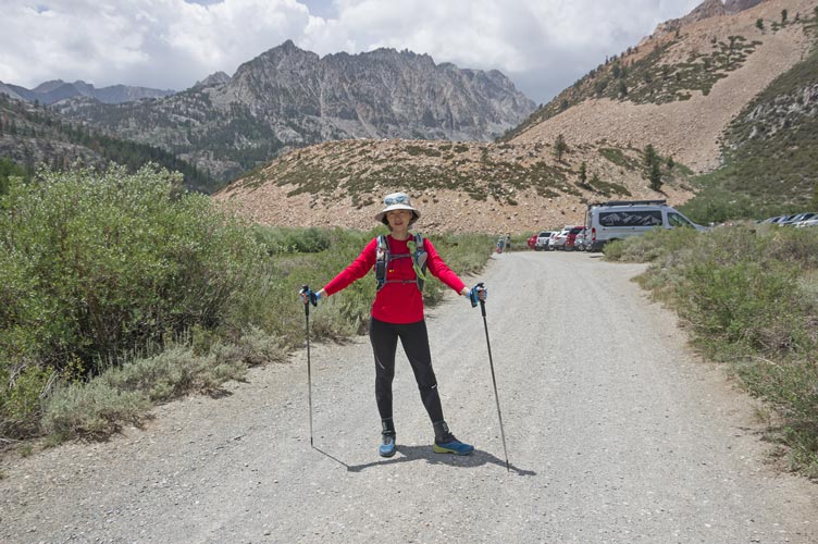
7-24-2021 It was time for some more exercise, so we went up to N Lake to meet up with Jim Burd. Jim and Iris were going to go fishing, I was going to head up some of the Piute Crags as well as Bishop Bowl Summit. I originally intended to climb the Bishop Bowl first, but when I got a look at it I changed my mind. It seemed like going the other way would mean I was mostly scrambling up the sawtoothed ridge instead of mostly scrambling down.
| |
|---|
 |
|---|
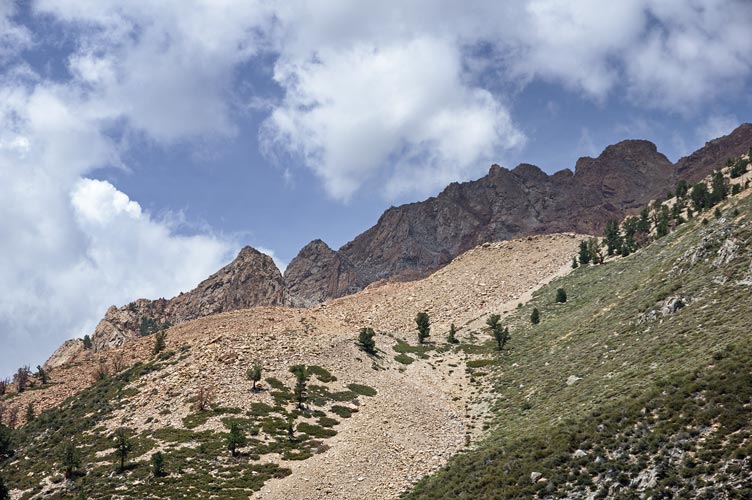
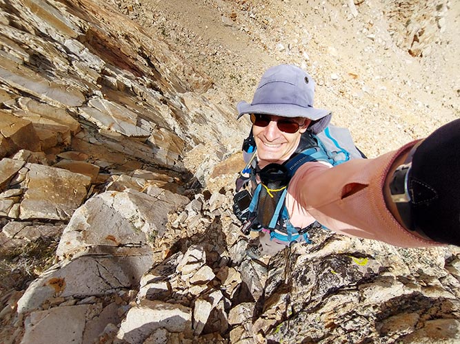
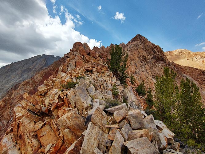
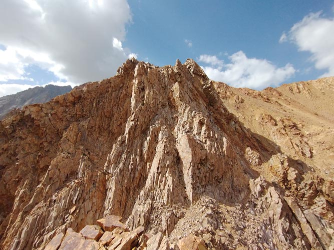
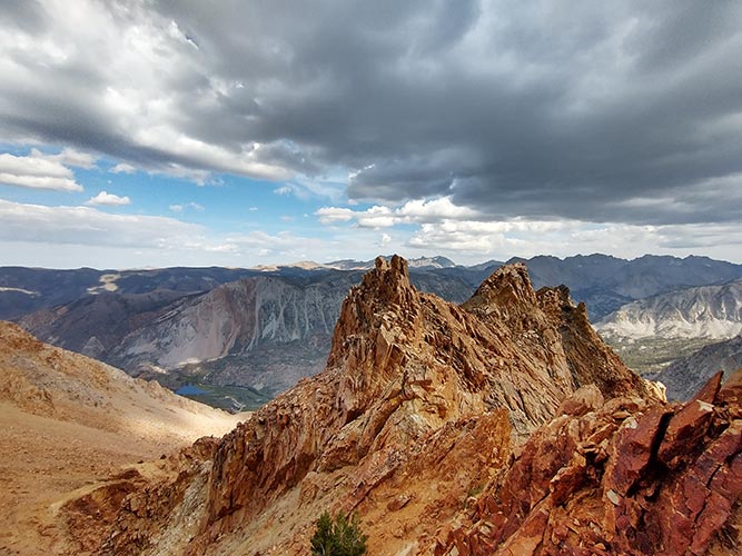
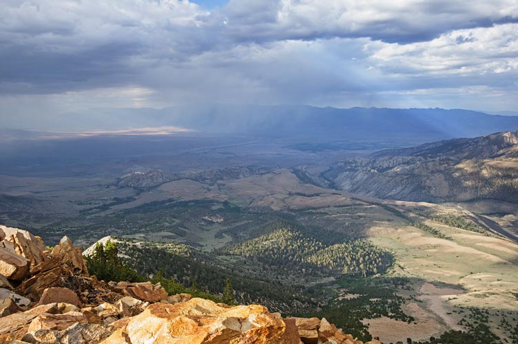
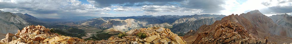
We all headed up the road and then the trail after noon. As the trail passed close to the toe of the ridge I cut off and headed through the scraggly trees and up the talus. Once I left the trees there was a bit of a breeze. I worked my way up the most stable talus I could find planning to go up past the first peak and cut back up a chute. As I headed up I saw a series of ledges going straight up that looked a lot more interesting, so I packed up my trekking poles, ate a few bites of bagel, and headed up. The rock was mostly pretty solid and fine grained, but there were some loose blocks and the occasional broken bits that needed to be watched. I scrambled up a series of ledges, chutes, and steep scree towards what I thought was crag #11. As I got higher I realized that #11 was also higher and farther north. There were a few sections without as many holds as I would have liked and I searched around for a more secure path. Eventually I got up there and was disappointed that it wasn't much of a peak - maybe they meant another peak a little farther down the ridge? In any case I made it to the peak closest to where the GPS said it was although maybe it should be the peak to the SW or maybe that should be #12. I called Iris on Jim's radio "Grundy to Ma, Grundy to Ma...". There were a few places where the mountain blocked radio communication, but most of the time we were able to talk.
 |
|---|
 |
|---|
 |
|---|
 |
|---|
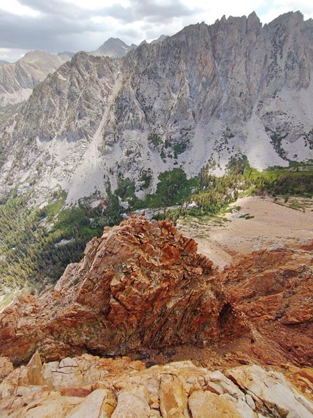
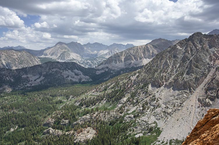
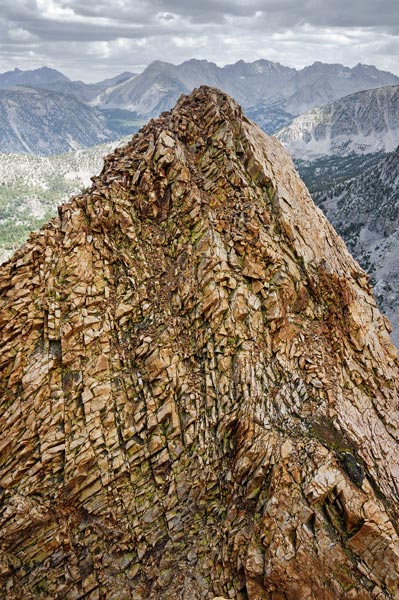
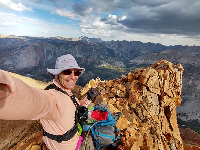
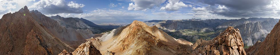
I worked my way up to along the ridge with some difficulties - mostly getting up to #11 and the descent from #10. I think the prominence of these peaks was derived from somewhat spotty elevation data, since it seemed that some had more than listed. It wasn't until after 5 that I made it up to Crag #7 at 12,140 feet my high point for the day. Here the ridge turned to the west to head up towards Mt Emerson. I think it is along this segment where the rock quality deteriorates but I will leave that for another day. I descended back to the NE and headed up towards Bishop Bowl Peak. This was farther with more up than I expected. It was also the only summit where I found a register although I had seen a few cairns and seats on other peaks. I talked to Iris from this summit and they were running a little (or a lot) behind schedule too. Plus there were fish rising in the little lakes they were passing so they had to stop to check them out. It looked like rain out over Mount Tom and in the Owens Valley but I only got hit by a few drops.
 |
|---|
 |
|---|
 |
|---|
 |
|---|
 |
|---|
 |
|---|
 |
|---|
 |
|---|
The descent was less straightforward and longer than I thought it was going to be. I picked my way down the ridge towards the SE and then found some decently soft scree to descend rapidly towards the ENE. I wanted to cut a bit more east but there were scraggly trees in the way so I continued down the drainage until I saw a gap in the trees. Then I cut over southeast. There I stopped to dump the sand and gravel out of my shoes (new (to me) La Sportiva approach shoes that climbed ok but rubbed my heel in an unfortunate way). I descended down to the slope above the Pack Station and stopped to change my shoes. I had a spare pair since I correctly didn't fully trust the new shoes. These shoes fit my heel a lot better and had more padding which was greatly appreciated as I headed down the slope and then when I got there jogged down the old trail. I kept hoping to see Iris and Jim on the road below but it was not to be. I radioed from the road and they were still up the trail. I went back to the truck to drop off some extra weight and then headed back up to meet them. I went about as far as I did the first time before I heard and saw them ahead. Then we went back down, turning on the headlamp somewhere before the campground - same high price ($27) new less service (they took out the water spigot).
Back at the parking lot we sat in Jim's RV and enjoyed some cold beverages. We ended up talking long enough that we had some hot dogs. Eventually we headed back down to Bishop for a much needed shower.