Tom Grundy's Red Mountain Page
4 months after surgery Iris was ready to try a peak. We decided to go for Red Mountain which didn't look like a whole lot of up (maybe 2000 feet) and most of the distance was class 2 or below - quite a bit on trail.
On Friday July 16, 2021 we got up early and after breakfast and packing up we drove to the trailhead at the pack station in Rock Creek. There are much shorter ways to get to this peak, but we figured starting higher and walking on the trail would be a good plan. Right before we left a mule ride went past - 11 mules with tourists ambling up the trail ahead of us. Sadly they stopped soon after starting so we passed them, and then shortly were passed again. Fortunately we didn't leap-frog all day, although the trail was fairly sandy and had plenty of trail apples and flies.
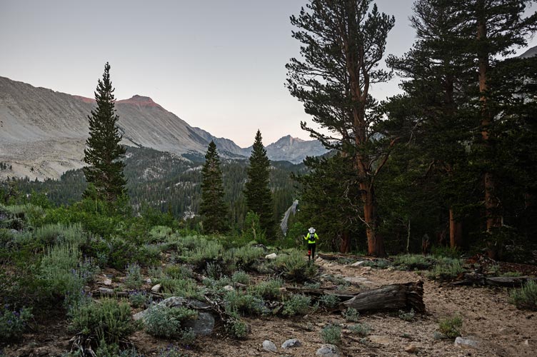
The theme of the day was slow and steady - we certainly weren't hiking fast. I was carrying a fairly heavy pack with enough water for 2, and Iris was hiking very carefully. It seemed like we did as much downhill as up until we turned left and started up over the ridge to go to Hilton Lakes. At a big switchback we left the trail and headed northish up to the ridge and towards Red Mountain. Mostly it was fairly easy cross country travel through the open woods, but there were a few downed trees, tight aspens, and rocky sections to avoid or work our way through. We generally worked our way down towards a large meadow SW of Red mountain, stopping for a bacon-cheese english muffin sandwich break.
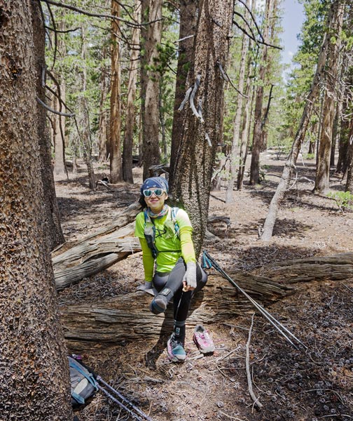
Iris rests and stretches on the hike in
 |
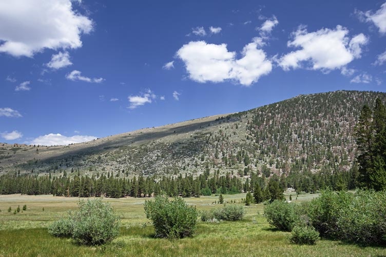
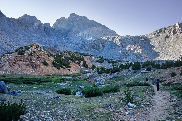
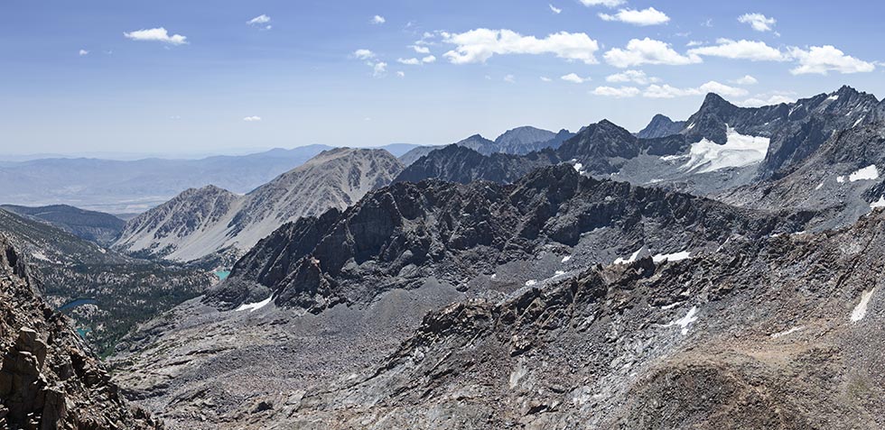
Red Mountain from near the start of the meadow
 |
We crossed the meadow which was slower than expected due to lots of uneven ground from burrowing critters and then we started up through the brush and little aspens. I tried to find the easiest path and bash down dead branches in the way. Eventually we got through this into the more open sagebrush above. We slowly worked our way up the path of least resistance to the 11,467 foot summit, but it was a lot more up than we had expected (there was more down on the way to the base of the mountain).
Iris works her way up through the aspens - Patricia Peak on horizon above her
 |
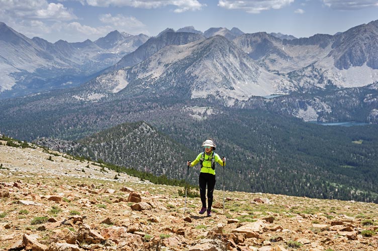
Iris almost on top - Hilton Lakes behind her
 |
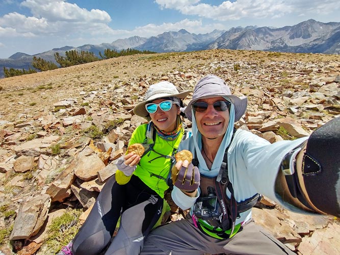
On top we enjoyed the views, summit cookies, cell reception, the summit register, and a long break. Iris' strava said we had come 8 miles, mine said just under 7. In any case we had come farther than we planned on, and had a long long way to go back. The descent to the meadow went a lot faster, although not necessarily easier. Iris was on point the whole time carefully stepping down, since the biggest worry was a slip or a fall leading to a re-injury. We took another break in the shade on a log at the edge of the meadow before heading back up the shallow ridge towards the trail.
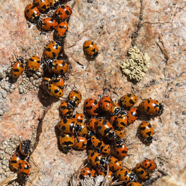
ladybugs congregating by the summit
 |
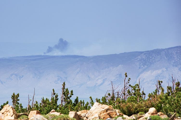
smoke from the Dexter Fire in the glass mountains on the horizon
 |
summit cookie time
 |
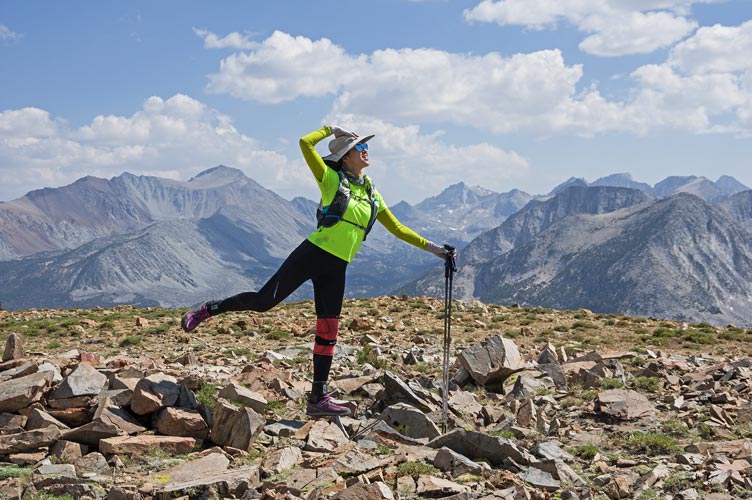
Iris on top of Red Mountain
 |
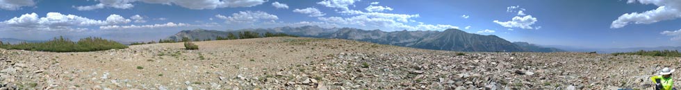
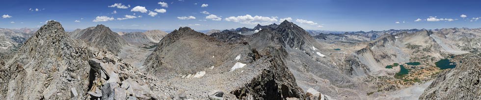
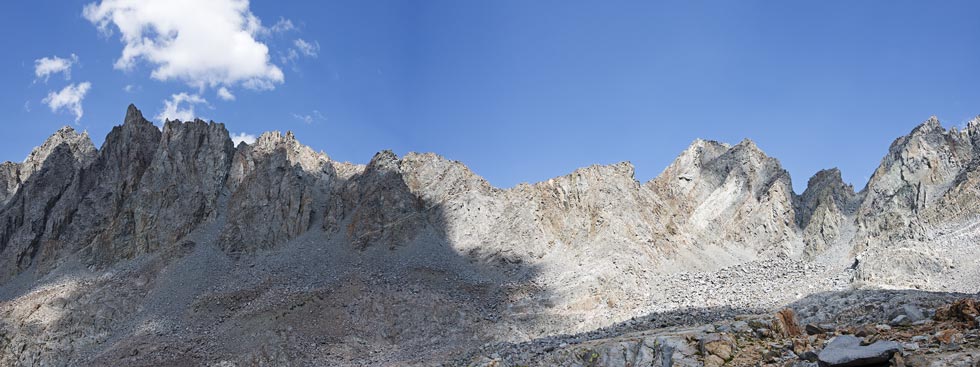
panorama from the summit of Red Mountain - center is southish
 |
We picked a better line towards the trail on the west side of the ridge but still had a few harder sections to work through. Then we hit the trail closer to the ridgetop so we essentially backtracked farther down the stupid switchbacks going the wrong way. (I say stupid switchbacks because the more direct trail had been re-routed to one that went much farther). Maybe this cut down on erosion, but it mostly just looked like more mule pounded sandy ground to cover.
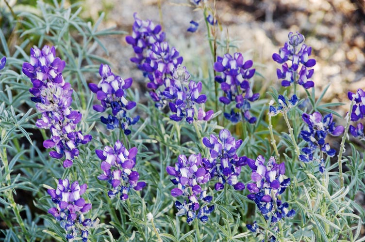
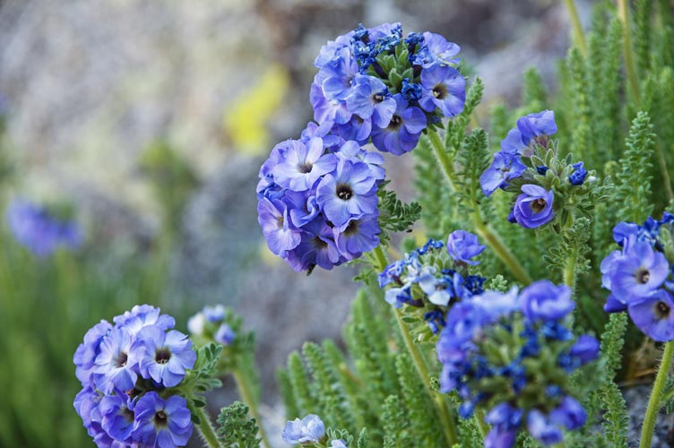
lupine flowers
 |
Once we were on the trail we went slightly faster, except the big steps and sloped rocks covered with sand were more treacherous than most of what we were on cross country. It seemed like a lot of uphill as we worked our way towards the trailhead. At some point we found a chunk of rope and played around with towing a little (slowly). Finally we made it back - shortly before we would have needed headlamps. We headed back to Bishop but failed to get to sleep as early as would make sense for waking up at 5 the next day. This was probably more than we should have done, but we managed to pull it off, so I guess it is ok.
Iris nearly back to the trailhead - Mt Morgan (S) on the left and Bear Creek Spire center
 |
Iris' strava page for hiking Red Mountain
Saturday July 17, 2021
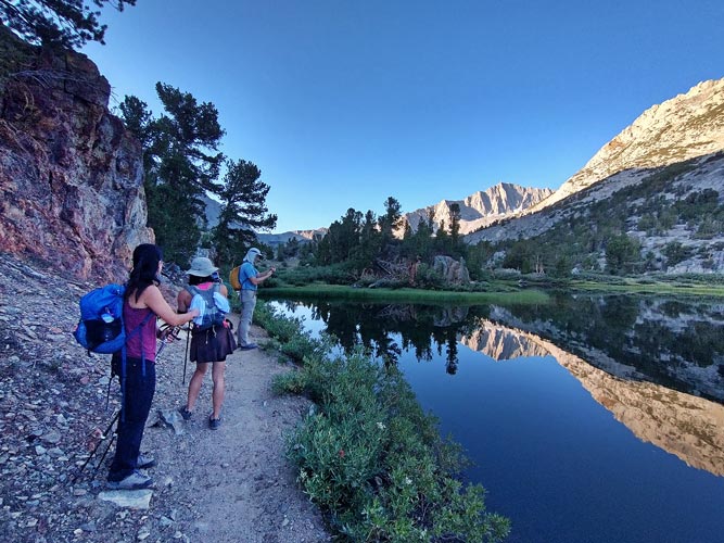
Iris cleverly elected to sleep in and have a 100 meter day after the previous big day. I got up at 5 and grabbed caffeinated beverages and my stuff and drove up to S Lake to meet up with Chris and some "lady crushers" - Mei and Akiko. They were hiking up Agassiz and I was going to go up Aperture Peak - another red dot in the neighborhood that needed to be turned green. We also saw Michael at the trailhead - he was going to head up Fusilade Peak later that morning. We left shortly after 6 am and headed up towards Bishop Pass at a Sierra Challenge pace. One advantage of the early start (and a bit of a break in the heat wave) was that it wasn't all that hot, in fact it was pleasantly cool most of the way up, or at least until the sun came over the ridge. I left the others at the top of the switchbacks to Bishop Pass and then headed towards Jigsaw Pass.
Akiko, Mei, and Chris taking some pics by Long Lake
 |
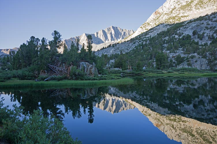
Mt Goode and reflection in Long Lake
 |
hiking up towards Bishop Pass - Aperture to left, Agassiz center
 |
I definitely didn't take the easiest path through the talus to the pass, but it wasn't horrible. I mostly was able to stick to stable rocks up to the pass (actually I went up the rock on the side to a different slightly higher pass at the top) and then headed right scramblng up to the 13,265 foot Aperture Peak. The scrambling was pretty easy 3rd class with numerous options. This peak featured a nice Sierra Club cast aluminum register and a place to sit out of the wind. I even briefly had cell reception to post a summit cookie selfie.
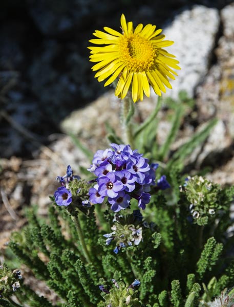
skypilot or Polemonium flowers
 |
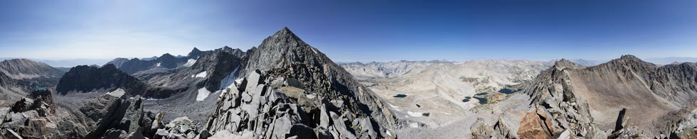
panorama from the summit of Aperture Peak - Agassiz is big peak to south - center left with Bishop Pass to right of it
13,218 doesn't quite hit the horizon center right while Picture Puzzle barely does and Gendarme is above the horizon to the right
 |
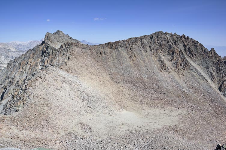
Gendarme Peak on right, 13,218 and Picture Puzzle on left
 |
I decided to head to Gendarme Peak next - so I scrambled down to Jigsaw Pass and then a long rising traverse up to the ridge to Gendarme. It wasn't obvious that the point I was on was the high point so I went a little farther to another pinnacle. Neither of them had a register, and the first location was marked on peakbagger. This peak is 13,252 feet and has less prominence. I ate my second sandwich here and then headed to the final bump of the day.
360 degree panorama from Gendarme Peak - Agassiz on far left, Aperture in the shade below it
13,218 below a little cloud middle left with Picture Puzzle to the right of it, Cloudripper just right of center
 |
crop in on the N Palisade Glacier and Mt Sill and N Palisade on the right
 |
The last point was an unnamed spike on the ridge S of Picture Puzzle Peak - one I had done earlier in the snow in 2017. The point on the ridge is elevation 13,218, but the prominence is not noted - probably under 100 feet. Anyway, it was another red dot on peakbagger that needed to be turned green. I slowly worked my way up to the summit and found a register. I signed that and ate my last sandwich before heading down. It seemed like a lot of down and up before I reached Jigsaw pass, and the descent from that was more tedious too. I did pick an easier line across to the foot of Agassiz and then found a pretty good old trail nearly to the Bishop Pass trail.
alpine gold and skypilot wildflowers
 |
panorama from the summit of 13,218 - Picture Puzzle is to the n far left
Gendarme is middle left, Agassiz is big peak to south - just right of center with Aperture hiding below and left of it
 |
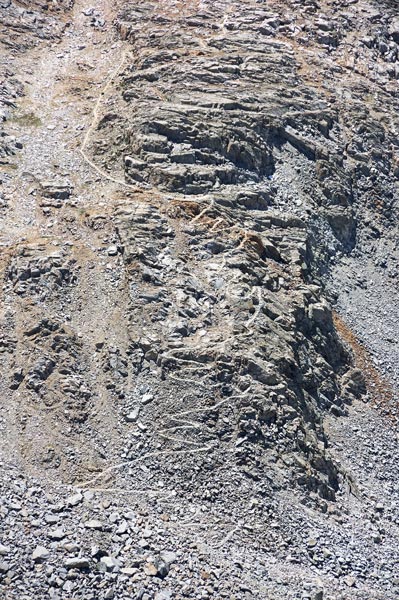
The switchbacks on the trail up to Bishop Pass
I left the trail after where it bent to go up at the top
 |
view up towards Jigsaw Pass - right of center with Aperture to the right of it (with wide stripes on it) and Agassiz just out of view to right
Picture Puzzle is left with peak 13,218 the spiky one in the shade
 |
I did some half-hearted jogging down the trail, but my fairly un-padded approach shoes (especially under the forefoot) made it less fun (but they do scramble well). I still moved down the trail fairly steadily back to the truck. I considered jumping in one of the inviting lakes, but it didn't happen. Chris et al. had climbed Agassiz and then traversed around to Mount Goode and descended the slope back to the Bishop Pass trail from there. Later that evening Chris and Mei stopped by the Church for showers and to talk over dinner, Akiko headed back to the Bay Area that night.
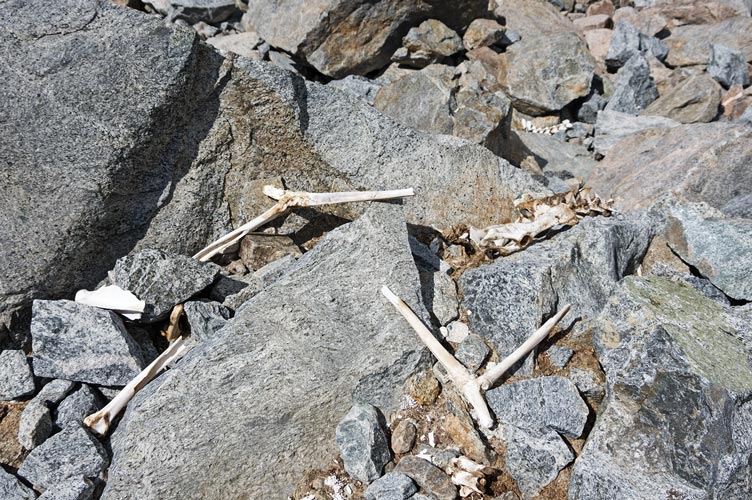
the remains of the dead deer from late 2017 (fortunately no longer stinky)
 |
my strava page for Aperture, Gendarme + hike
No material on this page may be copied or used without permission.