Tom Grundy's Arrowhead, Mchenry, Powell, and Thatchtop traverse Page
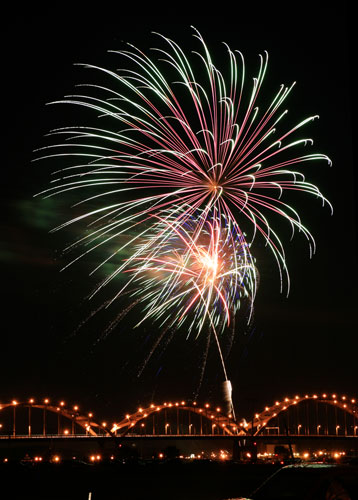
After an extended stay at low elevation in the east, it was time to get into the mountains. I suppose I could have eased my way into things, but why? I had done a few trips with Kim in the Sierra and she is always up for a bit of suffering in the mountains. She had e-mailed me a few possibilities, and rather than go big with something like the Diamond I opted for a traverse with a few bail points in case I couldn't handle the altitude (I figured the distance would only result in being tired and in pain). I drove from Boston across a number of states with a brief stop in Davenport to see some fireworks the 3rd of July. I made it to Estes Park the 5th and festered for an afternoon (unable to get in touch with my friend David who was also up in the area).
Fireworks over the Mississippi in Davenport, Iowa
 |
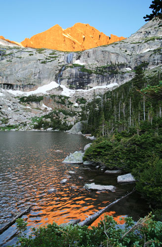
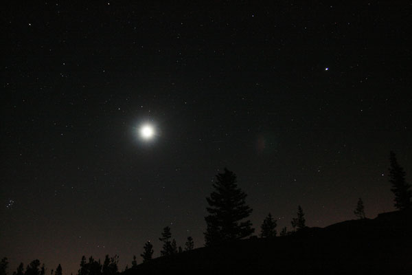
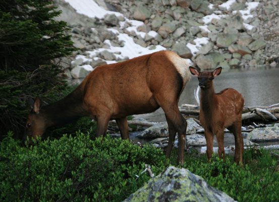
I met up with Kim that evening and we packed up and then crashed for a few hours. We woke up on the 6th at 2:30 am and headed into Rocky Mountain National park. The stars and crescent moon were pretty impressive when we started hiking (at 9,180 ft) from the Glacier Gorge trailhead at 3:40. We managed to find the climbers "shortcut" trail and headed up that. By the time we got to Black Lake at 10,620 feet and 4.9 miles minus whatever we saved (.75 mi?) by taking the shortcut, it was starting to get light. There we watched a mother and baby elk for a while. They seemed pretty unconcerned about us and walked to within 10 feet or so at the closest. Then we headed up towards Arrowhead Peak.
Black Lake and morning light
 |
It was a nice night for a hike (the crescent moon is blown out)
 |
Elk mother and calf at Black Lake
 |
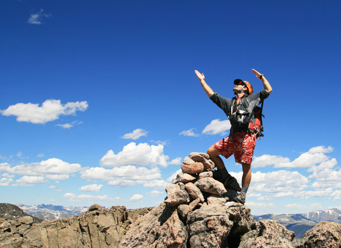
After the first easy slope up Arrowhead I realized I had forgotten to fill up my water reservoir. I managed to get it filled from a seep running down a steep rock slope, but then I slipped on the wet rock climbing back down and slid a bit. My fingers were already frozen from the icy water and the slip really hurt (along with a few cuts and scrapes). From there we continued on up taking Kim's "interesting" route rather than the absolutely easiest (and more boring) route. At one point where she suggested the fist sized clump of grass as a handhold I would have been happier w/ boring. My Asolo approach shoes weren't giving me a lot of confidence for toeing in on little holds. The clump of grass led on to a better hold and soon we were up at the top of Arrowhead Peak (12,387 ft). The views were spectacular.
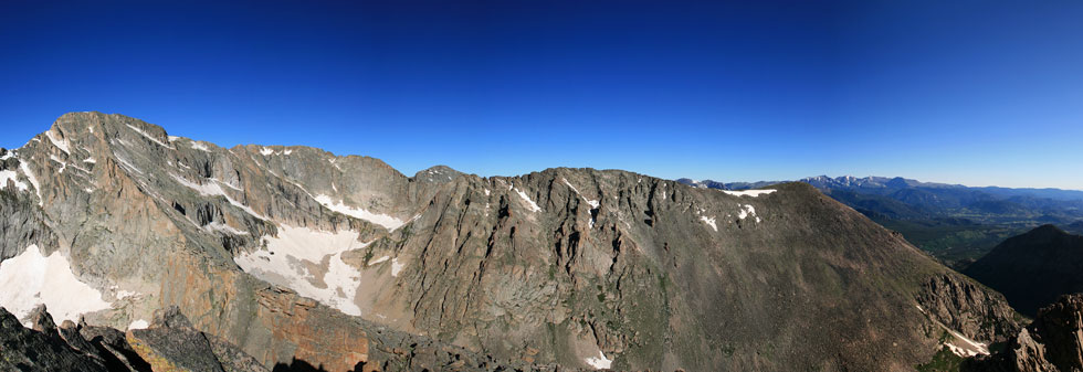
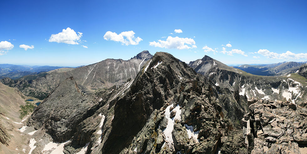
panorama from Arrowhead with McHenry on the left and Thatchtop on the right
 |
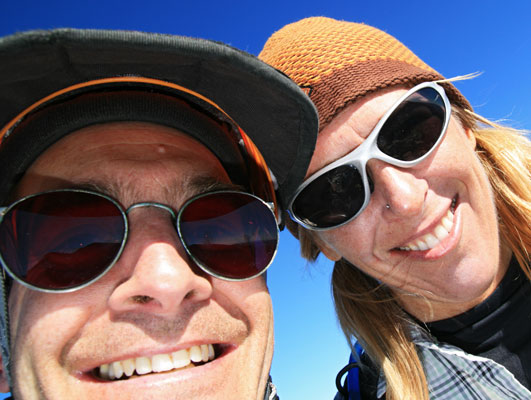
Here we are on top of Arrowhead Peak
 |
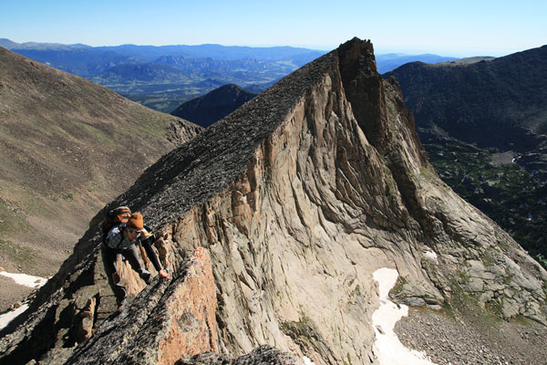
Kim climbing the Arrowhead-McHenry arete
 |
From Arrowhead Peak we dropped down to an arete that was leaning to the south like a massive breaking granite wave. Some of the rocks along the ridge leaned far enough over the edge that it wasn't clear why they were still there. The scrambling along here was a lot of fun, and got even better as the arete rose towards the summit of McHenry Peak at 13,327 ft, the highest point in the day. I was definitely feeling the altitude because I wasn't feeling hungry. In fact I was a bit nauseaus and my head hurt. I put some snow into my water, drank up, and we headed on towards Powell.
Stitched image from McHenry (you can see Thatchtop, Arrowhead, and Longs Peak as well as Black Lake)
 |
To get there we had to drop down into a deep notch and then scramble back up the other side. The downclimb was probably the most technical climbing we had to do along this traverse, but I am guessing it was hard 4th class with maybe a few easy 5th class moves. I was glad that all the snow was melted away from this section though. The traverse to the west and scramble up to the summit of Powell was easy but airy. Powell is at 13,208 feet elevation and we were ready for a break, but we could see that there were a few clouds starting to build and we had a long ridge still to go, so we only took a short break before heading down the arete towards Thatchtop.
Here I am posing on Powell
 |
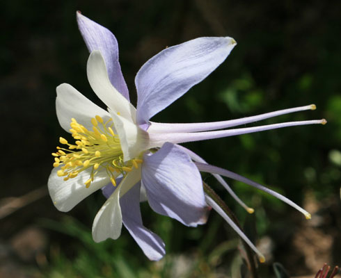
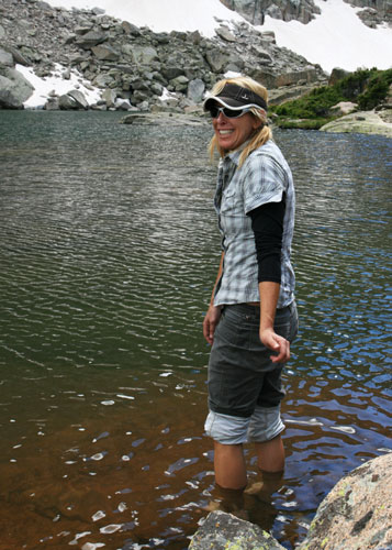
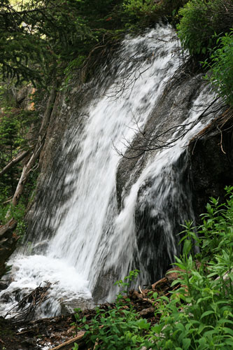
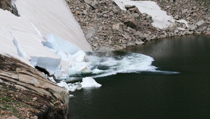
Once again we were on the crest of a great wave of granite crashing to the south. I think parts of this arete overhung even more than the Arrowhead to McHenry arete. It was also a lot longer. Finally we were past the last of the technical scrambling and passed over Peak 12,836? and down before rising gently to the summit of Thatchtop (elev 12,668) from here we descended the endless steep slopes and talus down to Solitude Lake around 3:15. The lower slopes had some most excellent and fragrant wildflowers. Now that we were out of the major lightning risk area we took our time eating and resting a bit and soaking our feet in the frigid water. We even devoured a "fat pill" (fried cherry fruit pie). At Shelf Lake we saw a large amount of snow break off and drop into the lake. It was a bit like seeing icebergs calve off of a glacier, but on a smaller scale. From the lake we were able to pick up a climbers trail which dropped down steeply and endlessly to the trail we had hiked in on. Then it was simply a matter of hiking down the trail back to the truck some time around 6:30 or so. We saw a snowshoe hare in summer colors sitting on the trail. It only ran off when we got within about 5 feet and didn't go far. The wildlife in the park didn't seem very scared of people at all.
Columbine
 |
Kim cooling her feet in the frigid water
 |
small waterfall below Shelf lake
 |
Snow falling into Shelf Lake
 |
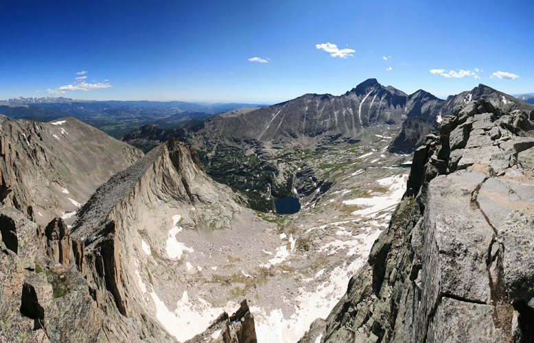
panorama from Powell with McHenry in the center
 |
here is a link to the spot tracker page showing our approximate path on a map
spot tracker page for RMNP 2010 traverse
Blog teaser for this traverse