Sept 20th was the first day in a long time I needed to climb a peak (for my very haphazard quest to climb a new p300 every calendar day of the year), I was down in Orange County and not getting a whole lot of exercise, so why not go big. Sadly I had to get a permit, but happily it wasn't through recreation.gov and there were plenty available online. I packed up my stuff and tried to go to bed early the night before.
2023-9-20 The alarm went off at 4 am - what was I thinking. I got up, dressed for hiking, microwaved the now cool tea and put it back in the thermos, toasted a bagel and some blueberry loaf, grabbed the car charge port I had forgotten to pack the night before, and headed out to the truck. Then I drove to the trailhead - with some drizzly rain along the way. Fortunately traffic was pretty sparse at this time of day, although there was still plenty of it. My truck was the only vehicle in the lot when I got there. It was chilly at 6900 ft but I figured I'd warm up soon enough. I was glad to have gloves and a buff though. I ate a bit more food and drank some more water, started my spot, visited the outhouse, and at 6:10 on my few minutes fast watch I was on my way - probably really 6:07 - all the other times here are based on my phone timestamping pics.
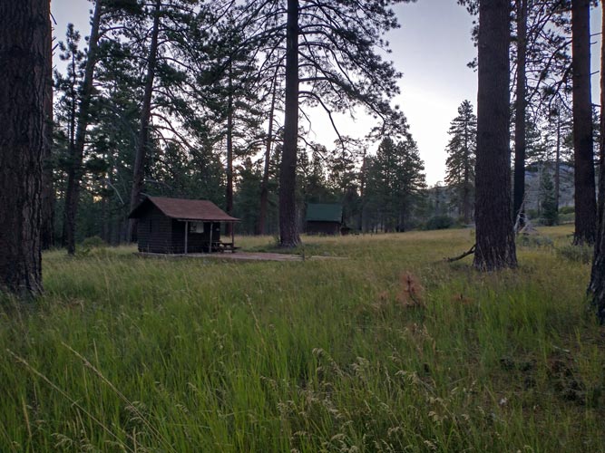
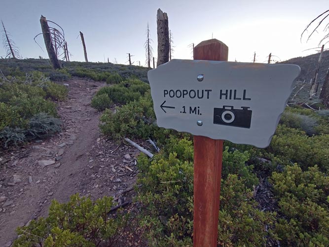
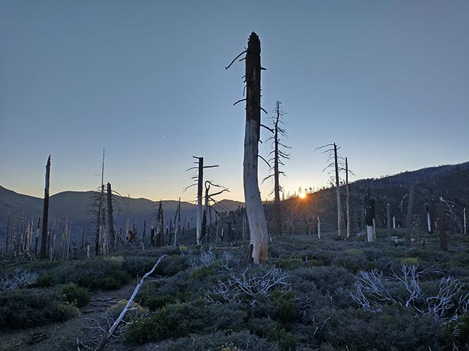
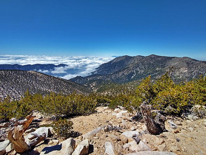
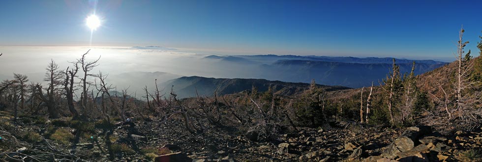
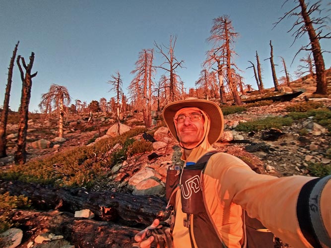
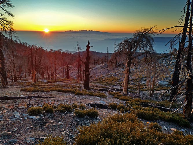
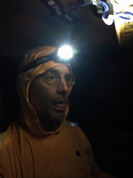
I started with my headlamp on, but could have probably gotten away without it. It did help with navigating and an early stream crossing though. It was pretty chilly to start, but the uphill travel warmed me quickly. It also got light enough to turn off the headlamp. I passed a few cabins at horse meadows and checked Wahoo to see what my pace was - it asked if I wanted to start - I thought I already had, so I started it and watched it to make sure it was running, then I headed on. I tried to jog the level parts with smooth trail, but there wasn't a whole lot of that. I had big plans for the day and would need to move quickly to finish without a lot of headlamp time. There were a number of places I could cut the loop short, so I figured I would just keep an eye on my pace and time and decide along the way. By 6:45 I was at the turnout to Poopout Hill - probably the last uphill when you were allowed to drive closer. I took the detour and tagged my first bump of the day at 7,840 ft. The sun rose over the nearby ridge while I was on the hill. I dropped back down into a valley though so was in the shade for a while longer. The San Gorgonio area has had a number of wildfires over the past few years, including the El Dorado fire started by a gender reveal smoke bomb in 2020 (congrats, it's a fire!). Much of the time I was walking through burned areas with various levels of recovery. Fortunately it wasn't all that hot so I wasn't in dire need of shade (although there were times shade was appreciated and I took advantage of it when I had the option).
| |
|---|
 |
|---|
 |
|---|
 |
|---|
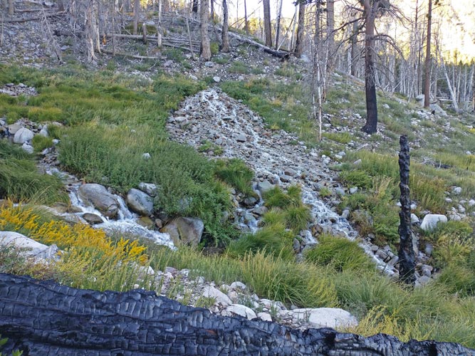
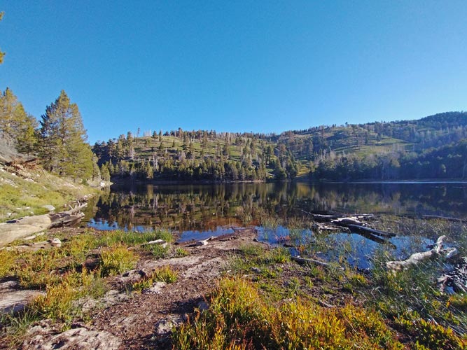
I lost the trail where it crossed a creek - the track I had was probably from when there was snow on the ground and they just hiked up the valley instead of crossing the creek and taking the trail up the other side. I pushed on up the side of the creek past a very impressive spring - sometimes on a bit of a trail but mostly not - until it looked like it would get worse down in the valley, then I crossed the creek and went up the slope dodging the downed logs up to the trail. I followed the trail up to Dry Lake, which was anything but dry this year. The outlet creek was no longer flowing though. The trail went near the shore and I carefully tried not to step on any of the myriad tiny toads hopping about. This was my last known water source for a long time, so I stopped to fill up my empty bottles (why bother carrying water up to here? - the answer is because this wasn't the greatest water source). I was able to filter probably close to 3 liters (one 64 oz bottle, plus a 15 oz bottle plus another be-free into my camelback). I also had another bottle that was full. The water was a bit brown and I had to push pine duff aside to fill the filter bottle - and scoop above the swimmers near the bottom. It took longer than I liked, but at least I had quite a bit of safe to drink water. It did make my pack a lot heavier and tasted a little mucky. Fortunately I had zip-fizz and other tasty additives. I checked Wahoo - did I want to start it? sigh. So I started Strava tracking too (it uses more battery power and has a habit of stopping recording, but at least it will start up again if you notice it and doesn't seem to lose what it has already recorded). Later I was able to find some of my short Wahoo recorded segments. I'm not sure how useful they are as they seem to have plenty of gaps in between them.
 |
|---|
 |
|---|
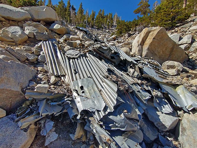
The trail was pretty rocky for a while but then got a bit better when it left the drainage. I headed up and up to peak number 2 - another short detour up from a saddle to Zahniser Peak - 10,005 ft around 9:15 - about 3 hours, 3000 ft, and 6.6 miles in. From here I was pretty much in the sun for most of the rest of the day unless I was under trees or when the sun set. The trail traverses south for a long distance and then starts switchbacking up the mountain. I passed what at first I thought was the remains of a water catchment system but a closer look revealed it was the remains of an airplane crash - confirmed by a memorial plaque. It was a military C-47 that crashed in a snowstorm Dec 1, 1952 killing all 13 aboard. After the wreck the switchbacks really kicked into gear, but they were pretty gentle. The grade and rocks were enough to keep me from jogging very much, but it wasn't one of those trails that is more like a staircase.
 |
|---|
 |
|---|
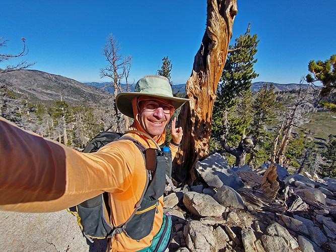
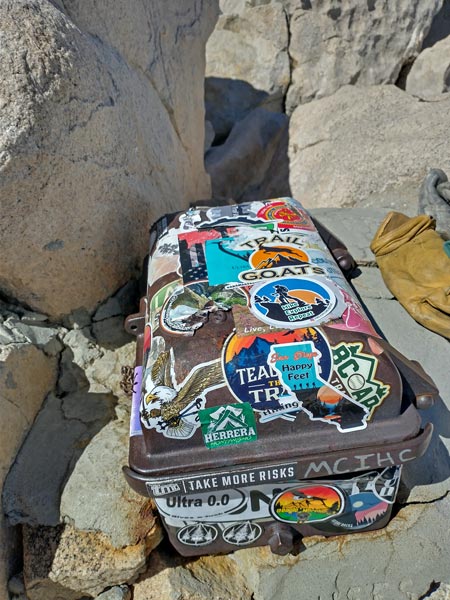
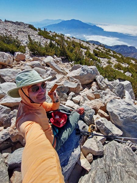
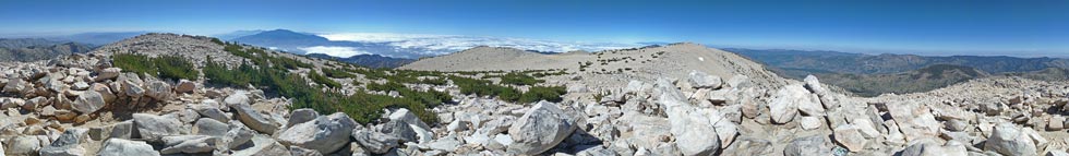
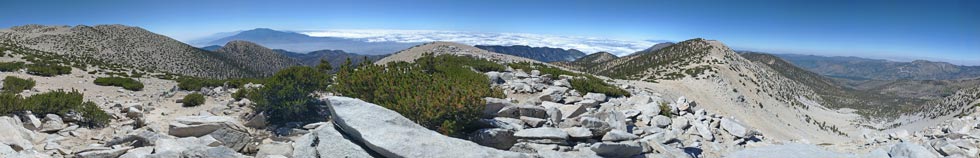
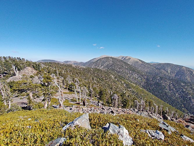
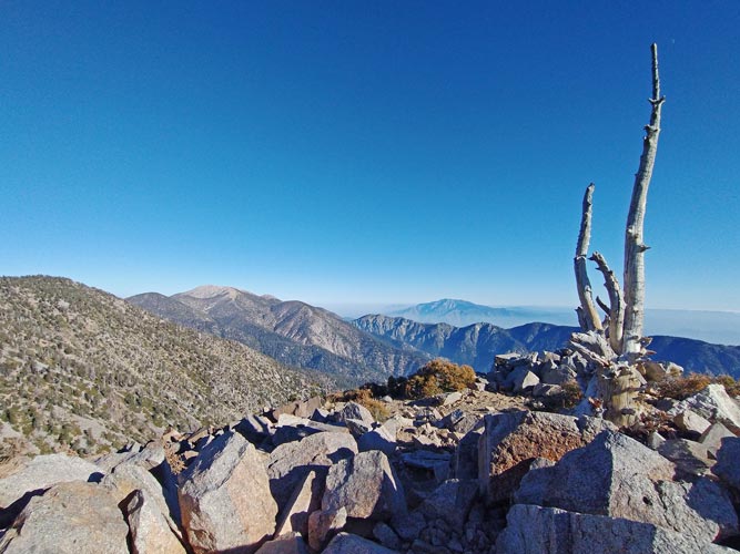
The trail wrapped around the south side of the mountain and rather than continue around to the west side I headed straight up towards the summit. This was fairly slow going but I made it up to the highest peak in California south of the Sierra Nevada at somewhere around 11,500 feet (there are a number of different reported heights within a few feet of this). The LA basin was almost entirely filled with clouds with the taller mountains poking out through them. San Jacinto was to the south and San Antonio to the west along with plenty of other peaks. The summit itself is a bit of a high point surrounded by a plateau so the views down were probably better closer to the edge of the plateau. Still, nice views from peak number 3 as well as a cool cast iron summit register box. Sadly the top was covered with stickers so I couldn't read the words cast on it. I had a little bit of cell reception here so I posted a summitcookie pic and texted Iris. I also started eating one of my 3 sandwiches.
 |
|---|
 |
|---|
 |
|---|
 |
|---|
The next peak wasn't really a peak - San Gorgonio northwest slope - but it was a red dot I could turn green so I did. I was now following a trail down the west ridge of the mountain and I had to keep checking to see which of the little bumps along it were actually peaks. This wasn't too hard, but probably did waste some time and electricity. Next up #5 - Big Draw Peak at 11,171 ft. Then I had to really leave the trail to follow the ridge up to Jepson Peak at 11,205 ft. Most of these peaks did not have a lot of prominence - unlike San Gorgonio with over 8000 ft. I went down to the trail fairly directly from Jepson because I had heard the conditions on the ridge were worse. The way I went down to the trail was casual not very steep scree with occasional rocks and trees to weave around. Then on down the trail and around the corner to a saddle where I left the trail and headed on up the ridge to #7 Little Charlton and more up the ridge to #8 Charleton Peak at 10806 ft. Then I continued down the ridge to Dollar Lake Saddle - this was a pain as it was steep, rocky, and loose with enough trees to get in the way. No part was particularly hard, but the 600 feet of elevation loss were tedious and required careful footing.
 |
|---|
 |
|---|
Dollar Lake Saddle was the first opportunity to bail back to the car. It was about 8 miles back and since it was only 2 that seemed a bit early (actually it would have made for a plenty long day, but I was feeling ambitious). So I headed up the ridge on the other side to a tiny bump not entirely accurately named Red Rock Flat - Number 9. Then a lot more up the ridge with a fair number of trees down across the trail with a detour to an little unlabeled peak and on up to Alto Diablo - #10. At this point I was following the San Bernardino Mountain ridge and tagging the named bumps along the way. Usually with a short detour off of the trail which wisely opted not to go over the top of every peak.
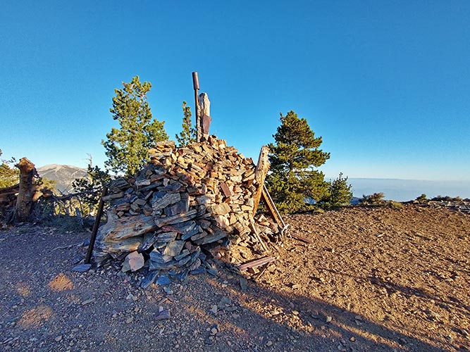
Next up #11 - Shields Peak and then another chance to bail off back to the start - a little farther, and it was later - I now knew I had some headlamp time in my future for sure, but figured it would be good for me - or something like that. So on up to the next peak - quite a bit off the trail and the high point of this ridge - Anderson Peak at 10,840 feet with 840 feet of prominence. San Bernardino East Peak was next - conveniently it was barely off the trail. Then San Bernardino Peak at 10,649 feet was peak 14. The trail deviated from where it was marked on the map, but the track I had on my phone was correct for where the newer trail is - I am guessing it was rerouted after one of the many fires through here. I followed the trail down to where the ridge drops off steeply and Washington Monument - more of a surveying marker than a peak it did feature a big pile of rocks with a log full of survey markers. I figured this might be my last cell service so I checked up on that before dropping off the end of the ridge and following the mostly shallow wide switchbacks down.
 |
|---|
 |
|---|
 |
|---|
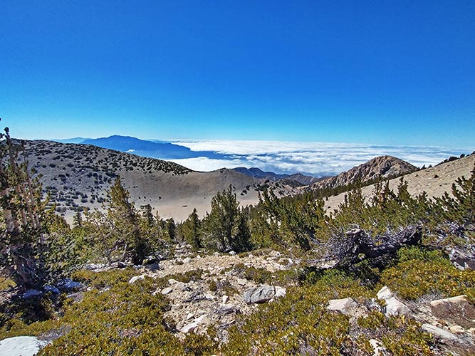
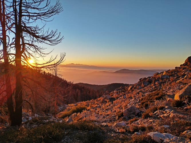
The sun was low and I was doing a bit of a shuffle jog to try to go a bit faster. The peaks poking up through the clouds below looked nice as always. I dropped down a few switchbacks and maybe 500 feet to Limber Pine Springs - the water was flowing clear and cool and I drank a bunch and refilled my small bottle here. Much nicer than the warmish filtered pond water I had been drinking most of the day. I still had at least a liter of water, so I guess I didn't need to carry so much, but when traversing a long ridge it is probably best to err on the side of a little too much water. Soon after this stop the sun set into the clouds to the west. I took some pics, but this is where having a real camera would have been nice. Then I went down to the last bump of the day, Gerhardt Peak - number 16 at 8574 feet. It was pretty much dark when I got there and definitely time to pull out the headlamp. On the way up this last peak there were more annual plants including some sort of dried out thistle? that made a rather alarming rattling noise when I brushed up against it. Once again I was glad to have long pants. The last person to sign the register before me was Matthew - another Sierra Challenge hiker - who had done most if not all of the same peaks earlier in the month. I took some pics of the fading sunset, started eating my last sandwich, put away my hat and put on my headlamp, and put my phone into airplane mode - the battery was down to 28% and I was a little worried I'd need it a bunch for navigation. Had this been the end of my hike it would have been just about perfect - but I always seem to add about 30% too much.
 |
|---|
 |
|---|
 |
|---|
 |
|---|
 |
|---|
I went down the trail a bit to where there was a trail split - marked only by a burned square pole. The route I planned to take wasn't even on my map, but I did have a track for it and there was a faint trail on the ground - that almost immediately went into a gully and disappeared - uh oh. I found the faint trace heading out of the gully and consulted the gps/phone map to confirm it was what I wanted. Then I played track the trail for the next few miles. Having to do this by headlamp probably didn't help. I was quite glad that I am generally pretty good at finding a faint trail and even more glad that I had the track on my phone and that the battery wasn't going down all that fast. I usually only lost the track when it went through new plant growth or was washed out by landslide or streamflow.
After a few miles I got to a place that looked like people had done at least a little bit of trail work and there was some flagging tape. Then I crossed a stream and passed a camping area - I think it was John's Meadow. The trail from here got a little more defined but still wasn't all that great. It also seemed to go uphill a lot more than I expected it to - it was mostly just sidehilling along in and out of drainages. It still hadn't really gone down much when we got to a trail junction with one of the other loop options and then finally it went steeply down to Forsee Creek trailhead. From here I cut cross country down through the woods to the road (the trailhead road went down to the same road, but almost 120 degrees from the direction I wanted to go). Back on the paved road I had 1.4 miles straight line to get back to the car, but the road wasn't a straight line. I stowed my trekking poles and turned off my headlamp. The road was wide and the white lines on either side were very obvious even before my eyes got dark adjusted. I was mostly hiking uphill now with one short section of downhill. A car passed me and then turned around ahead of me and passed me again. Then when I was less than a quarter mile away a truck went by - and turned into the parking area. There were 4 vehicles there now, my truck, and another parked vehicle and 2 people that I guess were meeting there to start hiking the next day. I got back just before 11 pm - some 16:50 out on the trail.
 |
|---|
I had no idea how far or how much up I had done. I later tried to calculate it out and came up with 31 miles and about 8000 feet of elevation gain. There were 16 bumps including the 9 peaks in the "San Bernardino 9 Peaks Challenge". Some were barely bumps at all, but 2 had significant prominence - especially San Gorgonio. I didn't see a single person the whole time I was out on the trail. I was exhausted and my legs got pretty stiff on the drive home, but it was a highly successful mission.
my Strava page for San Gorgonio Plus - not a very complete track