I originally planned to do this hike Wednesday the 11th, but delayed a day so I could take a new camera. I did plot out a plan and load some tracks and peaks onto my phone and tried to pack up and go to sleep early the night before.
10-13-2023 I got up at 3:15, reheated the tea, dressed, fed Plato, and headed out. Fortunately there isn't a whole lot of traffic at this time. I drove up to the state park ranger station in Idylwild and filled out a wilderness permit and then backtracked to the trailhead. It was a bit of a scary drop off the pavement to the parking lot, but it looked worse than it was. Then I put on sunscreen and packed up the last of my stuff to head out. Oops, I forgot my fanny pack and sunglasses and spare camera battery. doh! fortunately I had another pair of sunglasses in my truck which I thought I put in my pack, but when I looked for them later they weren't there. I headed off by headlamp at 6 am up the Marion Trail. I had visions of jogging a bunch, but the trail was really too steep for that most of the time, and I was carrying a lot of water because I didn't trust the potential water sources up here.
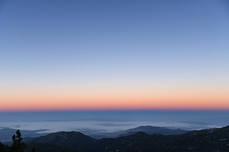
It wasn't very long before it got light enough to turn off the headlamp and there were a few nice viewpoints out through the trees to the west. There was a layer of low clouds over the LA basin with a few peaks poking out through it. I passed a few sad water sources and some decent streams before I turned off the trail and headed up towards Mount Saint Ellens. I spent a lot of time dodging around solid plants and bigger rocks and bashing my way through mostly brown ferns. It wasn't that bad, but it wasn't that good either. I wasn't paying much attention to direction, just heading up the slope and I ended up too far N and had to cut back across the drainage to get on track. The summit blocks required a bit of scrambling and then I was on top. This peak is named after a woman who hiked a lot of peaks - or so it appeared from the book of photographs in the summit register.
| |
|---|
 |
|---|
Up next was Marion Mountain. I headed more or less straight for it with some solid scrambling to get up to the summit block. There I signed in and was chilled by the wind. This was the probably higher west summit. I then went down the usual scramble route - still at least solid 3rd class and then headed over the middle summit to the east summit - the one that is marked on the USGS topo map. This one had a register too, but it looked lower to me.
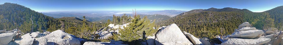
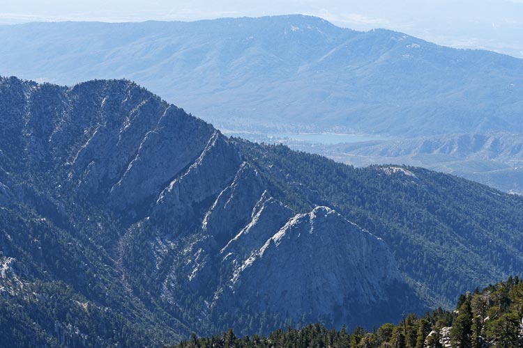
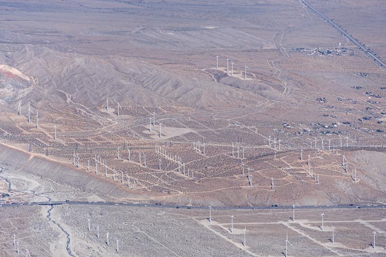
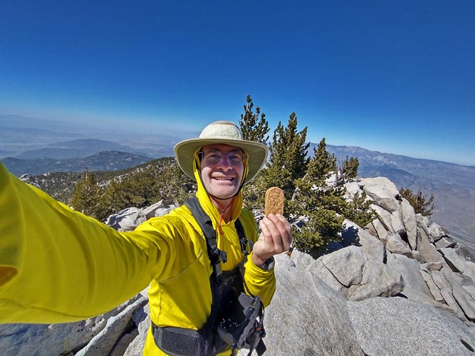
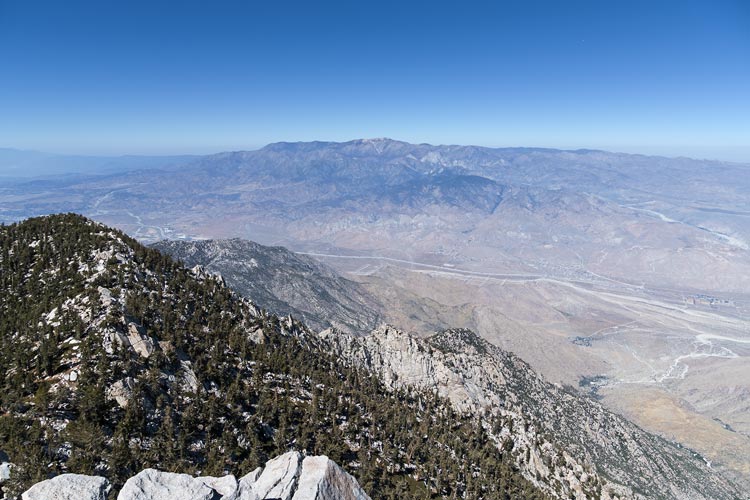
The terrain after Marion Mountain was a lot easier - open forest and mostly not too steep. I headed up towards San Jacinto working my way over Shirley Peak, Jean Peak, and an Azimuth Benchmark. Then I got to the trail up from the aerial tramway. Instead of heading up to San Jacinto from here I went down the trail as it cut across the SE side of the mountain over to Miller Peak. There I had a good view N and E out over the desert and the wind farms along I-10 where the wind blows through the gap between San Jacinto and San Gorgonio. Then I followed an old trail up to the 10839 ft summit of San Jacinto. The wind up here was cold so I sat lower in the shelter of some rocks to eat a sandwich. This is where I saw the only other person all day - someone who hiked up to the summit and then headed back down.
 |
|---|
 |
|---|
 |
|---|
 |
|---|
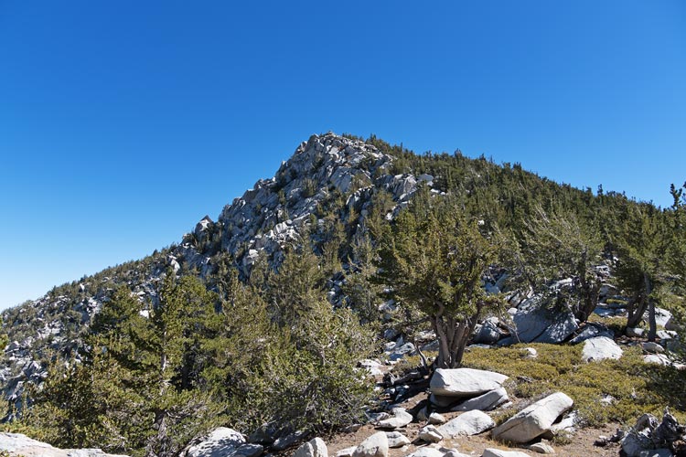
I headed down the rocky NW ridge towards Folly Peak either on the ridge itself or to the west side to avoid harder terrain. There were a few deep gulches to navigate but it was mostly just slow going rather than hard. Folly Peak had some nice views across to San Gorgonio.
 |
|---|
I headed back to the SE and then S from Folly eventually hitting the trail which I followed for a while before cutting off across the saddle and up to Newton Drury Peak. The main difficulty here was avoiding the worst of the chinquapin and manzanita. There were the remains of a camp and a large cache box at the saddle. Newton Drury sits in the bowl S of San Jacinto so it had a view of the rim and many of the peaks I had done that day. I signed the register and ate some more and refilled my little water bottle from the bigger bottle in my pack. I also switched out my bluetooth headphones (I had 2 pairs since the battery life isn't that good and charged them between uses). I'd rather just use wired earphones, but it seems that the phone thinks that the earphones are telling it to skip ahead or back or change the volume or something. It is annoying when listening to music but makes listening to audiobooks nearly impossible.
 |
|---|
I headed back down across another little creek to the trail and then followed it the remaining 5 or so miles back to the trailhead. I probably could have jogged some of this, but my legs and joints weren't feeling very peppy, so I used the trekking poles and took my time. I got back just before 6. The drive back was pretty tedious with a fair bit of traffic but it was an easier and shorter day than my San Gorgonio marathon had been.
strava page for San Jacinto hike