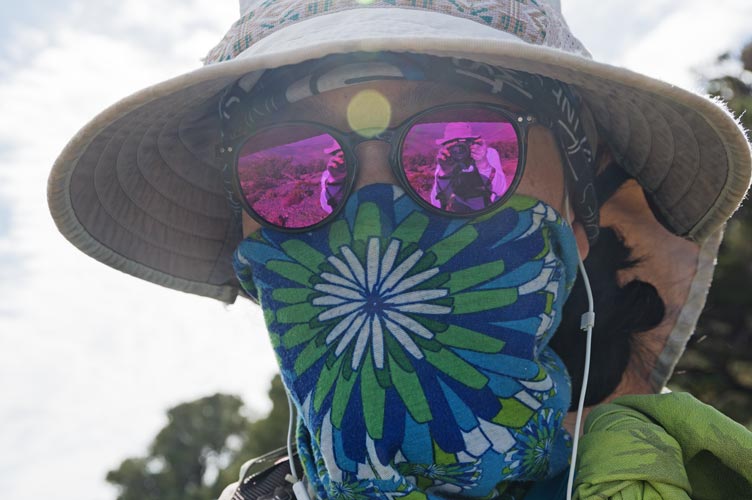
10-08-2020 Most of the local National Forest areas were still closed and it looked like smoke and a cold front might be a problem, so we decided to head to Death Valley NP to camp and hike up some peaks. We drove in Thursday evening and were delighted to find that the road up to Mahogany Flats had recently been graded making it easy to drive up this sometimes 4WD road. We took one of the last available sites and went to sleep.
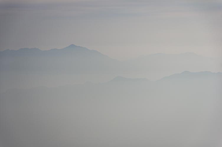
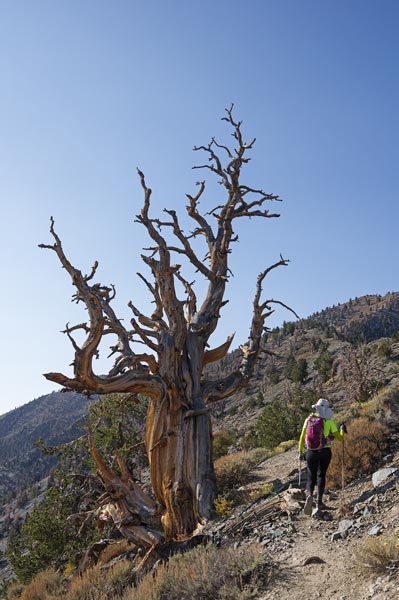
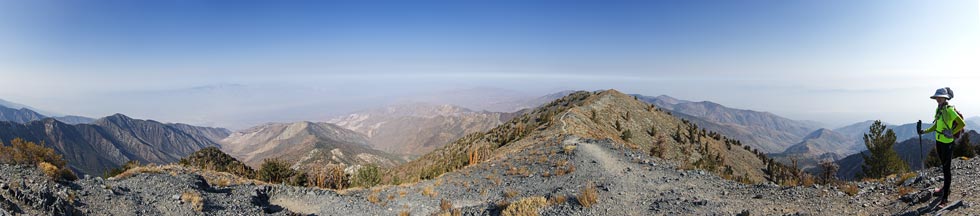
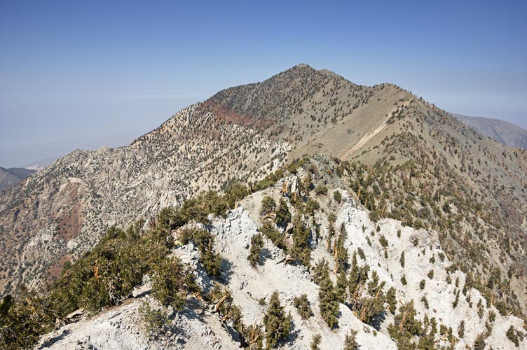
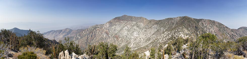
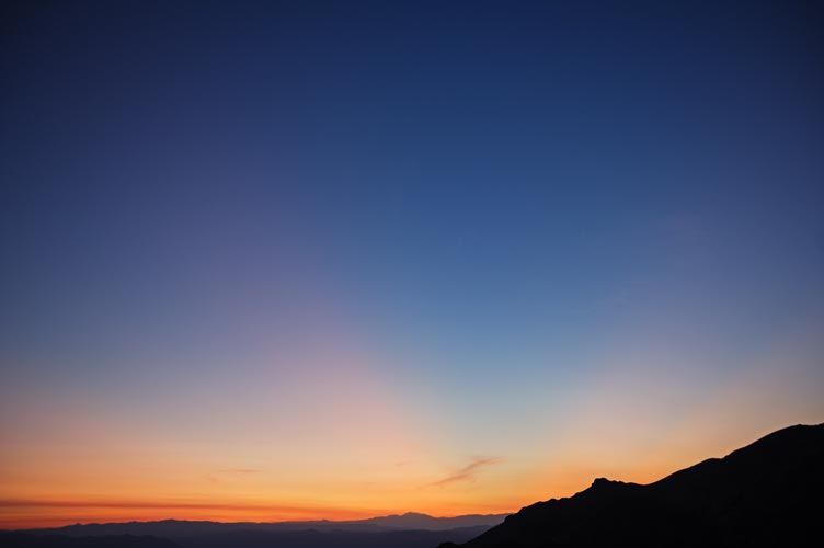
10-09-2020 We got up at 6 am and prepared to hike. Getting ready and breakfast took a while but we were going soon after 7 am. We made decent time up the trail passing a few people and seeing some deer along the way. There was pretty widespread haze at about our level and below making for some fun views of peaks poking out of the haze but also cutting down on the views. We made it to the 11,048 ft summit in about 2:40 and spent some time up there reading the registers and eating. This is the highest peak in Death Valley National Park and it really does seem to be the highest point for quite a distance - especially when smoke and haze obscure the horizon.
| |
|---|
 |
|---|
 |
|---|
We decided to head on to "Telescope South" This involved a bunch of off-trail travel including a little scrambling and took a little longer than I expected. Then while we were there we headed on down to "2:00 Peak" we got there just before 2:00 and then had a long way to go back. We opted to side-hill around to avoid going over Telescope South on the way back. I don't know if this saved us any time, but we did avoid some up and down. Then back on up to Telescope.
 |
|---|
 |
|---|
 |
|---|
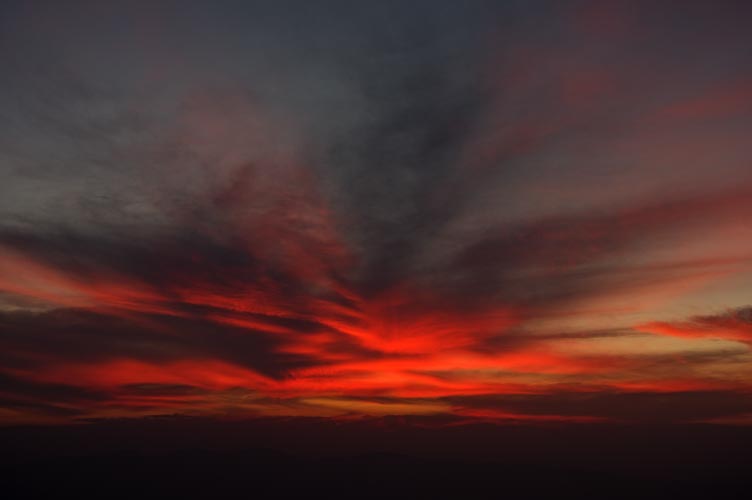
By now it was much later and we hurried on back catching a nice sunset from the saddle up towards Bennet Peak. After that it was time for headlamps up to the radar installations on Roger Peak. Then we headed down the N ridge until we hit the road and followed that back to camp. Iris' hips were getting pretty tight making walking down the road slow and painful until she discovered that silly walks worked better. Then we made a bit better time skibbling down the road.
 |
|---|
 |
|---|
10-10-2020 Once again we hiked out of camp and traversed around and to the E and N over Pinjuni Peak and down to the trail up towards Wildrose Peak. Once on the trail we were able to make much better time and we tried to go fast up from the final saddle to the summit. Sadly Strava decided to just zip-line me from the start to Wildrose Peak (it didn't record the interim), so I don't know how fast I went up - not all that fast, but fast enough to be sweating a lot. There were 2 other groups on the wide flat summit, but probably nowhere near the traffic Telescope was getting on a long weekend (for some) Saturday.
 |
|---|
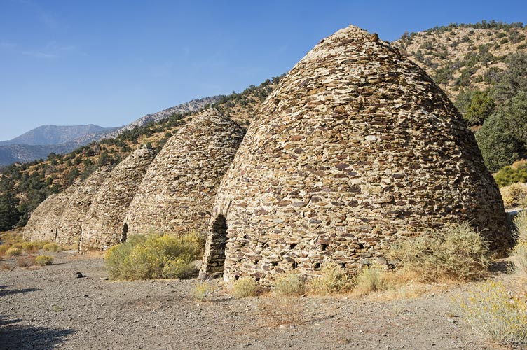
After a relaxing time on the summit we headed back down the trail all the way to the charcoal Kilns - these were a series of rock kilns used to make charcoal for nearby smelters for a few years. I don't know if they stopped because the wood ran out or if the ore ran out or there was another easier source of charcoal or coal available. Some of the domes had pretty nice acoustics in them and they still smelled a bit like smoke or creosote even after well over 100 years of inactivity.
 |
|---|
We then hiked up the road back to Mahogany Flats and camp. It looked like the road already had some deterioration since we drove up with a few more divots and washboards. Sadly it probably won't be easily 2wd accessible for long. While we were cooking dinner a group of people asked to share our camping area - we said ok since we were sleeping in the truck and planned to leave the next morning. They set up a number of tents immediately next to the truck.
10-11-2020 We got up at 5 am and drove off before 6 heading slowly down the road and then on pavement and up another fairly recently graded dirt road towards the Skidoo mining area. We parked on the side of the road where an old double track headed across the desert and hiked from there. The theme for the day seemed to be lots of up and down including one quite large descent into a wash where we joined another 4wd road for a bit. This was the way Bob Burd had gone years ago and seemed fine, although there was a lot of up and down and it was a little warmer than desired when the wind stopped.
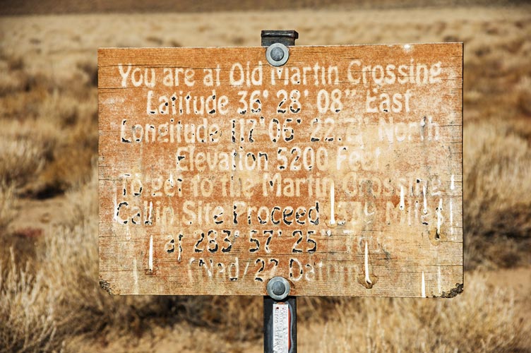
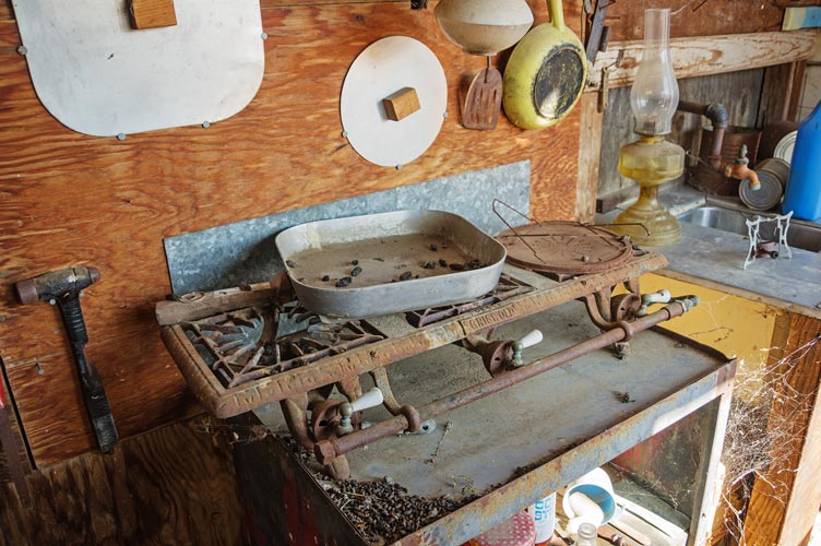
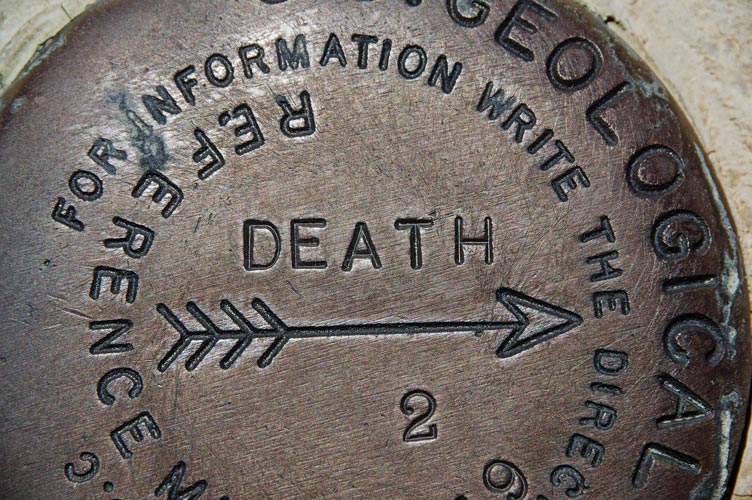
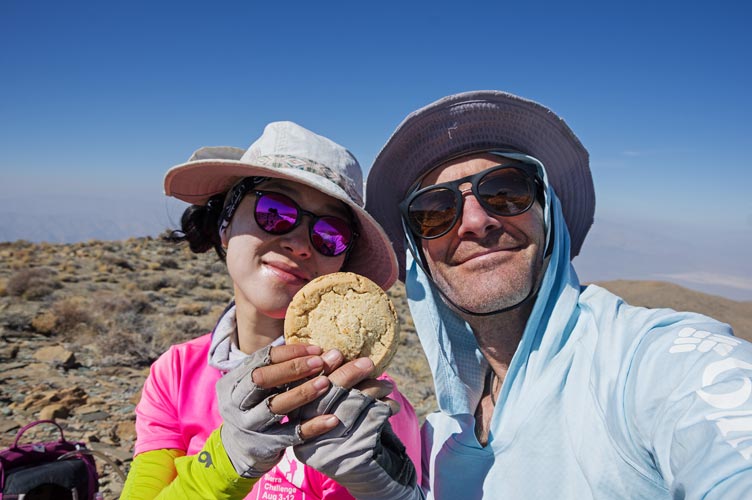
We went to Martin Crossing and detoured to the cabin there. It is in pretty lousy shape and very rodent infested but still has some interesting things in it including an old 3 burner propane stove. From there we busted up the slope before another descent to a saddle followed by more up - and down - and up... you get the theme. Finally we made it to the 6729 ft top. At one point this was called "Death" and is labeled as such on the old topo map. The arrows pointing to the benchmark are labeled "DEATH", but sadly the actual death benchmark was not to be found. This was a fairly large broad summit so there were no great views down into the adjacent valleys and the smoke and haze limited the distant views to the horizon. We ate our summit cookies and read the register before returning more or less the way we came.
 |
|---|
 |
|---|
 |
|---|
 |
|---|
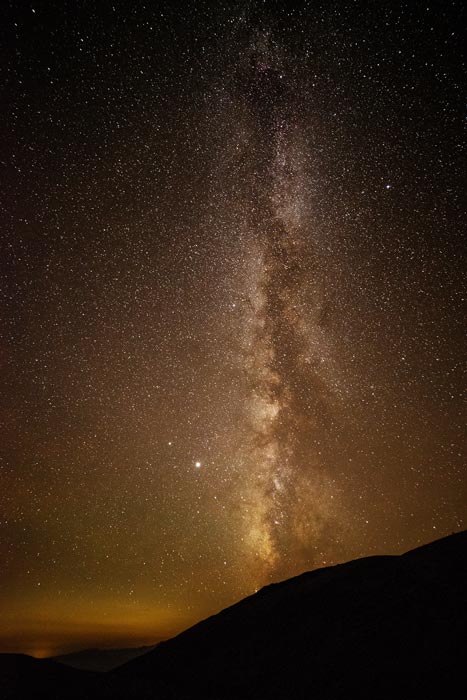
We did take a more direct route to Martin Crossing avoiding the cabin and then took the old road over the ridge - more direct and easier walking but more elevation gain than the notch we took hiking in. Then for the big climb out of the next valley we took the ridge up rather than the canyon we came down. Somewhere near the top of this ridge I filled up my water bottle and realized that was the last of my water. I don't think my water bladder was as full as it could have been and I definitely would have consumed more water if I had it. From this notch we followed an old use trail and a wash back to the double track. This worked out pretty well and we made it back to the truck with a little bit of sunlight left. This allowed us to wash up in the sadly not all that warm water (the truck was facing east so the water on the dashboard hadn't been in the sun for a while). This was ok though because it was still warm enough and we dried quickly. Then we ate snacks while driving out and up to Towne Pass. The old road we planned to drive up to camp was blocked at one end and gated at the other so we slept near the gate. The stars were pretty nice.
 |
|---|
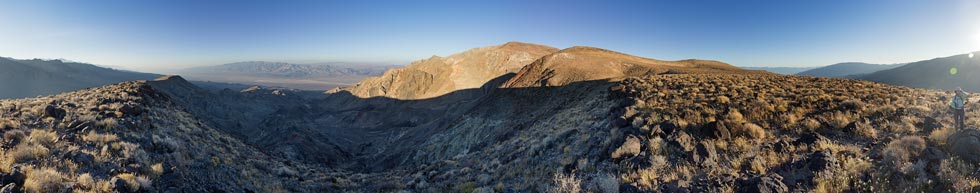
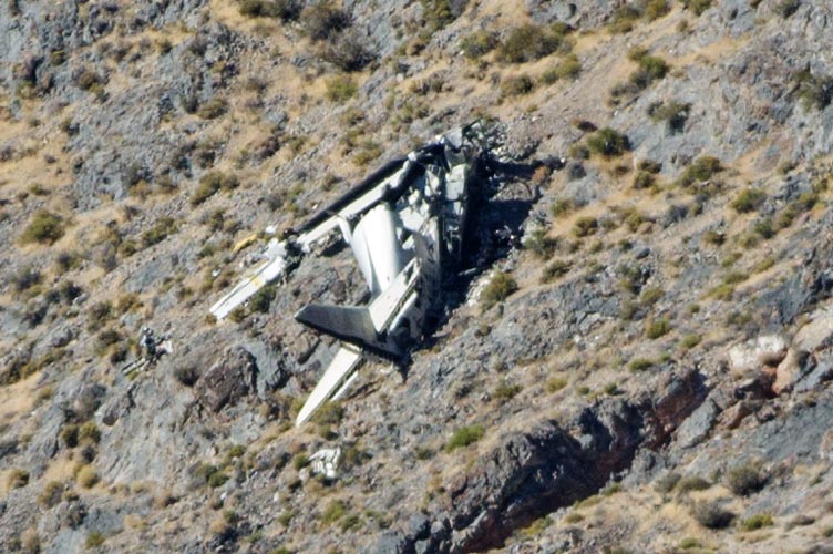
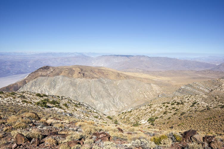
10-12-2020 Another early morning saw us hiking up from Towne Pass as it got light. Once we hit the ridge the views were pretty good. Things were finally clearing up a bit and we could see the distant Sierra on the horizon. We followed the ridge up and down and more up to the 7287 ft Towne Benchmark Peak. There was an old airplane crash visible down the ridge - but over a mile and a lot of elevation loss kept us from wandering over to check it out.
 |
|---|
 |
|---|
We headed North on the rolling rounded ridge and then dropped off down into the top of Panamint Canyon. We weren't sure if the bottom of the canyon would go through some narrow drops so detoured a little on the N side which worked out ok. Then we cut out of the canyon and to the saddle. There we found a cache of an old UV destroyed canteen and a big ammo can. Inside the ammo can were some more stashed canteens still full of water (of dubious quality - I didn't open them) and a few MREs and an emergency ration pack. Sadly they had also stashed a number of beers in here which had exploded in the extreme heat of the Mojave desert sun. This meant all the stuff in the ammo can had been marinating in old beer for probably years. I dumped out the nasty beer as best I could and would have left the can open to dry out if we were coming back past here, but we weren't planning on it so I packed everything back in it and closed it up.
 |
|---|
 |
|---|
We took the ridge up to a bonus peak (6500 ft) the highest bump on this ridge. The westmost bump had a very nice view down into Panamint Valley. Then we dropped down to a saddle and headed up to Panamint Butte. This was a 6584 foot high spot on a broad plateau with a more impressive looking spot on the end of the ridge that was supposedly 4 feet lower. We probably should have added the extra distance to go out there to get pics and check it off, but it was the opposite direction from where we had to go and we still had a long way to get back.
 |
|---|
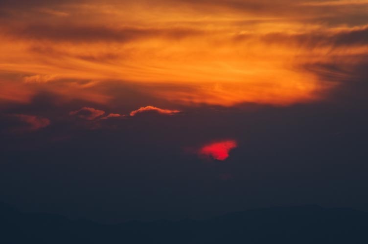
We dropped down to the east and then headed up a long slope towards point 7250. We cut to the south before we got to the top and then were back on the track we came in. We also avoided the detour to Towne BM and continued back the way we came. There was another nice sunset and then when things got dark we turned on our headlamps. We cut down the final slope a little before where we had come up and went down and south across the slope. I overshot a bit and then cut back towards the truck. There we changed out of the worst of our sweaty clothes, drank most of the last of our water, and headed back home eating chips and guacamole on the way.
 |
|---|
Iris' Strava page for day 1, Telescope Peak + - map and pics
Iris' Strava page for day 2, Wildrose Peak + - map and pics
Iris' Strava page for day 3, Tucki Mtn - map and pics
Iris' Strava page for day 4, Towne BM + - map and pics