Tom Grundy's Villager and Rabbit Peak Hike Page
Dec 6, 2012 The forecast wasn't particularly good, so we opted for a desert hike. We drove down to the trailhead on Friday and camped a bit up a dirt road there. Just as we were set to make dinner it started raining. We retreated to the back of the truck 'til it stopped and then cooked up dinner.
At 6640 ft / 2024 m Rabbit Peak isn't particularly high, but we would be starting below 1000 ft and passing over 5756 ft Villager Peak on the way. Some of the trip reports talked about bringing 6 liters of water and running out. It was supposed to be mostly cool and cloudy so we didn't think we would need that much, but it was still going to be a long day with packs made a bit heavier with water weight.
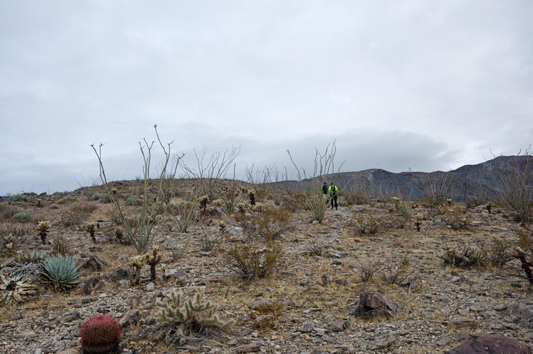
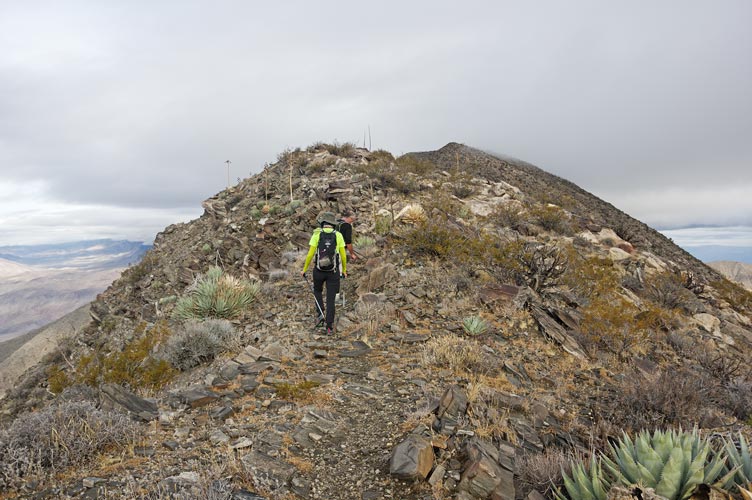
Dec 7, 2012 We got up early and made it to the trailhead to meet Tom Becht at 5:30. We started hiking by headlamp around 5:45. We headed up the wash instead of going straight across it and up the ridge but it wasn't very hard where we went up. Things were getting light as we headed up with a nice reddish glow to the east. There was a lot of agave, ocotilla, and cholla as well as the occasional barrel cactus along the way but enough space between them that the hiking wasn't much of an issue. There was also a use trail along the way although we did lose and re-find it on a regular basis. Basically we just had to head up the ridge.
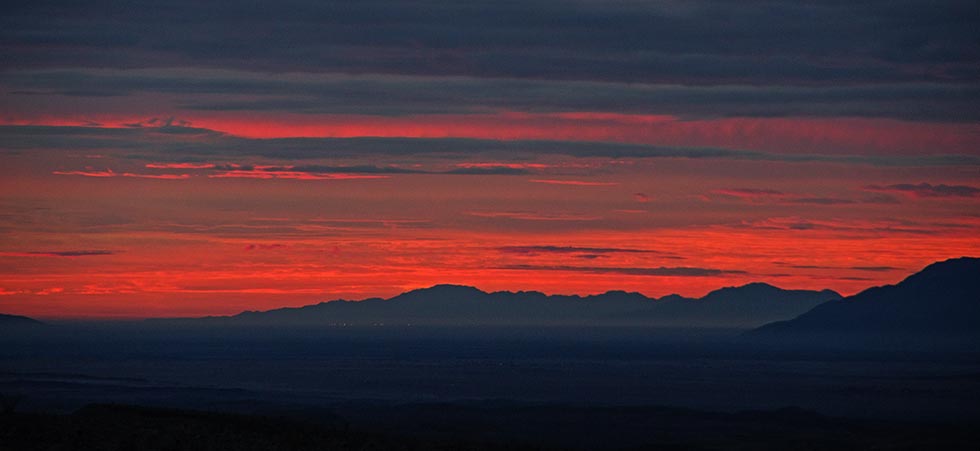
there was a nice strip of light to the east
 |
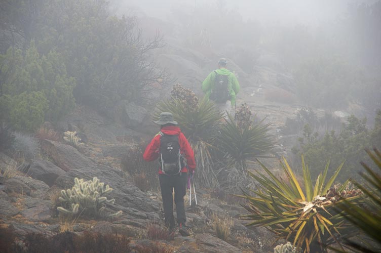
cacti on the ridge following Iris and Tom
 |
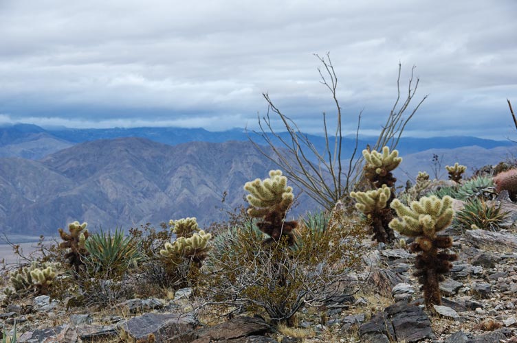
cacti, especially cholla on the ridge and view to SW
 |
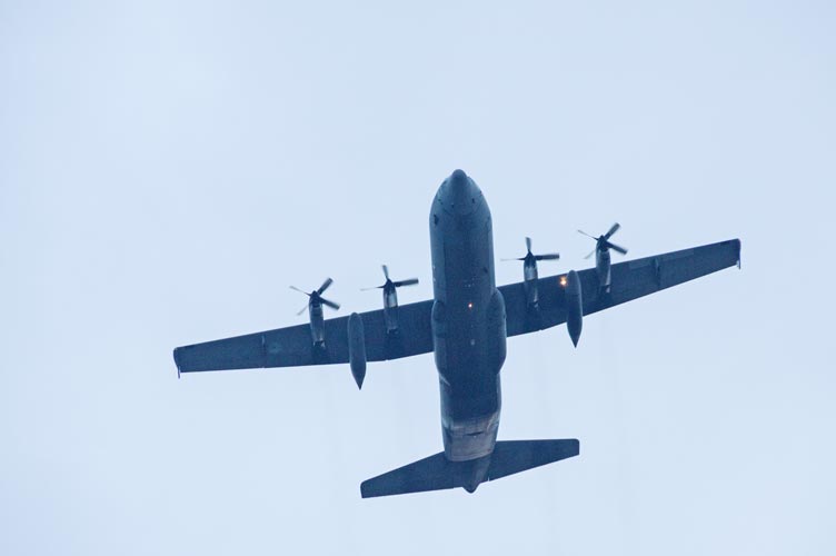
transport plane overhead
 |
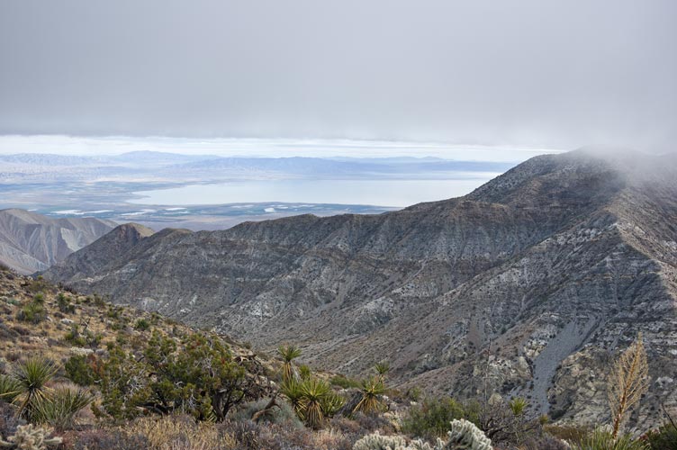
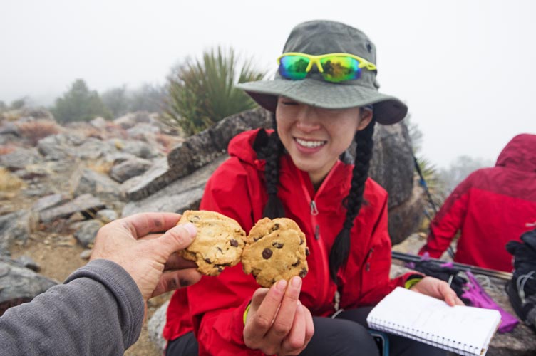
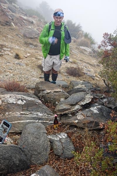
There was one party ahead of us (they started about 5) and we saw them ahead of us on the ridge and then eventually passed them. They were just going up Villager. A group of people Iris knew (the "11th Essential") were also doing this hike today, but were starting at 7. I could see the cars at the trailhead way below with my zoom lens. At some point we got high enough to see Villager - except we couldn't because it was in the clouds. Before we entered them we had a good view down to the NE to the N end of the Salton Sea. Then visibility reduced to a few hundred feet. We had been going uphill steadily for a few hours now and my triceps were getting a good workout with my trekking poles (my legs were getting a good workout too). Someone had done this hike the week before and knew his friends were doing it this week, so he stashed some beers along the way and left a poem and GPS coordinates. The first one seemed a little too far off the trail, so we skipped it. We got to Villager Peak around 9:30 in a light drizzle. We took the time to sign the register and eat a summit cookie before heading on.
the ridge disappeared into the clouds above
 |
the Salton Sea and Mile High Peak off to the right
 |
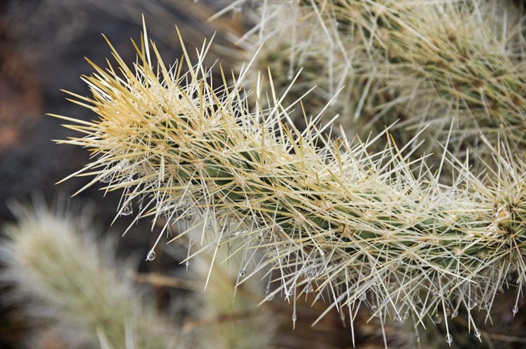
wet cholla detail
 |
Iris and summit cookies on Villager Peak
 |
I dropped off a 64 oz water bottle and a can of Mtn Dew and Iris stashed some more Soda at the first deep saddle on the way to Rabbit. As it was I could have left the whole bottle back in the truck, but at least I didn't carry it the whole way (I also had a 3 liter bladder). I'd like to say I was much faster without the weight, but I doubt that was the case. We searched for a while before finding a beer about half way to Rabbit. We left the empty bottle in the middle of the trail with the lid on to tease the others looking for it, but also so they wouldn't spend a lot of time searching. The rain came and went and I kept putting my raingear on and off and stashing my camera. Every once in a while we got a glimpse down through the clouds but mostly we were just in our own little bubble. I was starting to get hungry as we approached the last uphill. I was going to stop for lunch but instead just grabbed a granola bar and pressed on. The summit itself was a rather non-descript little rock outcrop on the summit plateau. I bet there would be a nice view on a clear day, but we didn't have that. We spent a bit of time searching around before we found the stashed beer. We also ate sandwiches and cookies and then headed back.
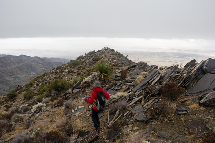
Iris and Tom disappearing into the clouds ahead of me
 |
we found a beer
 |
Iris from the summit of Rabbit Peak
 |
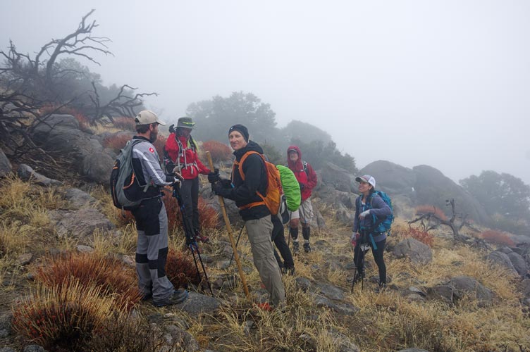
On the descent we passed the group of 7 or so heading up. They had found the first beer and were disappointed by the second. Iris gave them the last one we found and we continued down. and up. and down. and up. and down. There I picked up my water bottle and drank the Mtn Dew before the last big up. We passed right by Villager and then it was mostly downhill.
Iris and some of the "11th Essential" group heading up
 |
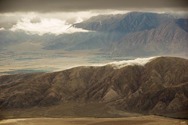
Iris taking a pic of the nice view we finally got under the clouds
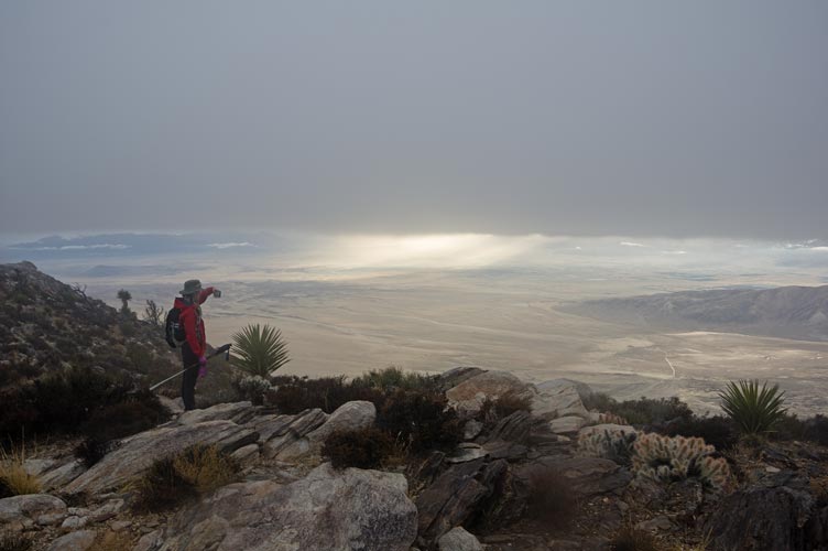 |
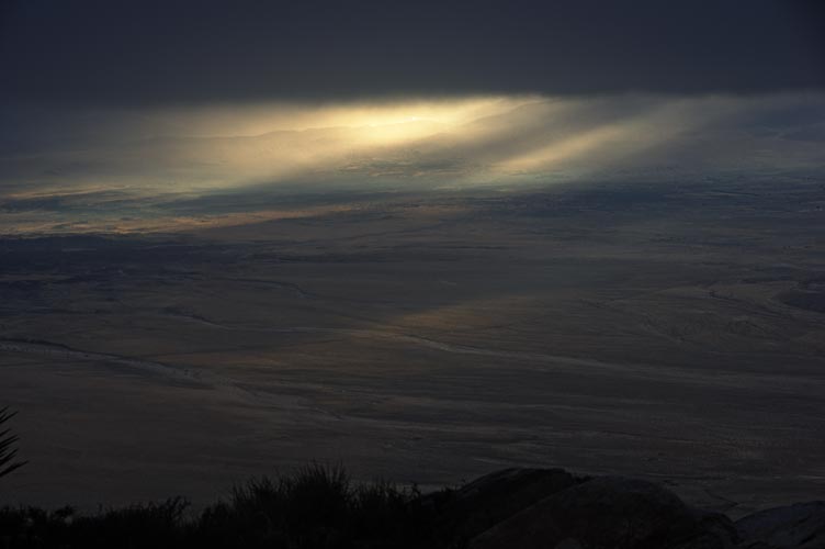
detail where the sun was shining through
 |
There was a lot of downhill. Somewhere along the ridge we passed below the clouds, and then a little later it got dark. We took out the headlamps and continued down, down, down. Finally we went down the last steep downhill to the wash and then headed across the desert to the parking area. I think we got back around 6. According to Strava it was 22.8 miles and 8,500 ft of elevation gain.
Iris dancing down the ridge
 |
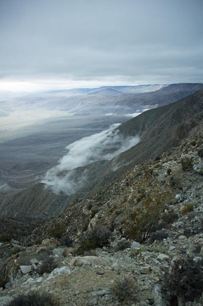
more clouds and ridges below us to the south
 |
it was practically dark by this time - more clouds below
 |
No material on this page may be copied or used without permission.