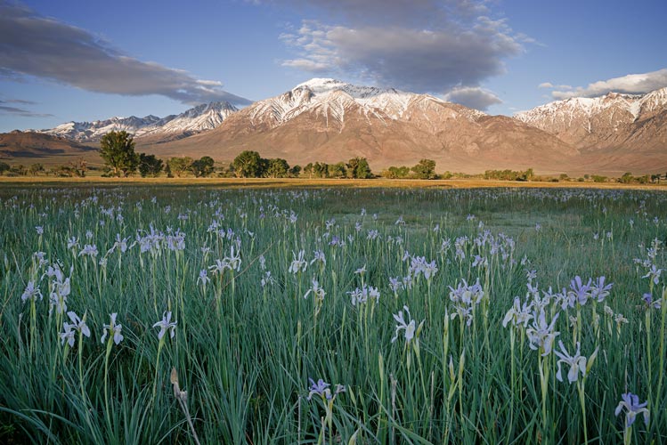
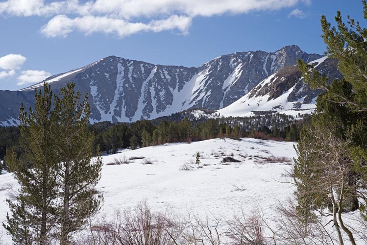
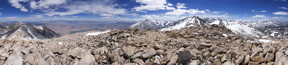
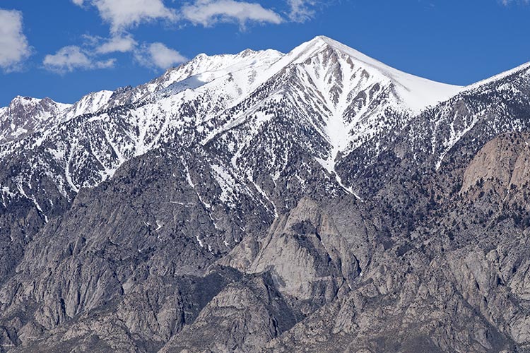
I had been cleverly avoiding skiing for most of the winter and spring by going climbing, but I figured I should get out and get after it. On May 8 I got up early and headed out. I stopped on the way in Round Valley to get some pictures of the wild iris and then continued on up to Rock Creek Lake. There I strapped the skis and boots to my pack and started hiking. The snow was still quite hard but mostly not icy so I made decent time around the lake and up onto the plateau. I had to traverse around the North end of the ridge from Mt Morgan South and then I got a view of my objective - the peak at the southern end of Wheeler Crest - or more accurately, the 2 peaks. One Sierra Challenge we did the peaks on the northern end, so these were new to me, and part of my "Bishop Rim" goal of climbing all the peaks you can see from Bishop. The west side of Wheeler Crest didn't have a lot of snow on it, but there were some big snowfields on the northern side of my goal.
| |
|---|
 |
|---|
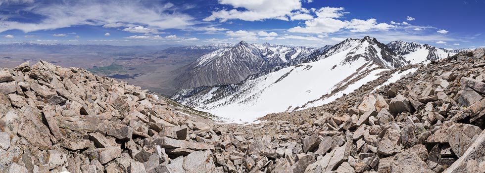
Soon the snow softened up and I began to post hole a bit (where your boots sink into the snow like you just stepped into a post hole). That was my cue to find a dry rock and switch from walking boots to my ski setup with skins. From there I skinned more or less in the direction of the big snowfield I planned to head up. I had some difficulties with one short steep hard slope that was still in the shade but managed to get up it (I think ski crampons would have been handy here). Then I headed up the big snowfield. I was able to go straight up for the most part but eventually things got harder and steeper and the skins just weren't gripping. Normally I'd start traversing to lower the angle but the snow was still too hard to get much grip. So I took off the skis and started kicking steps with my boots. It was easy enough to kick in steps, but since I forgot my ice axe I really didn't want to slide. I slowly worked my way up to the top of the snowfield and stashed the skis, ski-boots, and skins. Then I worked my way up the talus to the ridgeline and then NE to the top of a peak. According to the register, this was the Bumpkin. I didn't sign the register because there was no writing implement. I took some pics, used my phone, and ate some food. Sadly my spot tracker didn't seem to be sending out the spot track. I've had problems where it took a long time to start tracking, but perhaps the GPS clock rollover has made it even worse. (It has managed to get a few points out since then, but I've also had entire trips without a single point being transmitted).
 |
|---|
 |
|---|
 |
|---|
 |
|---|
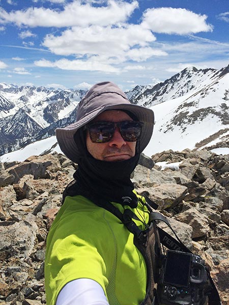
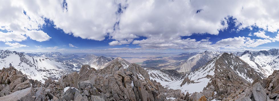
I wasn't moving particularly quickly and it looked like maybe 2 more peaks to go up here. I worked my way back down to the saddle and then up to the next peak. This one involved both walking on snow (with a little postholing) and some scrambling. I made it up to the high point about 3 pm and decided the next lower point would not be in the itinerary for this day. After more photos and food and I headed back down.
 |
|---|
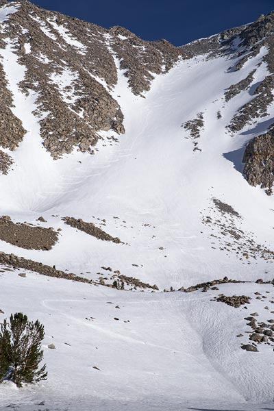
Back at the skis I switched into skiing mode with my bibs and raincoat as well as thicker gloves and the ski gear. Then it was time to ski down. Fortunately the sun was still on this slope and the surface at least was somewhat soft. I picked my way through a few boulders onto the open slope and then started working my way down with turns followed by traverses and frequent rests. It certainly wasn't flowing nicely. Then I crashed somewhat wrenching my knee and popping a ski off. I looked over at it as it rocketed down the slope. I watched it zip down away from me and prepared to try to see where it ended up for eventual retrieval. It bounced up into the air and started cartwheeling down the slope and then augered in and stood quivering in the air. I was able to boot heel a few hundred feet down to it. I thought the heel must have rotated in the crash and lifted the brakes up but they were down when I got to the ski so unless they rotated twice the ski just took off with the brakes down. So much for them. I was thankful for my experience near the top of Rainier where my ski came off and the leash broke and I managed to keep a hold of the ski and stop sliding on the icy slope. I put my skis back on and gingerly skied down the rest of the slope. Once I hit more level terrain my goal went from maintaining control to maximizing momentum for the flats and uphills. I was able to shuffle or use my poles to keep moving on the flats and gentle uphills but eventually I had to take my skis off to walk uphill. Maybe I should have just put on the skins which would have had the added benefit of slowing me down when I had to weave my way steeply down through trees and rocks. As the sun slipped lower and lower I still wasn't out, and I wasn't even sure which way to go (sure I knew just head west and downhill and eventually I'd hit the road, but I wanted to go the easiest way and also not have to backtrack uphill to my truck). I used my phone gps and figured out which way to go and continued down through the woods. There were some exciting times dodging trees and holes and rocks and taking my skis off for dry patches. Eventually I ran out of downhill snow and booted my way with a distressing amount of post holing to the campground and then around the lake back to my truck. I made it back just before dark. It was hardly a triumphant return to skiing but I did get up most of my goal (with more time I would have tried for the last high point to the south).
 |
|---|
 |
|---|