Tom Grundy's 2023 Sierra Challenge Day 5 Mount Ithaca Page
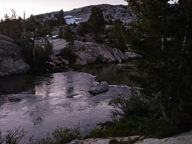
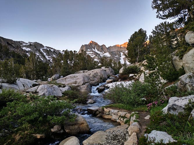
8-08-2023, I woke up at 3 am and tried to get dressed and out of the house quickly and quietly. I drank a small vat of tea on the drive up. By 3:50 I was hiking up the Lake Sabrina trail with frequent stops to unload some of the tea I had taken on. I saw a light up far up ahead - probably Chris. I tried to keep a good pace but it was hard to tell in the dark. I nearly slipped into the water at one creek crossing where my shoes just started sliding down a wet slab. Fortunately I cought myself before I went into the water. The stream crossings were a little lower than they had been a few weeks earlier on an overnight trip. As I got far above the lake I could see some lights below coming up the trail. There were a few bugs after Blue Lake, but I was moving fast and there was a little wind so they weren't bad. I caught up to a hiker along the trail - wearing a headnet and with a big pack - I was not expecting that. I passed him quite quickly. The river crossing after Dingleberry Lake was still barely underwater, so I went across with my mock crocs and then fed the mosquitoes a bit on the far side putting my shoes back on. Then back to the trail - the snow piles were noticeably smaller than my previous trip and there was one place I had crossed a stream on the snow that required a jump this time.
view back to the creek crossing after Dingleberry Lake
 |
sun starting to hit the Picture Peak and stream crossing that was a snow bridge earlier
 |
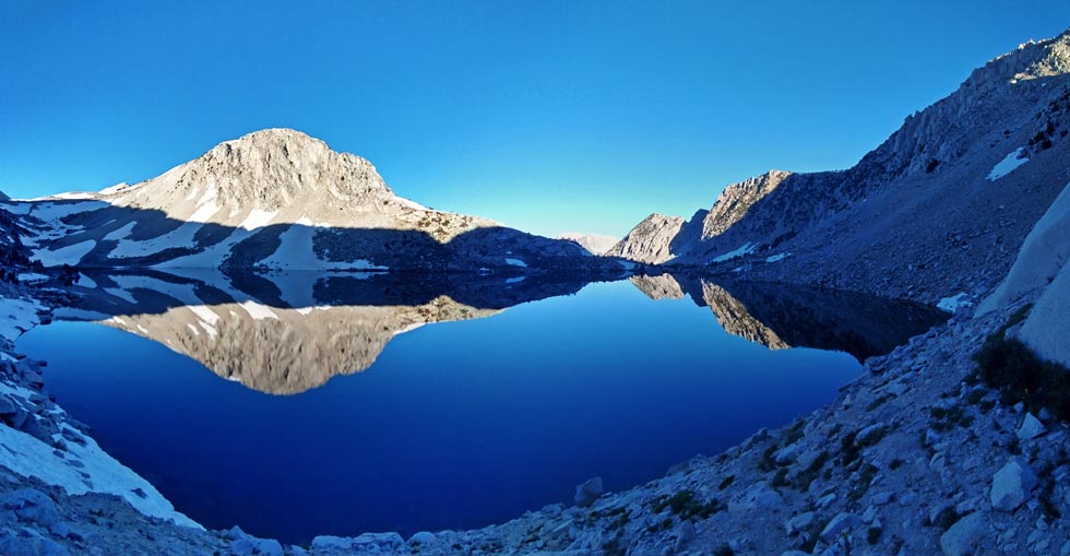
Golden Lake reflections
 |
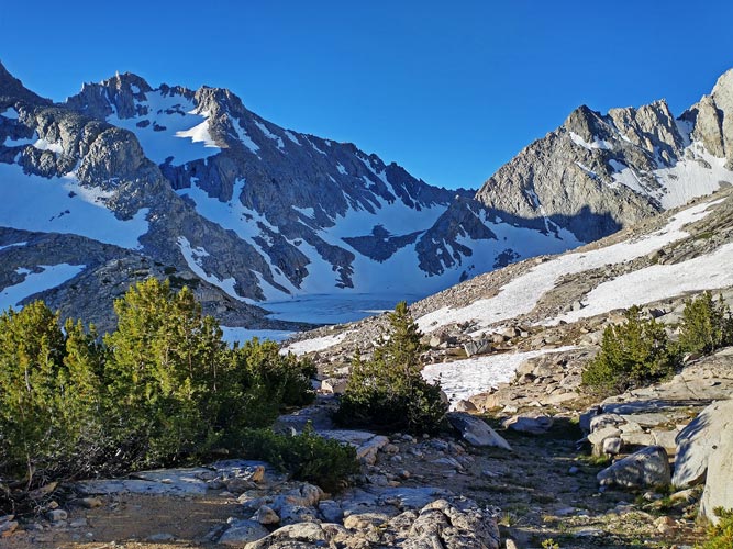
I caught up to Chris about the end of the trail. We decided to head up the ridge between Moonlight and Hungry Packer Lakes to minimize route finding and wet feet - even though there was a bit of extra elevation gain. I don't know if this saved us time or effort, but it worked out ok. We reloaded water at the outflow from Echo Lake and then decided to walk across the west and south sides of the lake rather than the steep climbing and sidehilling the normal route takes. The main worry was getting on and off of the ice as there were some open water leads along the edges of the lake. We walked along the shore until we saw a place that looked like a decent spot to get out on the ice and then we cramponed up and headed out. It was a little nerve wracking to walk on the partially melted spots, but the snow was still cold and hard and it seemed fine. It felt a bit like we were tromping around Antarctica or some other polar spot. It was not very reassuring when I poked a thin spot in a crack with my trekking pole to show how strong it was and was able to punch through into water beneath (but the crack was only 4 inches wide or so). On the far side of the lake we exited where the snow had creeped down into the lake making a solid exit and then traversed over and up the steep snowfield. We were able to keep our crampons on all the way to the final rock headwall to Echo Col where we scrambled up and over. It was 8:45 am and we had already been going for hours - even more for Chris who started about 50 minutes before me.
Echo Lake from the ridge
 |
Chris at the Echo Lake outlet
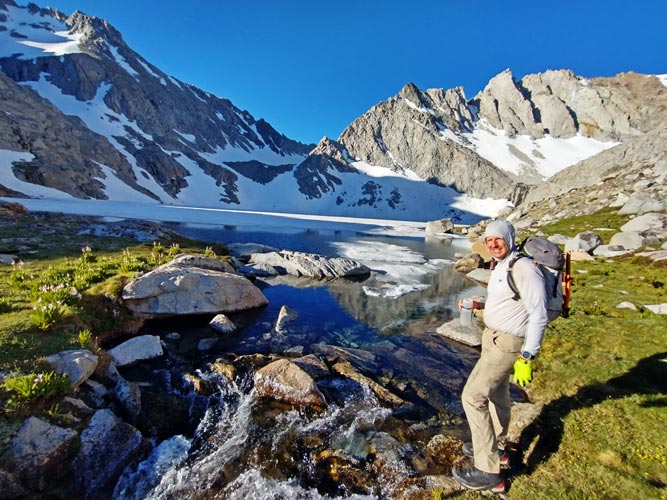 |
Chris walking across Echo Lake
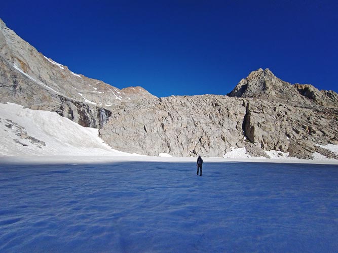 |
hiker view of Echo Lake Ice
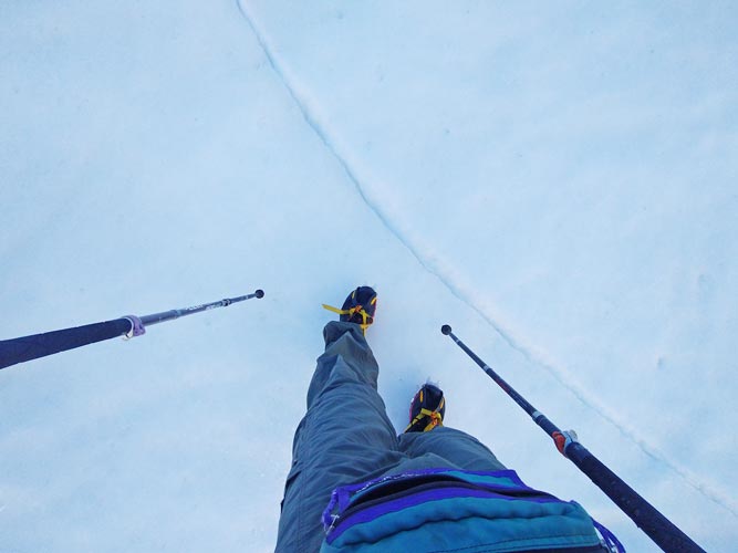 |
looking down at Echo Lake - we went on the left side
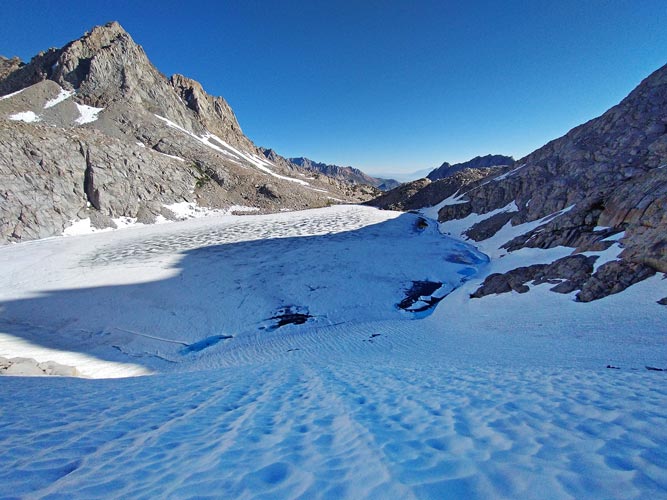 |
looking SW from Echo Col
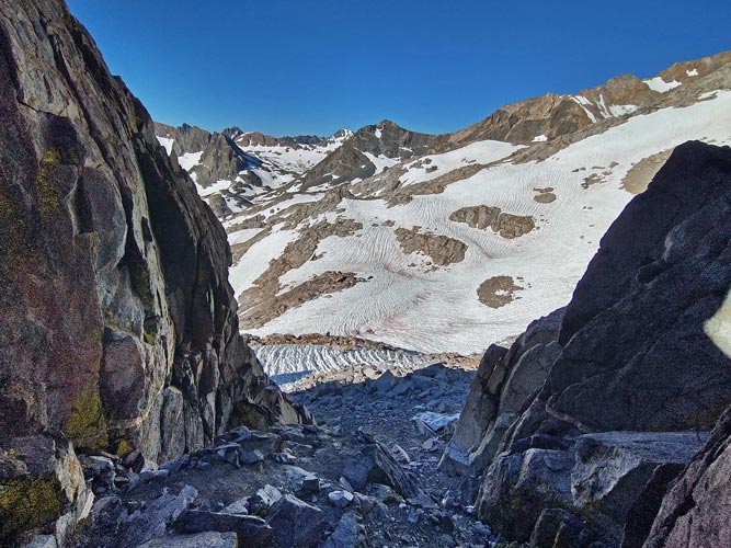 |
panorama from near Echo Col looking south and west
 |
The snow was lower and we scrambled down the talus where I had boot skied 2 weeks earlier. There was still a lot of snow and sun cups though. We followed a similar path, although we went up through a notch and descended scree instead of climbing down around one buttress and we generally took a path that avoided more scrambling in favor of a little more elevation gain and loss. Chris had steel crampons and fairly solid approach shoe boots (5.10 camp 4 I think) so he was able to leave his crampons on for small sections of rock and scree. I had to take my aluminum crampons off so that slowed me down a bit until the snow softened up enough for me to just leave them off. We made steady progress to the traverse below a black cliff and then headed on towards the small peak near the outlet to Helen Lake. Here we heard a yell of "ROCK! ROCK!" and looked down and back to see an alarmingly large block bouncing down the cliffs and slabs and into a snowfield. Fortunately soon after that we saw a small figure up above moving along (it was Clement who had dislodged a medium sized rock and it had knocked loose a large (piano sized?) rock. In previous trips I had traversed around the peak by the Lake Helen outlet on the N and W side but we decided to see if the more direct E and S side would go - the answer is not really - Chris ended up going up and over and I took a thin ledge that ended in some class 4-5 downclimbing. Then I should have headed straight to the outlet but instead traversed west to meet up with Chris, but he had already passed below me by then. During this time Clement came up the JMT and passed us.
Chris crossing the snow - Echo Col is the notch left of the dark rock
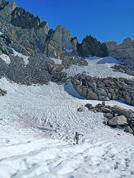 |
LeConte Canyon from the traverse
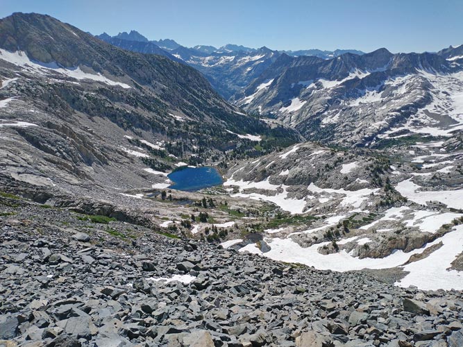 |
Black Giant on left, Mt Solomons right of center, Ithaca right of that
small peak by Lake Helen in center below horizon
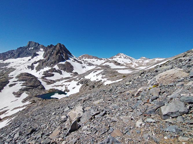 |
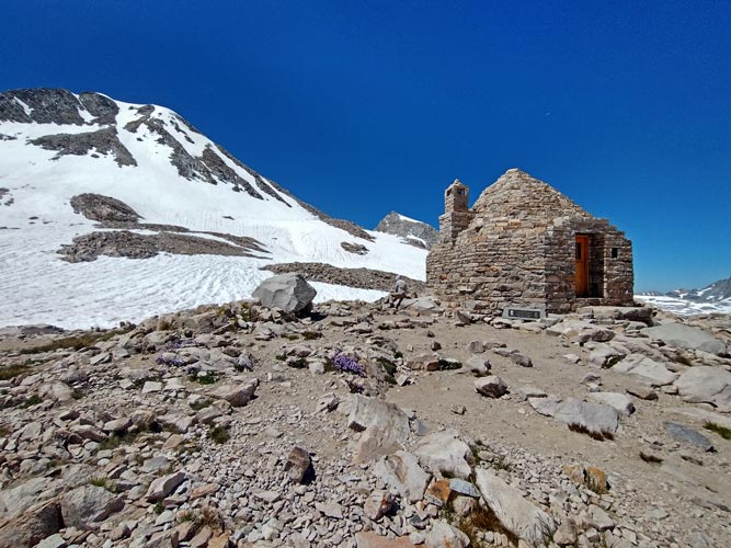
Back on track we followed the footprints on the JMT towards Muir Pass. This was usually easier than taking our own path as the footprints beat down the worst of the suncups or at least warned us of where it was most treacherous. We got to Muir Pass by around 11:30 and stopped for a first lunch break. We could see Clement heading towards Ithaca ahead of us.
Chris at Muir Pass (with the Muir Hut)
Mount Ithaca above him, Solomons to left
 |
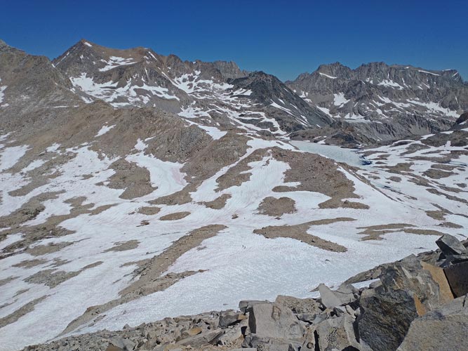
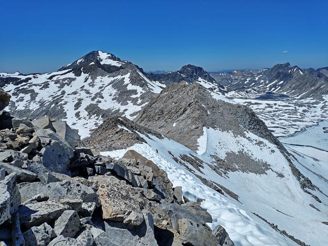
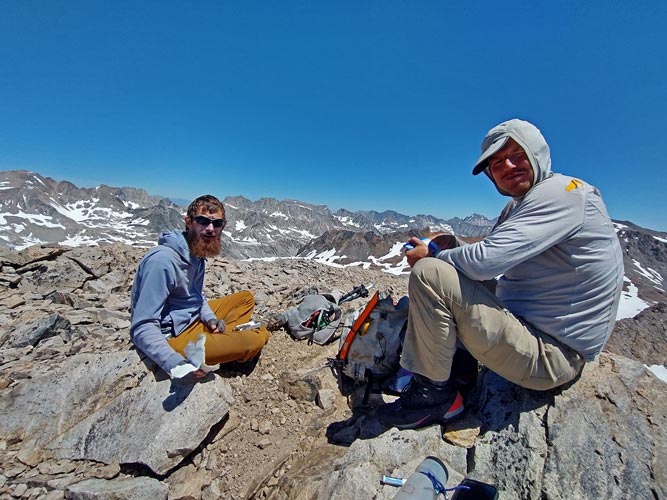
We headed up towards Ithaca, but ended up on steep talus below Solomons. At some point we decided it would be easier to just go up this peak (which I wanted to climb anyway) and then follow the ridge to Ithaca. I headed up the talus trying to avoid the worst of the loose stuff (it is easy to see how Jim Porter got injured coming down this - there were a lot of big loose rocks). I took a talus line that went nearly to the summit plateau, Chris took one that dead-ended into a snowfield that got quite steep at the top. I saw him climb up the last of that from the plateau before heading to the summit. As Chris got close to the summit he was getting overtaken by Clement coming up the ridge from Ithaca. This ended in a short but fast sprint for the summit - won by Clement and followed by a lot of heavy breathing to try to restore oxygen saturation at 13,034 feet. I think when Iris saw my spot track going up this peak she might have had some words for me - "what are you doing?"
view down towards Muir Pass from Solomons side
two dots in lower center snowfield are Sean and Dylan, Muir Pass is behind and right of them
 |
Chris approaching the top of the snow slope
Ithaca behind him, Goddard upper left
 |
Clement and Chris on top of Solomons
 |
panorama from the summit of Solomons
Godard is in center, Charybdis is spiky peak center left, McDuffie is left of that
 |
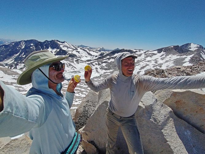
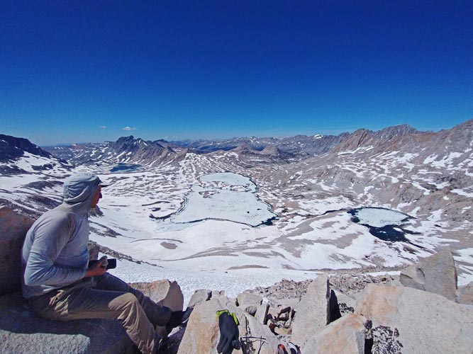
It was pretty easy to get from Solomons to Ithaca, although it still took some time. We saw Dylan and Sean King up on top of Ithaca on the way and Sean traversed over on his descent to chat. We made it to the summit of Ithaca with 2 minutes to spare for Chris' 2 pm turnaround time. We signed the register (placed in 2019 by Scott and Iris on a suncup thwarted attempt to climb the three sirens). We knew all of the people that had signed in since then. We did not spend long on the summit and soon were dropping down the ESE side to the bootski the snowfield and then traverse our way back to Muir Pass. On the way there was one snowfield that had a very short but steep bit that I slid down. At the bottom it was quite icy and I did a classic cartoon fall with my feet up in the air landing hard on my butt. Fortunately just on meat and not bones although it did really jar me. After a few tentative steps I seemed to be ok though.
taking #summitcookie pics on Mount Ithaca
 |
Chris on Ithaca, Wanda Lake below
 |
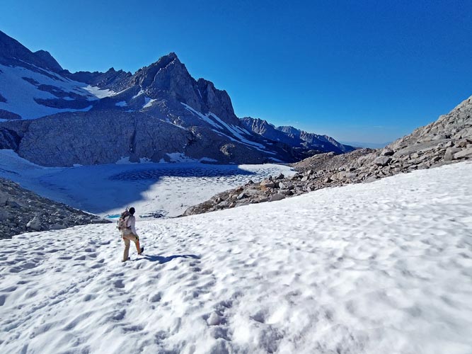
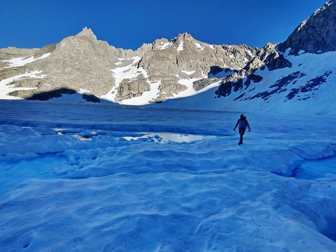
From Muir Pass it was just a matter of reversing our course - over softer snow. This was fine for the downhill sections but was very tedious for uphill and sidehill situations, especially with the deep sun cups and runnels. We worked our way back below Helen Lake and around the NW side of the little peak there and then traversed under the black cliff and on towards Echo Col finally arriving around 5:30. We were a little nervous about crossing the lake again, but decided to go for it. The snow was definitely softer and there were a few more wet looking spots in the middle, but we made it across (deciding to exit the west side of the lake a little south of where we had got on in the morning). My feet never sank in more than a few inches, but it was possible to push the trekking poles in far deeper than I liked.
another panorama from near Echo Col looking south and west
 |
Chris heading down the snow towards Echo Lake
 |
Chris approaching the exit from Echo Lake
 |
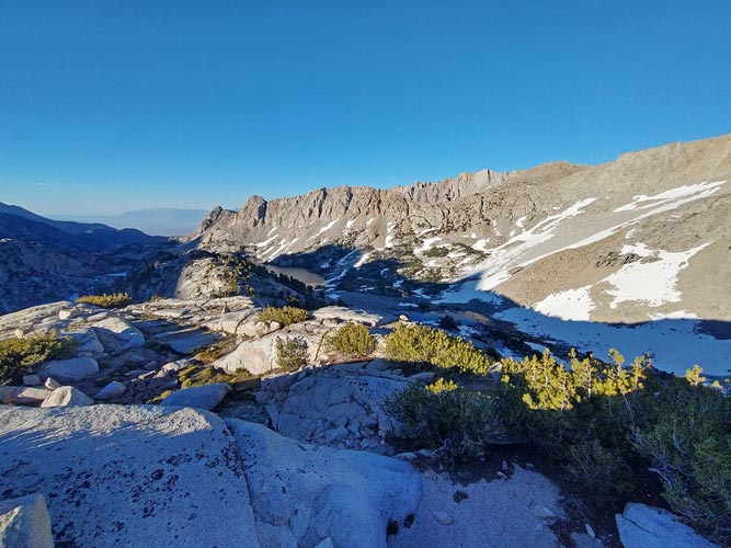
We took a short break at the outlet of the lake to drink and refill water and eat a bit but the cold wind was good incentive to move on. We opted for the ridge again - Chris found a better line cutting across with less wasted elevation gain - but it did have one steep snowfield to negotiate. We easily made our goal of getting back to the trail before dark, but the mosquitoes were out. This gave me incentive to just splash across the crossing here rather than take my shoes off and have to sit still and give blood while putting them back on. We turned on our headlamps before Blue Lake and just kept walking down the endless trail. We finished at 9:40 or so for a total time for me of 17:50 - not my longest challenge days ever, but right up there in terms of difficulty, especially considering I only did one bonus peak that wasn't very far out of the way.
on the ridge looking down at Moonlight Lake
 |
I sat in the front seat hiding from mosquitoes and drinking a protein recovery shake and eating a cold can of chili mac. I was too tired to tell if it properly "annihilated my cravings" as advertised, but it certainly helped. Then I drove to S Lake and crawled into the back of the truck to sleep.
Total for the day 5, 2 peaks. Strava said 24.6 mi (moto gpower) and 8827 ft of elevation gain (but it zip lined me for a portion between Echo Col and Lake Helen) in 17:50.
My Strava Page for Day 5 of 2023 Sierra Challenge
No material on this page may be copied or used without permission.


