Tom Grundy's 2025 Fall Sedona Page
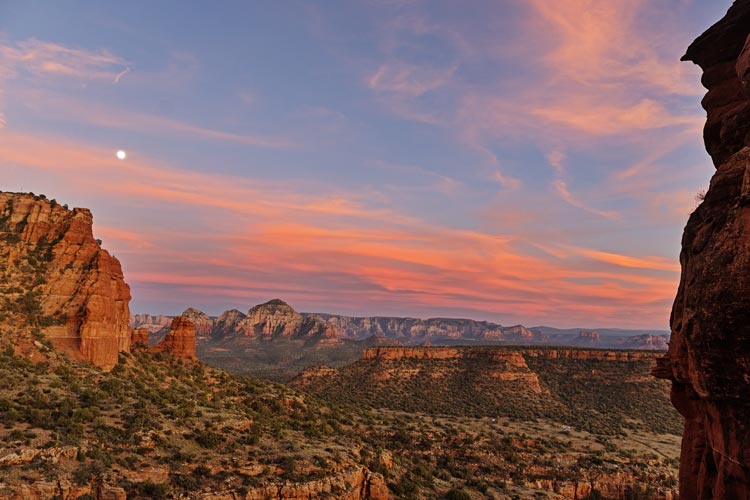
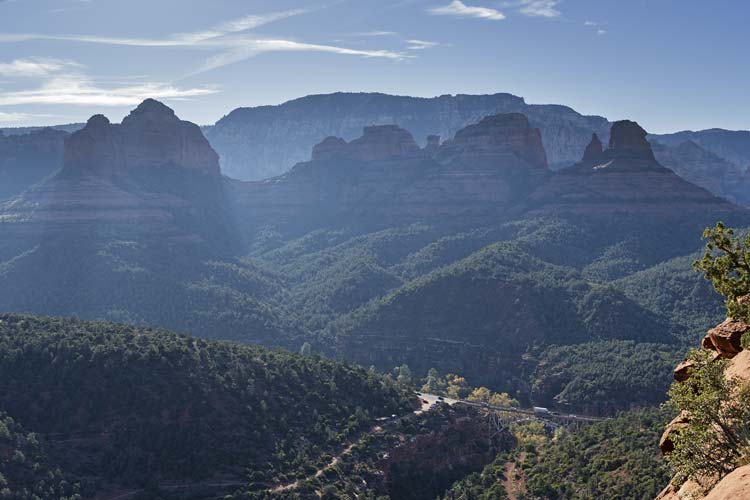
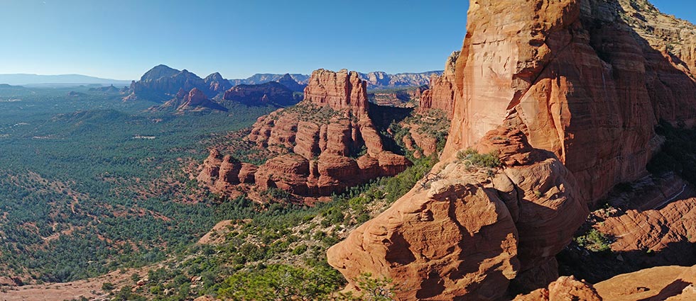
2025-11-03 Following our visit to Flagstaff and the Grand Canyon we headed down to Sedona. This was delayed by some more work so we arrived fairly late on Nov 3rd. We headed through town and then NWish to the Doe Mountain Trailhead. There we parked facing into the sun for solar. We grabbed our climbing gear and headed up the Bear Mountain Trail. We didn't stay on the trail as long as we should have and ended cutting up the S and then E side of Ursa Minor - a minor tower S of Bear Mountain. It would have been easier to stay on the trail longer and then cut up the W side to the saddle on the NE side of the peak.
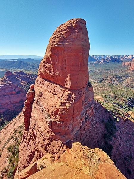
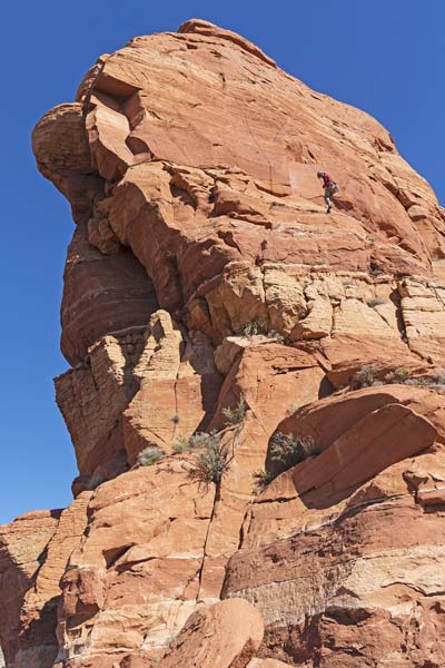
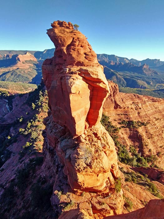
Ursa Minor from the saddle
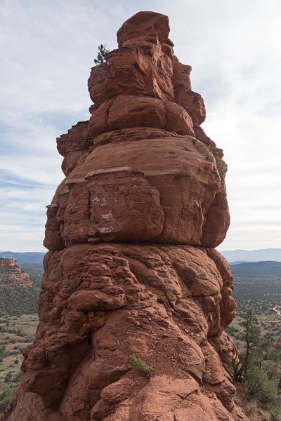 |
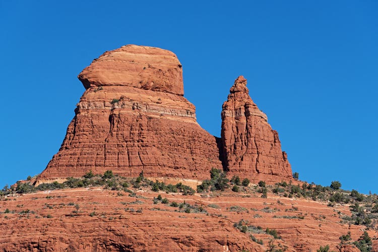
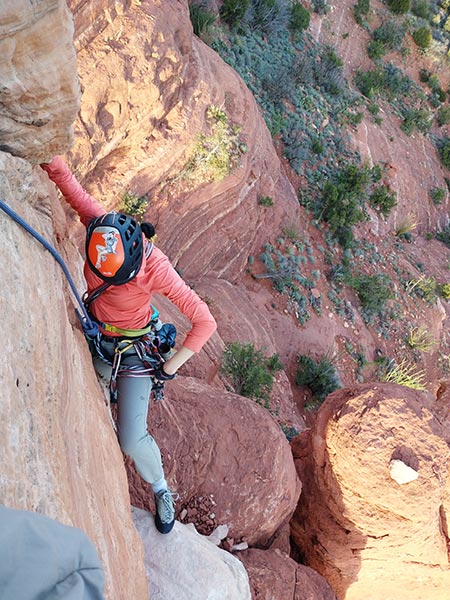
We got out the rope and harnessed up and I started climbing. There was a bolt a bit up. I clipped it and then traversed pretty far left to ascend that little cliff before traversing back right above the bolt and around to the base of a crack. This probably skipped the 5.9 slab crux. I built an anchor here with gear and brought Iris up. I had trouble hearing what she was saying as she explained she needed to traverse left and I needed to pay out rope. In frustration she yelled "Slack" which is what I could understand and let out enough rope for her to climb up and then over to the belay. The crack above was fun but all to short. I clipped into bolts near the summit and belayed Iris up. From the summit we could see the shell and head of Turtle Dome to the west. It looked more like a tortoise, but was more aptly named than most formations in the area. I poked around on Mountain Project and learned that there was a 5.6 meandering route up it.
Iris follows the second pitch
 |
Iris on Ursa Minor - note Turtle Dome to the right
 |
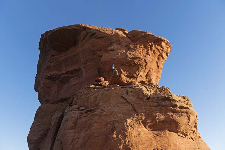
Iris raps from Ursa Minor
 |
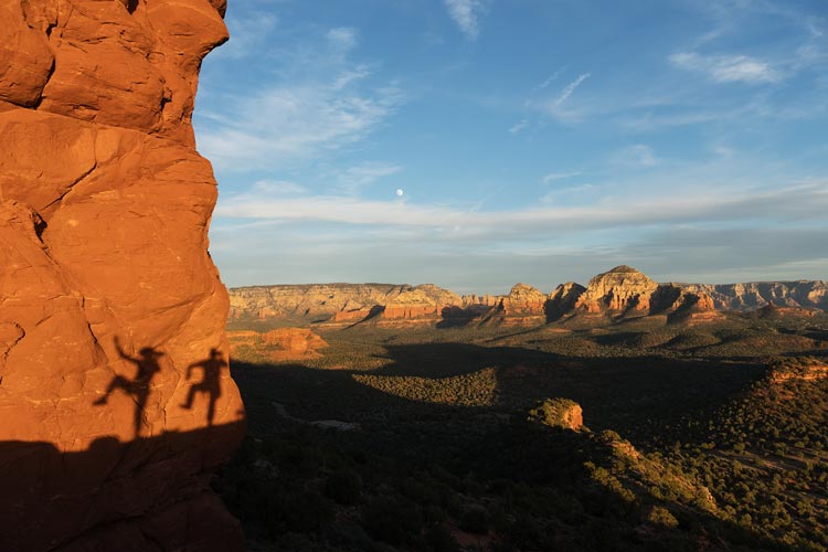
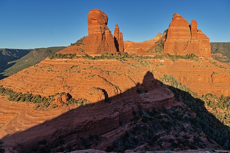
dancing with shadows
 |
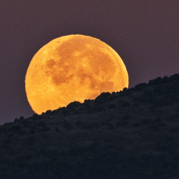
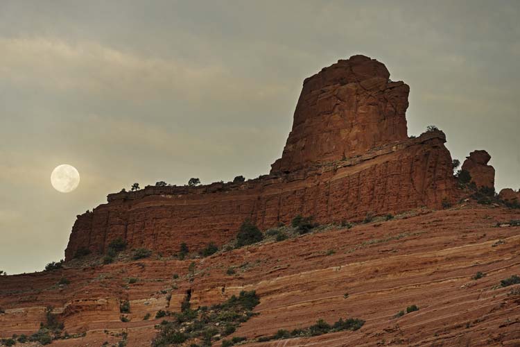
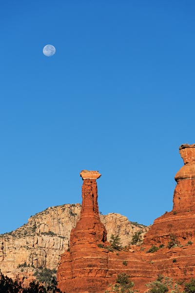
moon and Ursa Minor
 |
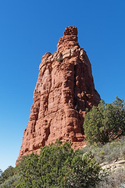
Once we had rappelled from Ursa Minor and admired the moonrise and played with our shadows we packed up some of the gear (the rest we were still wearing) and headed down to the Bear Mountain trail and followed that uphill towards Turtle Dome. We left the trail probably a little later than we should have and dropped down around a semi-bowl following a bit of a use trail to the slickrock on the S side of the dome. Then we traversed up along the base of the wall to the starting gully for the climbing route. By now the sun had set and it was getting pretty dark. I couldn't see the bolt that was supposed to be on the traverse, but I was pretty sure I could identify a few rock features from one of the photos. We scrambled up the gully to an alcove where I built a bit of an anchor in a crappy crack and then Iris belayed me as I traversed along a ramp/ledge to the left. There were some surprisingly solid seeming pockets that I was able to place some gear in and then I found the bolt. I went up and then left after that for a bit and then decided to head up instead of continuing to traverse left. A few moves later this proved to be the right move when I saw the bolted rap anchor up and right. I moved up and then belayed Iris up. The reported rating of 5.6 seemed reasonable.
sunset from the base of Turtle Dome - Ursa Minor down and right of moon
 |
We had finished the roped climbing part but still had a lot of scrambling to get to the summit. We dropped the rope and rack and then started walking/scrambling up towards the summit. Mostly it was easy walking with a few 4th class? moves near the top. We didn't find a register on top, but there was a large glass paper weight orb. This ascent of Turtle Dome was a bit of a tribute for the birthday of the late Matt Yaussi who often included "turtle power" in his summit register entries. We descended to the ropes and then set up the rap and descended to our gear. We packed up and then hiked back in the dark - doing a better job of following the somewhat obscure social trail up to the main trail. Back in the parking lot we discovered that at least one of the bathroom stalls was not locked, just required a very strong pull to open. This proved to be a nice warm windless location to rinse off, but there was a frighteningly large (wolf?) spider that scurried off the windowsill when I put my headlamp there.
After rinsing off we headed down a dirt road towards the so called "dispersed" camping area. In reality this is more concentration camping as they have limited many square miles down to a few small parking lots and one short section of dirt road with pull outs. There are probably lots of other places you could get away with car camping in the area, but also lots of no camping signs. One of the downsides of a trip to Sedona, but probably inevitable with so many people living in close proximity to popular trailheads, especially as the nearest homes are often multi-million dollar ones or resorts. We didn't know if the Element could make it down this dirt road (google maps was trying to send us the long way around), but it did. We camped at the Nolan concentration camping area - it at least was a bit of a spur road with pullouts rather than just a dirt parking lot.
link to Strava page for Ursa Minor and Turtle Dome. 11-03-2025
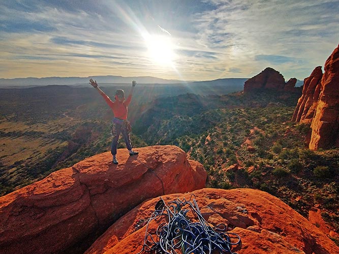
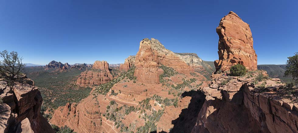
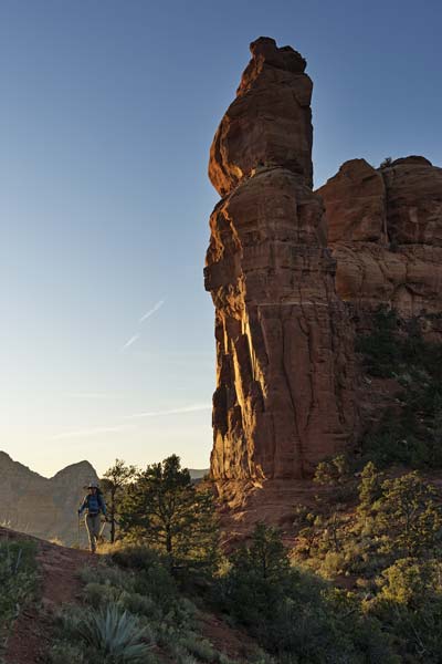
2025-11-04 Our plan for the day was Queen Victoria Spire - something I had been wanting to do for a long time, but somehow had not yet gotten around to it. Iris would have a work call at 11, but rather than try to do something quick before then we just hiked up to the base of the route and then she took her call there. Since we didn't have 4wd and the 4wd mafia constructs barriers at the start of many of the 4wd roads we were forced to park at the paved Huckaby Trailhead. From there we walked a combination of the Munds Wagon trail and the Schnebly Hill road until we were able to cut north and back towards the spire on the Hangover trail - you do go a bit past the spire and then cut back to it. We left the trail under the saddle east of the spire and hiked/scrambled up to the saddle where Iris took the call and I took photos and relaxed. It had been hot in the sun hiking uphill but got a little chilly in the shade just sitting around. Once Iris was done working we got to work climbing.
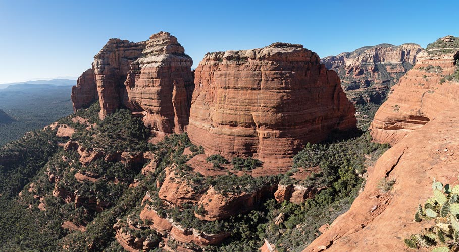
Pointed Dome and Queen Victoria Spire
 |
Queen Victoria Spire
 |
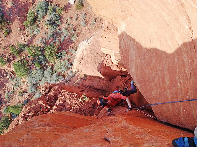
The first pitch had the most continuous climbing up a crack in a corner. Then the second pitch was the crux with a short but polished offwidth up through a limestone band. The problem was you were supposed to have a #4 camalot to protect this. I had a number three which was just rattling around in there like a bicycle in a monster SUV garage. I slung the tree below this crux so at least I wasn't going to die, but it was a bit of a grunt getting up. After the move I walked left to the bolt and gear anchor and brought Iris up. She took the struggle bus up. The last pitch was more wandering and I belayed off the rap anchors. Iris had trouble getting a tight cam out, so after she came up I downclimbed and cleaned it on TR. The view from the top was pretty nice, but I couldn't help but stare at the higher Pointed Dome to the west. This is a worthy objective but unfortunately is also 5.11 R - with a long slab runout above the crux - supposedly it is only 5.9 climbing for the most runout part, but it seemed a bit above what I was willing to try - plus I think you needed 2 ropes for the descent.
Iris follows the first pitch
 |
Pointed Dome from the summit
 |
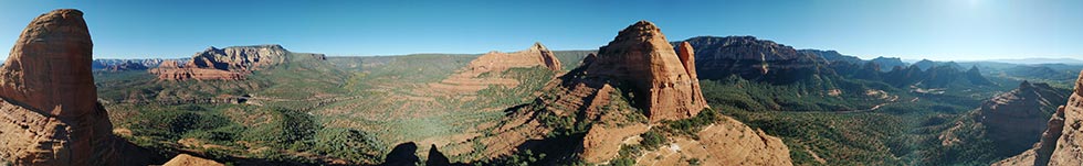
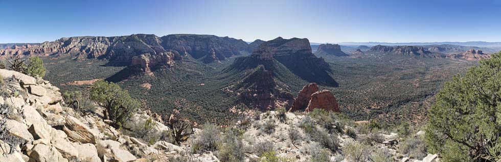
panorama from Queen Victoria Spire
 |
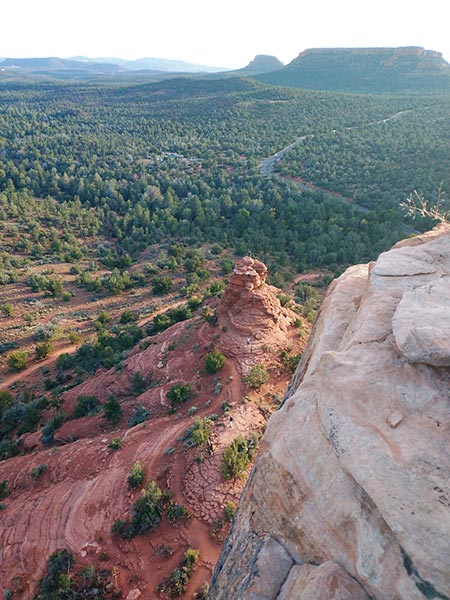
We did 2 rappels back down to the base and loaded up. Instead of returning the way we came we dropped down to the trail to the north and then headed west in the shade around the N side of Pointed Dome and then down to the saddle to the west of that. There we left the trail and followed a social trail up towards Peak 5200 - aka Elephant Rock. We cut around the E end of the ridge and looked through the window (between the trunk and the rest of the elephant?). there was a nice view back towards Pointed Dome and the other rocks to the east. We traversed around to the west ridge and then scrambled up to the summit with at least one 4th class move with a bit of exposure. By now the light was pretty good as the sun descended towards the horizon.
Iris on the "trunk" of Elephant Rock
 |
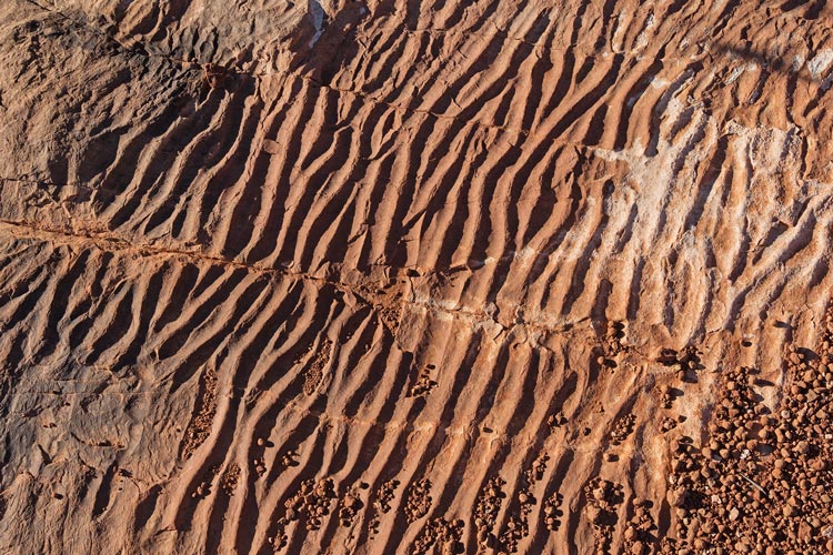
sand ripples fossilized in the rock
 |
Mitten Ridge with the shadow of Elephant Rock
 |
We returned the way we came up back to the Hangover Trail at the saddle and then followed that back to the Schnebly Hill Road and followed that most of the way back to the parking lot (with a little bit of trail). There were a lot more pink jeeps heading back along this road as the sun set and the pretty full moon rose behind us. Back at the trail we witnessed a marriage certificate and then once the parking lot cleared a bit more rinsed off in the outhouse and then drove back through Sedona to the concentration camping - this time we were in one of the dirt parking lots.
link to Strava page for Queen Victoria Spire and Peak 5200 11-04-2025
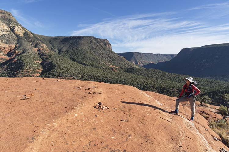
2025-11-05 Today we were planning to hike and scramble. We drove to the Margs Wash parking lot which still had plenty of space when we got there around 7 am. We could have driven farther up the road, but the 4wd mafia had built a low clearance trap at the start of the road - I was tempted to turn it into a 20 inch clearance trap but refrained myself. We followed the Twin Buttes trail and then the Hog Heaven trail for quite a while - and should have followed it farther. It was cold at first but once we started uphill it was much warmer and soon we were glad to be in the shade. We left the trail and headed up a gully that was easy travel at first but then got more bushwhacky. We should have stayed on the trail and followed a social trail that was west of the gully we went up. In any case we were able to work our way up to the ridge east of the saddle between East and West Twin Buttes and turned left towards the higher East Butte. We traversed below the cliff until an obvious break up a steep gully that we followed up through the cliff band. It was easier going than I expected but there were enough loose rocks to take turns for a few sections. Then we continued on social trails and followed cairns east and up to the summit. There were multiple options and they all seemed to work, although I think our descent was a bit better.
morning moonset
 |
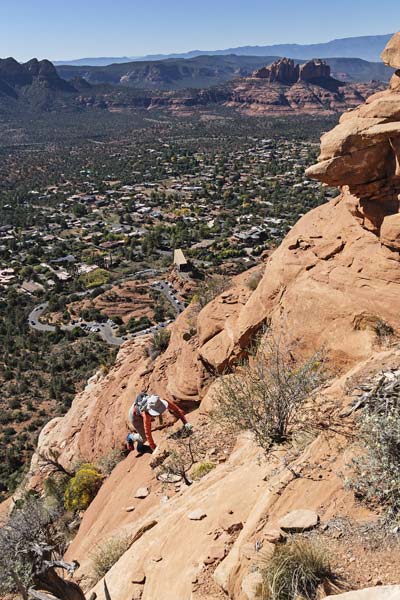
The 5558 ft summit had pretty good views, but they were better if you went a bit closer to the dropoff on whichever side you were looking at. I was scoping out the spires to the S (Streaker and Christianity among others). Someday I'd like to do these too. We returned back along the ridge a bit more closely and then dropped down and through the notch we came up. Then we traversed down and across the ridge to the west getting stranded where there was a dropoff. We backtracked and downclimbed to the north and continued west. The views down to the S to the Chapel of the Holy Cross were pretty good. The parking there was pretty limited, but at least there was pretty good turnover. The start up the East Butte had some fun scrambling but then there was a bit that was more following a social trail through the hostile plant life. Not bad, but the scrambling up the rock was more fun. The summit was sort of hiding among a juniper, but there were nice views where it dropped off to the east. There was a plastic container with a whacky manifesto about becoming enlightened or something like that.
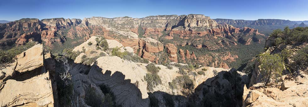
panorama from East Twin Mountain looking ~ N-E-S-SW
Mitten Ridge is on the left, Christianity and Streaker Spires are lower center with Courthouse Butte and Bell Rock up and right of them
 |
panorama from East Twin Mountain looking SW-W-N-NE
the Mace is in the formation to the left, West Twin is center left
 |
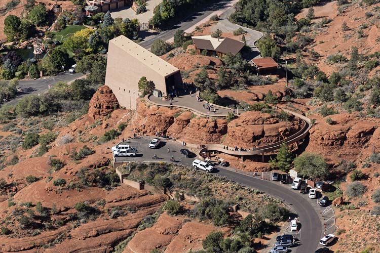
Looking down at houses and the Church of the Red Rocks
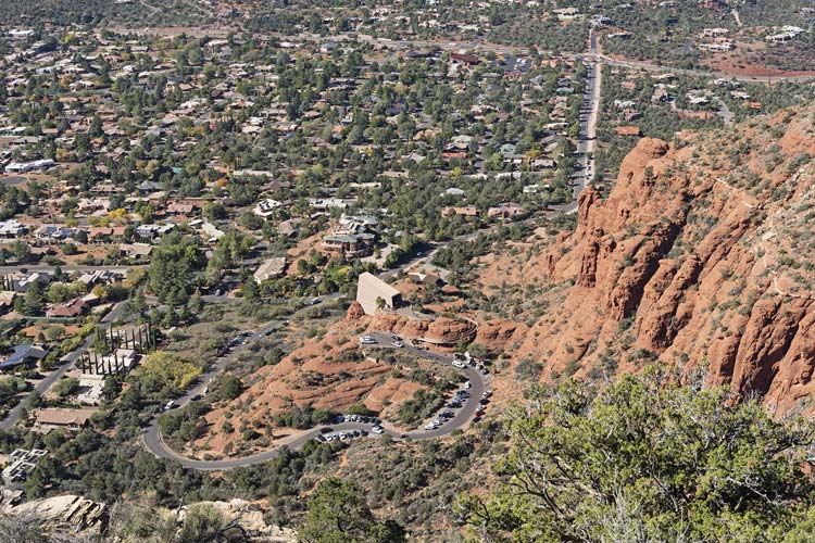 |
telephoto image of the less iconic side of the Church of the Red Rocks
 |
Iris scrambles up W Twin
 |
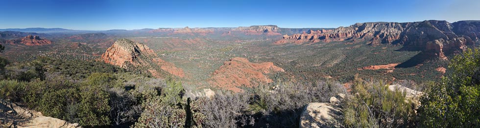
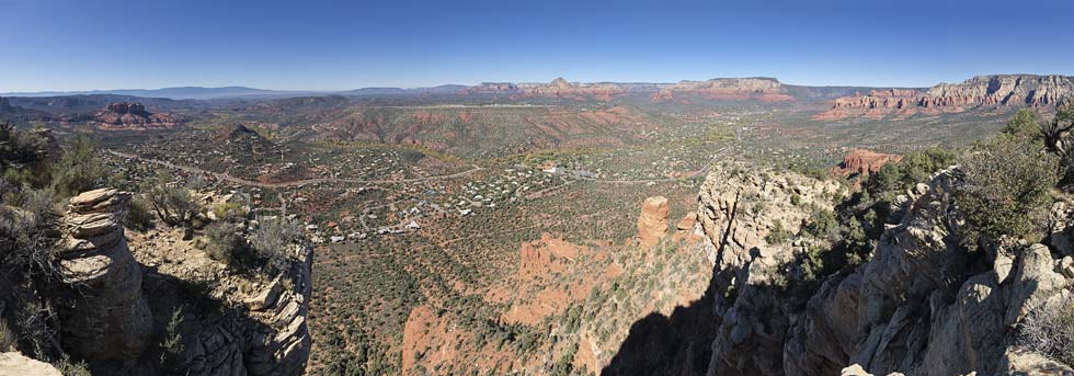
panorama from West Twin Butte with Sedona and Oak Creek down below
 |
We dropped back towards the saddle missing a potential shortcut earlier. Then headed down the hill soon picking up a social trail that got better and better all the way down to the main trail. We crossed that and headed up a pretty obvious trail towards Battlement Mesa. We got up to the S ridge end and then backtracked and cut around the west side and scrambled up the north ridge to a surprisingly nice summit. Then we headed back down and continued north before cutting down a gully to the trail we started on. Once back at the car we realized we still had some time for something. I suggested Kachina Woman Spire also known as Bandito Spire.
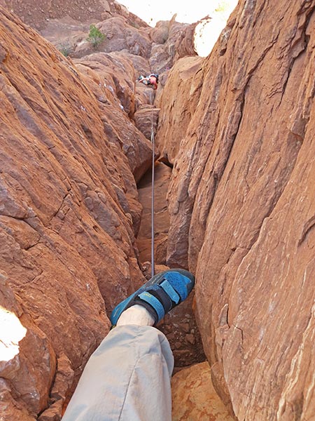
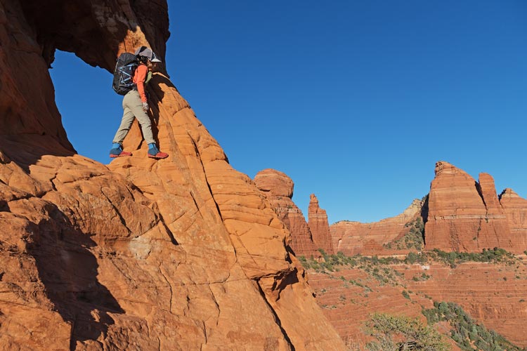
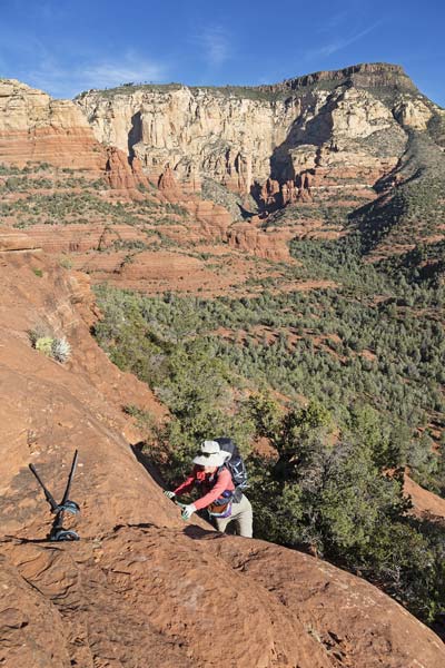
We drove to the Boynton Canyon Trailhead - it was full, so we headed back down the road a bit and then hiked in. The spire we wanted to climb is right next to a vortex. In fact it is in between the spire and another smaller rock bump. We followed the trail up to the vortex between the rocks and then looped around on the west side up to the saddle on the NE side of the spire. There was a bit of scrambling the way we went but if you went a little farther out of your way I think you could keep it to class 2. There we got ready to climb up. Directly above the saddle heading up to a bolt looked a little spicy without great pro, so I started farther right and then traversed left past the bolt and into the crack. There was some pretty chossy rock but the crack mostly seemed solid. I climbed up it to a pedestal where the left side ended and then up the limestone cap rock to the summit. Although originally rated 5.10 maybe that was a reverse sandbag as it felt more 5.8 ish. The rap anchor was on the far side of the summit cap and I extended that back to the side I came up to to belay Iris up.
Iris climbs the final limestone cap
 |
someone on top of Warrior Rock below
 |
At least I could be entertained by people hiking up to the vortex and some that triumphantly climbed up Warrior Rock - the bump on the other side of the vortex. Someone started playing singing bowls in an alcove and there were people sitting cross legged watching the last light move up the red rocks to the east. In short, it was almost peak Sedona. We were just missing a wedding party or 2, a helicopter, pink Jeep, and some influencers (there was a flute or whistle earlier though). Iris came up and joined me and we looked for a summit register (no luck) and then set up the rap and descended. After packing up our gear we headed back down where a woman who had seen us on top from the resort (yes, there is a massive resort just west of here) and hurried up to ask about our ascent. Then past the vortex (we felt compelled to stop yacking as we passed the meditators) and scrambled up Warrior Rock. After a few moments on this rock we went back down and past the parking lot to the car. We were not far from the Doe Mountain trailhead so we headed there for a rinse and then bumped along the dirt road to the Nolan camping area.
Iris raps from Kachina Woman Spire
 |
link to Strava page for E and W Twin Buttes plus Kachina Woman Spire 11-05-2025
2025-11-06 Another pre-dawn start got us to the small parking area at Midgley Bridge before it filled up. Then it took a while before we actually left. Meanwhile I took some pics of the moon setting behind Steamboat Rock. Steamboat Rock is also sometimes referred to as Submarine Rock - it actually looks more like a submarine, but then a lot of rock formations in Sedona look somewhat submarineish. As we hiked up we admired the morning light hitting the rocks, and also the Acropolis - a large formation - or maybe just a mountain to the north of the area we were going to visit. This looked interesting too, so we tried to scope a way up it. It was chilly as we started up the trail ascending Wilson Canyon before turning west onto the Jim Thompson trail which headed uphill. After a few switchbacks we left that trail and took one of many social trails up the ridge towards the steamboat "deck". There were a few scrambly bits on the way up but nothing bad. We decided to try to climb this formation first, and then work our way north with a very stretch goal of investigating the Acropolis.
the moon about to head behind the top of Steamboat Rock
 |
Steamboat Rock once the sun hit it
 |
looking back down at Midgley Bridge with Queen Victoria Spire visible above it
 |
Iris scrambles up the ridge towards Steamboat Rock
 |
Iris on one of the lower decks, Wilson Canyon and Oak Creek Canyons behind her
 |
panorama from a lower deck on the way up
Steamboat Rock, Princess, and Tisha Spires on the left, then The Acropolis with Wilson Mountain to the right
 |
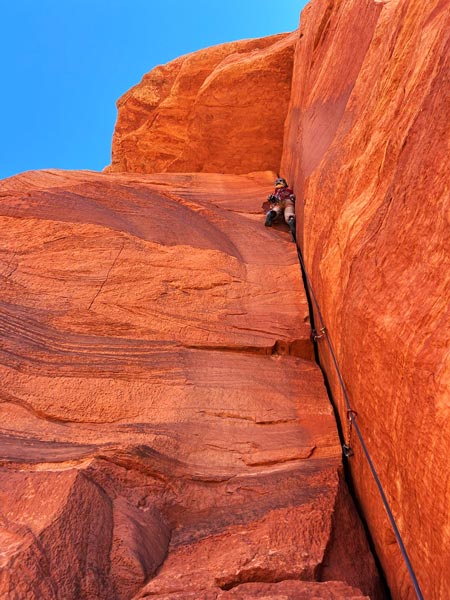
We scrambled up to the second "deck" and then traversed along under the final fin on the S side. There we used the shade of a juniper to set up for the actual climbing. We went up "SuperProw" which is also known as "Project 941". Rated 10a, it featured a roof with a hand crack (that you could mostly stem up). It was awkward to turn the lip of the roof and I probably should have made an anchor there. Instead I pulled one more move and then made and anchor and brought Iris up. She appreciated the long series of slings I dangled down through the crux. Then she scrambled up to the summit and I followed. The rap went down the S side and a 70M rope was just about perfect (although a shorter rope would work with some scrambling).
Iris raps from Steamboat Rock
 |
Iris got a pic of me rapping off Steamboat Rock
the route we went up is to the left
 |
panorama from the deck a bit west of the summit with Iris sitting on the edge below the climb
 |
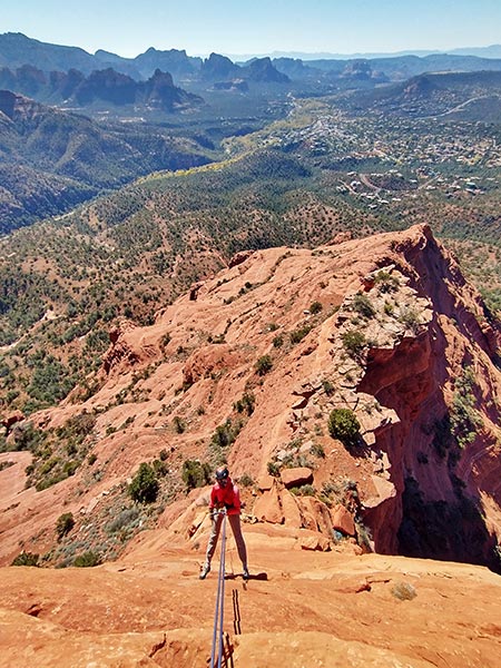
Next up was Princess Spire. There are 2 5.10 routes to the summit. One gets lots of stars but it was 5.10+ and people suggested doubles of #2 and 3 camalots plus at least one #4. I had singles of #1, 2, and 3. Fortunately there was a bolt a little left of the junction of the vertical crack and the horizontal wide crack below the roof. We climbed up the easy first pitch to the wide ledge at the base of the crack up the dihedral. I was able to place a #1 at the start, but it got wider beyond that. I walked the #2 up a bit but then left it before it got critically tipped out (placed in a crack too wide to be safe). Then I walked the #3 up almost to the corner where I was able to reach out to clip the bolt. The horizontal crack was pretty sandy as any sand or dust would just pile up on the ledge. I made some half-hearted attempts to traverse out but decided that it was less scary and safer to hang on the bolt for a while. After regaining my physical and mental fortitude plus the #3 cam I headed out the horizontal crack under the roof. It was pretty wide so I wasn't able to get many jams or place the #3 after more than a few feet - and it was dubious how good it was anyway. I grunted my way out past the roof and somewhat crawled into a pod beyond that for a bit of a rest before extricating myself and turning the corner up to the bolted anchor. I didn't think Iris would enjoy that, so I lowered down and then followed it on toprope to clean (which I did in much better style than on lead). Then I set up Iris with a gri-gri and tibloc to ascend one side of the rope while I belayed her on the other. That worked, although it scuffed up the rope in a few places when the tibloc failed to grab properly. Then we carefully scrambled up to the summit.
I lead Princess Spire (Iris pic)
 |
on the summit of Princess Spire - Steamboat Rock behind us
 |
panorama from Princess Spire - thin wall is in the center
 |
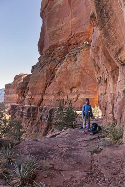
We rapped back down and then walked around on a very nice ledge to the N side of Tisha Spire - the last and easiest for the day. This featured 5.8 climbing - first up a bolted face to a slung block anchor (with massive static cord) and then up a crack. From the summit the view over to Princess Spire was especially good.
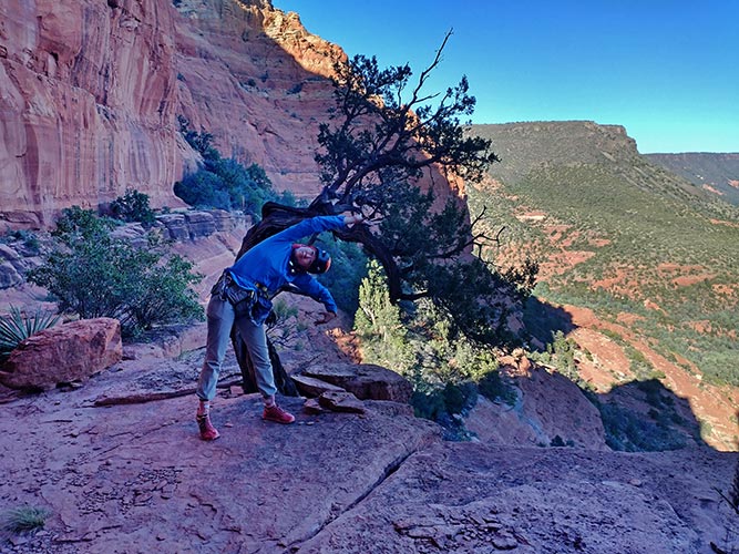
there was a scenic bent tree
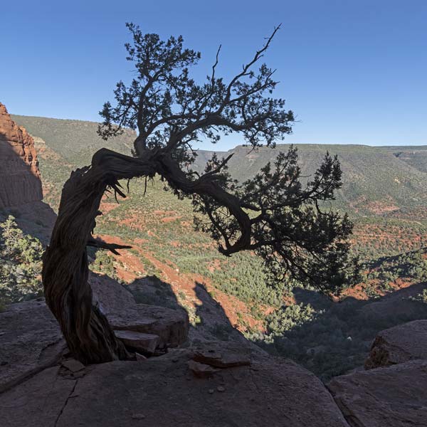 |
Iris is a bent tree
 |
Iris on the excellent patio along the east side of Tisha Spire
 |
Princess Spire from Tisha Spire
 |
Iris raps from Tisha Spire
 |
By the time we rapped down it was very clear we wouldn't be exploring the Acropolis today. We traversed back to the lower deck of Steamboat Rock and then back to the Element as the sun set and it got dark. Back in the parking lot we took advantage of the outhouse for a quick rinse before heading back to the Nolan concentration camping.
Iris hiking out with Princess and Tisha Spires behind her
 |
link to Strava page for Steamboat aka submarine, Princess, and Tisha Spires 11-06-2025
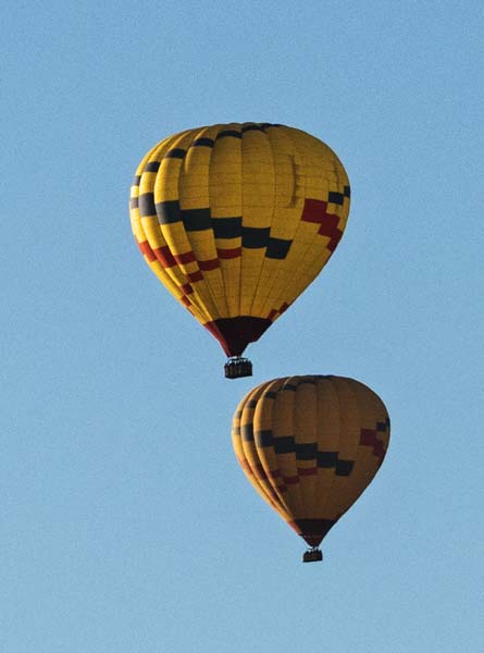
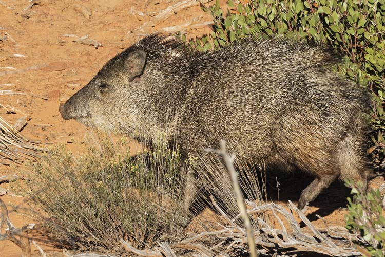
2025-11-07 Another early morning got us to the Boynton Canyon parking area before it was full. We watched the hot air balloons while getting ready to hike. The lot was full before we left. This would be our last day in Sedona as we figured that it was crowded enough midweek and the weekend would just be worse. Our plan was peak 6,027 - which was on Adam's list of "best desert scrambles". We have done a number of the peaks on this list, and many of them are quite good, so we had high hopes. It was quite cold at the start, especially as we dropped down into a shallow drainage for the first part of the hike. I tried to push the pace to warm up a bit, but got distracted by trying to line the setting moon up with Kachina Spire - unfortunately the place where things lined up happened to also have trees in the way. Oh well. We followed the trail a little too far and then backtracked to head cross country - following various use trails. Here I heard something in the brush - it turned out to be a javelina - the first Iris had seen out in the wild. She followed another one with her phone and got some pretty good video of it.
a few of the hot air balloons
 |
I hoped to line up the moon with Kachina Spire
this is the closest I could get with the trees in the way
 |
javelina
 |
The trails were going all over the place but generally we were able to follow ones that went where we wanted to go - towards the east ridge heading up to the peak. Then we traversed below the cliffy ridge until there was a weakness that we followed up to the plateau. This was probably the best scrambling of the day. Then we traversed south around a bowl mostly on a sandstone ledge with nice views of the adjacent peaks (like 5634 and 5461 to the south) before traversing up to the summit. It was no longer cold, although the air temperature really wasn't that warm, hiking uphill in the sun out of the wind was enough to get us sweaty. The views from the top were pretty excellent although the best views in any particular direction required hiking out to where the cliff edge in that direction was.
panorama looking south from partway up pk 6027 - peak 5634 on the left
 |
panorama from near the edge, Boynton Canyon to the left, Long Canyon to the right
 |
We returned back the way we came up mostly finding a better line. Then we crossed the trail and headed up the slope on the far side to the ridge heading north from Mezcal Mountain. We followed that ridge crossing above the so called "birthing cave" and headed up to the 5047 ft summit. This was a slightly higher spot on a large plateau, so not particularly exciting. I headed south to see if we could easily get to the west peak (no, more scrambling down and up than we wanted to deal with). Then we dropped off to the SW following a track and some cairns as we worked our way down through some cliff bands to the trail below. We followed that NW and down to the trail we started on and followed that back to the parking area. There plenty of people asked when we were leaving as we packed up.
We headed SW from Sedona on our way to Prescott. First we pulled off the road to rinse off at a secluded shooting area. That turned out to not be that secluded as a number of people drove by including someone who parked at the next pullout probably under 100 feet away and proceeded to shoot a bunch. Welcome to America. Iris wasn't sure if she should be more concerned about people that were just driving along and had the sudden need to shoot something or the fact that they were just driving around with a gun all the time. As I said - welcome to America where the estimates range from 390 to over 500 million civilian guns. More than one per person, but probably not one for every hand.
We headed up through Jerome and over the mountain to Prescott. This winding road was not kind to Iris' motion sickness, but we made it. There we went to visit with Jenny and Jay (I've known Jenny since ~2000 and have run into her in various states climbing as well as visits to her home in Thailand when she was teaching there). They have left teaching and settled down in Prescott and after a year's work, their home is looking good. They aren't done, but are well past the construction everywhere stage. It was great catching up with them.
link to Strava page for Peak 6027 and Mezcal Peaks 11-07-2025
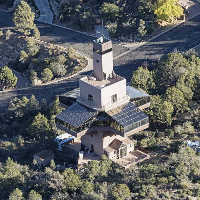
2025-11-08 We took a walk through the neighborhood hoping to climb a nearby bump while Jenny and Jay were off biking. We were thwarted by private property and no trespassing signs with scary warnings. I'm sure Bob would have just walked up to the water tank with no problems, but I was feeling risk averse for some reason. We did end up trespassing through a Christian Camp on the way back though to make a loop. Then that afternoon we went with Jay to hike and scramble up Thumb Butte - a nearby volcanic remnant that is closed some of the year for falcon nesting. While there are actual rock climbs there we just scrambled up to the top and then spent quite a bit of time enjoying the view and talking about Prescott. One oddity was a local artist's house far below. This 5 story tower had cantilevered glass rooms at about the 3rd floor level as well as some terraces above. Not necessarily what I would choose to build with that kind of budget, but far from a boring cookie cutter house. That night we played splendor and ate delicious homemade pizza.
funky artist house down below
 |
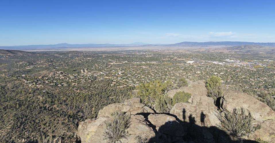
pic from the top of Thumb Butte - Mount Humphreys is on the horizon in the center
 |
link to Strava page for Prescott Walk plus Thumb Butte 11-08-2025
2025-11-09 In the morning we went out to do a short hike to peak 5843 while Jenny and Jay went mountain biking. Not much of a peak, but it had some ruins near the top and it was a lovely day. The ruins were just some old rock walls, but the views were nice. Then we headed back for another game of Splendor before packing up and driving east. We were going to spend another night out but realized that it probably made more sense to head all the way back to Yorba Linda that night, so we did just that.
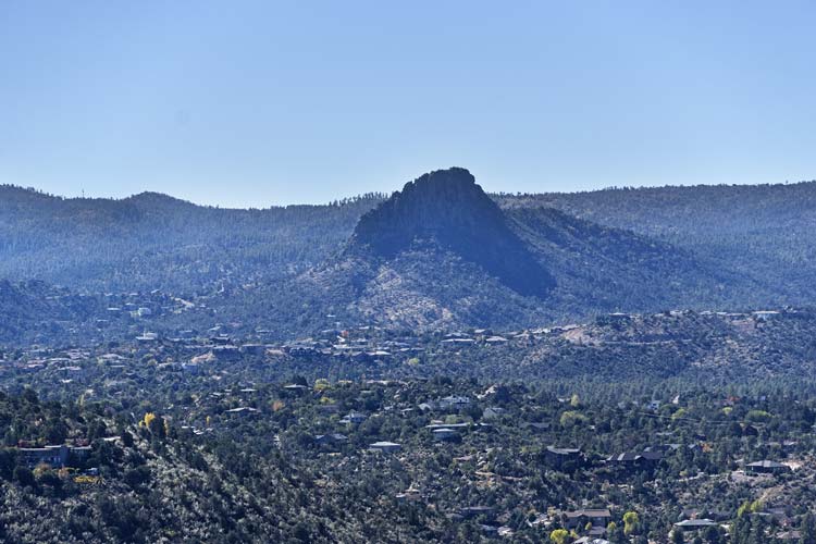
Thumb Butte in the distance
 |
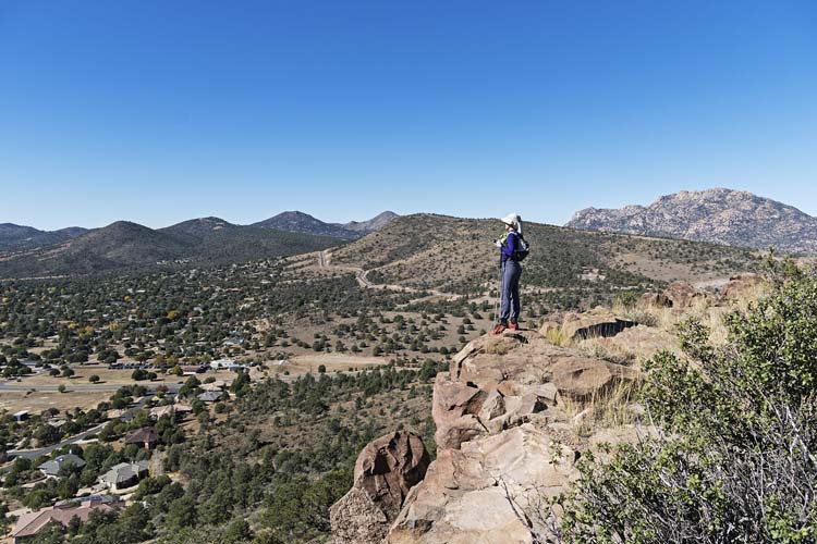
Iris on the edge of Peak 5843 with Granite Mountain behind her
 |
link to Strava page for Peak 5843 10-09-2025
No material on this page may be copied or used without permission.