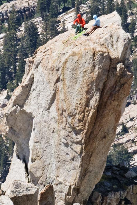
The Doodad was on the Sierra Challenge in 2007. It is a large block perched on the ridge with the easiest way up being a short chimney/dihedral on the S side. Many people had already climbed Matterhorn Peak, so there were a number interested in the Doodad, especially if someone else was going to carry the rope and lead the thing. Chris Kerth had volunteered to carry a rope and a bit of gear, so we planned to get up there when he did.
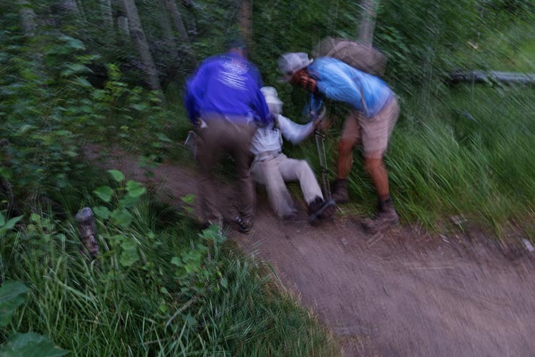
8-01-2025, We got up early since Iris was planning an early start. I stayed mostly in bed while she drove to the twin lakes trailhead. It was about time for me to get up when she started off with Mason. We tried to move quietly through the campground to the trailhead start. On the way Bob suffered the indignity of tripping on some roots and going down surrounded by people. I tried to get a picture as I know he would have before the others helped him up, but it was pretty dark. We had quite a lot of people assembled at the trailhead for the start - the main destinations were Matterhorn, Whorl, and the Doodad. (I still need to do Whorl, so that was my original plan, but who am I to pass up a climbing peak, especially if someone else is carrying much of the gear). A few started off running up the trail, but I was part of a long chain of hikers. At some point I felt the need to pick up the pace and passed the pack and then tried to catch up with a faster group.
| |
|---|
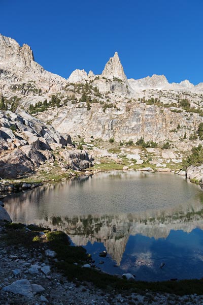
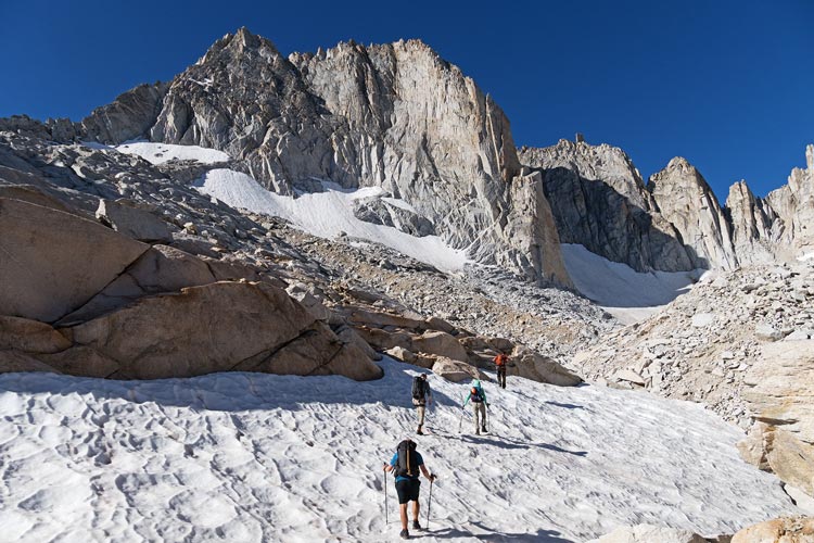
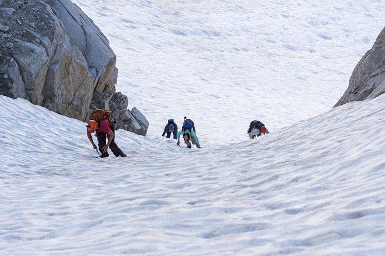
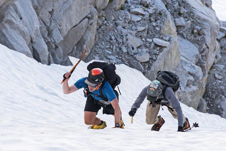
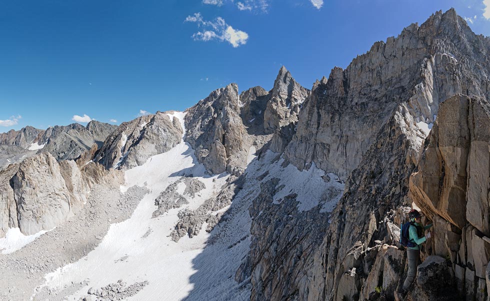
We headed up and up and up the trail. A bunch of people had brought radios. Mine talked to Mason and Chris Henry's, Iris' talked to Chris Kerth's. Since Iris and Mason were together I could communicate with them about where to leave the trail. Since the downloaded map was not visible on my phone despite claiming to be downloaded I opted to follow the track. Before I left the trail Stav came blitzing up and chatted a bit before he took off up the trail. He would have passed me much earlier but he was talking to Bob near the back of the pack for a while and then had to work his way up past almost everyone else. I saw some other people leaving the trail a bit before I did, Chris K caught up with me about where we left the trail. We went up and converged with the other group at a small lake. Then saw Iris and Mason a bit higher. We got water where it was running out of the snowfield and then crossed the talus and prepared for snow travel (put on crampons and helmets and got out our ice axes). I headed up in the lead and felt pretty solid on the mostly firm snow. Every once in a while I had to stomp in all of the teeth in an icy patch or scuff a step where it was a little soft on the surface. We all made it up to the top of the snow and Polemonium Pass although Dylan K had some trouble with just microspikes. Fortunately Chris had a whippet (ski pole with snow arrest pick) in addition to an axe which he loaned him. It was here that I realized my cnoc water bag was leaking because it had a little hole in it. I put a piece of duct tape over the hole (that was also covered by the fold) and it didn't leak much for the rest of the day. I used Iris' bag for the next few days and then patched it hopefully more permanently at home with a tear-aid patch.
 |
|---|
 |
|---|
 |
|---|
 |
|---|
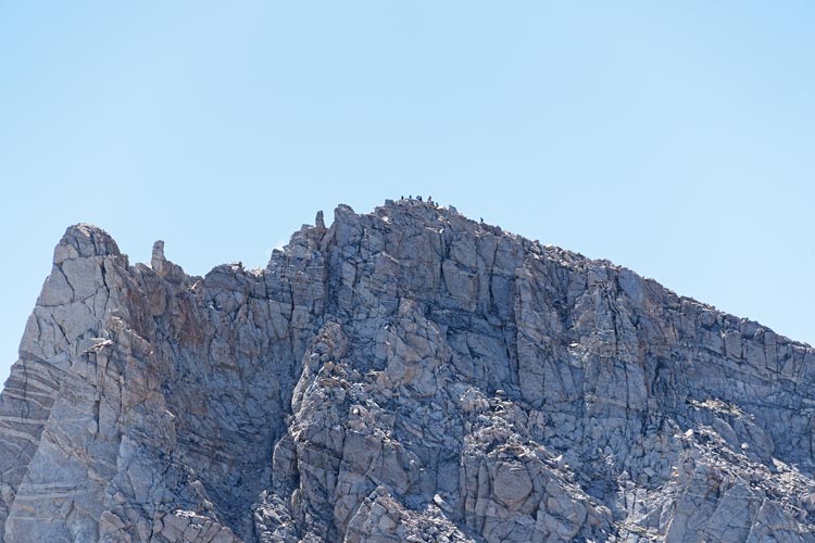
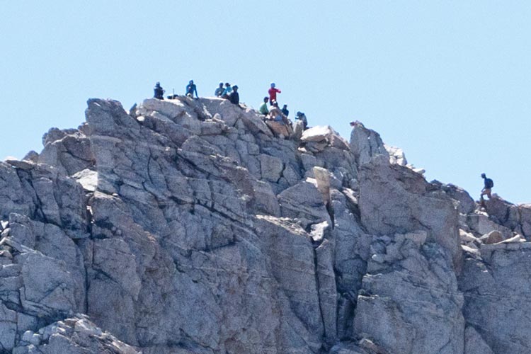
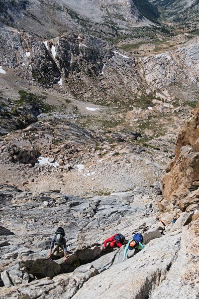
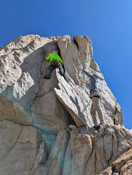
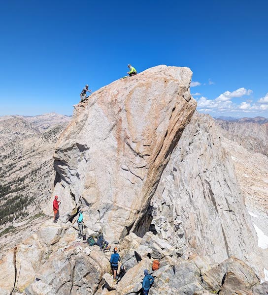
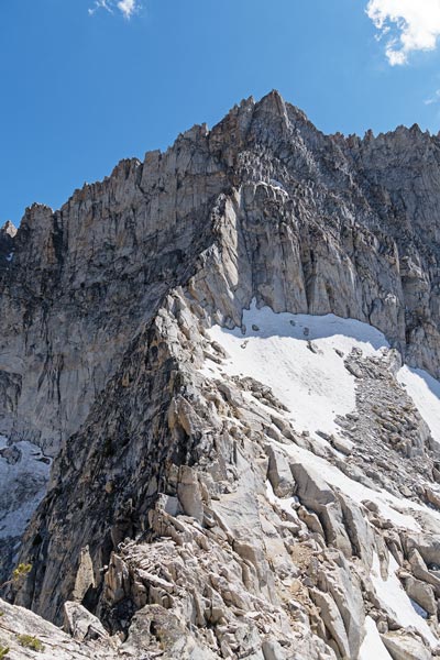
When I got to the top of the snow I heard Clement above - he had gone up the NE arete of the Dragtooth and was descending to the pass, then he tried to go up the opposite side for a bit before traversing around to the easier S side. The rest of us descended a bit before we could get onto the less steep S face and work our way up and west to the base of the Doodad. Meanwhile Clement had soloed up. He came down once we got there and headed off west, later we would see him on the next peak that way. We could also see a number of people on or near the summit of the Matterhorn. I put on my climbing harness and shoes and tied in and then went up. It was pretty secure, you just had to stem and wedge yourself in. I placed one cam on the way up (#1 or 3/4 camalot I think - either would work). On top I clipped into the bolts and placed another cam as backup (the bolts were not the freshest and the cord on them was even more sad). Then I started belaying people up. We got everyone up and then set up a rappel off the bolts and some more cams. Everyone rapped off and then I threaded the rope through what was up there and downclimbed with the rope set up as a rappel - really just a backup in case things went bad. Back down I had some trouble getting the rope to pull but eventually was able to flip it over to a better location and got it down. Meanwhile, there was a helicopter somewhere over on the other side of the Matterhorn - we were hoping it wasn't a rescue, and especially not a rescue of someone on the Challenge. It wasn't that, but I was unable to find out any information on what exactly it was - someone else later said they saw a litter being helicoptered out. Maybe a SAR training activity?
 |
|---|
 |
|---|
 |
|---|
 |
|---|
 |
|---|
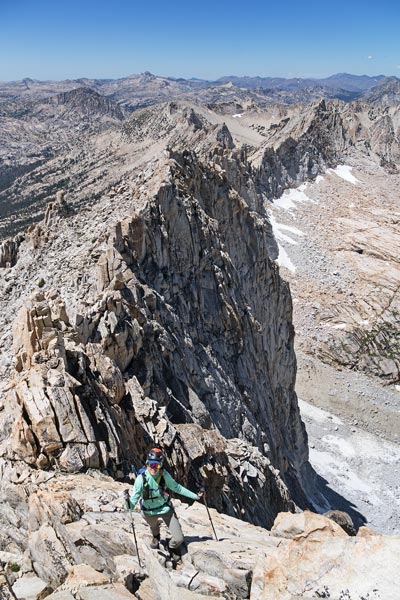
We started scrambling down about the way we came up with a detour down lower that was easier. On the way we passed Chris H and Mason coming up (they had gone up the SE ridge of Dragtooth too, just much more slowly than Clement). Once off the rocks we crossed below Polemonium Pass and started angling up towards the summit of Dragtooth. This was a nice pointy summit with the NE ridge dropping down below. Sean Casserly headed down the ridge while the others dropped down the S side - some wanted to go to the Matterhorn or Whorl N, others just thought it was the easiest way down. Iris and I saw Casserly below the steepest part of the top of the ridge, so we opted to head down that way.
 |
|---|
 |
|---|
 |
|---|
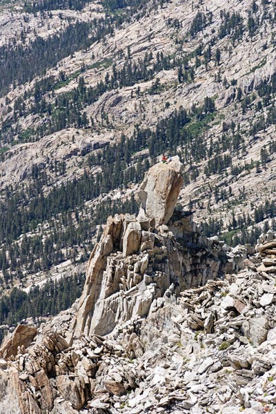
The scrambling was mostly pretty good with just enough edges to keep it from feeling insecure. There were some loose rocks, but fortunately they were on the lower angled sections. We went down and down and then had to traverse onto ledges on the SE side. We probably went down the wrong (of many) ledge ramp since there was some harder climbing in one section here. Then we got back on the ridge and went up Horse Creek Tower (or at least the bump that was labeled so in Peakbagger). It didn't qualify as a proper bonus peak for the Challenge, but we were right there. Then we dropped down to the snow and back to the way we came up. There were some people camped by the little lake, but we swam on the other side. Somewhat refreshed we continued down to the trail and then followed it for what seemed like forever back to the trailhead. We heated up some leftover stew and ate that in the car. We planned to get hot water for tea and oatmeal at the Mobil, but it was closed by the time we went past it. Oh well. We drove up towards Tioga Pass and parked near Jim's RV to sleep.
 |
|---|
 |
|---|
Total for the day 2 peaks 1 swim. Garmin said 12.1 mi and 5433 ft of elevation gain.