Tom Grundy's Early 2026 Bishop Area Peaks Page
Back in Bishop I needed to get some peaks for the completely arbitrary and silly full year grid - basically I am trying to climb a new peak every calendar day of the year. At the start of the year I had completed ~334 days with most of the missing days in the first 4 months of the year. I have decided not to pursue this silly goal in a single minded manner - if there is something better to do, I'll do that, but if I am not doing anything else, I'll try to climb a new peak. One difficulty is that although there are many peaks in the area, I have already climbed most of the easy ones, especially those at low enough elevations and/or with easy road access in the winter. This forces me to go farther afield to find fresh peaks. The other complication is that the peaks have to have at least 300 feet of prominence. I should probably have gone for 100M of prominence, but that would just be one more difficulty. I have cleaned out most of the peaks I can easily (or not that easily) get to under my own power or via e-bike, so now I have to drive. In any case, this page will have a lot of silly peakbaggery - you have been warned.
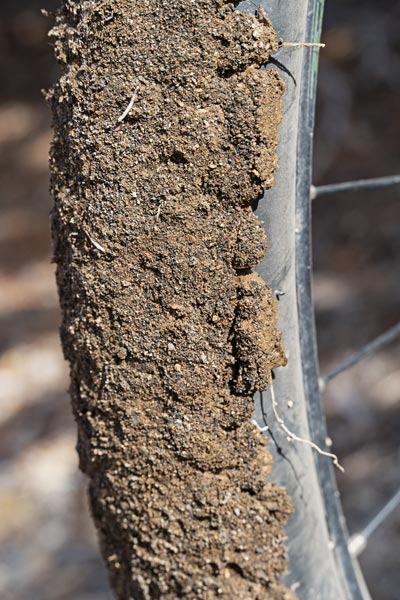
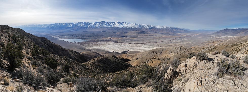
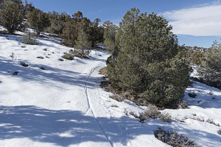
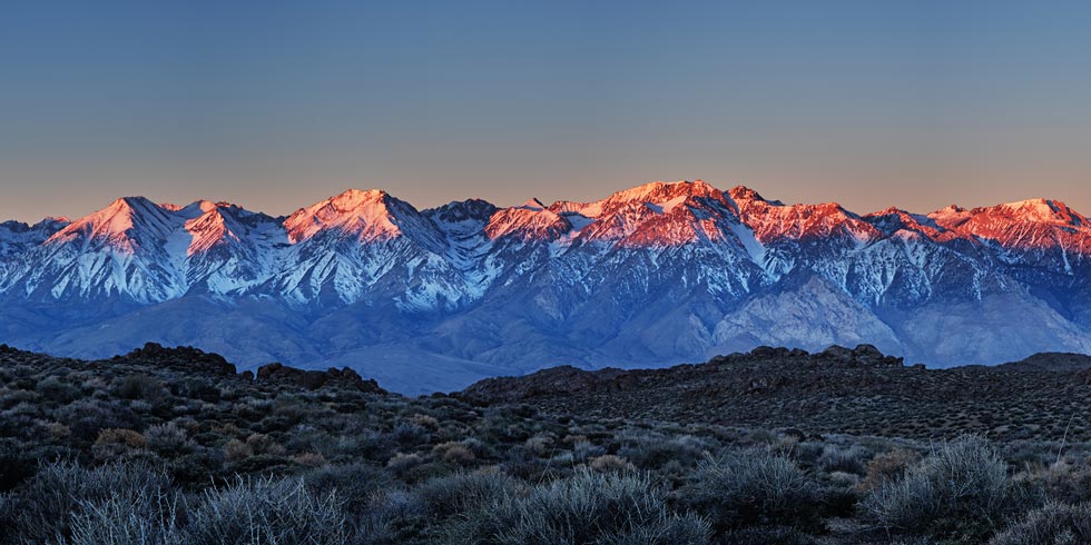
2026-01-25 I drove up the Death Valley Road out of Big Pine and parked at the start of a 4wd road and then went up the road on my bicycle. Iris and I had driven partway up this road and then hiked it to do 2 peaks in October 2025, but I had to go farther up the road and figured the bicycle would be easier and faster - at least on the descent if not the ascent. It was pretty cold when I started but biking up the hill in the sun warmed me quickly. I went past the farthest I could realistically drive my truck and continued on up to Harkless Flats. There things went a lot faster across the relatively level plain and then slightly downhill past some muddy sections (I rode on the center ridge) and down to an even muddier section where the mud really gummed up on my tires. I probably should have stopped before this section, but I didn't know it would get that bad. Then I parked my bike and started hiking. At first I was just hiking up a closed road, then I turned right and headed up a steep slope. The rock was pretty grippy limestone and I powered my way up to the summit of Peak 7640 (or maybe 7655, 7660, or 7665 depending on which map or database you believe or how you interpolate between contours). There was a craggy dead tree on the summit that was pretty scenic.
tire collecting mud
 |
dead tree on Peak 7640
 |
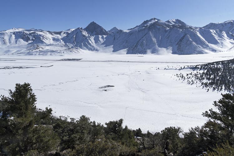
I headed back down taking the ridge to the south and then straight down and across the closed road and up the ridge on the other side. I more or less followed this ridge west and then south to Harkless Peak, which at 7600 feet and only 186' of prominence wouldn't be very worthy except it managed to make it into the Desert Summits Book. It did have a pretty good view, but a point N on the ridge probably had a better view. I tagged the summit and took pics and then headed back down the ridge and then cross country to my bicycle. The ride through the muddy part went better than I expected and the uphill wasn't as long as I feared. I picked up a lot of speed as the road headed downhill with nearly disastrous consequences when it suddenly got steeper and rockier. I managed to hang on for the ride and made it safely back to my truck where I loaded back up and headed home.
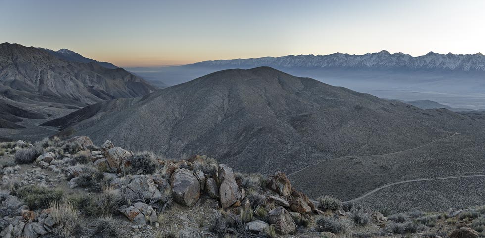
panorama across the valley at the Sierra
 |
My Strava page for biking portion to Pk 7665 (or 7660) and Harkless 01-25-2026
My Strava page for hiking portion to Pk 7665 (or 7660) and Harkless 01-25-2026
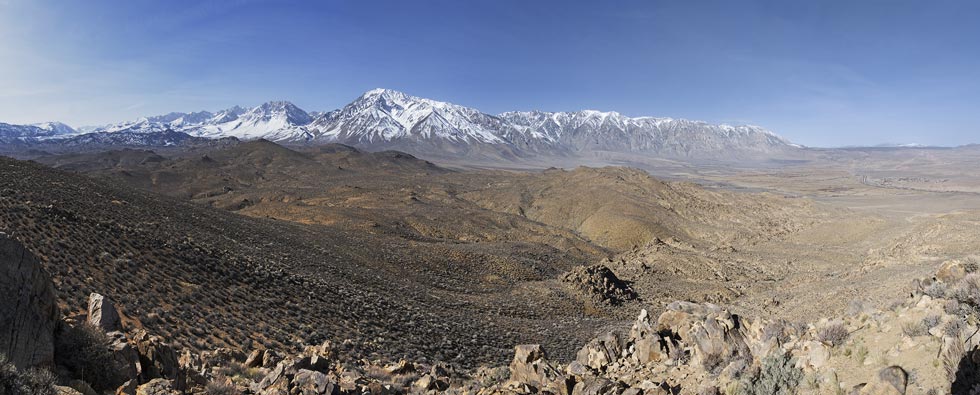
2026-01-30 I needed a peak January 30th, but got confused on the date and e-biked and hiked up Tungsten Peak - a peak I had already done, although not in January, so at least it was some good exercise, lovely views, plus progress towards climbing this peak every month of the year, another completely pointless arbitrary goal. I guess I'll have to find another peak to do next year on the 30th. Hopefully I am out on a trip at that time.
panorama from Tungsten Peak
 |
2026-01-31 This time I had 2 arbitrary silly goals - first, to get a new P300 and second, to get a bunch of peaks to insure I wouldn't lose my spot on the LoJ monthly top 10 peak leaderboard (yet another arbitrary pointless metric). To do this I found a clear Peakbagger p300 plus some LoJ p300s that weren't on PB and probably would not make the P300 cutoff there since PB uses minimum based on the contour lines unlike L0J which uses a more generous measure based on contours (so with 8 40ft contour lines between the saddle and summit PB would say it is a p280 and LoJ would say it is a P320). Once they get measured by LiDAR we will know better, but I have had peaks removed from the list by PB and I had to find a new peak to do the next year - and then LiDAR added it back. Oh well. I drove up the Death Valley road out of Big Pine and parked on the side of the road and hiked up my first peak, Peak 7083. This was a pretty straightforward tromp up the hill from the road and back. There was a bit of loose talus, but not much.
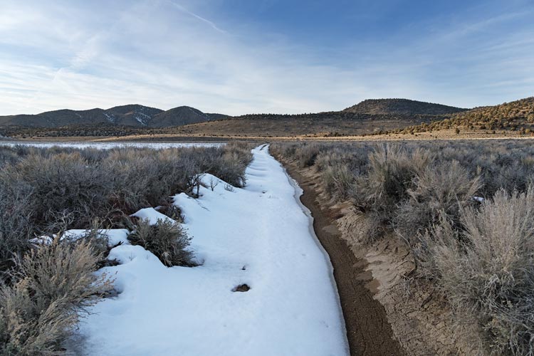
Next I drove back up the paved road and then off a bit to a camping spot. I parked here and prepared to bike. I could have driven a little more up this road, but I knew there was a spot that I wouldn't want to drive past soon. In fact there was a downed tree even before that. I biked up the road fairly slowly - it was steep plus there were some snow and soft places. I walked a few places where the snow went all the way across the road. The biking was slower than I expected or hoped as there were only a few areas that weren't either steep, rocky, snowy, or muddy. I went on to a saddle with a lot more snow and decided I would have to opt for some closer peaks than I originally planned for. I rode the steeper part down in the snow but then had to walk. Then there was a long flat section across a wet meadow that I was mostly able to ride on the snow. The part without the snow was too squishy, and sometimes the snow was too soft too. Then I turned off and headed west on a much less used road. This had a lot more snow and I ended up mostly walking. The sun was also setting. I knew that would happen to me, but I had 2 headlamps and there was a full moon. I was a bit more worried about getting cold as I didn't have any really warm layers. I did have decent gloves though. I got to a point where I would turn left and abandoned the bike to walk. I listened to an audiobook as I tromped across the snow and then tried to stay on a S slope where there was less snow. I headed up a long slope to Peak 8180 - another LoJ p320 and then headed back and across the drainage and up Peak 8140 - yet another LoJ p320. By now there was more light reflected off the moon than anywhere else. Most of the time it was bright enough to not need my headlamp, especially when tromping on the snow.
snowy muddy road
 |
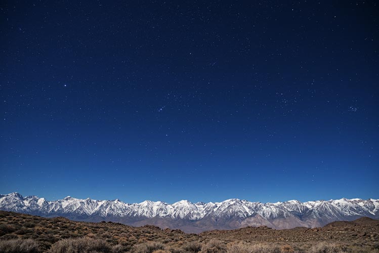
night in the Inyos lit by full moon
 |
I headed back to the bike and then rode up the road a bit before parking and heading up the hill to a PB Peak 8180 (a p280), but also a red dot I should turn green while I was out here. Once again I went up and down a SW slope so it was mostly snow free. Back at the bicycle I had some difficulties with a mix of snow, ice, and mud on the road. While walking the bike I managed to crunch through a thin crust of snow into a puddle with one foot. It didn't get soaked, but it also was not dry. I cut out the corner and went straight up the snowy hill a bit to rejoin the road. Once at the saddle I was able to ride a little bit before parking and heading off on foot again. The road wrapped around the N side of the ridge and soon I was mostly walking on the snow. At least it was starting to get colder and firmer so there wasn't much postholing. I cut onto the top of the ridge and was able to walk more on the S side to avoid the snow up to the summit of Peak 8360 - a p440 which would definitely fulfill the requirements for the day. I ended up staying closer to the top and the S side of the ridge on the return which worked better.
There was some steep(ish) rocky descent which required a lot of attention by moonlight but wasn't that bad. The next part that was muddy on the way in was nicely frozen on the way out. I stopped for one more peak (Peak 8080, a PB p320 that I had already done, but I figured I was already going big, and it would probably guarantee I would stay on the monthly leaderboad (I ended up with a total of 36 peaks for the month, tied for 5th, and had I done no peaks this day I still would have remained on the list near the bottom) There was quite a bit of heads up downhill after this peak which kept me watching the road intently by the moonlight. I probably could have gone a bit faster with my headlamp on, but it was sort of nice by the moon and I wanted to see if I could do it. Back at the truck I continued listening to the audiobook while drinking a warm protein shake (I had hot water in a thermos) and eating soup (in a different thermos) plus some other snacking in the back of the truck.
My Strava page for biking portion to peaks 01-31-2026
My Strava page for hiking portion to peaks 01-31-2026
2026-02-01 I was pretty tired from the day before, but I figured it would be easier to bike on frozen ground and snow which convinced me to get an early start. I drank my tea and ate some muffins and then biked back up the road. I was quite right about the frozen ground and made better time to where I turned west the day before. I continued on heading up to another pass. There it looked like the road was almost all snow covered on the other side. I wanted to go to the farthest out peak from here, but was tired and figured if I came back once the ground got sloppy again it would be much slower and more work. So I parked the bike here and headed up the hill to the top of the ridge and then back west to the summit of Peak 8720, a PB p360 to fulfill the goal for the day. Then I tromped back down and started biking back. I was mostly able to stay on top of the snow and frozen ground although the surface was starting to melt. I did wipe out once on a patch of ice and had to walk the bike up the snowy hill. Then the rest of the way back went pretty easily although things were starting to get a bit warmer and sloppy by the time I got back down. I packed up and drove home.
snowy section of road going up a north facing slope
 |
My Strava page for biking Portion to peak 8720 02-01-2026
My Strava page for hiking Portion to peak 8720 02-01-2026
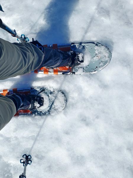
2026-02-02 I had a dentist appointment in Mammoth today, so afterwards I parked out east of Hwy 395 and started walking around the buttress of a ridge. I was able to mostly stay out of the snow - mostly. As I came around to the south there was a more abrupt edge between a steep loose slope and the snow. I put on snowshoes and splotted around the rest of the buttress crossing up and over a short rocky section. Then down and across a flat valley to the base of my objective. There I left the snowshoes and headed up the steep slope. It was pretty slow going but eventually I got to the top of the ridge, unfortunately there was a lot of snow up there. I plodded and postholed and weaved my way up to what seemed to be the highpoint of Peak 8152 (according to my eyes and PB) and then headed back. Once I started down the slope it was a lot faster. Then it was back to snowshoeing around. I kept the snowshoes on longer and then a bit of tiptoeing around the snow back to the truck. The sun had set behind the mountains by now and I was pretty exhausted and hungry. At least my face was no longer numb.
snowshoes - not the easiest way to travel, but it beats postholing
 |
view down from near the top of the peak
 |
snowshoe tracks
 |
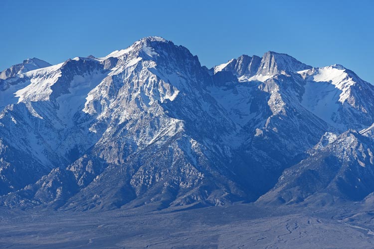
Mount Morrison in the distance
 |
My Strava page for hiking plus snowshoe to Pk 8152. 02-02-2026
2026-02-03. I needed some more peaks for the next few days so after a busy morning at home I threw my bike on the back of the truck and drove down to Independence and then across the valley and up Mazourka Canyon Road. This was a slow washboarded or rocky affair with a bit of a center berm at times. It was pretty slow going. I think it was over an hour to get up to a nice parking place for the night - a little longer walk, but I wouldn't have to drive again for a bit. I headed across the flat towards my goal as the sun set behind the Sierra across the Owens Valley. It was a short power hike up to the summit of Pk 6942. I descended slightly to the north past some mining activity - or at least prospecting. That night I took some night photos and finished a book.
panorama across the valley from peak 6942
 |
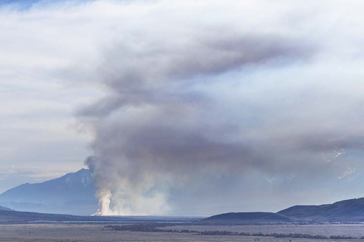
better view towards Peak 6965 from 6942 - the haze down below is from a controlled burn
 |
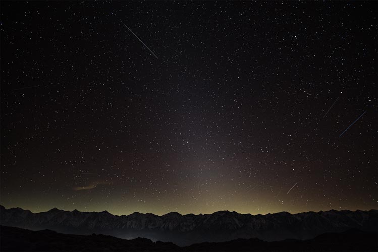
looking across the valley at night before the moon came up
I can see at least 40 satellites in the full res pic
 |
looking across the valley at night after the moon came up
 |
My Strava page for hiking to Pk 6942. 02-03-2026
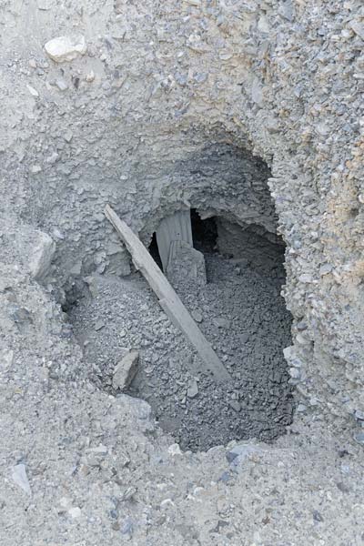
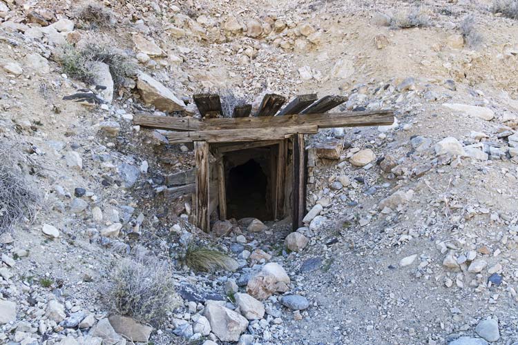
2026-02-04 I headed south from my camping spot in the morning and quickly made my way up Peak 6965. The views from up here poking a little out from the main bulk of the Inyos was quite nice. I relaxed a bit and signed the register. It had more action than I would have guessed based on it's status as a little brown bump, but maybe it is prominent from below, and it is a short easy walk. I headed back down and then bumped my way back down Mazourka Rd stopping at a few mining spots to check them out. There were a few vertical shafts starting in the gravel - a scary thing to get close to, and one horizontal tunnel. No gold that I could see though. Then back home. Evidently I didn't need the bicycle.
panorama across the valley at the Sierra at sunrise
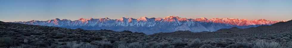 |
cropped in on the panorama above from maybe Kearsarge Pk to Colosseum Mountain
 |
Mount Williamson and Mount Tyndall across the valley
 |
an uninviting mining shaft
 |
a more inviting mining tunnel entrance
 |
My Strava page for hiking to Pk 6965. 02-04-2026
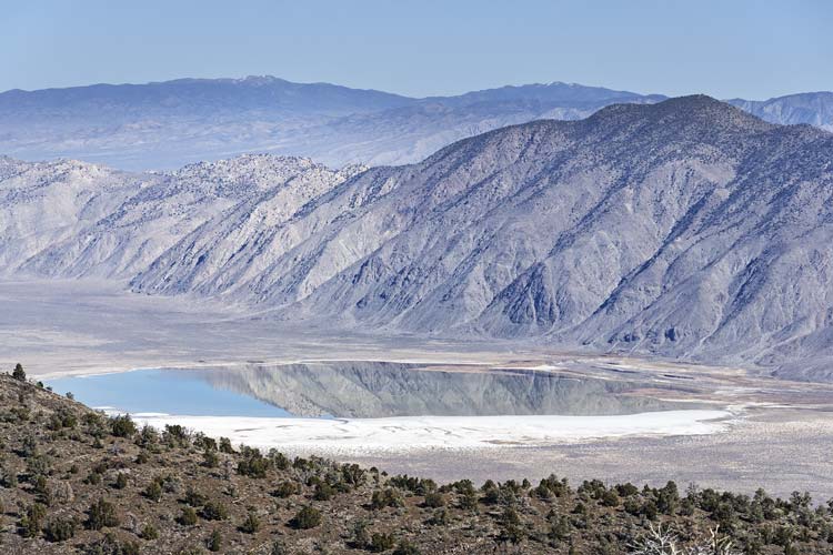
2026-02-05 I drove up 168 almost to Westgard pass and parked just off the road. I might have been able to drive up the dirt road a bit closer to my peak, but I just loaded up the bicycle and rode that. Probably a wise decision as there were snow patches almost immediately and a bit of mud. I could mostly ride up with a stop to break a bunch of branches off a downed tree and a few snowy patches I had to walk. The road leveled out a bit after a mile or so and even went downhill a bit, especially as I got closer. I left the bike off the side of the road with my half empty orange juice bottle buried in the snow and set off on foot. It was under 1/2 a mile and a few hundred feet of gain up to the summit of Peak 7900. The north side had some snow but the west side was mostly clear. I didn't find a register, but did find a flat spot to sit down to eat my sandwich and enjoy the views. To the West and South were the Owens Valley and the Sierra with smoke from a controlled burn (I think) rising up behind the flank of the Inyo Mountains. To the east was Deep Springs Valley which had a lake at the low point with mountains reflected in it.
ephemeral lake in Deep Springs Valley
 |
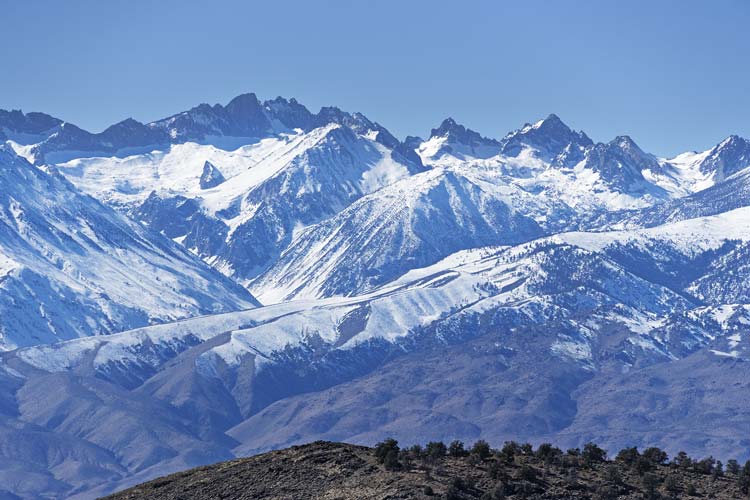
Palisade Range across the Owens Valley
 |
Deep Springs Valley from near the summit
 |
I deployed my poles for the descent which was probably wise as a few sliding rocks tried to betray me. Then I biked back - the uphill part wasn't very fast, but the downhill went quickly and soon I was back at the truck to pack up and put the bike on the rack and drive back to Bishop.
smoke from a controlled burn in the Owens Valley
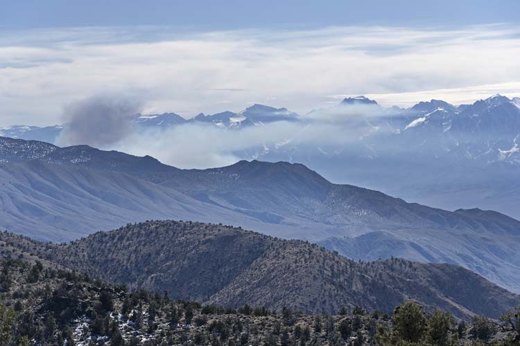 |
better view of smoke from a controlled burn down the Owens Valley
 |
My Strava page for mountain biking towards Pk 7900. 01-05-2026
My Strava page for hiking to Pk 7900. 02-05-2026
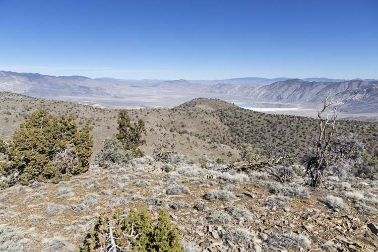
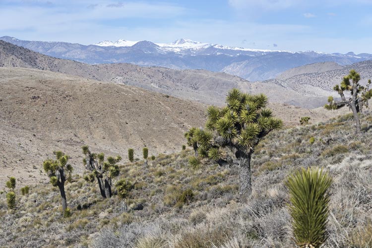
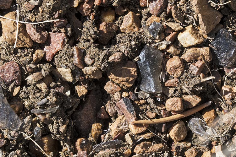
2026-02-07 Another day, another peak. I headed back to the Death Valley road and cut south over the ridge on an old closed road. I left the road and dropped down across a valley and up the far side to a false summit. I dropped down across a saddle and up to the 7848 ft summit of the ridge. I sat on some nice rocks and ate a sandwich before continuing east to a PB point at the end of it. This had nice views down into the valley towards Eureka Dunes. On the way back I found a circle of rocks that Bob had mentioned in his trip report. The ground in this area was covered with obsidian chips suggesting it was a popular place for knapping. On the return I skipped the first false summit but had to dodge some steeper ground on the descent. The weather was quite pleasant for the hike with sun and a cool breeze. It was probably quite warm for early February though.
Joshua trees with a distant White Mountain
 |
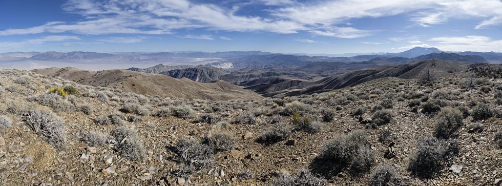
panorama out over the Eureka Valley and the Inyo Mountains
 |
obsidian chips on the ground
 |
My Strava page for hiking to Pk 7848. 02-07-2026
2026-02-10 On the drive down south for the next trip I stopped off just south of the 395/14 junction to climb a peak. I drove in on the aqueduct road and parked. The aqueduct is underground here, but the road is decent. It was quite windy with off and on rain sprinkles so I wore a raincoat over my camera. I headed up the ridge and veered to the N side to avoid the worst of the wind. Not necessarily the easiest footing, but not getting blasted was worth it. Up on the 4378 ft top I grabbed the summit register to move a little out of the wind to read and sign it before starting down. The descent went a lot quicker with downhill travel plus the wind partly from my back. Despite the sprinkly rain I remained mostly dry because the wind dried me as fast as the rain got me wet.
view out towards Ridgecrest from near the top of Peak 4378
 |
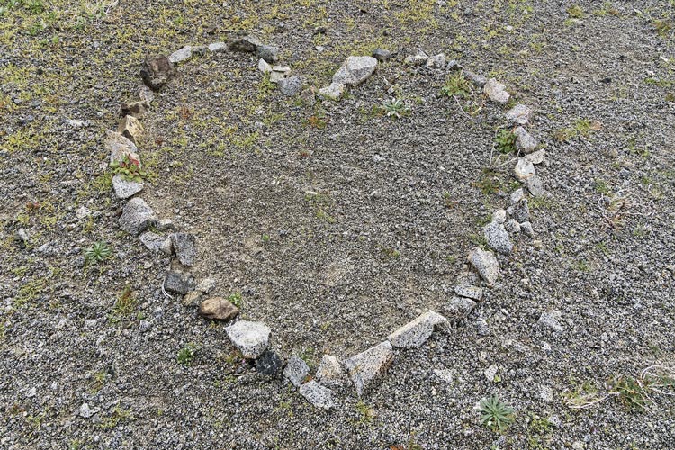
heart rocks on top of Peak 4378
 |
My Strava page for hiking to Pk 4378. 02-10-2026
I came back to Bishop in the midst of a snowstorm which continued a bit the next day and then stayed cold for a few days. Once I shoveled out my solar (hot water which probably would have self cleared) and photovoltaic which would have taken at least another day or 2) things were a little better inside. It stayed cold for a while and then in the course of about 24 hours it went from snow on the ground and quite chilly inside and out to no snow and 75 outside and sunny which meant that opening up doors and windows warmed things up considerably not to mention plenty of solar hot water for floor heating.
2026-2-26 Another day that I need a peak - the last one for February. Iris was here, so we worked around her work schedule lining up times she could take calls with cell reception. We got up early and drove down to Lone Pine where she took one call. Then up to the Alabama Hills where we parked and walked down a gated dirt road that gradually disappeared. This probably wasn't the shortest way to the peak, or maybe the fastest, but it looked like not a lot of weird boulder scrambling to get there. There were a few places where I tried to get up to the ridge but the boulders suggested I stay on the S side. This mostly worked and we went up over a false summit and up to the actual summit of Peak 4349 which required climbing up to the top of a boulder. It was pretty windy up top so we went down to an easier seat on a rock to have a snack and enjoy the views before heading down.
On the descent we followed what looked like a good way down but we ended up having to do a bit of downclimbing to return to our path up. Iris had another work call on the hike back so I spent some time scoping out some decent looking climbs. Then we headed back to Bishop before the next call.
Mount Whitney far above
 |
link to Strava page for Peak 4749. 02-26-2026
2026-2-27 I didn't need a peak, but I wanted to climb Tungsten Peak in February and there weren't many days left. We got up early again and drove to the trailhead. Iris was on a work call so I started up without her. I tried to push the pace - not running, but not taking it easy. I managed to get up in under 30 minutes, so I was pleased with that. I wasn't able to catch up to the trail runners, but I probably wasn't much slower than them on the way up. Then I headed back down meeting Iris 3/4 of the way down and went back up and down with her. I wasn't huffing and puffing as much the second time, but it felt warmer. We also went over to the PB marked summit (that probably is higher but doesn't have a benchmark). We took a sandier descent path.
2026-02-28 Iris needed a peak, so we planned on one I had already done - with a bonus not enough prominence dot on the way. I planned to bike much of the way, but it turned out to be snowier than I expected, so we only bike a bit and walked the rest. The walking was a bit more than I wanted, but it was ok, and on the return we managed to stick to the south slopes a bit more and thus had less snow.
link to my Strava page for bike and mostly hike to a S white mtns bump. 02-28-2026
No material on this page may be copied or used without permission.