Tom Grundy's 2026 USARA Nationals Page
The 2026 United States Adventure Racing Association (USARA) national championship was to be held in Oregon - put on by Jason and Darren among others. I wasn't planning on attending, but when Andrew dropped out of Tower Racing and Jameson asked me back in July, I said yes. Theoretically this left me with plenty of time to train, but first the Sierra Challenge and then the Salmon River trip. Then I could actually get down to it, and boy did I need to. My first jog was a pathetic painful slow shuffle. I alternated jogging and mountain biking and over about 2 months actually got into better shape. I think this helped come race time, but nothing I could do would really prepare me for the enormity of the full race course.
I headed up towards Oregon early the 21st getting to the Diamond Lake Resort that evening. I saw a few friends and packed a bit of gear and tried to get a lot of sleep that evening. Jameson and Kellee were planning on making it up that evening but stopped in Klamath Falls with a busted thermostat in their car.
2026-10-22 I got up and after eating a bit worked on my food and gear a bit more and then spent some time geeking out on the info they had sent us in the pre-race letters. Since there was no internet here and my cell service was only rarely able to even get a text out I wasn't able to look up as much as I would have liked. Fortunately I had saved all the letters on my laptop. Jameson and Kellee got a loaner car from the dealership that would fix their car under warrantee. It didn't have a hitch for the bike rack so they had to really tetris their gear in. Ari drove down from Bend and the team was together. Kellee made a huge pile of peanut butter and jelly sandwiches and we put together our paddle bags and started loading our gear bin and so on. There was a pre-race meeting where we briefly saw the flythrough and got a little more info and then we had to get our gear bins and boat bags and emergency cold weather gear bag together and drop them off. Then we tried to bank as much sleep as possible.
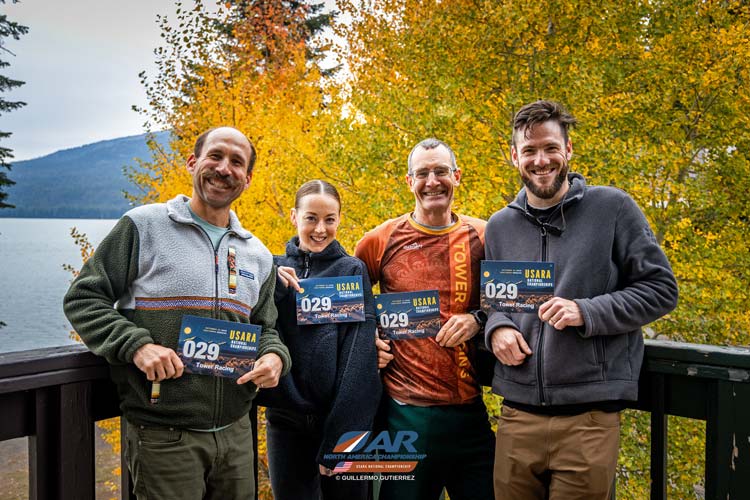
Tower Racing, Jameson, Kellee, Tom, and Ari (Guillermo Gutierrez photo)
 |
A note on the scoring for this race. The team with the highest point score wins and in the case of a tie the faster team is ahead. Going to the TA (Transition Areas) via the designated means of travel (bike, foot, and packraft) and getting at least one point between each TA was required for full ranking. Beyond that all points were optional with 5 points for each regular Checkpoint (CP) and 3 points for pro CPs (Pro Points) and 1 point for Orienteering course points (O points). At the checkpoints there were little flags hanging (sort of like 3 sided white and orange lampshades) with punches that had specific pattern of pins. We had to punch our passport in the correct space to prove we had found and visited the CP. We were hoping to be able to get every point along the course, also known as clearing the full course. There were plenty of other rules about where you weren't allowed to go (mostly busy paved roads) and having to get certain points in the correct order or via the designated travel mode not to mention not being allowed to use GPS or other maps and so on, but mostly you just try to get as many points as fast as you can.
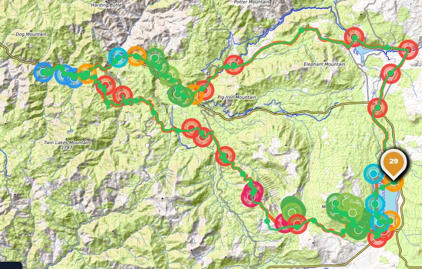
overview map - our path is green, the start and finish are where the 29 is
red checkpoints are biking, transition areas are yellow, blue is boating, and green is foot travel
 |
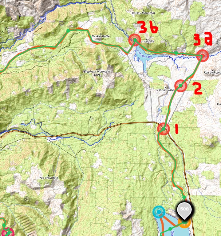
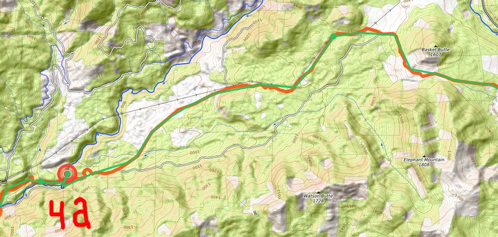
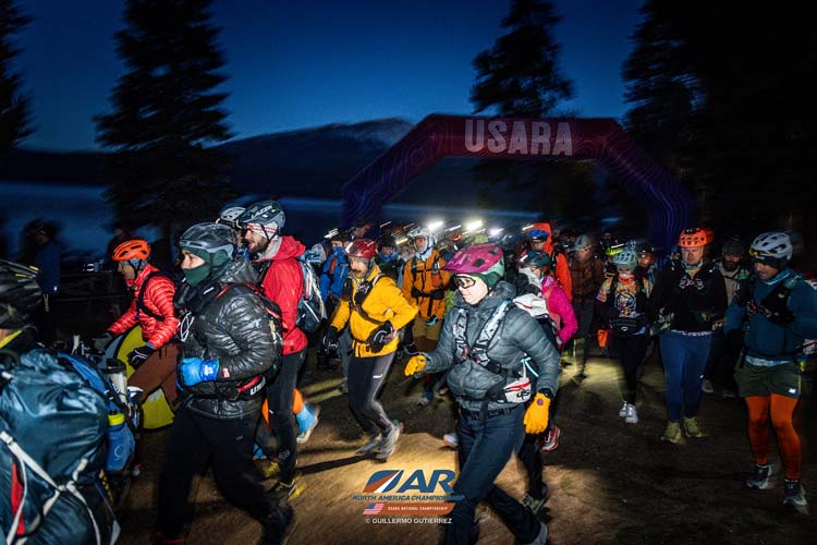
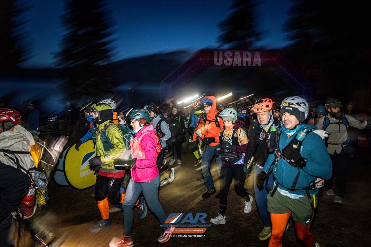
2026-10-23 RACE START DAY! We got up at 5 and got our stuff together. I tried for a while before managing (I think) to get a text out before shutting off my phone. We dropped off our bikes near the start. Then at 6 we got our maps and started poring over them. I tried to get my spot tracker to start but had no luck so I sent it back to the room with Kellee. Then we headed out to the starting chute. It was about 24 degrees at the time I heard. It was cold enough that there was ice on top of my truck that morning. After singing the national anthem and a few words of encouragement, we started just before 7 am with a jog to the bikes. We got on and headed a bit south before getting onto the road north. Soon we were on a gravel road and the clip popped off of Ari's map board and he stopped to grab it. Jameson was right behind him and he went down. I was right behind Jameson but fortunately the direction he fell was not the direction I dodged. There were heaps of teams streaming by as Jameson took a few breaths to collect himself before we headed on. Soon we were bombing downhill and it was cold. We all had pretty warm gloves on, but a few random finger tips on my hands got cold. We passed 2 CPs which gave us a brief reprieve and eventually I pulled out my gore-tex cloth mittens and put them on over my gloves - that helped and soon my fingers were fine but my toes were getting cold. Then we turned off onto some singletrack and more effort was required and the speed dropped and we were able to warm up again. Along this stretch you were required to follow the trail - they had CP3a at the start and CP3b at the end to keep you in line.. Also we were at least occasionally in the sun although we were mostly under trees. Back on the roads we were able to grab sandwiches out of each other's packs and pass them around. I also had one of my bike bottle full of 4-hour fuel. Then we got to a bike drop where we left our bikes and walked up to the Umpqua hot springs and CP4a. There one of us had to get into the water for a minute. Ari had volunteered but by the time we got there his toes were frozen enough he feared they would not be happy, so I stripped off my bottom half and lifted my top clothes and submerged up above my belly button (the requirement). It did indeed cause a burning sensation in my toes, but it also warmed them. After the minute was up I got a little dried and dressed as fast as I could before we headed back to the bikes and down more singletrack past CP4b to TA1.
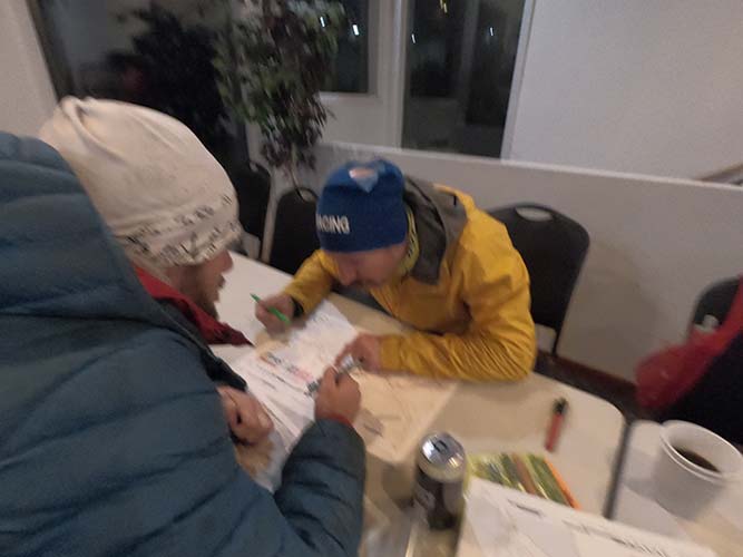
plotting our race on the maps
 |
start map - biking - note map scales are not all the same
 |
map 2
 |
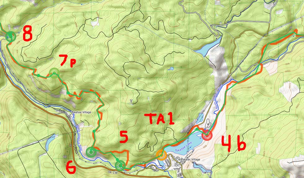
map 3
 |
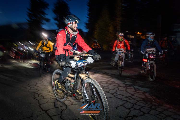
Ari and Jameson in red and yellow left of center just after the start (Guillermo Gutierrez photo)
 |
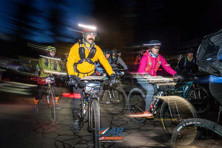
Tom and Kellee in green and pink a moment later (Guillermo Gutierrez photo)
 |
Ari on the bike with Jameson behind him (Guillermo Gutierrez photo)
 |
Jameson and Kellee start riding while I get my gloves back on (Guillermo Gutierrez photo)
 |
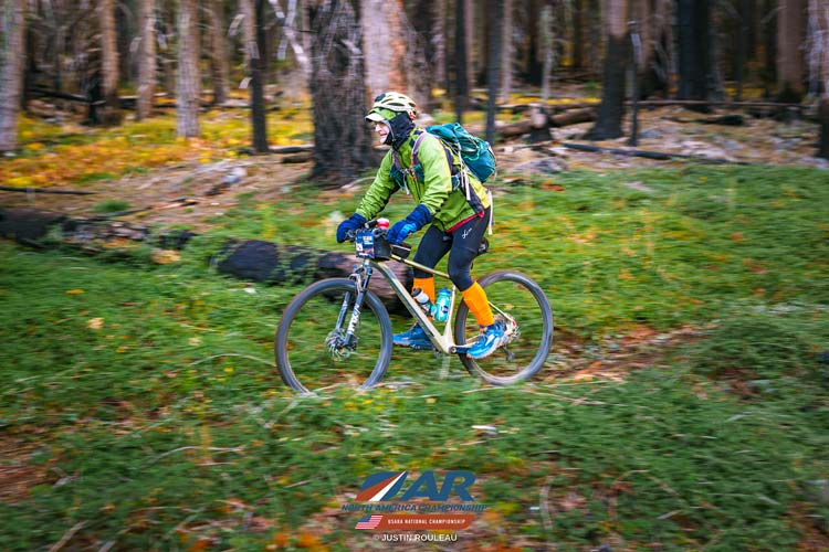
I ride my bike somewhere between CP3a and CP3b (Justin Ruleau photo)
 |
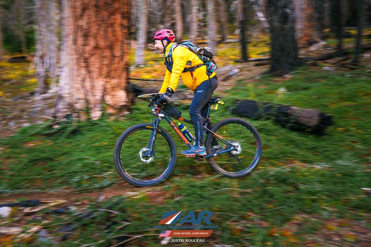
Jameson on the bike (Justin Ruleau photo)
 |
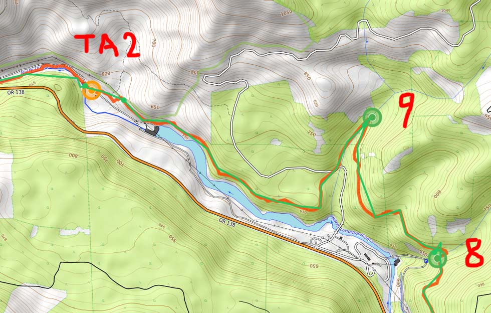
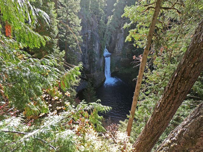
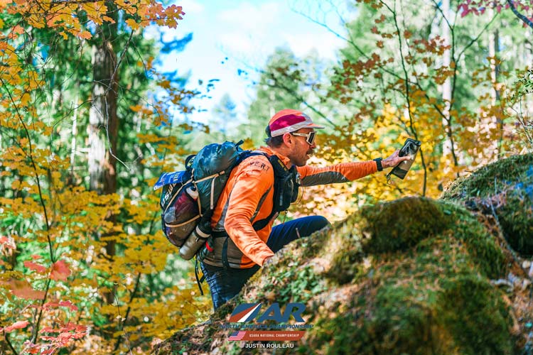
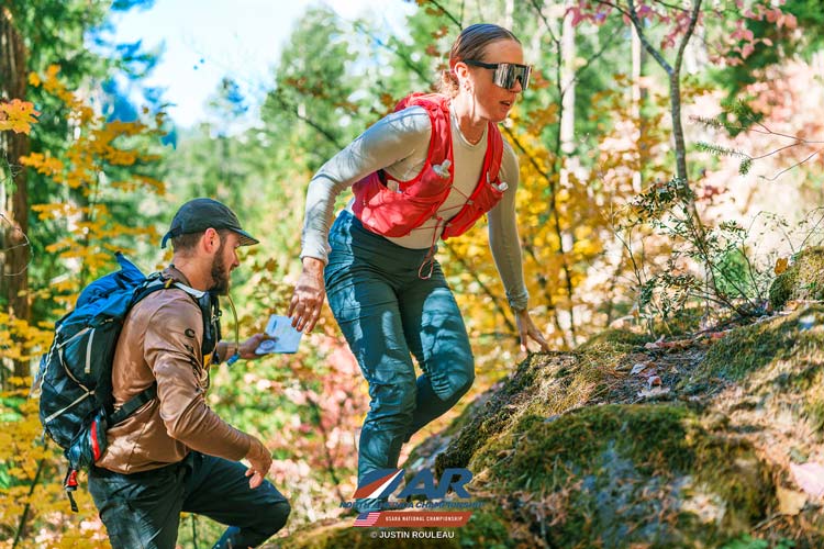
At TA1 (Transition Area) we left our bikes and set off on foot. I was the last one ready because I was putting gaiters on. First via the road and good trail to CP5 at the Toketee Falls lookout and then backtracked a bit and started bushwhacking up the steep slope and eventually to another trail. We followed this trail downriver with a few deviations to get to CP6, 7pro, 8, and 9. The last 2 required heading up or down a drainage. I think we had mountain biked this section in the snowpocalypse 2022 Expedition Oregon. This section (and the earlier mountain biking) were quite scenic with lots of yellow and a little orange and red foliage. TA2 was in the same place too - at the power plant water outfall on the N Umpqua River with most excellent columnar basalt. We changed into paddling gear, stowed most of our stuff in the boats and inflated them. Then we manhandled the boats down to the water - tempered them (added more air as the air in them contracted from the cold) and cast off down the river.
map 3 (repeated)
| |
map 4
 |
Toketee Falls from the overlook
 |
Jameson leaving the trail to bushwhack up the slope (Justin Ruleau photo)
 |
Ari and Kellee head up the slope (Justin Ruleau photo)
 |
Ari had guided this river in the past, so he was lead navigator in the back of my boat and I was in the front. Jameson and Kellee were following. We made pretty good work of the river and it was a lot of fun even though sometimes the visibility was very bad facing into the sun. It wasn't very bright when we put in so I was just wearing my glasses instead of my polarized sunglasses. I regretted that when we were facing into the sun, but luckily being in the front I didn't really have to navigate. We did hit a few sleeper rocks hiding in waves, but they were mostly rounded and covered with waterplants so it wasn't too traumatic unlike one of the other teams that sliced their floor. We pulled over for CP10 (a manned CP) along the paddle and then continued down passing a few teams. We managed to mostly style the rapids and made it down to the takeout at CP11pro. I think we did the paddling in about 1:35. There we deflated the boats and put them in 2 bigger packs we brought for the occasion and bushwhacked up to the trail which we followed for a short but tiring km or so to where we were able to drop the boating gear. I was carrying the gust pack with a lot in and on it and the bushwhacking was not so easy. Once we hit the trail it was better.
map 5 "BD" is where we dropped off our boats
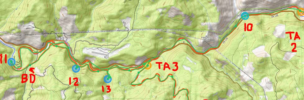 |
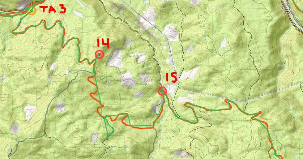
It was a relief to drop the debilitating weight and bulk of the boating gear and just have the relatively light packs. We headed up the trail eating more PB&J sandwiches with a detour up a crappy burned slope to CP12pro and then up a very wood choked drainage to CP13pro. The rocks here were slippery and more than one foot slipped in, but I managed to keep my feet dry here. It was getting dark at this point and we refilled some water and pulled out our headlamps. The rest of the trail to a road and TA3 were uneventful. At TA3 we had to find our bin and bikes and we were given maps for more of the race. I added a few more warm layers and trekking poles to my pack and more food. I also got my bigger headlamp and bike light and a spare red blinker as I correctly guessed the one I had would run out of power. Ari was plotting our next course with help from Jameson. What we should have done was really looked at the maps and elevation gain and bikewhacking and decided how much we needed to skip and how to get the most points with the time we had left (nearly 20 hours).
map 6
 |
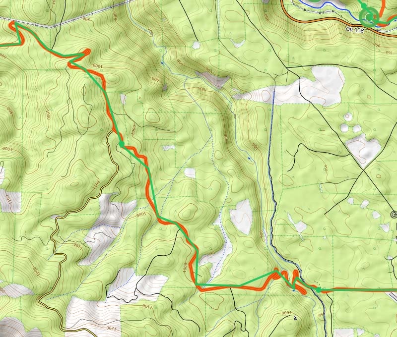
map 7
 |
map 8
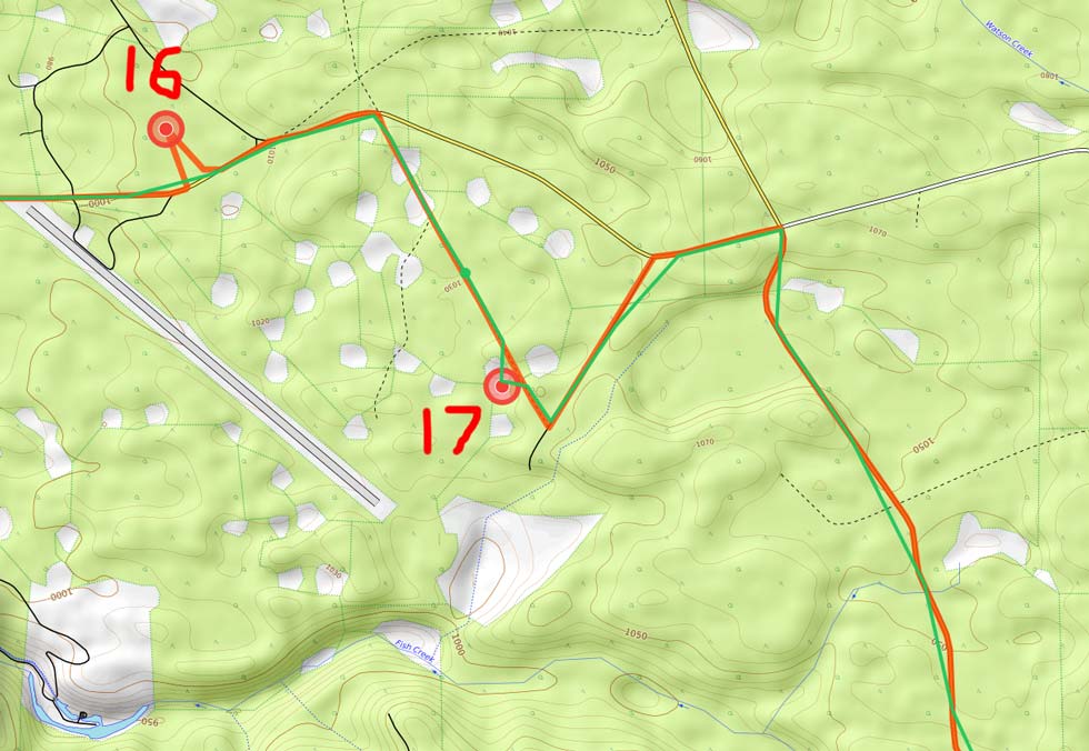 |
The first bike was mostly downhill, this bike would be mostly uphill - with long downhills thrown in to freeze us and so we could go up even more. We started off with the "quads of steel" section. Basically a long grind gaining ~ 2000 feet over 5 miles. It was low enough angle to ride it and we just ground our way up and up and up. Someone had parked their trailer in the spur to CP14 and multiple teams had already taken out their starlink as they had the cable running across the road. The guy was out directing people around it - it was going to be a long night for him. Then back to the road and a little more up before we put on some layers and bombed down the hill with one mistake where we turned up the wrong road and gained some elevation (and warmed up) (there was a road on the map that didn't exist or we didn't see it that led to the wrong turn). Once we turned around it didn't take long to drop back onto course and continue down to CP15 (which we barely went past before backtracking). We lost about 1500 feet in this section and then gained another 1500 as we ground our way up again. I'm not sure if it was steeper through here or we were more tired but we stopped to walk a few sections. It wasn't much slower and it was nice to change things up. There were a number of teams congregated near CP16 - bonus - easier to find, downside - a bit of a crowd. It was also just about midnight now. We successfully got the point and left ahead of the rest and managed to find and tag CP17 and move on before any caught up. At this point things were a little more level to CP18.
map 9
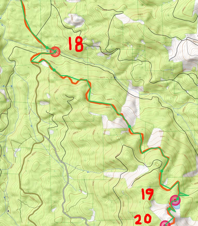 |
After CP 18 we headed off the bigger road by a gravel quarry and headed up again. This is probably where we should have opted to skip some points, but we didn't. The road didn't seem to be heading exactly the direction on the map but otherwise lined up with what we expected. We went up and up and up with walking breaks from time to time. Then we had to do a bit of bikewhacking to get to CP19pro. We started up and were met with a team heading down saying it was downed trees and bad. We sadly let them convince us and went down the road a bit before deciding we were in the right place all along. We went back and another team (Cosmic Confusion) was just showing up. This time we were in the lead and indeed did find plenty of downed trees, but you could avoid most of them and there was a pretty obvious trail. We continued up over a ridge and dropped down to Skookum Lake and a most impressive rope swing at CP19pro. I took a short swing and then Ari saw a higher launch point. Jameson, Ari, and I all launched off the high point at least once (ok, maybe twice). There was an even higher launch point up a tree, but we didn't try that one. Then we continued around the lake and got some water here. It was a little mucky and algae-ish so we didn't completely fill up - a serious tactical mistake.
map 10 - we tried to get water at the little spur south of CP24
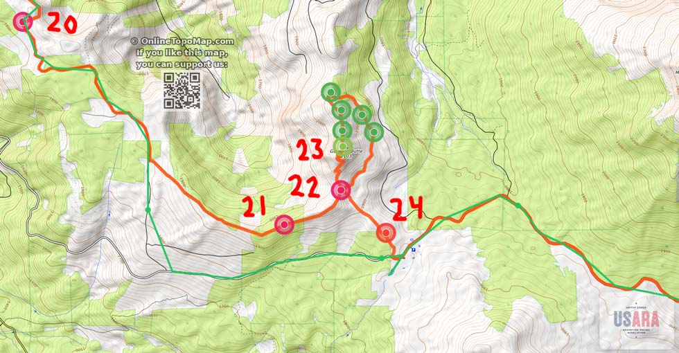 |
From the lake we followed a sometimes rideable trail up to CP20pro. At that point we realized we probably needed to skip going directly to more pro points and the Garwood Butte O course and head for the next (and last) water for a while. We did that and found it, but it was a scummy frozen over lake. I managed to find a spot with broken ice and carefully fill my befree and filter one bottle worth but the others were uninspired. It was sort of gross water, but it was water. We looked around for any better options with no luck and then sadly headed off towards TA4/5. We should have just sucked it up and got water here even though it probably would have taken much of the life out of our filters.
map 11
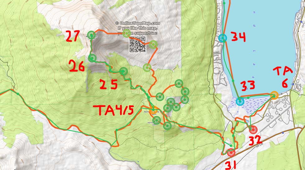 |
By heading to TA4/5 we were skipping 3 pro points (probably smart to skip even if one was an actual peak that the peakbagger in me would have liked to visit), 5 O points (probably also smart to skip, although some of them were along a rugged ridge, so I probably would have enjoyed doing them), and one regular CP #24 that we probably should have gone to. We got to TA4/5 around 6:45 while it was still dark although there was a hint of light in the sky to the east. We went inside where it was warmer and got some hot chocolate and warm expedition mash (supplied by the race) and tried to get water. They were adamant that they didn't have enough. One possibility was to drop down over 800 feet to some springs/stream and then head back up or continue on from there skipping all of Mount Bailey. Not a very attractive option. At this point if we did that our score would be low enough that we were willing to take a massive penalty to at least do more of the race even if we wouldn't place well. At least it was light outside the hut when we went out and Jason pulled up and we pressed our case to him - not only was he in favor of us doing more of the cool parts of the race, but he had water - so we got a gallon. We didn't know how that would effect our score, but at least we were back in business. We quickly hydrated up and started off up towards Mount Bailey. We weren't going all that quickly, but we were on a trail and we were moving again with a plan (climb Mt Bailey and then get as many more points on the way to the finish line before the 3 pm time cutoff).
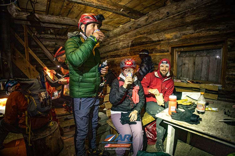
Jameson eating some expedition mash in the TA4/5 cabin (Guillermo Gutierrez photo)
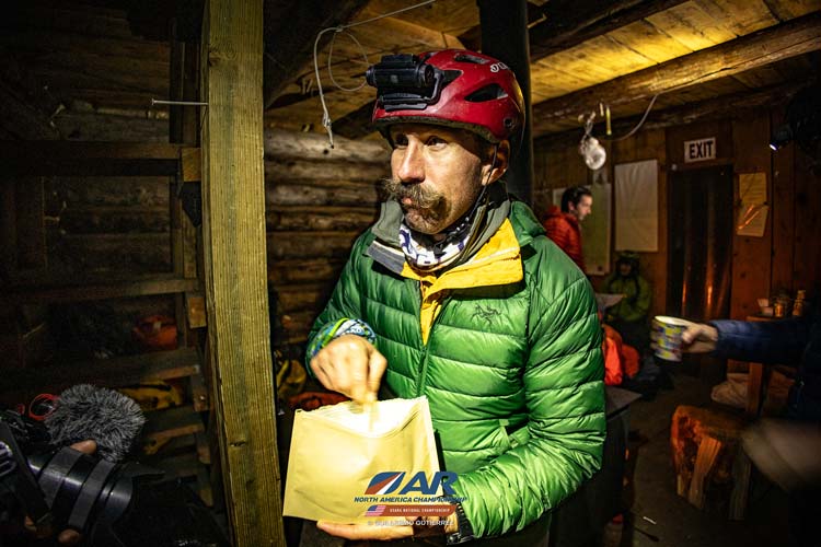 |
Jameson, Kellee, and Ari in the TA4/5 cabin (Guillermo Gutierrez photo)
 |
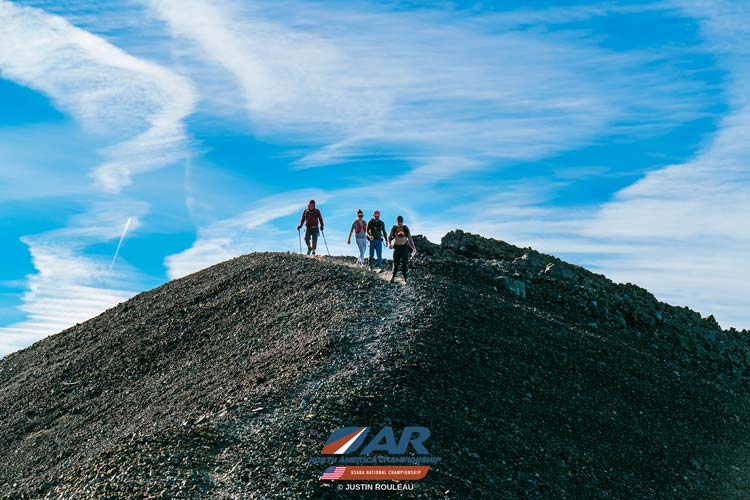
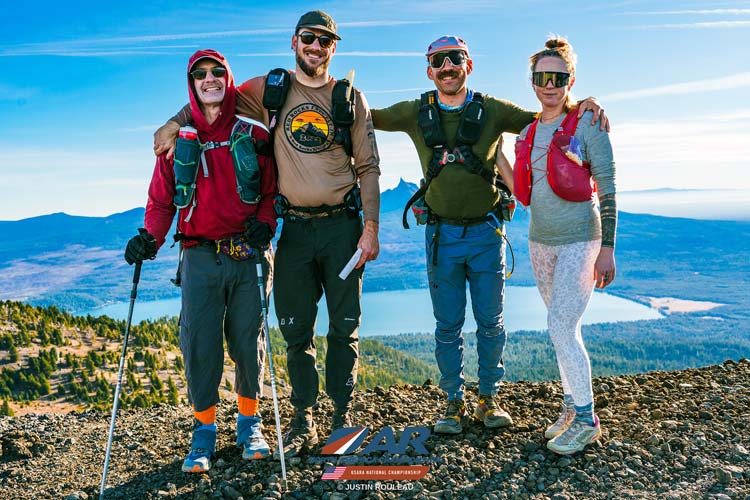
We collected CP 25 and 26 on the way up to the CP27 at the summit. Also passing a photographer (Justin) who took some pics of us. There was also a CP here in Expedition Oregon 2022 , but we actually went to a sub peak in a blizzard, so it was a bit of unfinished business for me to get up here, plus really awesome views this time. We did not linger on the summit and headed back down almost immediately as it was now almost 10 and we only had 5 hours left. We made better time back to the hut but not as fast as we would have if we were fresh. I could go down the crappy loose part a lot faster, especially as I had poles, but otherwise couldn't really push the pace much. We were surprised how many teams were still heading up while we went down. I am guessing these teams would be biking to the finish line instead of paddling.
coming over a false summit on the way up Mt Bailey (Justin Ruleau photo)
 |
team on the way up Mt Bailey (Justin Ruleau photo)
 |
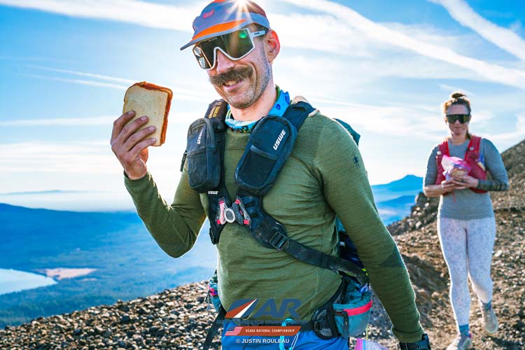
we were definitely powered by PB&J sandwiches (Justin Ruleau photo)
 |
Jameson punches the CP on top of Bailey
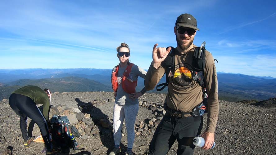 |
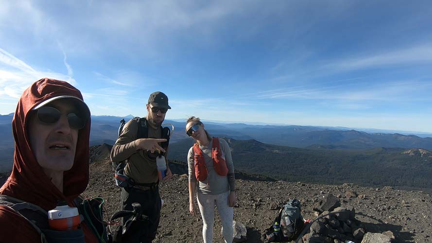
On top of Bailey
 |
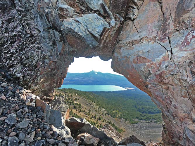
view through the rock window towards Mt Thielsen
 |
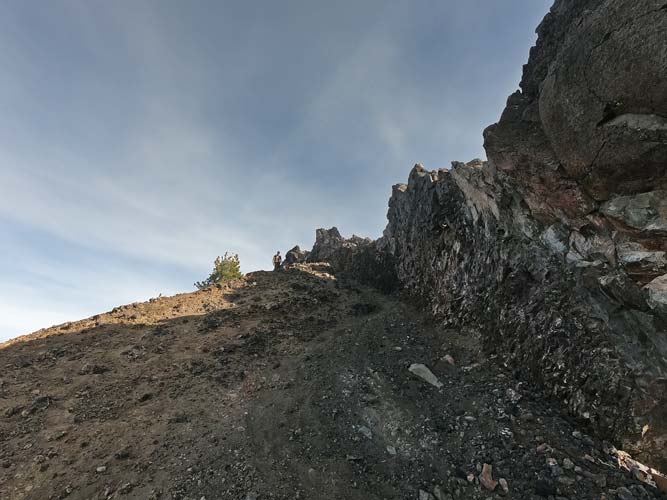
looking back up the slope as Ari comes into view
 |
Back at the hut we quickly repacked for biking and took advantage of the outhouse and then set off on a nice downhill singletrack. At first Ari and Jameson just bombed down the first steep rocky drop leaving Kellee behind, but then they slowed down a little and we all kept up zipping down the trail to the lower angle trails below. We took one wrong turn which judging from the tracks lots and lots of other teams did too. Fortunately it dead ended and it was a short bit to recover our mistake. Then we got to some springs at the start of a creek and collected and drank a fair bit of water (I was feeling a little nauseous at this point so confined my drinking to a lot of smaller sips). It took a bit of time to find CP31 as there was a T in the streams that lined up better than the T in the drainages - we should have looked at the large scale orientation though. We found it and continued on by bike to CP32 and then along a paved bike path to TA6 on the edge of Diamond Lake.
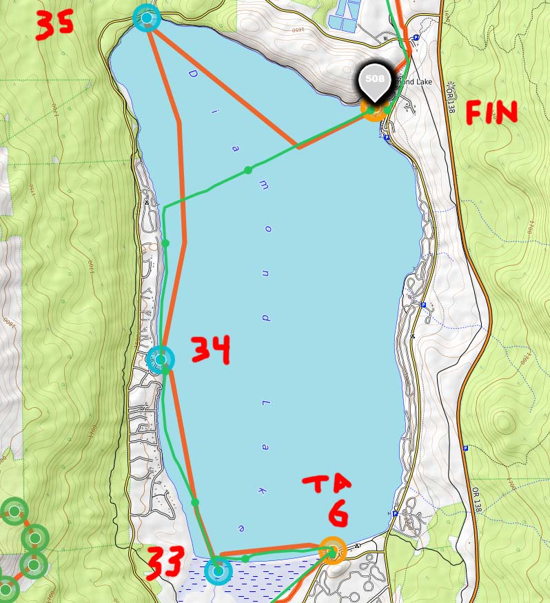
At TA6 we transitioned back to boats putting the skegs into our packrafts (skegs are little fins in the back that help the boats track in a straight line). We also attached the boats together with 2 little tow lines. I wore my drysuit as we figured at least one of the CPs would require splotching through a swamp. Then we cast off with Jameson steering the front boat with me and Ari and Kellee in the back boat. We headed off towards the creek flowing into the lake and CP 33 a little up the creek. We almost caught a team ahead of us here, but they were leaving the creek as we entered it. They had lost a skeg and had a longer tow rope so their boats weren't tracking nearly as well. We managed to pass them just before CP34 at the dock on the west side and then headed on towards the NW corner of the lake and CP35. We were doing mental calculations as we headed north and at some point realized we would be unlikely to get CP 35 and get to the finish line in time. Finishing a few minutes late would be ok, but losing one point per minute after the cutoff meant that getting there 5 minutes late would negate any benefit of reaching 35 and any later and our score would be lower. We turned straight towards the finish line here. There were a number of other teams heading to the finish line after reaching CP35 and they were mostly a little ahead of us. We were hoping to catch them, but at least I had been paddling pretty hard the whole time and it looked like the teams we were close to had some more energy to paddle harder as we got close.
map 9
 |
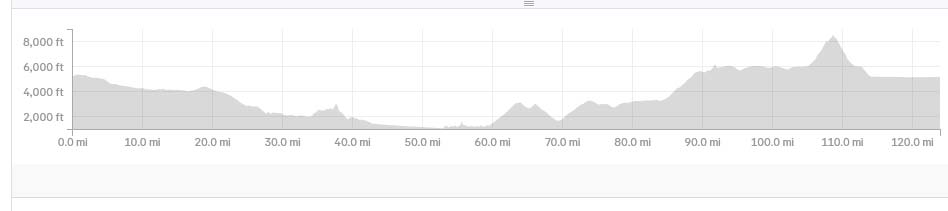
We hit the beach and I tried to make a fast clean exit, but not everyone got the memo and I also slipped in the sand. I guess I should have just jumped out and punched the finish CP but thought we needed to get the team and boats through the finish arch. I should find out what actually matters for any future races. In any case after going through the arch I punched the finish CP. Then we moved our boats aside and showed them our watches were still in AR mode (so it wouldn't let us see any GPS data for the duration of the race). Over the about 31 hours and 25 minutes we covered some 116-120 miles and gained 16-18000+ feet of elevation. Probably about 20 miles each were on foot and paddling and the rest were via bike.
race profile (from Jameson's Strava)
 |
It looks like our final total was 133 points (out of a total of 175) and total time of 31:24:53 . That was good enough for 11th place in mixed and 14th overall out of a total of 31 teams in mixed division and 48 overall. We probably could have ended up in the top 10 with a bit smarter racing or if there was better water at the last spot we tried to get it before TA4/5, but I'm sure other teams could have done better if conditions were different or they had made various different choices too. All in all I wasn't particularly pleased with our final position as we could have done a bit better, but in general we raced well and kept moving except for the bit with the water and when we made mistakes we recovered and got back on course without much drama, so I am pleased with how we worked as a team and so on, which is more important anyway. Plus we had heaps of PB&J sandwiches with the perfect amount of strawberry jam.
youtube video of race flyover
heavy metal cut video of race (Jason had previously complained about heavy metal soundtracks to AR videos, so this was a response to that)
facebook reel from day 1 of the race
facebook reel from the race, some is duplicate of day 1 reel
google drive with .pdf files of the race maps
smugmug account with pics from the race
Chelsey wrote a blog post about her race
My strava page for 2026 USARA Nationals total distance 116.4 mi and 16,329 ft of gain
Jameson's strava page for 2026 USARA Nationals his total was 124 miles and 18,885 ft of gain. I suspect he did get a bit more than me, but not that much.
No material on this page may be copied or used without permission.