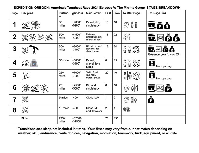
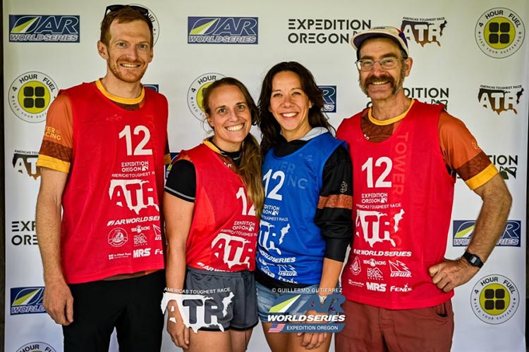
I wasn't planning on doing Expedition Oregon in 2024, but that didn't seem to matter. The race started Sunday the 8th, although check in and other things started earlier. I saw a post that a team needed someone on Wednesday, and would have been interested except my knee was still hurting a bit from the Sierra Challenge. Late Thursday afternoon I checked my phone and saw Jason had called - so I called him back. Evidently it was Tower Racing that needed someone and Jason sweet talked me into joining up. So I immediately started throwing the things I thought I would need into a pile in the floor. I also checked into the mandatory gear and vaguely looked at the race schematic (how long and what disciplines for each part). I continued packing and plotting Friday morning and by noon I was ready to roll. Highway 395 was closed on the way to Reno, so I detoured out into the desert and up past the aftermath of Burning Man in Nevada. I did stop to pick up some reflectix, a pile of bike tires, a sun shade, and a bin off the side of the road. If I was going the other way I'd have picked up some foam insulation too. I made it well into Oregon before I stopped for the night, but didn't get as much sleep as I would have liked (it was late by the time I stopped). As always it is a bit of a trip down memory lane combined with amazement at some of the development driving through parts of Oregon I spent a lot of time in years ago. The next morning (Saturday) I completed the drive up to Hood River where I met the rest of the team - Andy (who I had raced with before at Expedition Oregon 2021 and the Teton Ogre 2022 race, and Corinne - a YogaSlacker I knew from training and some other events plus I raced with her at the 2015 Bend Adventure Race, and Ella - another last minute addition who had previously been an alternate for another team. At the check in I picked up the bike box and bike from Jason and Darren. The rest of the day was spent sorting gear and food and trying to pack it in bags to go into the correct bins so that I would have what I needed during the race. I got it mostly done that night and had some fitful sleep - I slept fine for a bit, but then started thinking about things I needed to remember and stress about the race.
 |
|---|
 |
|---|
Sun 2024-9-08 I woke up and loaded my stuff into the bins and spent some time figuring out how to put the bike into the bin - including the difficulty of getting a pedal off. Then we dropped off our gear bins and paddle bags. We had to rearrange a bit and take some stuff out of the "B" bin to get it under weight. We should have thrown extra water bottles into our "A" bins to take advantage of the few Kg we had to spare. After that we had a bit of time to relax and move out of the airbnb before it was time to bike to the prologue.
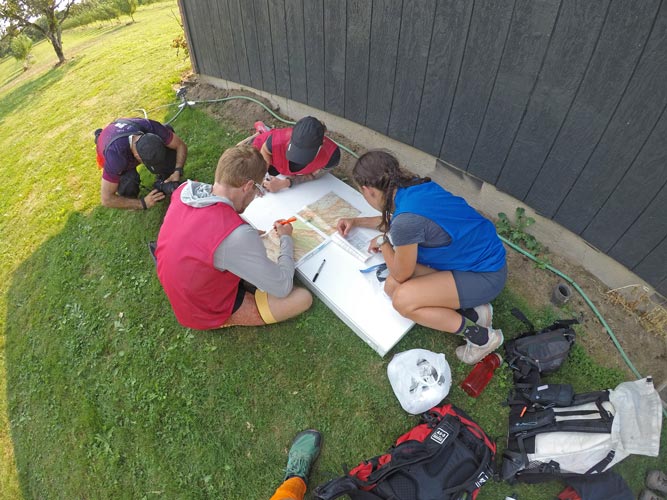
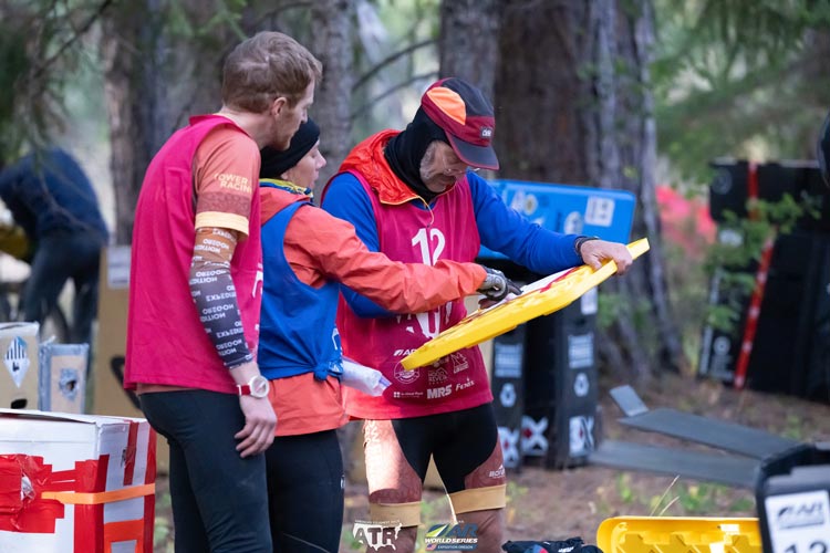
The prologue was held at Pearl's apple orchard a few miles up the road. We got there and relaxed a bit before the prologue started. This involved some competitions (race to find the largest strawberry, an apple hunt, some acro, and a corn hole tournament). I think we tied on the acro one, but they said we came in 2nd. the prize for that was to get to bike ahead at the very beginning which wouldn't have done us much good anyway. We could have used the hot water at TA 4/5 from the cornhole tourney though. Then we got the maps and plotted out our course. This involves a lot of guesswork and attempting to decide which path would be easier taking into account navigation ease, elevation, terrain, etc. We also ate burritos while doing this. Originally we were supposed to start at 18:30 but because everyone was nervous about having to paddle into the notoriously fierce Columbia River Gorge wind they decided on a 17:30 start. We changed our clothes and got ready to go. The start was a "rolling start" where everyone had to stay behind Chelsey for the first few miles to cross some busy roads and avoid racing there. We were somewhere in the middle of the pack. Shortly after everyone was free to go came the first navigational choice. Start uphill steeply and then less steep later or stay low for a while with steep at the end. We opted for the latter in the belief that uphill at the end later would be cooler. We weren't the only ones who opted for this choice although evidently it wasn't the one on the tracking map and probably ended up being slower.
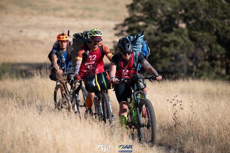
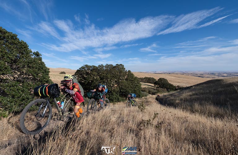
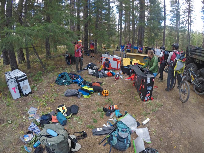
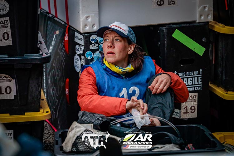
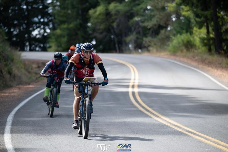
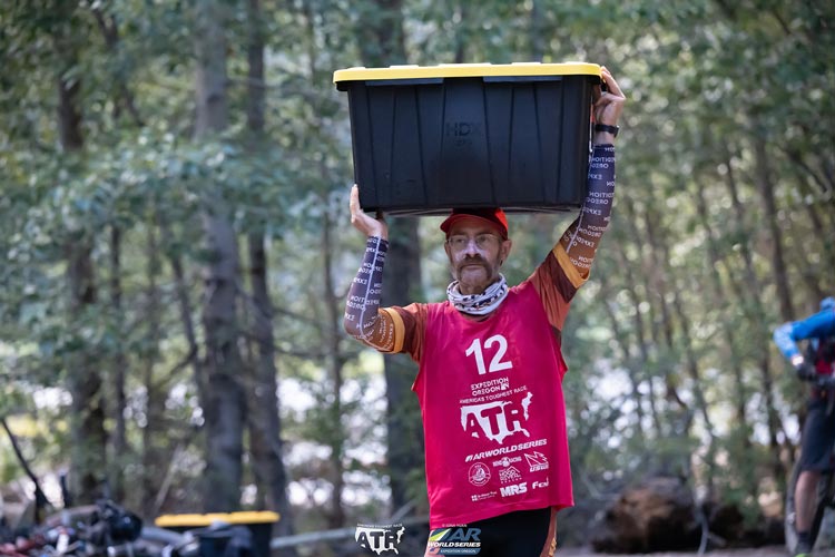
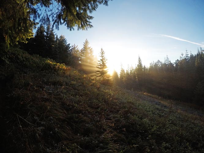
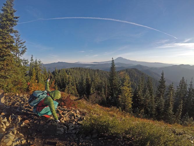
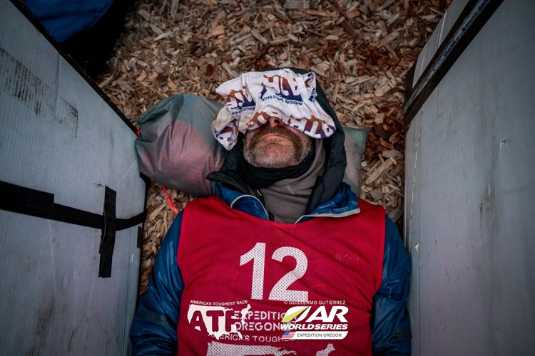
A note on the pics here - the ones taken on the gopro were mine - note the aspect ratio and near fisheye wide angle - such as the first pic below. The other pics were taken from various posts by the race and were taken by the race photographers. Guillermo Gutierrez's pics are labeled as such on the pics, I am not sure who the photographers were for the other ones.
 |
|---|
.jpg) |
|---|
| |
|---|
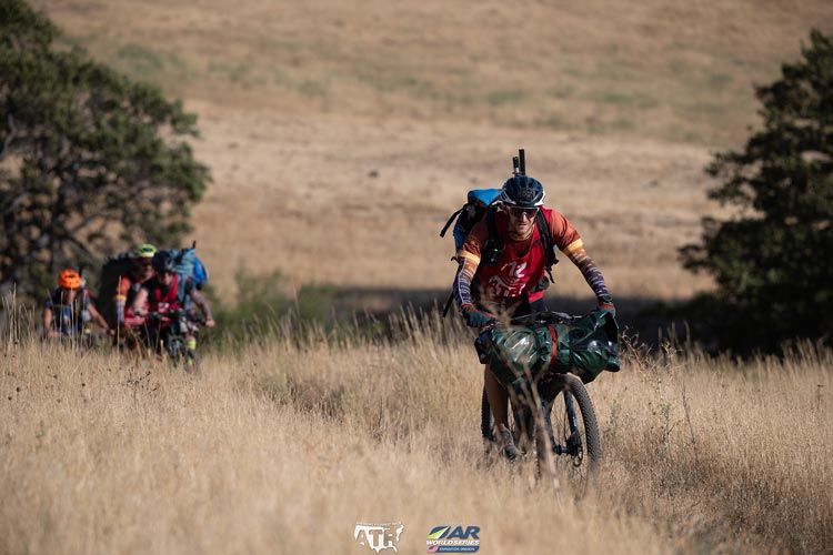
At first we were rolling in a nice valley in the shade, but then the road turned to gravel and started getting steep. We slowed down and even walked for a while where it was steepest or the road was particularly rocky. It was nearly dark by the time we got to the top - or at least where it was less steep, although we were still going mostly up. The next CP (Checkpoint) was at some power lines, I think there were 2 or 3 teams there when we arrived. Then we continued on dirt roads to the start of the Surveyors Ridge trail (which we slightly overshot before backtracking). Now we were on singletrack that was mostly fun riding, although some of the uphills were too steep or rocky or rooty to ride and I didn't really like the downhill turns that had a dropoff on the outside of the turn. We pushed on through the night stopping to get some water at a creek - where the temperature seemed to drop drastically. Partly because we stopped, but I think the valley was also full of cold air. Long uphills were hot and sweaty, long downhills were chilly, so we tried to dress as needed. Some of the downhills were also dusty, so visibility was impaired for the riders that weren't in the front. This was even worse when we were riding with other teams too. The other annoyance was branches at head height that required ducking but still were super bright in the helmet light.
We got a little confused at one intersection thinking we were at a later intersection but we still had to go the same direction so it didn't matter much. A general rule for night navigation is that you haven't gone as far as you think you have. Then farther down the trail we went down a trail that was rather loose and dusty and then a road that crossed a creek a few times. oops. So much for dry feet. Eventually we came out onto a road and headed down that. There were some options here and the way we went ended up going up a dead end road - always a little alarming. It turns out there was a way through on a road through a gate next to some fields, but it took a bit of searching to find. After a big downhill we hit pavement again and it started to get light. Our energy was flagging and we were not going fast. We were still going though. Once the sun came up we picked up speed a little, but our bike pace was still pretty slow. Finally we got to the downhill into the gorge to TA1 (Transition Area) and the paddle.
| |
|---|
by now it was 2024-9-9 We wanted to get on the water as soon as possible to avoid the strong winds blowing up the gorge later in the day. That meant a fast transition - something that I have never been all that good at and we didn't do a particularly good job of this time either. We grabbed food, refilled water. packed gear into the rafts, inflated them. Tempered the rafts (stuck them in the water to cool and shrink the air, then add more air so they don't get too floppy while out on the water) then we tied our bikes on the boats and set off. We stopped before we got to the Columbia to readjust a bike that was dipping the brake in the water and then headed off. We stayed close to the shore in the hopes of avoiding the worst of the wind and waves (but maybe also avoiding the useful current?). It wasn't too bad to the first CP on the OR shore although we did see a lot of trash and dead fish on the bank. Then we cut across the river heading for where the bridge got to WA. We had Andy and Myself in the lead boat with Corinne and Ella towed right behind us - hopefully this would help keep us together and minimise wind resistance. It still wasn't that bad crossing the river and getting to the bridge although the wind and waves were picking up. After the bridge it got worse - around noon. Just paddling along was no longer cutting it, we had to paddle hard just to make headway. We powered against the wind for about another hour passing a team that was in single packrafts and looked to be going backwards some of the time. Finally we got into the lee of the boat ramp jetty and the take out at CP8. There was one more CP to paddle to - CP9, but it had been changed to an orienteering point so wasn't as mandatory that we get it. We figured it would be at least 2-3 hours and maybe more if the wind continued to get stronger to get there and we were pretty tired of paddling. So we opted to skip it.
We packed up the boats and our packs (we had to carry all our paddle gear with us). I had some moments of panic as I searched for the trackers that we had to carry with us at all time. I eventually found them in my PFD pocket (where I had carefully put them before the paddle). Then we headed off on our bikes. The larger load of the paddling equipment was immediately noticeable with overstuffed packs and rafts strapped to the handlebars of Andy and my bikes. We headed uphill and then into the wind towards the first orienteering or "O" course. For the O course we dropped our bikes and headed off on foot to collect a number of points in the Horsethief Buttes. One involved a scramble that only one person had to do (me), and there were 2 points that Andy and I had to climb via topropes to get. These were a nice break from sitting on the bikes with heavy packs.
Then we got back on the bikes and headed uphill to another state park. Here the terrain was dry grassland with a few scrubby trees. As we ground our way up the steep hills I had my first sleepmonster hallucination (a sleepmonster is something you see that isn't really there) - in this case there were some branches down on the side of the road and I thought they were a bunch of bikes down on their sides where people had left them to go to a CP. Not so. We looped around to an overlook with a sign about the Dalles Dam and then more uphill to a barn where we left the bikes for the second O course. It was around 6 pm now and we had to start this course by 8 pm so we probably would not have made it had we paddled to CP9. We had 2 maps for this O course so I carried one. I was a bit out of it at first - confusing CP 13 with O13, but I followed the others and then after a while figured out what was going on. We picked up the points, getting water out of a little creek on the way (we were running low by now). It got dark by the time we went to point 08 on the top of a hill. We dropped down to point 09 at a telephone pole and then had some debate about if we should go out of our way to get 010 and 011 that were about 3/4 mile farther. Pro - more points, Con - this might push us into paddling in the dark tomorrow. We walked up the road and then decided to turn and take the road out to those points - in hindsight probably a good choice. By now I was thinking more clearly and while Andy did the big nav to get us close I seemed to be doing well finding the points once we were there. This worked out well and we picked up these last 2 and headed back to the bikes. We should have grabbed more water from one of the sources near here, but instead we just headed off up the hill.
 |
|---|
 |
|---|
 |
|---|
We had a long grinding uphill (1100 feet of gain) on a gravel road. Mostly we could ride it in low gear, but we did stop to walk a few times to give a different set of muscles some work and our butts a break. It looked like we were nearing the top many times, but that was not the case. Eventually we did get up onto the plateau and then had some level and finally downhill. There we had some question about which road we were on - but we had to go downhill either way, so down we went. We opted to take the road instead of a trail most of the way to CP14 - probably not the fastest since there was a headwind. On the way there we passed a few teams sleeping in the lee of an embankment. We were getting tired and useless, so we stopped for a few hours to sleep downwind of some plants. I checked the "creek" for water, but it was just a muddy cow puddle here. I used my pfd and pack for padding and put on the rest of my clothes and crawled into my bivy sack. It was warm enough out of the wind and soon I was sleeping.
2024-9-10 I woke up to Andy saying it was time to go. Fortunately we weren't relying on my watch alarm which pretty much failed to wake me at all. I think we slept a little long, but it was still dark and cold when we got up. We reloaded the bikes and headed off. We deviated a bit from the suggested course to avoid some uphill, but I don't know if it was worth it. We also stopped as we crossed the Little Klickitat River to get some water (as it began to get light). It had a algaeish smell/taste, but was still wet. We had written the clue for O15 instead of CP15 on the map, but soon figured that out. By now it was daylight and we had a nice view of Mount Adams as well as a much farther away Mt Hood.
| |
|---|
 |
|---|
 |
|---|
At TA2 we packed up the bicycles, but continued to carry the boats when we left on foot. We trekked along picking up CPs. One drainage we thought would have water was dry - a bad sign. CP 19 was down a steep slope and we followed a bearing towards it which made for a lot of side-hilling. Interestingly we did run across a survey marker on the way which gave us our exact location. Then we made a navigation mistake - or more accurately, followed our plan, which was a mistake. Side-hilling around to the next CP instead of going back up to the plateau and dropping down again. At first there was a bunch of bushwhacking, but then things opened up. It was still slower going than up and back down would have been, especially for those without poles and not used to using them. We did get to the next CP, but it took longer than necessary. Then we headed up to the plateau to get some more. By now we realized we probably weren't going to find any water until the river and we were rationing what we had left. I took a tiny sip whenever my tongue got stuck to my mouth. We passed a few more CPs and then started down towards the river following a ridge with one more CP on that ridge. We originally planned to continue down the ridge, but another team dropped off to the right and that looked decent so we went down that way. Then we wrapped around the toe of the ridge and had to avoid some dirt cliffs to get down to the road. From there it was easy walking to the CP and the put in point. First we drank a bunch of much needed water. The sun was down by now and it was getting dark - I guess we would paddle in the dark after all. Somewhere along here we had to take 4 hours of sleep, so we decided to see how the night paddling went and either stop soon or push on through and sleep after the paddle. I was worried about getting wet and being cold when sleeping, but that didn't happen.
It turned out the night paddle down the Klickitat River was not too bad. It was pretty mellow paddling with a current and some waves, but nothing too severe. Probably only class 2, although it was hard to tell in the dark. I saw quite a few eyes off on the side of the river - maybe mostly raccoons? The other boat almost ran one over near the takeout. We paddled downriver for a few hours and then took out. At TA3 we put our bikes together and then took our 4 hour sleep. It wasn't great, and there were a few sprinkles, but it was more sleep than we would have taken on our own and I had more layers from the bins to keep me warm.
 |
|---|
2024-9-11 We started off biking up out of the canyon. This was a long slow grind and my butt was not at all happy with sitting on the bike seat. I'm not sure that a little bit of bike training ahead of time would have helped me go faster, but it might have helped make my butt tougher. This was a pretty long bike leg and although we were trying to move quickly, we weren't going that fast, and my butt did not feel any better. At least there wasn't a screaming headwind or massive hills, although there were some long steady rises. We got a break at the ice caves where we got out and hunted down 4 boards with numbers on them in the caves. Even this late in the year there was some ice in the cave. One point required exiting the cave and going in a different entrance. Then we had another CP in a hole at the base of a basalt cliff and short hike a bike and a bunch of riding to get to TA4/5 at Goose Lake.
 |
|---|
| |
|---|
This TA was the start and finish of a massive O course. It was also the only spot we would see bin B. We rolled up and true to form, our bin was on an island, and the maps were on a farther island. Andy took one for the team and swam for the maps while I waded for the bin. It was deeper than my belly button so I stripped down. Unfortunately I got a little slice in my foot from the sharp rocks on the island. Back on shore I dressed for trekking and we planned on what points to get first. We thought we had until about 7 pm the next night to get points which meant we probably couldn't get them all. We decided to go for the ones that didn't look like they involved swimming and wading - that meant towards the lava to the south. Off we went as the sun went down. The first 2 we got, 030 and 031 weren't too bad although if we knew how good and bad various old roads were we probably would have taken a different route. Then we headed off onto the lava as it got dark.
 |
|---|
| |
|---|
This was older lava that had lichen and plants and trees growing on it. This meant it was mostly stable and some of the sharp edges were covered. It still had lots of topography to it though so straight line travel could be very slow and difficult. At first we were following a trail, but then it veered off to the N and we continued on. Maybe this trail went where we wanted to go, but maybe not. We pushed on over the lava making slow progress up towards 032 - a high point on a ridge. Fortunately we did find the ridge and as we worked our way up I went over to the N side in the hopes of easier travel - there I found a bit of a trail - the same one from before? who knows. We were almost to the CP so it wasn't that helpful. After tagging the CP we tried to follow the trail east, but that didn't last long. We tried to continue east avoiding the worst of the cliffs but ended up getting turned a little S. This is where we got confused - I knew we needed to go east to get to the volcanic crater, but I thought we had already crossed the saddle. Once again - you haven't gone as far as you think you have applied. We were all getting tired and a cold wind was blowing and not knowing where to go was demotivating. We decided to head N and find a place to sleep and wake up with the light and hopefully see where we needed to go. We set up for a cold night, but we had more layers. Sadly a bit after we went to sleep it started to rain. It wasn't a hard rain - more of a spritz or as they would say in Ireland "soft weather", but it was enough to get things wet. I had left a bunch of stuff out to dry and in my half awake state put my rain skirt over it and my head. This got me back to sleep, but didn't really keep most of my stuff dry. I had a poor sleep between waking up cold and shivvering myself warm plus the rain sometimes hitting my face and my left elbow slowly getting wet.
2024-9-12 Once again Andy woke us up. It was still pretty dark, but the sky was getting brighter. Unfortunately it was also still raining off and on. My pants were soaked (before I went to sleep they were only soaked from the knees down). At least my upper body was dry and warmish. We got our stuff together and looked around as it got light. Sadly we were in a cloud so there was no more visibility than by headlamp the night before. We decided we needed to get out of the lava to get a few more points before we had to leave. We headed N - maybe not the easiest way, but we didn't really know exactly where we were or what the easiest way was, so N we went. I was wearing my rain skirt now so my waist and upper legs slowly dried and stayed warmish, but the lower legs continued to get soaked as I pushed past wet brush. We worked our way north and down over the next few hours and finally made it out to the road - not far from TA4/5. We looked at the map and decided to head towards 019, 020, etc. We also met another team walking down the road that had also spent a miserable night out on the lava - and didn't even find 032.
We warmed up a bit as we walked up the road. We passed a spur road and then another - which was actually the spur road on the map. We took it and followed it north towards the CP. At the end of the road we continued on and down across a steep canyon. The part at the bottom was particularly steep, but there was a nice waterfall at the bottom. Then we found a place to get up the other side and continued across a bench and up another slope. Somewhere around here was O 019. We saw another team come in from the east and that probably helped us see the clearing and the point a little west of where we were. We picked that up and then went up the steep hill. I slipped on the wet slope going up but didn't slide far. On top we headed into the woods towards a drainage that we followed up to the next CP, getting there just after the other team. We followed a bearing to the next CP and got there just before that team. Every once in a while the sun barely shone through, but mostly it was gray with occasional sprinkles - enough to keep the plants wet and thus our lower legs and feet soaked. Back before we left the forecast called for a "chance of rain" on Wed. It was Thursday and still raining, we felt cheated - and wet.
Somewhere in here we ran into the Cosmic Confusion team - which contained people some of us had raced with before. They had had their own difficulties the night before and asked us when we planned to leave TA4/5. In the discussion we realized we had an entire day longer than we thought (we had gone back and forth on this, but read the rule book more carefully and realized we had another full day). That meant we might be able to get all the O points here after all, but also that we weren't taking the most efficient path. Oh well. The next point was on a little island. I waded out to it - fortunately not much deeper than mid thigh although without trekking poles I probably would have slipped in the mud and got soaked. At least the water didn't feel very cold. (I later read that the race referee was hiding out near this point and after someone went out to get it came out to remind the team that everyone had to be within 10M of the point when it was tagged. Fortunately we were far enough back in the pack that we didn't have that issue - although I guess we weren't quite all within 10M of the point when I got it). The rule is that the team has to stay within 100M of each other and then all had to be 10M away from the CP or O points. We tried to follow this, although especially on the downhill singletrack bike legs it is hard to strictly follow it. It is also tempting to just send one fit person to tag a point on top of a hill while the rest of the team rests (or to wade across a cold muddy pond).
We continued picking up points with various difficulties finding them - sometimes they were just downstream and we looked upstream and so on. We tagged all of the points north of TA4/5 and then headed back. When we got out to the road a race vehicle came up and checked on if we were ok. People had been out for a while (over 24 hours in our case) so they wanted to make sure everyone was ok. By now it was dark, and we headed back to the TA to get some more food and then we headed out to find a place to sleep. This time we opted for a place under some thick pine trees where the ground was dry. It wasn't the flattest, but being dry was worthwhile and helped me sleep. It was cold, and I woke up to shivver a few times during the night but then went back to sleep.
2024-9-13 We woke up while it was still dark and were pleased to see some stars in the sky. It was cold, but walking on the road soon warmed us. It was just starting to get light in the sky when we got to the trailhead for Little Huckleberry Mountain. Things slowly got light as we headed up the trail (Our plan was to hike up the roads and most of the trail while it was still dark). We passed a team coming down as we got higher. The sun came up shortly before we reached the summit - which was nice as it was cold up there. Then we started bushwhacking down the ridge towards another point. Unfortunately even though the sun was up the brush was all soaking wet and despite knocking a lot of water off it with my poles my legs were soon soaked followed by my feet. We continued down to ridge to the point - although I walked right past it thinking we had farther to go. Then we backtracked up the ridge and then dropped off down through the woods to the next point. This went relatively well, although we went back up the trail farther than we should have and as we continued down through the woods we had to side-hill on some steep slopes wasting a good bit of time. Finally we hit the old road and followed that to the end where I walked past the point again. Then we dropped down through the woods back to the main road which we took back towards TA4/5. We cut off and picked up 035 and then back on the road where we took a bearing to 036 in the lava. This was in a patch of more recent and harsher lava. After this point it was around noon and we only had the one point in the crater left to go. Originally we were planning on skipping this one, but we had the time and our energy levels and dare I say stoke had picked up too. So off we went across the lava again.
 |
|---|
 |
|---|
 |
|---|
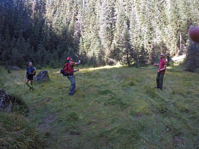
I don't know if it was the sunshine, our energy, or easier terrain, but we made pretty good time across the lava field and angling towards the NW edge of the volcano. We got onto the cone and followed sloping animal trails most of the way up to the rim, heading straight up at the top. Then we dropped down into the crater - except it wasn't the crater we were looking for - there was a crater in a crater thing going on. Andy figured this out and we went up and over into the proper crater and down to the center where there was a geocache and some badminton gear we had to take a pic playing with. I flipped through the register and saw someone mentioned finally finding the "short cut" but sadly nobody mentioned where it actually was. We headed back out over the double rims and down. Unfortunately I didn't find the nice animal trails and when my pole plunged into a hole and I slipped I broke it. Fortunately this was the last O point and I still had another pole to help. It didn't feel like I was taking quite as good a line on the exit, but we made steady progress and finally got off of the lava and hit the road. It was a pretty short walk back to TA4/5 where we grabbed our climbing gear and some more food and ditched some wet clothes. They also gave us new trackers with batteries that weren't dead - unfortunately they didn't seem to index the new trackers to us so most of the dot watchers still didn't know where we were.
 |
|---|
We biked off meeting up with Cosmic Confusion looking for CP30, we were looking too far downstream, as were they, but they had been looking longer. We found it fairly quickly. We planned to cut across a short gap between roads to pick up CP31, but it didn't look too great so we biked around and hit it from the other side. It was dark by now and unfortunately we found some prickly plants along with the CP. After an uphill bike ride we got to the second climbing area. This featured a slab climb protected by fixed ropes and ascenders. First we had to pass the mental test - taking turns count down from 100 by 7. We failed the first time and had a 5 minute time out. Cosmic Confusion showed up and started up the other rope. When we got to climb they were still waiting for the ascenders to come back down from a team that went up hours ago. Eventually the people running the climbing area went up and brought down some ascenders and the rest of our team (Andy and me) could go up. By now both ropes were clear so at least we could both go at once. There were a few moves that slowed me down wearing floppy Altra shoes, but mostly I cruised up as fast as my cardio would allow. At the top of the ropes I punched CP32 and then followed trails up and right towards the ridge. On paper CP33 looked pretty easy to find - just east of the ridge and just above a saddle in the ridge. So we went up to the ridge where we saw Cosmic Confusion and team 19 (who had already been looking for hours). Well, the ridge was covered in brush and not easy to travel and the saddle was not obvious at all. I headed up the ridge to meet up with the others but somehow missed them and went up over the top and way too far down the other side. Then I cut down west a bit looking for the trails, but I was too far north. Finally I saw Andy back up on the ridge and headed that way - across some slabs. They were pretty easy to walk across, but the fact that I was passing bolts was a little unnerving. Sadly the track for this doesn't exist. Back with the others we could see that Cosmic Confusion was trying to shoot a bearing from CP32. I headed slowly down the ridge going back and forth through the brush looking for the saddle. I was wearing bike shorts and tights and a windbreaker - not ideal for bush bashing. I never did find the saddle, but I found the CP. I considered just punching it quietly and walking away, but instead called out I found it. Cosmic Confusion was relieved (and their bearing wasn't going to intersect where I found it). About now it started raining again. ugh. We didn't know how to get down, but I figured somewhere S of the slab would work - and it did. Fortunately we got down before the brush got wet enough to soak us. Back at the bikes they asked us about team 19 - who had a dead tracker, no water or food, and had been up there for hours (they did eventually find it and come down, but it was a while later).
| |
|---|
Getting back on the bike I dug out my spare headlamp. I knew the fenix headlamp battery was running low and thought I had put a fresh one in my pack - but evidently I had not - or in my sleep deprived state I took it back out or something. We had quite a bit more uphill road riding before we hit the Monte Cristo trail. At first this seemed to be mostly decent riding - and then it started getting steeper - both uphill and downhill. The uphills especially were unrideable (by me at least), and I had a few slow speed crashes on the downhills, one of which broke my bike light mount. Then we got to the super big uphill bike push. We could see other teams up ahead slowly working their way up the switchbacks. At least I wasn't cold pushing my bike up the endless slope. Of course once we did finally get to the top it was cold with a stiff wind blowing across the ridge. There were a few options to get down and we tried to find the one that had enough switchbacks that it wasn't straight down the slope. At the start of the first downhill my headlamps both decided that they only had enough power for the lowest setting. This made riding downhill scary and when we got to a stop I pulled out my spare headlamp spare battery. Then we headed down again, except I forgot to put my glove on and had to walk back up a hundred feet or so to pick it up. DOH. Then we could go down. Almost immediately it became a battle to stay awake and not get mesmerized by the blinking light in front of me. We stopped a few times to make sure we were going down the correct road (there was a wrong way that ended up in private property and when you are going downhill it does not take long to get very far off track). Fighting to stay awake we dropped down into the valley and finally to the paved road and to TA6.
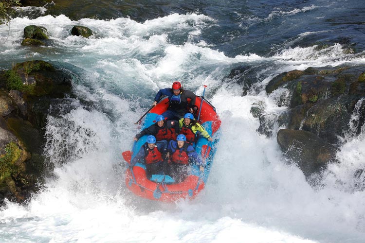
2024-9-14 The sky was just starting to show some light and as we checked in they weren't sure if just skipping the CP9 O point meant we were full course and would get to go in the first wave of boats - in about 40 minutes. yikes. We packed up our bikes and then got the word that we wouldn't be in the first wave - more likely after 9 or 9:30. I packed up some stuff and took a nap between some bike boxes. Then got up, had a hot meal (backpacking food), and then it was time to get ready. We packed the mandatory gear into the paddle bags and put on our wet or dry suits and the raft companies helmets and pfds. Then we got into a 5 person paddle raft and after a little talk from the guide set off down the White Salmon R. The water was cold and clear and once I managed to train myself not to try to steer the boat but just follow the instructions or paddle forward things were pretty easy. Mostly I just enjoyed the ride and didn't stress about squinting into the sun to read the water ahead. This was a class 4 run finishing with a class 5 drop down Husum Falls - the internet says it is a 12 foot drop - although most of that isn't vertical. When we got there we lined up and then just hunkered down in the raft and held on as we dropped down and plunged into the water before popping up and paddling over to the takeout.
 |
|---|
 |
|---|
Next up we inflated our packrafts and put on the gear for paddling the last bit of the White Salmon and across the Columbia. Then we waited to put in the water and temper the rafts as fast as we could with others waiting to put in. Then we cast off. The first rapid was "rattlesnake" which had a number of flips we later learned (from looking at the videos the race posted). Fortunately we hit the line right and made it through. Supposedly this was class 2-3, but some of the rapids seemed close to class 4 to me, maybe I am just getting soft, or as Darren said "White Salmon class 3" - sort of like California scrambling class 3 compared to Colorado. In any case we continued down the river a little concerned about the take out for the portage around a waterfall. It turns out that was easy to see with people there and a rope along the shore and it wasn't even in the middle of a rapid. We took out and followed another team down the portage past a waterfall (not a huge waterfall, but not one I would have been happy to run). Then we put in and continued down the river. We were following the other boat when we hit a line not quite right, a lateral wave pushed us to the right and turned us enough that the hole caught us and we flipped. I jumped onto the upside down boat and paddled to Ella who grabbed my befree water filter and helmet and handed them up and we got to the side. The straps from my helmet had just pulled through the buckle and I lost my hat. More alarmingly, Ella lost her paddle (her right wrist had been hurting for days with weak grip and minimal mobility - and not enough strengh to hang on when we flipped). We looked for it but it was all black and we didn't see it. We were able to portage around the next drop and then we paddled down to the other boat. Still no sign of a paddle, but at least it appeared we had flipped in the last rapid. We were setting up to tow the other boat with only 3 paddles when Andy M came by in the safety boat. They were taking out here so handed us a paddle. We loaded back up and paddled under the bridge and out onto the Columbia.
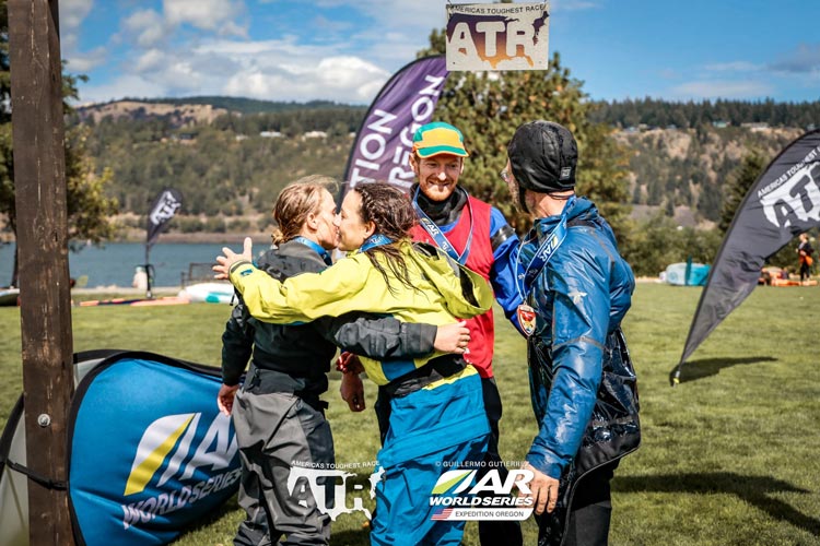
The paddle across the Columbia was straightforward. There was a crosswind and decent sized waves but we just kept moving. We had the entertainment of watching all sorts of wind powered recreation going on - mostly with hydrofoils which looked pretty cool and had the advantage of being quite fast and also not nearly as effected by the waves. We pulled into the takeout and grabbed the rafts and then came up onto the lawn and through the arch to finish the race. There we were handed a bottle of bubbly to spray about (and drink should one be so inclined) and our finisher medals. We got our gear off to the side and could finally take a break. Soon we went to find the bag we had given them at the start of the race to change out of our wet gear - at least in my case since I was wearing a wetsuit. The others had drysuits and could just take those off.
 |
|---|
Later on we got burritos, and I was also busy catching up on hydration and talking to other racers. Then we went to pick up our vehicles, sort gear, pick up gear from the bins and bike boxes and so on. Then finally a long shower and glorious warm dry sleep. I did notice my feet were starting to get a little ugly - I was fine for this race, but a few more days of tromping in wet shoes and they could have really fallen apart. Still, I had a lot less scrapes and scabs on my legs than some people did.
2024-9-15 After a wonderful night of sleeping we headed back to the waterfront for the closing ceremonies. We got brunch and a beverage and the awards were given out with a few stories about particularly memorable events. The Bend Racing/4 Hr Fuel team won - finishing Thursday morning at 8:22, followed by team Fear Youth, Kumho and Sardine Racing (3rd tie) all from NZ, Estonia Seiklushunt/Honeypower, Team 4 hr Fuel... Team Jackalopes had some equipment issues but managed to clear the course just barely making the time cutoffs to come in at 11th and we were 12th missing only CP9. I was a little surprised that we were the only team to get all but one O point, but there it is. If we went for CP9 I think we would have missed more points at the second O course and if we were faster on the bikes and got on the water before the wind picked up... well, if we were faster we could have placed higher, but that is the case for everyone. This was a pretty stacked field with some competitive teams from overseas as well as some strong US teams.
I started this race in a bit of a sleep deficit, which is not a good thing, but then because of the mandated 4 hr sleep as well as semi forced sleep at night when we didn't trust our navigation on the final O course plus some sleep waiting to get on the river at the end I wasn't horribly sleep deprived. Sure, I was tired, but I wasn't really seeing things and it didn't feel like all I really wanted to do was close my eyes and sleep like I had by the end of the other 2 EO races I did. My food seemed fine for the race. I probably could have skipped some for the final paddle, since I never got to it anyway. I did however fail on keeping hydrated in a few places - more because I didn't have easy access to water or didn't load up on enough water when I had the chance than I wasn't drinking enough of the water I had. It didn't help that the befree wasn't filtering so fast. It probably would have made sense to use some sort of chemical purification for most of my water and just the filter for water I was going to drink immediately. My butt was definitely not happy about sitting on the bike seat so long, but I suppose that is expected if you haven't ridden a bike more than maybe an hour in a month or longer. All in all I think I did pretty well for jumping in at the last minute. At least I had been doing plenty of trekking and peak bagging in the last few months although some paddling and more importantly biking would have helped. I also wonder if I would have benefited from a bit more rest going into the race.
official ATR page describing race