
This is part III of this trip, you can see Part I , and Part II of December Desert Peakbagging here. This trip report isn't really done, but I figure I should post what I have and maybe someday I will get it finished.
Dec 13, 2021, This day there was some uncertainly about what people would do. We ended up splitting up a bit for the morning with a group heading up Copper Mountain. We started near where we did the day before (more shaking up the road). First we were on burro trails and old mining roads before maybe a faint use trail or maybe just cross country up the steep ramp onto a high mesa. This mesa had some pretty impressively thick cholla forests and it took some doing to avoid them (not always successfully). Iris and I were the last up to the summit where we had some nice views down the the Colorado River as well as a reservoir that was part of the aqueduct system. The descent didn't go any quicker because Iris had to be very careful to avoid slipping on the loose gravel over rock. We could also see the impressive spire of The Monument that others had climbed a few years ago.
 |
|---|
The descent could have gone fast and messy or slowly and carefully - we opted for slow. Then we went a bit to the south to head up another smaller bump - Peak 1982. Bob had done this one and told us it was a fun scramble up the notch on the west side - that was in fact true, although we went more on the N side of the chasm up to the summit ridge, and then either a descending traverse or a climb up onto the summit blocks with a fair bit of exposure. I ended up climbing up on the way up and then reversing the descending traverse on the descent (making it a rising traverse - much easier). Then we headed back to the vehicles and back to camp.
Next up we reloaded on rusty water at a visitor center complex and then made a quick change of plans to climb a peak near the road while Iris relaxed. This was peak 1140 - a bit up through a wash - with a little water and some palms for a bit of it and then up steep limey sandstone to what was the high point even if it wasn't the one marked on Peakbagger or List of John. Then Iris and I went to do Castle Rock on the Arizona side of the river. This isn't much of a peak as far as prominence goes, but it has steep sides and overlooks the river complete with a trail and a flag on the summit. We parked in a little mobile home park and made quick work of the not so great trail - but compared to bushwhacking cross country it was pretty good. The summit had some nice views although it was starting to get darker. There was a nice sunset on the descent and we made it down just in time to avoid needing headlamps. We talked to some residents when we returned and they were surprised we had enough time to make it to the summit and back. On the way to the next camp site we picked up some hot water at a gas station and then stopped at a viewpoint to wash up. The air was not warm, but at least the water was.
Dec 14, 2021 Today we drove the jeep and then did some peaks in the Havasu Wilderness, these were 1819, and 1594. In between we were able to mostly follow burro trails, and on the return we started through a canyon but had to detour to get up a dry fall - I probably could have climbed up - but it would have been 5th class climbing. Then we went back to the rest of the vehicles and drove to "the claw" - a short but steep chunk of rock. We scrambled up to the start of real climbing and I poked around a bit looking for a way I was comfortable soloing - especially with the 20+ mph gusts. I ventured out on the west side and poked around up a crack on the NE side, but then decided that it was better to leave it for when I had a rope.
The next peak was 2090 which had steep sides, I went around a little to far on the E side and ended up scrambling up somewhat loose rock and traversing back to the somewhat loose ridge. It felt a little like I was holding it all together as I scrambled up. Bob and Iris more cleverly went up the face and a notch on the SE end. We all descended that way. The last peak, 2063 was across the valley. We headed up a notch and then scrambled up to the ridgeline. Then we descended down the ridge to the east and then back to the Jeep. We got a warm water (thanks truck stop) "shower" off the side of the road with a cold wind blowing. Then it started raining. By the time we got to dinner in Kingman it was pouring rain with gusty wind. This continued through dinner and most of the way to Boulder City. Good timing as we were almost entirely inside a vehicle or a building instead of trying to cook dinner or set up camp during a downpour, or worse in a wash that was subject to flooding.
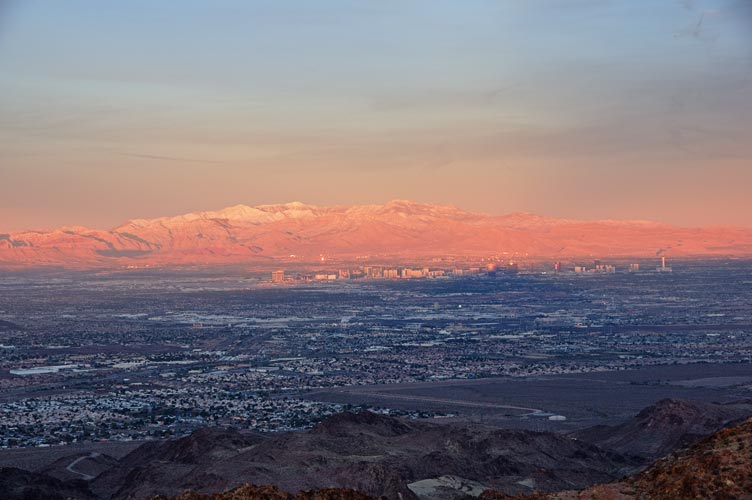
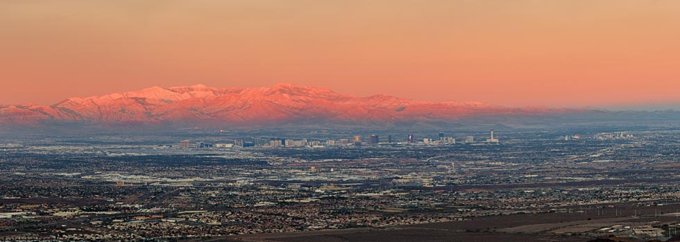
Dec 15, 2021 Iris had to fly out this day, so we got up early and went up Bootleg Peak arriving on the summit just around sunrise. The sun lit up the freshly snow-capped peaks on the other side of the Las Vegas Valley quite nicely. There was a cold wind blowing though. Then we drove most of the way up Red Mountain and hiked the rest of the way on the road. After that I took Iris to the airport while Eric and Bob hung out at Starbucks. I met up with them after dropping off Iris and we headed down towards an overlook near the dam. We headed up hills from there - called Rough, Pluto, and Uranus. Then we headed down towards the old railroad grade and walked back through some tunnels to under the overlook and then scrambled back up. Next up we tried to figure out how to get to another peak, but between the road and security checkpoints it didn't look so easy from this side (you could scramble up from the south maybe), so we went across the bridge to Arizona and then parked and walked back along an old road grade and up to the summit of the Sugarloaf. This night was cold, with a harsh wind. After dinner we all just hid in our vehicles (except I did take a few pics looking for the comet unsuccessfully).
 |
|---|
After the soak we continued up the canyon and Bob and I diverged to go up the Fortress. This had a pretty easy fun scramble sneaking up a steep side. We had intended to also climb White Rock Canyon Peak, but talk of needing a rope and loose steep climbing with serious exposure convinced us to leave it for another trip with a rope. We headed back up the canyon instead of taking the trail over a saddle. This ran us into some dry falls but nothing stopper. Then back across the desert to rejoin the other path back to the parking lot. On the way back we had time for one more peak - Saddle Island. The water level has fallen so much this isn't really an island any more - and they might have built a causeway out to it anyway. It is where the Las Vegas water intakes are - or out under the lake beyond the "island". We parked at an old high and dry boat ramp and walked across the old bottom of the lake and up past the old shoreline. There were a few odd things like an anchor on the ground and lots of shells. On the return a security guard stopped on the road behind us but we just kept walking away and I guess he decided we were leaving and it wasn't worth following us.
Dec 17, 2021 Eric headed back home, and Bob and I set out to do a bunch of little bumps. The first one - Mount Mangreed was by an active construction area and there was a brand new road almost to the summit. Next we had to search for a way onto the network of dirt roads to get to the Pinnacle - a fun little scramble. Then we went to the Red Needle. It wasn't too hard to get up to the wide crack, but the rock quality was iffy at best. There was a wedged rope which we were able to pull down, and I tied a loop over a chockstone and used my slackline to "belay" up to the chockstone but I decided not to commit to climbing up above that. I will leave it to later to climb up this one. Then we went on to go up Red Fox Peak. Probably the most interesting thing about this one was the vast array of things at the base that had been shot. Next up was a more substantial peak, Lava Butte. This one was steep and somewhat loose. We worked our way back and forth trying to stick to the most solid rocks. It had nice views at the top as well as a somewhat busted flagpole and ratty flag. Someone had carried a heap of cement and a 20 foot pole up here at some point. We drove around on the dirt roads for a bit and then went up White Eagle Peak - a prickly desert limestone peak. Then it looked like the one in the guidebook with the most stars was the east ridge of Division Peak - so we did that. It did have some fun scrambling on grippy but perhaps somewhat suspect rock. Then we traversed over to Unity Peak. The descent was steep and loose and had a few cliff bands to work our way around. Bob took me back to my truck before heading home (he would not get there until the next day though), and I went to wash up and kill some time before Iris' flight came in. Sadly the truck stop I went to closed off the store area for some sort of cleaning or renovation shortly after I got there. I did get enough hot water for Ramen though. Iris came in late (for me these days, we had been going to bed early and getting up early for a while now). We drove to Lovell Canyon and set up camp. It was below freezing.
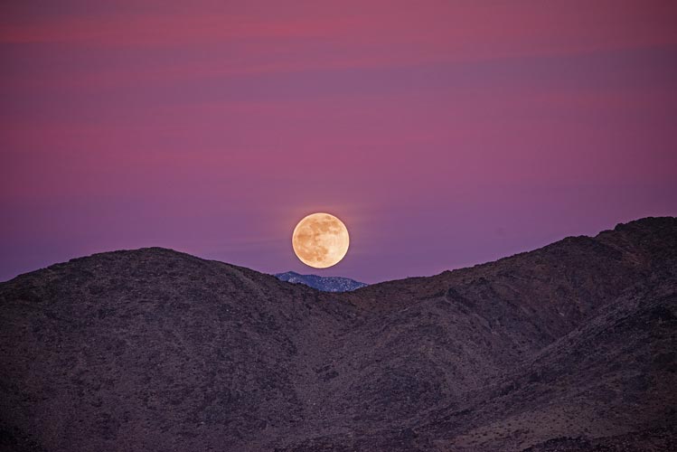
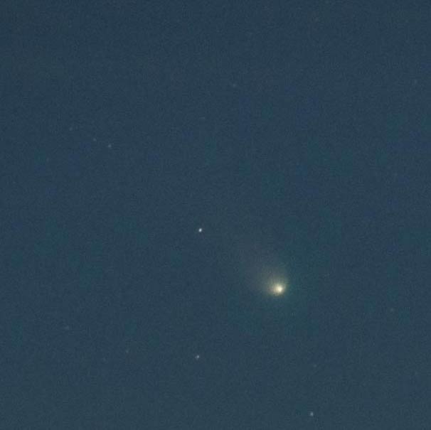
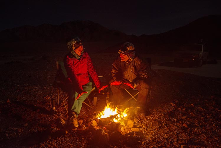
Dec 18, 2021 We slept in a bit and then decided to hike up a nearby peak - Mesa Benchmark. We worked our way up past a few snowy patches and in between cliff bands to the mesa top and then I accidentally started the wrong way to a maybe lower summit that had a geocache. We backtracked to the marked summit which had the remains of some sort of battery powered strobe light system and a register. We enjoyed our usual summit cookies and a sandwich here before heading north and down to a lower point (Peak 5926). Then we dropped off the east side following what we could of some cairns and a faint trail down to some roads. We followed those back to Lovell Canyon Road passing an aggressive dog who was being called by its owners, but not really responding. I kept a trekking pole pointed at its face and it didn't get any closer but it looked like a wolf and was growling a lot and circling around behind us. Then we walked back on Lovell Canyon Road back to the truck and headed on. We got gas before leaving Nevada and then stopped to wash up a bit off the main road. Iris noticed the full moon rising over what was I think the Last Chance Mountains and I scrambled to get my camera and telephoto out to snap some pics. Then we washed up and drove on to Slabby Acres - a failed mobile home park near the entrance to Death Valley. We got a nice spot up on a saddle and I took the camera and tripod to try to find Comet Leonard. I found it, but I wasn't able to get very good pics. Then we had a fire and dinner. It was cold, but not that windy and the fire kept us warm.
 |
|---|
 |
|---|
 |
|---|
Dec 19, 2021 This was our last day, we hiked up Red Cathedral - a peak overlooking Manly Beacon - sadly I didn't see a way to traverse down to it. Then we went up Zabriskie Point because we were right there before driving down to Death Valley. We stopped to go up Harmony Borax Works Hill, a completely unimpressive peak with 40 feet of prominence but fun because it has an elevation of 160 feet below sea level. Then we headed home. Iris drove a good bit of it - noteable because she is learning how to drive manual transmission.
It was a good trip with lots of mostly smaller peaks although a few we will have to return with a rope to do. We also did a pretty good job of dodging some bad weather. Also lots of good times with good people.
 |
|---|