Tom Grundy's Liebre Range Long Weekend Page
2025-3-21 Since the petulant billionaires required Iris to go into work full time to do remote calls from the office instead of doing remote calls from home she hasn't been able to spend as much time in Bishop. She did have a long weekend lined up in March and we met up along with Bob in the Liebre Range area north of Castaic. According to Wikipedia this area is now known as the Sierra Pelona Ridge or the Sierra Pelona Mountains. This trip was thrown together a little last minute and I was up late packing (and still forgot some stuff - oops). We all met up close to 1 at a pullout near an I-5 exit. I was the last to arrive and quickly threw my hiking stuff together and piled into the Jeep to go to the end of the Templin Highway (at least as far as we were allowed to go, it was closed before a partial washout).
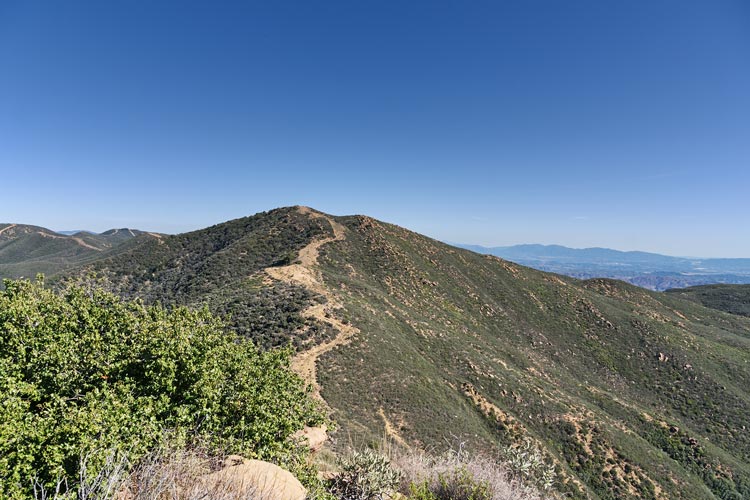
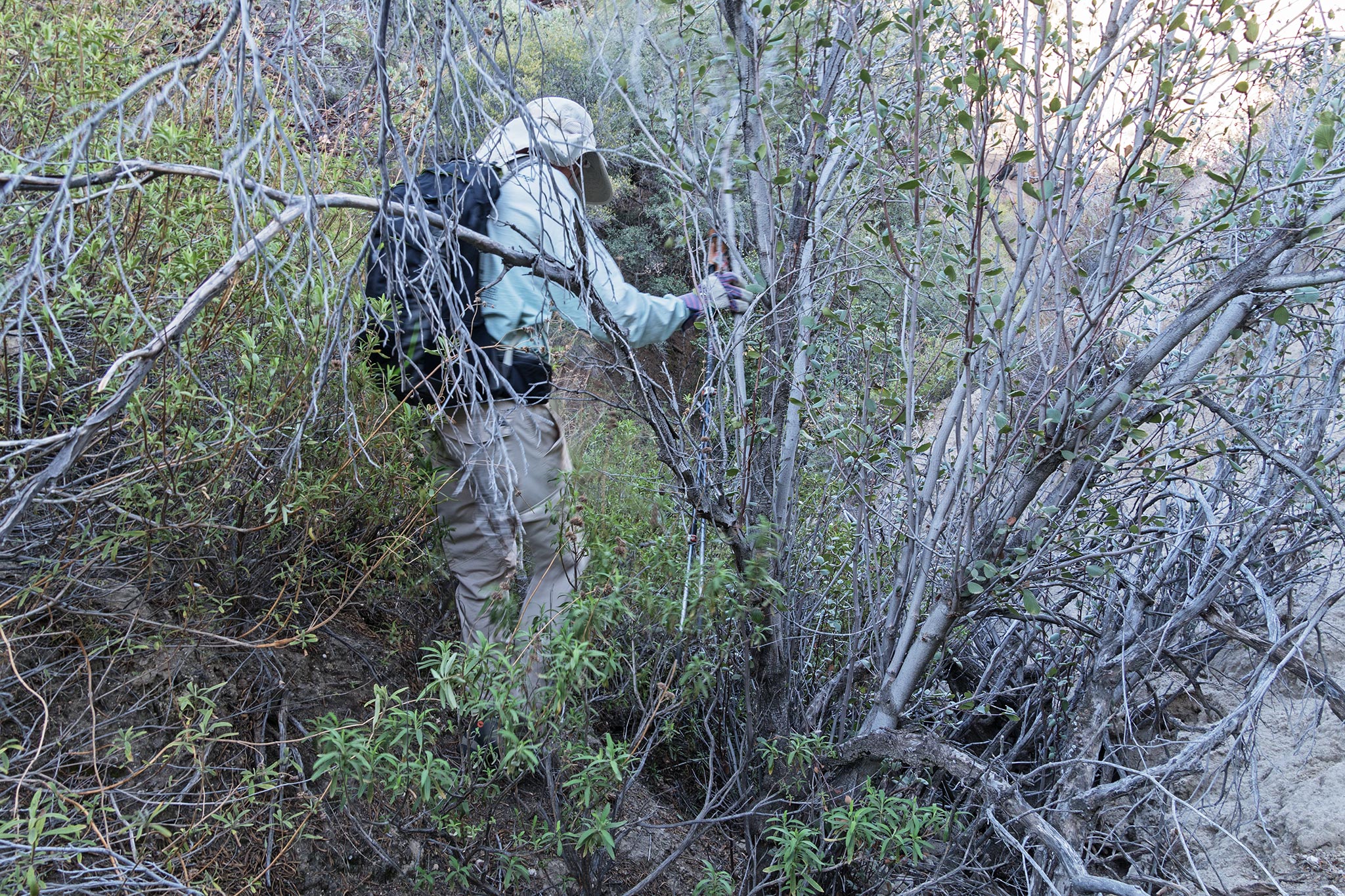
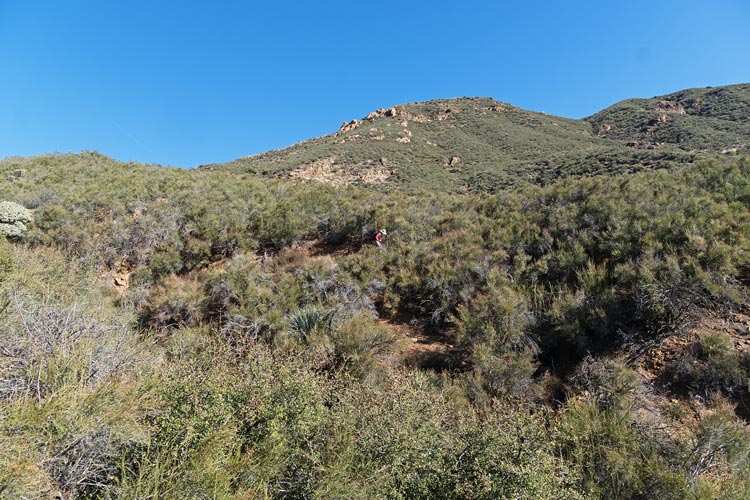
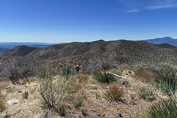
We headed off down the road and then hopped across the creek on rocks and then left the road (that continued down to the reservoir) and headed up a fairly recently cleared fire break that went steeply up the ridge. The tread tracks were still evident and some of the water bars didn't even look like any water had flowed in them. It seemed like the recently cleared fire break went at least halfway up the peak, but in reality it was much much less. The fire break continued but it had been a lot longer since the upper section had been cleared. It was pretty easy walking though - other than the fact that it was relentlessly uphill. Iris did spot some ticks crawling up her pants and alerted us - I had one on my pants too. This was the only one I had on me all weekend although the others had many more. Fortunately none actually bit us that we know of. It was pretty warm in the sun, but there was a bit of a breeze keeping it bearable. We worked our way up past a series of false summits - it didn't seem like they were the actual summit, but maybe one or 2 short of the actual summit - except we passed numerous bumps on the ridge that felt like this. Finally we made it up to the top. This was peak 3786 with no recorded previous ascents - although obviously people had been up here surveying and building fire breaks, they just weren't on Peakbagger or Lists of John.
heading up the recent firebreak
 |
not this bump, no, not that bump, or the next one, maybe the one after that...
 |
The descent went more quickly. It also really highlighted how much less of the firebreak was recently bulldozed. We still had plenty of daylight when we got back to the road, but didn't think there would be enough to make it up our second planned peak before it got dark. We headed back to the other vehicles where we discovered someone had written on our windshields with permanent marker "no parking" plus lots of lines. This is despite the fact that we weren't blocking the locked gate and were probably in a gas pipeline right of way with plenty of space for others to park or get around us if they wanted to. Sigh. So we spent the next bit of time washing that off before heading up I-5 towards Pyramid Lake and our campground for the night. We stopped to rinse off before we got there. That night we had a fire at the campground which was quite nice although helped encourage us to stay up later than we would have without it.
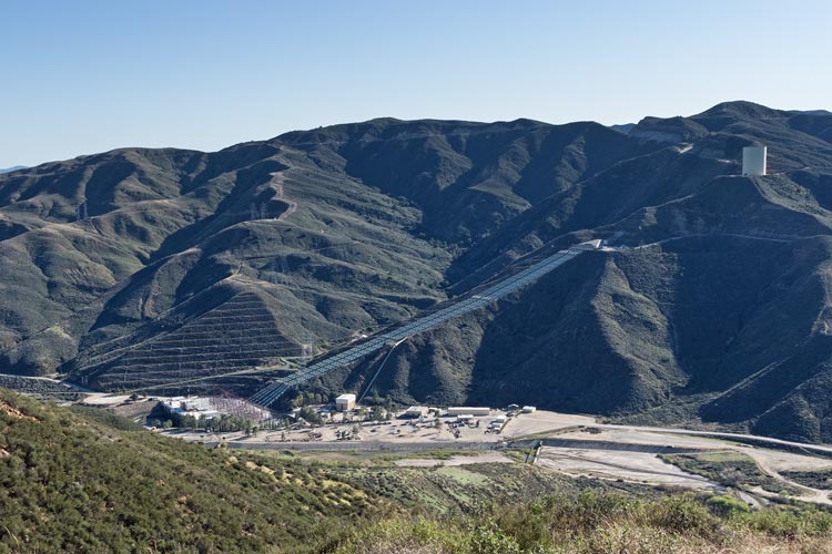
LADWP Castaic Pumped Hydro Plant - mostly used just for generation
 |
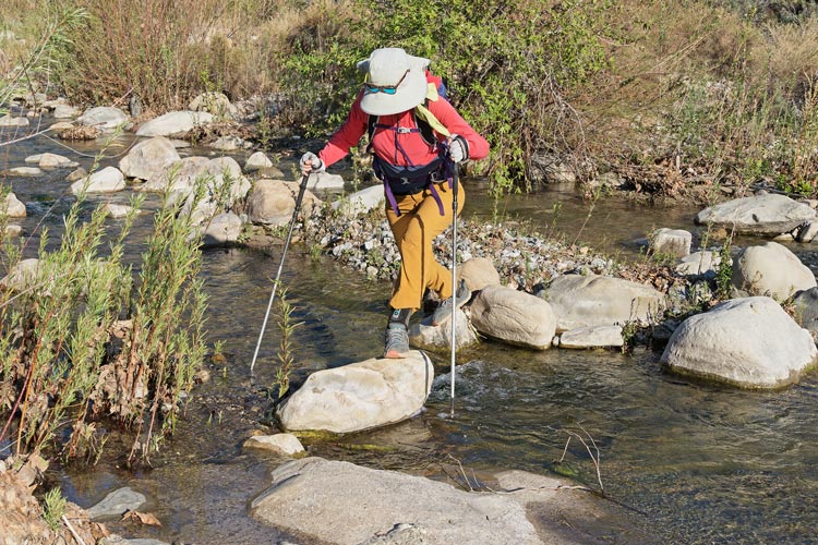
Iris crossing the creek
 |
my Strava page for Peak 3786 with Bob and Iris. 03-21-2025
Bob's Page for 3-21-2025
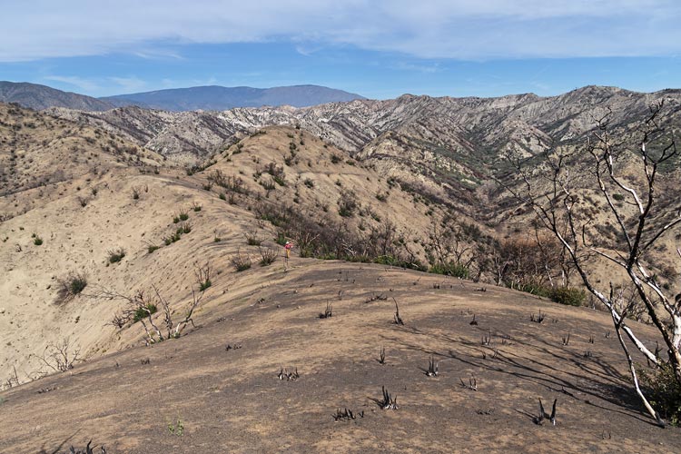
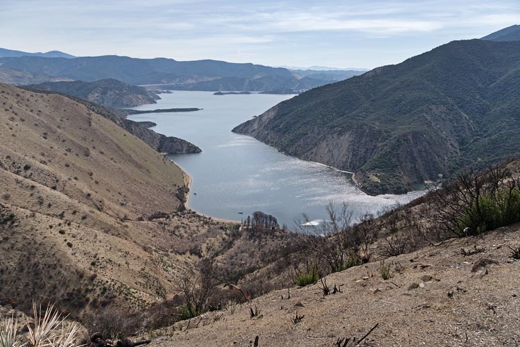
2025-3-22 Today we were hiking right out of the campground which was convenient. We headed up a canyon skirting around a tent set up in a campsite there. The terrain was semi-badlands made more badlandish where it had burned last year (the Post Fire burned in June 2024). Sometimes the fire was intense enough to really clear the landscape but in other places it left lots of charred brush or even still living plants in the way - we got lots of carbon all over us pushing past it. Still it was a lot easier travelling than the places that had not burned. There were green shoots coming up from the bases of many of the burned plants. We worked our way up and over one ridge and then descended a canyon on the other side. This went mostly well but we had some difficulties in a few unburned sections. Then down a wide open canyon - where we noticed lots of little poison oak sprouts just starting to leaf out - uh oh. Fortunately it was open enough to be avoidable (we hoped). We left this broad sandy valley and headed up another ridge. From the top we could see our destination peaks - a long way away. It looked like there was a long burned ridge that went most of the way there so we followed that. It was here that we had enough reception to join the family zoom call for a while. The ridge did in fact cover most of the ground with only a few unburned sections slowing us down. Then we dropped down and crossed another drainage before heading up the final ridge to our first peak - Peak 3320 on a steep ridge over an arm of Pyramid Lake - this peak would be a lot easier to get from a boat - but do it soon before all the brush and especially poison oak grows back. There were quite a few boaters down below - presumably fishing.
Iris on a burned ridge - the campground is below in the valley
the ridge we returned on is above her head
 |
Bob and Iris preparing to drop off a little eroded cliff
 |
Bob tangling with a bit of the unburned section
 |
burned valley - some regrowth is beginning
 |
Iris on the severely burned wide ridge to Peak 3320
 |
the Piru Arm of Pyramid Lake below
 |
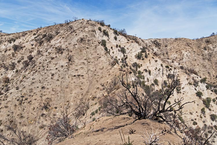
The next peak was to the west, and rather than try to maintain altitude and traverse around on the ridge which would have still lost and gained a lot of elevation we just bombed down the burned slope and crossed the drainage. The down went surprisingly well since the soil was soft enough to dig in and slide a little with every step, but the up on the other side was sort of tedious. This peak had 2 potential high points, one marked on Peakbagger and one on LOJ, I think the southern one was higher, but it wasn't completely obvious. The last little bit to the southern peak was not burned - and made us really appreciate the easier travel opportunity that the recent fire created. It is peak 3402 on peakbagger. The conglomerate/sandstone cliffs to the SW were pretty impressive looking and we joked about writing a fake climber's guide - and wondered how well "AI" could do if we supplied a few photos and asked for a quide.
partially burned yuccas look a bit like pineapple
 |
view over to the cliffs from Peak 3402
 |
hawk soaring above
 |
We considered trying to get to a trail to get closer to another peak to the S, but decided that would make the day extra long. It was pretty hot, but fortunately there was usually a decent breeze as well as some level of overcast to keep things pleasant. Throughout the day various soaring birds passed overhead and I tried to get decent photos of them. They usually didn't come close enough to be really worth photographing - but I tried anyway. We dropped back down to the north and then headed up a different ridge than the one we came in on. It was nice to see something new, but the first ridge was definitely easier travel with less up and down, more cleared area, and no ridiculously steep knife edge dirt ridges. Maybe they weren't dirt but almost sandstone - but they weren't the easiest to travel on and we didn't really know how risky they were. I figured if I slid I wouldn't go all that fast, but I didn't really know. In any case I was glad to have trekking poles and maybe a big ice axe would have been even better. Eventually we crossed into the next drainage and dropped down into that. The fire was more intense here and that made the descent pretty nice. Then we foolishly decided to try to loop around the ridgeline back towards camp instead of going down the drainage and up another arm. So basically we went up and over a little mountain and then dropped back to a drainage we could have just walked around to. oops. Then up one more steep ridge and then we descended the ridge on the SW side of the camp which was a little steep but had a bit of a trail (probably from the fire crew) that dropped us almost back to where we were parked. There we rinsed off and then headed north to get into the national forest - except it turns out that it was closed (I think because the roads were still muddy), so we headed back down south and parked off the side of a long maybe dead end road. It was windy and chilly but the Jeep made a decent mid-level wind break. Nobody drove by the whole night we were there - or at least none we noticed. There was a nice sunset though and we got to bed a little earlier than the night before.
not great picture of one of the steeper sections of the ridge
 |
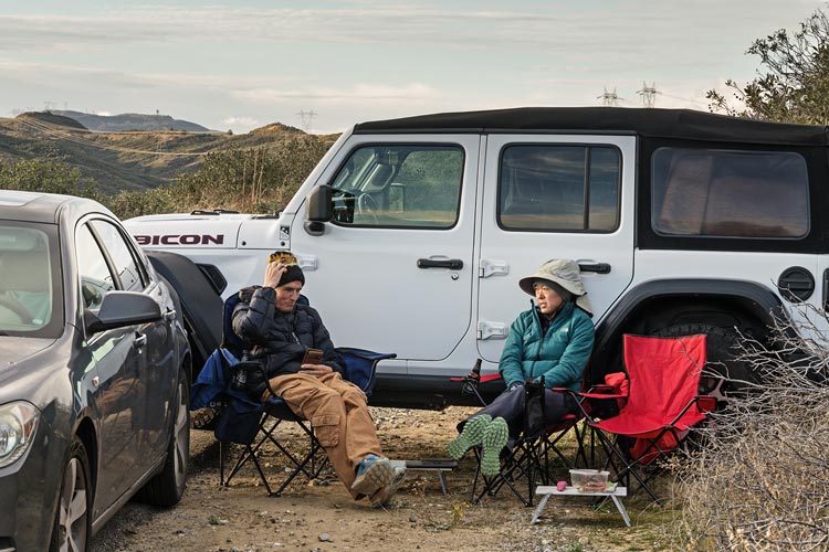
Bob and Iris take advantage of the Jeep windbreak
 |
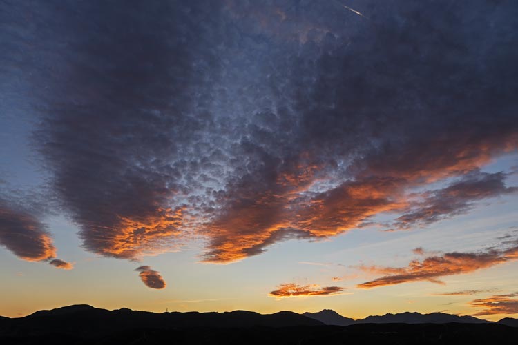
sunset
 |
my Strava page for Burned Badland Bumps with Bob and Iris. 03-22-2025
Bob's Page for 3-22-2025
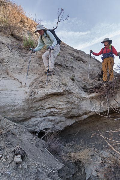
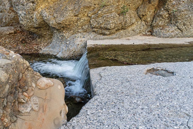
2025-03-23 Today we had a long day planned, so we started a little earlier - which meant getting up before we really wanted to - and it was chilly. In any case soon enough we were hiking back down the road we were on 2 days earlier, but this time we took a left turn and headed up the old road through Fish Canyon. This featured a number of stream crossings - 17 on the way in I think - although one could have been easily avoided. Mostly it was possible to step across on rocks or maybe a bit of a trekking pole assisted leap but we all got at least one wet foot. The tightest part of the canyon was pretty cool with the creek running between conglomerate walls with a concrete roadway (with various levels of erosion). We were also in the shade in this canyon which was probably nice - although we did have an easy source of cooling water if we needed it. There were a few bits of poison oak starting to leaf out to avoid as well as a few plants that looked a bit like it but probably weren't. The last section of road before the old campground was a bit muddy - but not quite enough to really soak our feet.
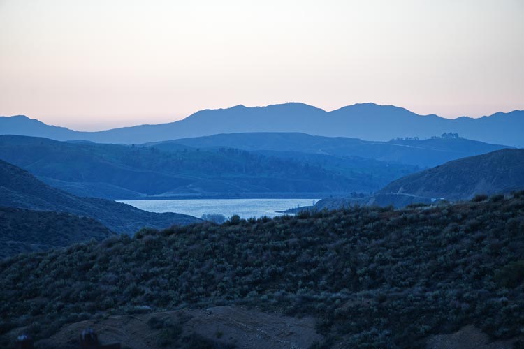
looking down at Castaic Lake in the morning - probably brighter than it actually was
 |
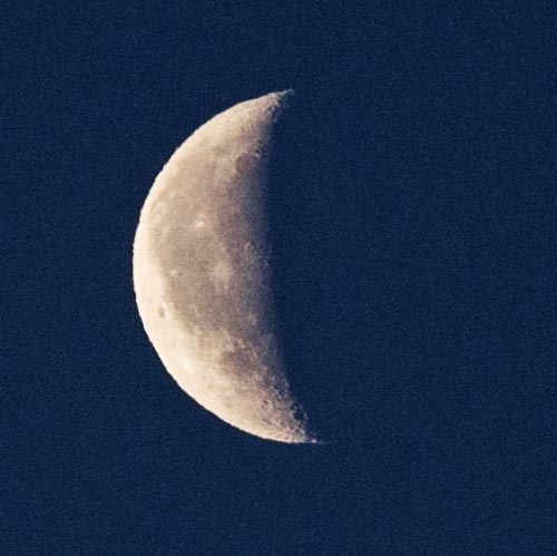
the moon in the morning
 |
one of the stream crossings
 |
the old eroded concrete road
 |
more eroded out old road
 |
Iris on the conglomerate cliff to stay out of the water
 |
The campground was in a wide confluence in the canyon and looked pretty nice in an abandoned sort of way. Then we took the left fork and headed farther up the canyon. The road we were following here was more of a trail at this point, and there was also more poison oak to be avoided. At an old mine (I think) we crossed the creek one last time and then started up a steep hill on an overgrown trail. Luckily we left the poison oak behind soon after leaving the water. I probably should have soaked my shirt and hat before leaving the water, but was already across by the time I thought of it.
Iris on the slope above the creek
 |
The trail was overgrown, but mostly easy to follow. Most of the plants were the sort that could be easily pushed past, except for some sort of thin leafed yucca that had needle tipped leaves. They were easy to push past as long as you could bend the leaves aside, but if they hit you straight on you got stuck. Ouch. A few days later I found and pulled a spike out of my big toe and in my after-action shower tick inspection I found many little stab wounds. In any case we went up. When we were in the sun and out of the wind it was hot, in the shade or wind it wasn't bad. We worked our way up the trail switchbacks to the saddle where we took a bit of a break in the shade and wind. In fact after a few minutes it was even a little chilly. I left a mostly full 48 oz water bottle here in the shade. Then we headed up the much more diffuse and direct trail to the first peak - Red Rock Mountain Benchmark. This one has a few rocks at the top but doesn't really have much prominence. It is on the Sierra Club Lower Peak Committee list though so sees a fair bit of traffic - it might in fact be the hardest peak on that list, although that is probably effected by plant and fire conditions and how willing you are to pay to get to an island. With this peak I've climbed 16 out of ~86, clearly not a high priority. This was the first peak on our itinerary for the day - but the Red Mountain High point was next - over 1 mile to the north and farther to travel if you took the obvious route following the ridge.
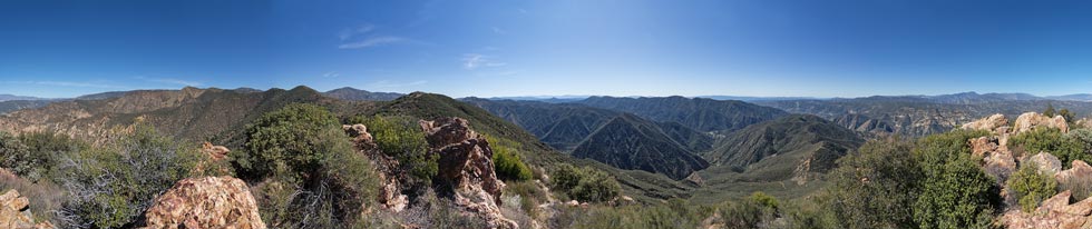
panorama from Red Mountain Benchmark
we came up center rt, Red Mountain is center left, Peak 3101 is lower right blocking the ridge from Pk 3786 (just rt of center)
 |
Iris on the ridge out to Red Mountain - center left
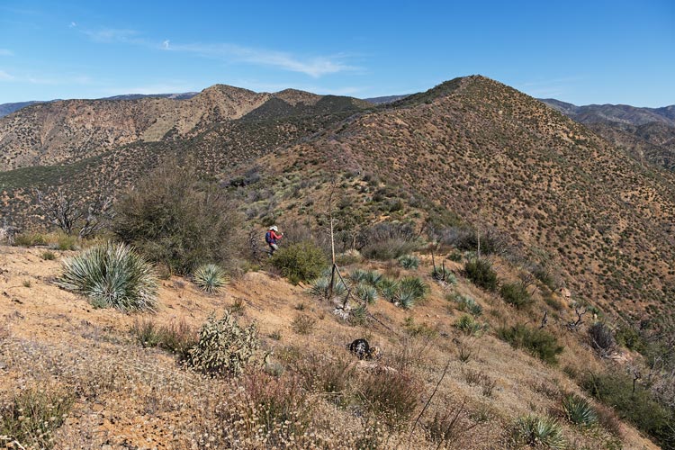 |
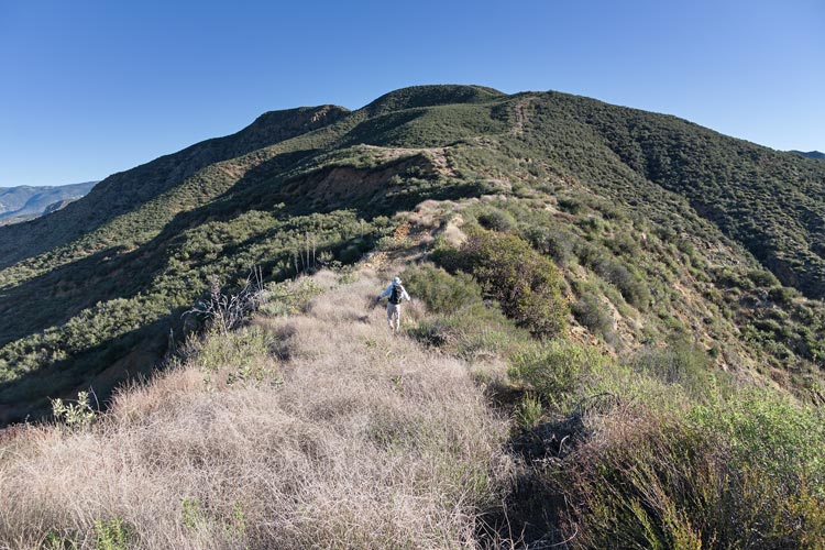
We followed the ridge as best we could. It was mostly easy going with more difficulties in the areas that hadn't burned recently or had more spiky yucca to dodge. It was made easier with some old fire breaks or where we could stick to the east side that seemed to have burned more recently. We made our way up and over a number of little bumps along the ridge up to the point marked on Peakbagger as the high point. There we found a little glass vial register that was a little wet inside. We stuck the paper and vial out to dry in the wind before closing it back up. The next point was the one marked as the high point on LOJ. I guess "super" LIDAR will reveal the real high point eventually, but meanwhile we will tag both points where possible (later it did in fact reveal that the south summit is the high point). This one seemed awfully close in elevation and we forgot to get a spot GPS reading on both points. This finished our main goals for the day, but the stretch goal was one more point. We felt ambitious and also figured we'd never be here again so this was our one chance to tag it - Peak 4460, about half a mile to the east in a straight line - but once again it made more sense to generally follow the crest over some bumps and across some saddles. there was even less of a path for this one, but once again old burns had cleared enough to make things mostly passable with a minimum of pain. You just had to stick to the easier terrain and dodge around the obstacles. The last uphill to the summit was pretty steep, but also a little more clear. Pretty much all day Bob and especially Iris were finding ticks climbing up their pants. Each time they called out and I checked my pants but for some reason I didn't see any. In fact over the entire long weekend I only saw one tick on my pants while the others probably had dozens. I have no explanation for this except maybe my floppy loose nylon pants are harder to grab hold of and when the wind flapped the pants it flicked them off more easily. We were a bit surprised to find there was a summit register on top. Success on our stretch goal - now we just had to get back.
view back from Red Mountain
Red Mountain Benchmark is 2 ridges from the horizon on the right
Peak 3786 from day 1 is 1 ridge from the horizon with the peak on the left
 |
Iris nearly to the summit of Peak 4460 - Red Mtn is about the center
 |
The return went more quickly as we had a vague idea of which areas were more easy to travel plus we could skip some of the summits. Still it took a while to get back to the benchmark and then the descent from there to the saddle was awfully steep and loose enough to be frustrating. I tended to go quickly so that my feet wouldn't slide and I used my poles a lot - so much I was worried about getting blisters on my palms. I managed to avoid that - but later discovered I did get a blister on my rt foot ring toe - I think this was caused by fine dust collecting inside my shoes - especially the day before walking on all the burned areas. I should have worn toesocks. We recollected at the saddle where Iris and I were almost out of water and quite glad to have some stashed and considered heading down on a different trail but decided on taking the known quantity for a few reasons - the "red canyon" way was perhaps harder to follow - and the tracks I had took a few variations, possible poison oak in the canyon, and if we went the way we came up we could take a dip in the creek. So we went back the way we came up.
The descent went a lot faster than the uphill even if it wasn't easier. It is just a lot easier and faster to push down through brush. Once we made it down we had to avoid the poison oak - mostly easily done, but it did require vigilance and effort. I had a good run of rock hopping aided by my poles on all the stream crossings and managed to keep my shoes dry. Iris and Bob were not so lucky and in fact at some point Iris just gave up and waded across the fords - which was quicker and easier than trying to figure out a dry crossing, but did make for wet feet. We counted the crossings on our return (16, not counting actual bridges). There was one spot where you could walk behind a boulder and avoid a crossing that we missed on our hike in. We stopped at maybe the 3rd from last crossing to take a dip. This one was still mostly in the sun and had a nice concrete slab and a bathtub and pool to get into. Bob continued on while Iris and I took a refreshing dip and wash. The water was quite shocking to get into but then felt refreshing after that and despite a bit of a breeze wasn't very traumatic to dry off. We remained cool for the rest of the hike until the last uphill to the Jeep where we got a little too warm even though we were now in the shade. Bob had jug-showered back at the Jeep and didn't have to wait long for us to arrive. We had drunk pretty much all of our water and would have consumed more if we had it. Considering I started with about a gallon I should have brought a water filter (I didn't have one with me on the trip though). Then we drove back to where we camped the night before. This time without the wind it felt about 20 degrees warmer. one car drove up past us and then back down. Not a high traffic area.
the road with Fish Creek (this is where Iris was climbing on the wall in the morning)
 |
another worn concrete waterfall on Fish Creek
 |
my Strava page for Red Rock Mountain with Bob and Iris. 03-23-2025
Bob's Page for 3-23-2025
2025-03-24 We got up at a slightly more reasonable hour this morning and after saying goodbye Iris headed on into work while Bob and I drove back down to the gate and headed back. This time we took a turn and headed up an even older fire break that headed up the ridge past some power lines and on up to the summit of Peak 3101. Not a very significant peak - but it supposedly had no previous recorded ascents (other than the people making the fire break etc. etc.). This was a shorter outing, but it was also more overgrown and hotter than the previous days.
Peak 3101 is just right of center - the far point
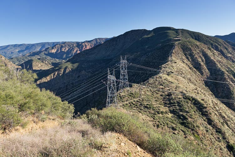 |
Power Lines going over the ridge
 |
following Bob up the ridge
 |
We made our way back down and rinsed off by the gate - it was nice and warm and the dashboard water was warm to almost too hot already too. Then Bob headed off home while I backtracked to the campground from a few days before to check for my mock crocs (they were still there where I left them - oops for leaving them, yay me for remembering that was where they might be and going back for them). Then I headed through LA to Yorba Linda. I avoided the truly horrendous traffic that picked up later, but it still wasn't a whole lot of fun with somewhat random appearing slowing down to stop and go traffic. It does help me appreciate living in Bishop every time I have to drive through the greater LA area (as a non native I sort of consider all the urban areas bounded by the mountains to the north, the marine base to the south, the ocean, and San Gorgonia Pass to be "LA") - obvious heresy to a native.
my Strava page for Peak 3101 with Bob. 03-24-2025
Bob's Page for 3-24-2025
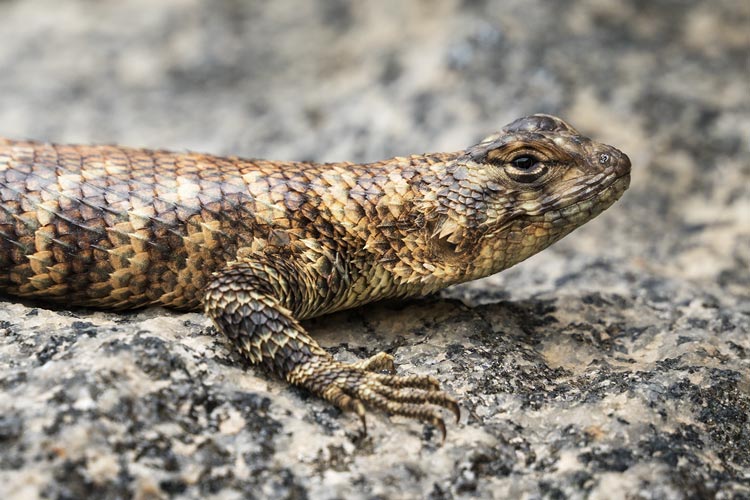
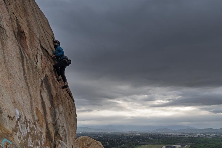
Bonus content - on the 28th we climbed at Riverside Quarry and then hiked up Peak 1739 and the 30th we hiked up Mt Rubidoux and did some toprope climbing there. Then on April 1, I hiked up Peak 3996 out in the desert on the drive back to Bishop. I also developed some itching in the small of my back and one small spot on my forearm that looked like poison oak rash. The forearm one is somewhat understandable but the small of my back is a little harder to explain.
granite spiny lizard near a bolt with no hanger at Riverside Quarry
 |
portrait of female granite spiny lizard or Sceloporus orcutti
 |
my Strava page for Peak 1739 and Riverside Quarry climbing with Iris. 03-28-2025
cross on Mt Rubidoux
I had to wait and line this up plus a little PS to have no people
 |
Iris climbing on Mount Rubidoux
 |
my Strava page for Mount Rubidoux peak and climbing with Iris. 03-30-2025
No material on this page may be copied or used without permission.