Tom Grundy's Picacho Del Diablo Page
Tom Becht had been cranking through the last few of the DPS peaks and Picacho Del Diablo (or Cerro de la Encantada) would be the last of the difficult ones he had left (and his penultimate one). It isn't an easy peak even if Bob Burd did do it in a weekend marathon . We would have a more relaxed pace to both increase our chances of success and increase our enjoyment plus tagging a few extra peaks.
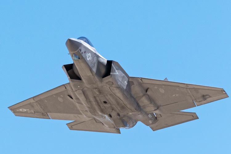
2025-05-20 I left home a few days early to drive down to Yorba Linda. I needed a peak for the 20th, so I stopped once again along the base of the Inyos and this time climbed up Haystack - the summit block was a nice little scramble. I also went up 2 possible rocks for the lower S summit before dropping back to the car with one painful slip onto my elbow. Back at the car an F-35 went overhead quite low. I still had my camera on, so I could get some pics as it approached. This was a pretty hot hike, but it wasn't that long.
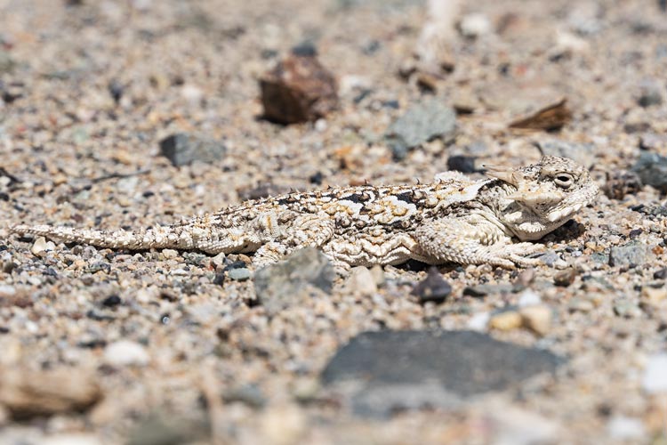
Horned Lizard
 |
F-35C Lightning II passing overhead
 |
Strava page for Haystack. 05-20-2025
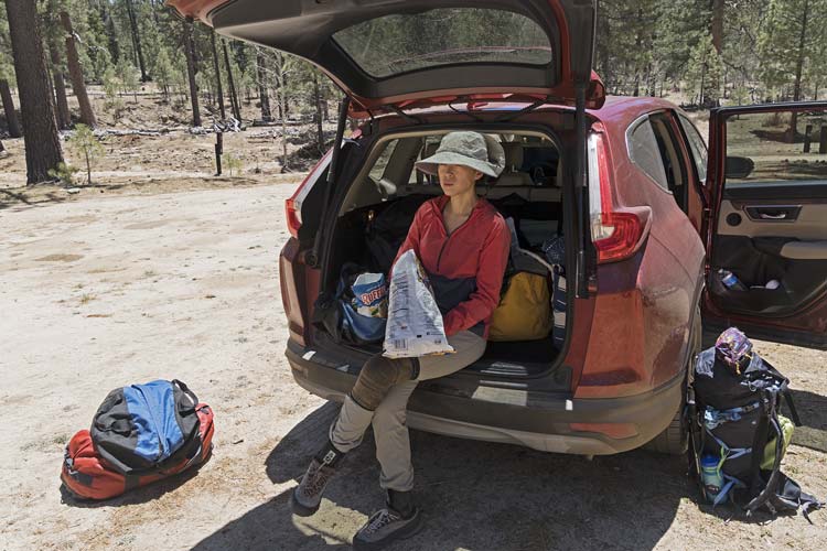
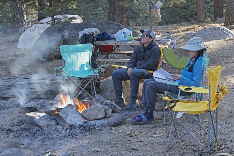
Iris was busy working but managed to pack up her stuff in between preparing for a harrowing briefing. Then we headed to Tom Becht's which wasn't exactly on the way, but did provide a place to park the car. The Jeep had been having some heating issues, so we took a Honda - probably more comfortable and better mileage and there wasn't any 4wd required. After some Thai food fortification we drove down to San Diego where we met with Chris Kerth at a hotel. He had flown in that evening. We had a poor sleep there - the air conditioner either noisily blasted out freezing air or was off.
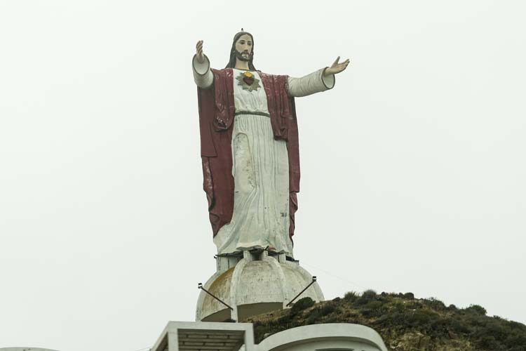
2025-05-23 We got up and rinsed and then left right after the breakfast opened (0630) - fortified with coffee and a quick grab of some food. We gassed up and got pesos and then crossed the border - just a few questions and we were through. At first we were going next to the walled and fortified DMZ before we turned south and headed down the coast towards Ensenada on the toll road.
giant Mexican Jesus
 |
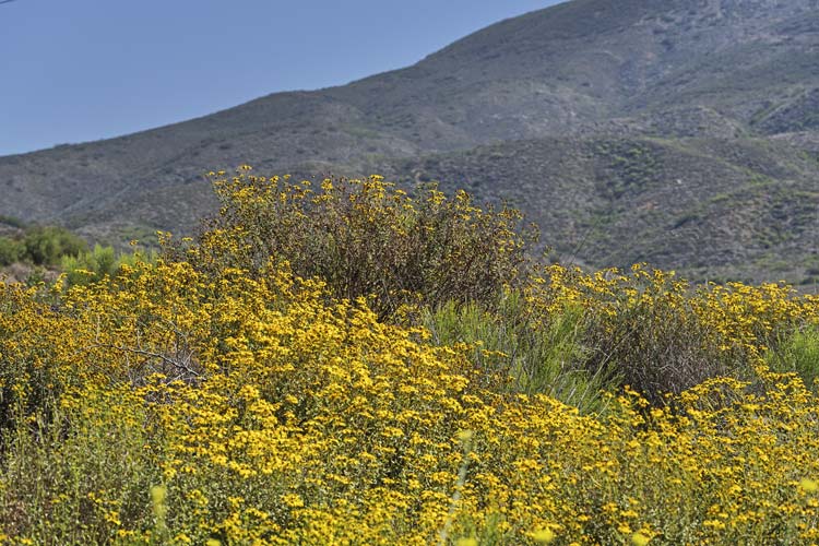
There was a marine layer keeping things cool but it burned off around when we passed through Ensenada. Then we cut inland with a quick rest stop on an old washed out loop of road. We continued down to gas up at a Pemex station before leaving the main road to head up into the mountains. Thankfully this road has been paved, but it was still a long, steep, and winding affair as we gained about 8000 feet in 90 Km. Iris had to put herself to sleep to avoid sickness.
lots of yellow flowers along the road
 |
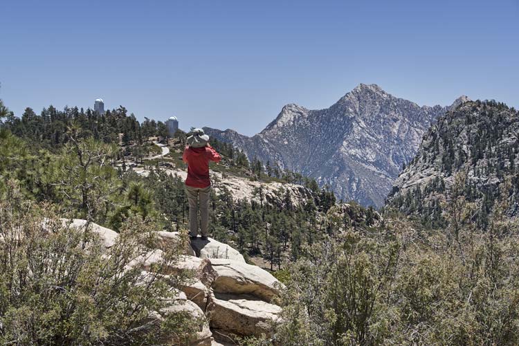
At the entrance station we paid - not 60 pesos/person/day but more like 110 or so (about $6). They also took our photos, made Tom sign a release, and gave us wrist bands. Then we drove to the trailhead. It was almost cool up at this elevation - or at least pleasant. We did some last minute gear and food and water sorting and eating and then headed up the trail. Just before we left 2 people came back on the trail - they had climbed the peak the day before and gave us a bit of beta on time and water. In researching this peak there are a number of descriptions going back many years. I think in more recent years the trail has become more obvious, but it is still nice to have a GPS track to follow or at least to look at when you aren't sure if you are heading the right way. The trail paralleled a wash with some sections in the wash - which was a bit of a pain since it was mostly loose sand. I did see a blue-tailed skink. It was very wiggly and zipped about until it disappeared under a rock. The trail gained about 1500 feet in 5 or so miles up to Blue Bottle Pass where we had our first good view of the peak - and the huge canyon we had to drop down to get there. But first I stashed a 32 oz water bottle and we dropped the packs and scrambled up Cerro Botella Azul (Blue Bottle Peak). This was 9646 ft high and had an even better view of Diablo. It also featured a plastic waterproof summit register with a nicely printed booklet. We signed in and stalled a bit before returning to the packs.
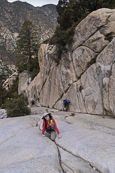
Iris recovering from the twisty road and calorie loading before the hike
 |
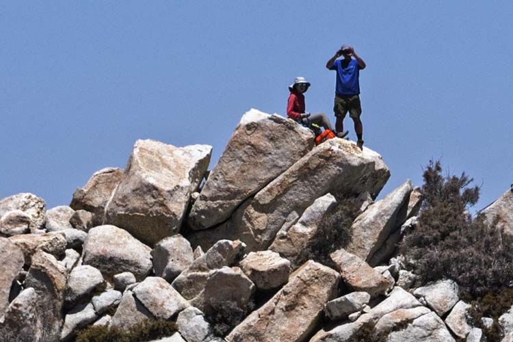
Chris enjoying our first good look at Picacho Del Diablo
 |
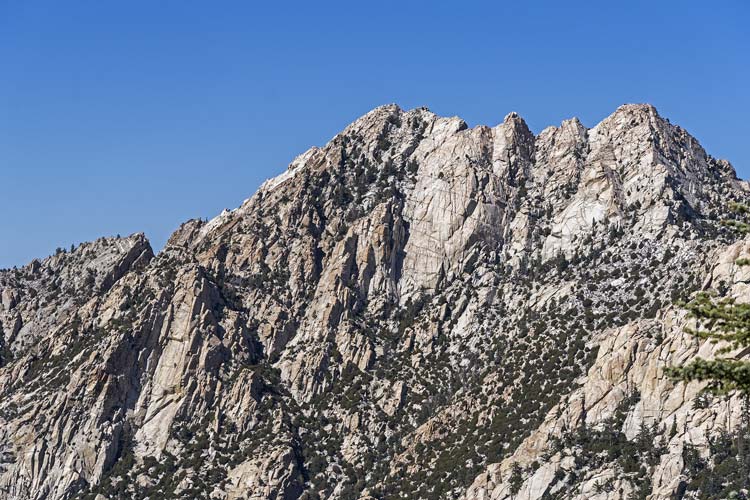
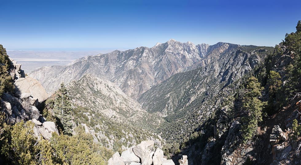
the summit area of Picacho Del Diablo
we went up the leftward rising ramp from the bottom and then cut back up ending just right of the summit
 |
Tom and Iris on Botella Azul
 |
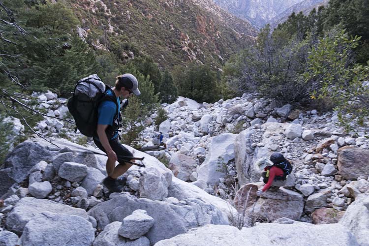
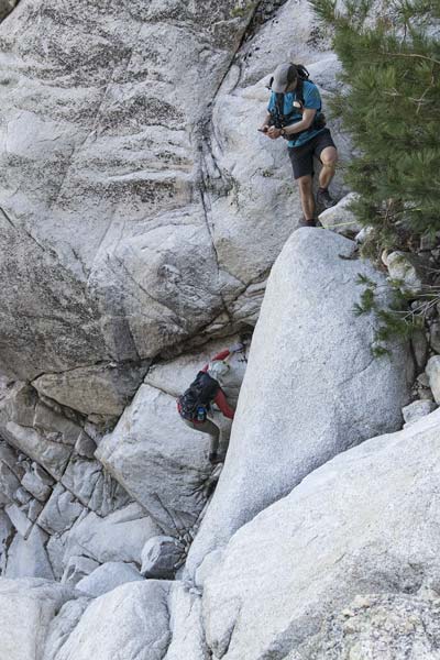
We loaded back up and headed down into the canyon - all the reports agreed not to head down to early, but the trail was pretty obvious dropping down to the east into the head of the canyon. It was also pretty loose. Then we turned more directly down the canyon and the going was a little easier before things got a little more interesting - with some huge boulders and cliffs to navigate. There were a few options, we mostly stuck to the left or followed trails down with maybe one short 4th or stiff 3rd class slot to go down - probably avoidable if you went farther left. It was starting to get a little dim when we got to the water - not quite jungle, but there were ferns and massive cedar trees. The canyon leveled off a little here and there was an occasional trail on the left (west) side. Mostly we were just boulder hopping down the canyon. We made it to Campo Noche just as it was really getting dark. There was a pretty large group there - who didn't speak English. They showed me another place to camp but explained they would be tromping through at 5 am to head up the peak. Meanwhile the others found a place to camp across the canyon, so we set up there. We got water to filter, set up tents, marvelled at the near plague of mice running around (ok, not really a plague, but it was pretty common to see 2 at once, and one climbed up my back when I was hunched over cooking). It took a while to get dinner and to stash all our stuff out of mice range (mostly in the tent). It was a pretty warm night, and not the best sleep between the snoring, mice, and early wake up. Iris freaked Chris out when he was in his tent and she was outside talking to a mouse "do you want to die?"
heading down some big talus into the canyon
 |
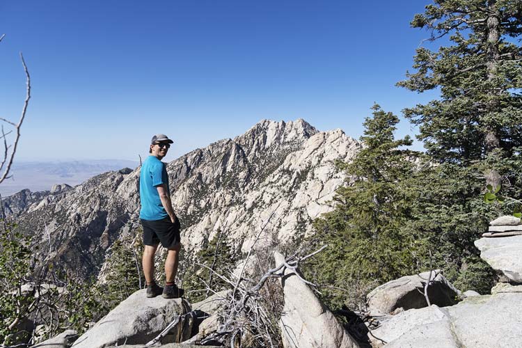
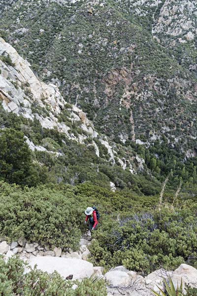
2025-05-24 We got up and had tea and pop-tarts while we geared up for the day. We could see the other groups lights head up across the canyon when they started. We started up shortly after 6. There were options - up the talus or a tunnel through the trees (we took the talus). Mostly it was steep, solid, and rocky with lots of weaving around bigger rocks or plants. Very little of it was actually hard but there were a few bigger rocks that took some effort to get onto and it wasn't always obvious which way the trail went. Mostly it was a lot of trying to figure out the easiest way to keep going. When it was less obvious we consulted the GPS. Sometimes the GPS tracks were helpful, sometimes it just told us we were more or less on the right path (3 tracks on one side of us - 2 on the other). There were also cairns, but it seemed they were marking lots of alternative paths too. Fortunately we were in the shade for the first few hours as the sun was on the opposite side of the mountain. At some point I got tired of poling in the talus and stowed my poles and put on my rubber gloves. This worked a bit better for the steeper parts and not quite as well for the lower angle parts. We worked our way up one chute and then crossed into another to the left and then into another farther left. At some point we turned a little to the right and went up "wall street" which was a low angled corner that was notable because there were less plants and more solid rock. It didn't last long. We continued up and passed the 6 in the other group heading down. This was just before 10 am. We didn't make it up by 10, but did a short time later. The views from the top were quite spectacular although there were enough clouds or haze to prevent us from seing the Pacific, we could see the Sea of Cortez (or is it the Gulf of California?). I was hoping to see some California condors circling, but I was thwarted in that regard. There were 4 summit registers, the orange waterproof box had a nice printed book in it with some of the routes and history, it didn't have a writing implement and I couldn't open one of the other boxes - so I had to pull out my emergency pencil. I also had brought some windmill summit cookies. We spent nearly 2 hours on the 10154 ft summit (the highest in Baja). Then Chris and I headed off towards the S summit while Tom and Iris stayed.
Iris getting out of some of the manzanita
 |
Tom crossing a little ridge
 |
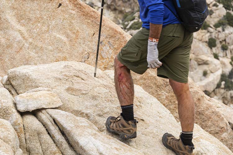
Tom made a blood sacrifice to the mountain
 |
Chris photographs Iris coming up a steep section
we bypassed this section on the descent
 |
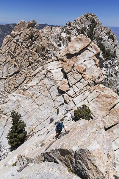
coming up "wall street"
 |
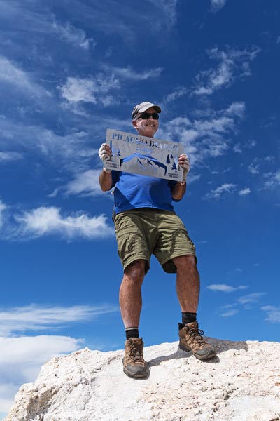
Tom Becht on the summit
 |
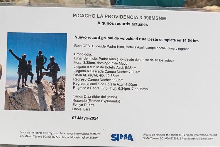
page from summit book - east route speed record? don't tell them about B Burd and co
 |
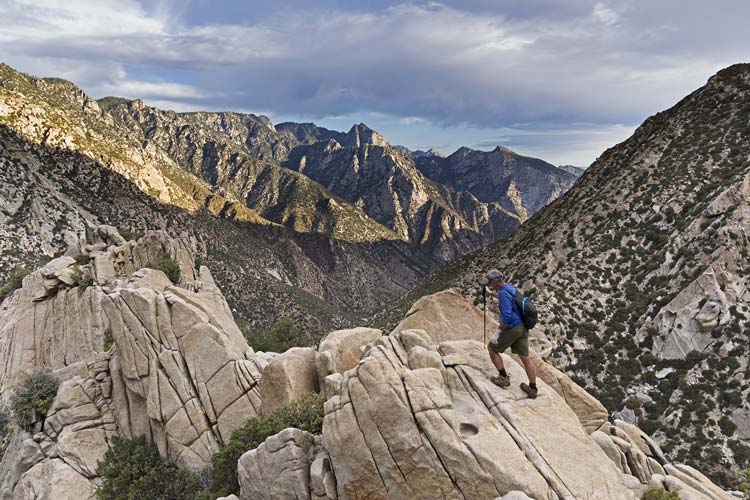
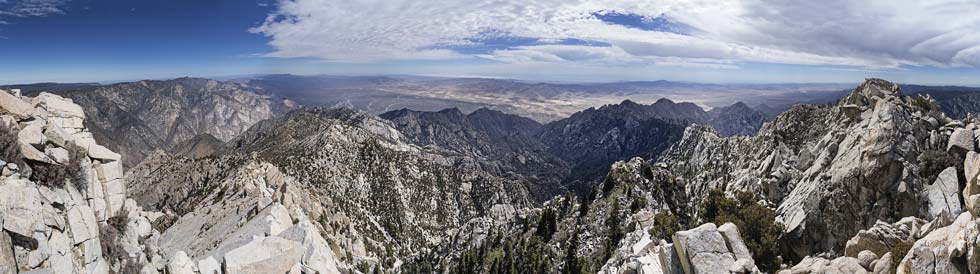
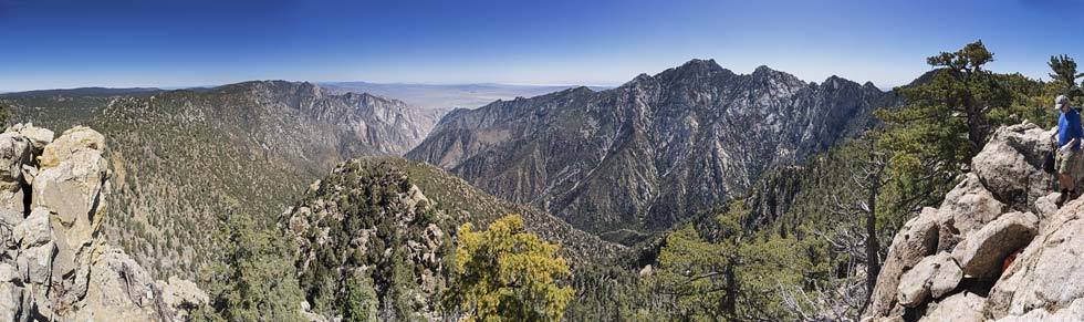
panorama from the summit of Picacho Del Diablo looking basically north through east to south
 |
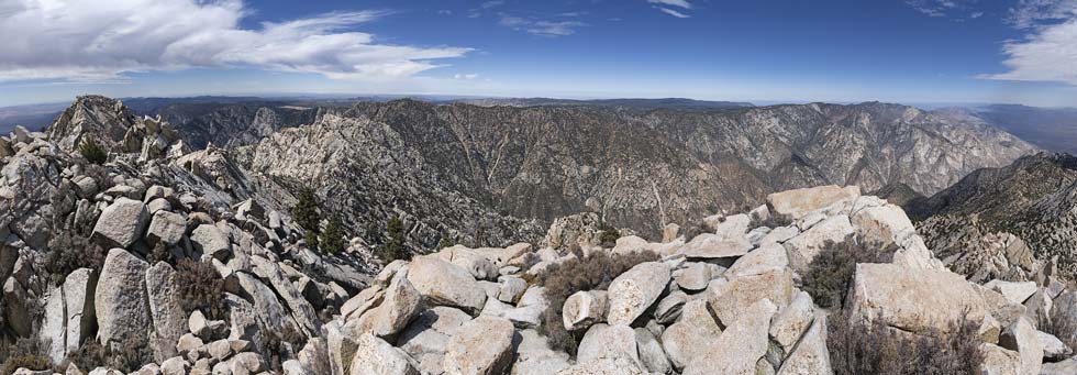
panorama from the summit of Picacho Del Diablo looking basically south through west to north
 |
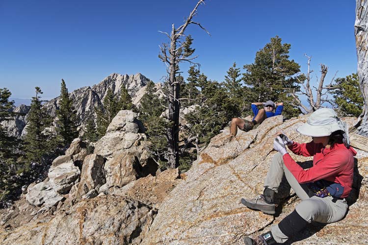
The traverse to the S summit looked daunting, but wasn't too bad. There were holds and a steep rampy ledge at the first drop which I climbed down. Chris opted to head down a more secure corner before this. Then we cut onto the east side to skirt around the next bump. It sloped down with lichen but was also pretty low angle and easy. This took us around the corner where we could drop down to the next notch. Then we cut around the next bump on the west side on a ledge system that reminded us of Dragon Peak in the Sierra. Then we went up a steep ridge on the west side - a little like some of Conness and cut around the east at the top to the S summit. We could see the others on the N summit packing up to go. At 10138 ft this was just a few feet lower.
scrambling towards the S summit (Iris and Tom are a dot on the other summit)
 |
Iris and Tom on the summit viewed from the S summit
 |
zoomed in on Iris and Tom
 |
We opted to drop down to the SW - first following the ridge S ish and then onto the west side zig-zagging to the top of a massive wedge. We went down the gully on the SW side of that and then followed the drainage down from there to a point just below Wall Street. We did pass occasional cairns on the way down so we knew at least someone had gone that way. I opted to wait for Tom and Iris while Chris continued down so he could explore down canyon. I got comfortable in the shade and soon I could hear Iris and Tom heading down. They joined me about 15 minutes after Chris left. We continued down, sometimes on the exact route we took up, sometimes more in the gully or up on the N side to skirt around a steeper section with a fixed hand line. There was a lot of descending to do and it was a lot warmer since it was later in the day and we were in the sun. Sometimes we took a poorer line just because it was in the shade.
There was a bit of a breeze where we came over the ridge into the last chute and we stopped under a tree for a bit of a break to cool off. Then down where it really felt hot. This time I followed the tunnel through the trees to eke out a bit more shade. It seemed to go slowly, but then we were down and in the shade of the big trees at the bottom. Chris was still relaxing in camp when we got there but soon left to explore down canyon. After a few minutes of not moving we rinsed off in the shockingly cold water and rinsed some of our clothes. Then we had an early dinner and did our best to rehydrate before going to bed pretty early. Before it got dark a party of 3 came down the canyon and camped across from us.
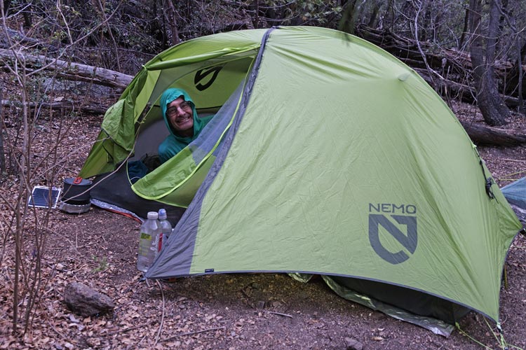
I'm in the tent at camp
 |
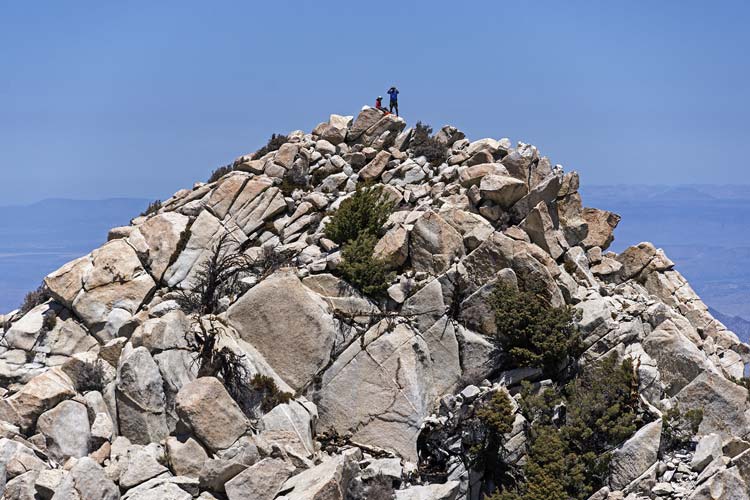
2025-05-25 We wanted to get out in time to go to the observatory which closed at 1 - that meant an early start. We had packed up and were hiking shortly after 5. This time we followed the trail on the west side of the canyon a bit better - it was definitely easier than rock hopping. There was still some rock hopping to be had. We caught up to some others at a steep place where we had been on the west side coming down, but they were on a ramp on the east side. We let them get past the steep section before following them up. We passed them in the talus above. It looked like the 3 who had come down the night before. One guy was looking pretty slow and we hypothesised he was feeling too tired to climb the peak so they were heading out that day. We went up the slot we had come down but it looked like they were maybe coming up another way. In any case we continued to power up the drainage to the point where we cut west. This was probably the least pleasant section - it was easy to follow but there was more loose pine cones and duff. Still it didn't take that long before we were back at the pass. I retrieved my stashed (and nice and cool) water and we took a little break before heading down the trail. We took a slight detour here on an alternative trail, but not much out of the way. I tried to keep a decent pace and when we got to the cutoff for Scout Peak we had enough time that we all stashed our packs behind a log and hiked over and then up to the 9318 ft summit. This was across the canyon from Diablo and had an excellent view. It also had another plastic orange register box with fancy book. We signed in and shared busted shortbread summit cookies and took pics before heading back down.
Picacho Del Diablo from Scout Peak - Tom is on the right
 |
The last bit to the trailhead was a bit tiring. It was warm, there were sandy sections, and I was tired of having a pack on even if it wasn't all that heavy. I tried to stay on top of my hydration. We passed some other hikers (they were down in the wash and we were up on a side trail) and then mercifully we were back at the parking area. There were a number of vehicles there now. We loaded our packs into the car and then headed back and to the observatory.
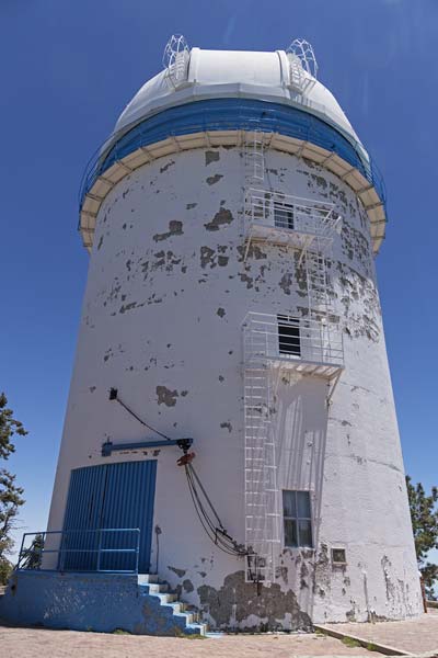
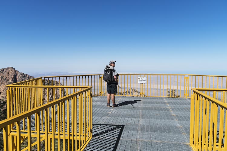
The observatory had a locked gate but soon someone drove up and opened the gate and motioned for us to follow him. We had the windows open enjoying the cool air - and now the not so cool stinky exhaust - maybe no catalytic converter? We parked at the base of the 2.12 M telescope building. He didn't speak English, so I don't know if the normal tour is more extensive. We walked around the building, looked at the plaque, took pics across at Diablo and the other telescope buildings, then Chris asked if we could go up a nearby bump with an observatory on top (that was a bump on the map). No. Oh well. We loaded back in the car and followed him back to the gate. There were 2 other cars waiting for entrance when we left.
the 2.12 meter telescope observatory
 |
Iris looking at more telescopes plus the distant Picacho Del Diablo and Pico Altar or Peak 2820 to the right
 |
We drove to the campground near the entrance. The first site we came to was absolutely mobbed - it looked like maybe SAR training, but I could be way off. Then we found an empty site and set up camp. After some relaxing and probably too many chips Chris and I drove back to hike up one more peak. We parked a little farther than we had to from the start, but it was just levelish road. Then it got steep following the road uphill. Chris was cruising along at Chris pace and I could barely keep up. We powered up the road passing a number of people coming down and one group going up. There were a few viewpoints at the end of the trail and we started with the southernmost one. It did have a most excellent view across the canyon to Picacho Del Diablo.
Picacho Del Diablo from Mirador Picacho - Botella Azul is 3 bumps to the right with trees on the right side
 |
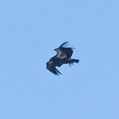
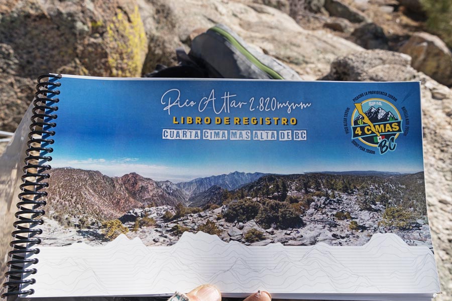
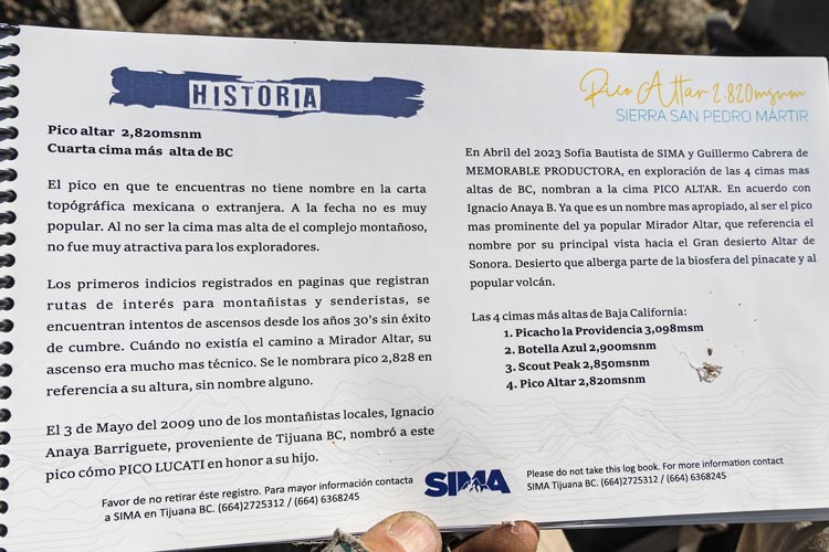
Then we headed back through the aspens and to the next overlook. This one had a metal mesh balcony cantilevered over the abyss. The view was more ENE out over the desert to the Sea of Cortez. Also a pretty spectacular view. Then we headed up cross country towards the peak to the N. This involved a number of false summits, some with antenna and solar panels. Eventually we made it up to the 9252 ft summit of Peak 2820 (I'll let you work out how many M tall it is). This also had a nice orange summit register complete with book which called it Pico Altar- as best I could determine from my poor reading of Spanish is this is the 4th of the 4 highest peaks of Baja (the 4 we had done this weekend). Sadly the list is not an official one on peakbagger, but Diablo did finish the "Desert Peaks Section Emblem Peaks" list for me. It looked like many of the people climbing this peak came over from the observatory. I did see a large dark bird fly by - it just cruised past and off out over the desert. Maybe a condor?
Chris on the viewing platform
 |
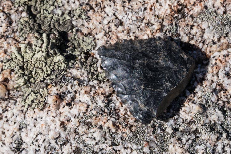
obsidian point
 |
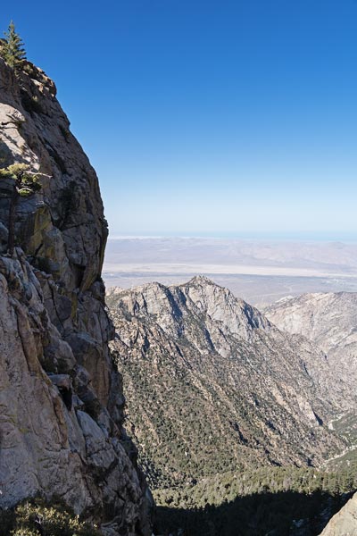
impressive cliff on the east side of Altar
 |
probably a condor off in the distance
 |
cover of the Altar summit register book
 |
page from the Altar summit register book with the 4 peaks
 |
We dropped down to the west to avoid the many false summits and then walked south across the aspen plateau (they were just starting to bud out) to the road. Then we followed that back to the car. I had to jog sometimes to keep up. We loaded a bunch of firewood into the car and then drove a bit up the road to a fallen dead tree to collect some more and rinse off. I opted for an exposed but sunny sandy "beach". It was lovely. Then back to camp where the others had scrounged some wood (the area was picked pretty clean) and started a fire. We had a lovely campfire and dinner and then a much colder (and better sleep) night.
Chris and Iris by the campfire at camp
 |
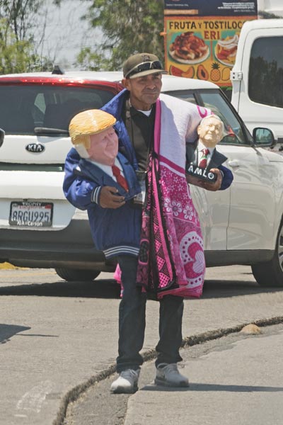
2025-05-26 It was another early morning as we wanted to depart as soon as the gate opened at 7. (Chris had asked if we could leave earlier, but that was a negative). So we packed up and were waiting at ~6:45. They opened the gate at about 6:50 and we were off down the long winding descending road. Iris put herself to sleep again. The drive was uneventful with a stop at a checkpoint where they looked at Tom's passport and seemed disappointed he didn't speak Spanish. We also had some confusion where google kept routing us away from the freeway (turns out Chris' map program had been set to avoid tolls). As we got nearer to the border the wait time started to increase rapidly. We took one wrong turn and had to loop around to get in line. The line was long and slow. There were a number of static and mobile vendors along the route selling everything from shots of tequila (I think) to puppies and mirrored last suppers and ceramic busts of Trump with a bandaged ear. We crawled along listening to tales of near misses in the outdoors before finally making it to the border after about 2 hours. Once in the US the line spread out to many border stations. We picked poorly since they decided to search a car a few ahead of us pretty thoroughly, then the next car just waited and waited before it was waved up. When we finally made it they took all our passports and asked us how long we had been in Mexico, what we did, and if we were bringing anything back. 3 days, climbed Picacho, no. They had us open the back and looked in and then we were through.
for sale in the border line
trump and AMLO busts among other things
(AMLO = Andrés Manuel López Obrador
the previous Mexican President)
 |
We dropped off Chris at the airport, then drove back to Tom's. There was a bit of slowing where some Osprey airplanes were flying around and distracting traffic, but mostly it was just heavy traffic but moving along. We were very happy to get out of the car and eat pizza and shower and sleep in a comfy bed.
The next morning Tom took Iris to the airport on his way to work - she went to Florida for a launch. I walked around the neighborhood looking at landslide damage while waiting for traffic to ease and then drove back to Yorba Linda and then later back to Bishop. A successful trip to a cool place, but not the easiest of logistics and too much driving. I think this leaves Iris with about 4 more DPS peaks to do. I need 11.
Strava page for El Picacho Del Diablo plus. 05-23 to 25-2025
No material on this page may be copied or used without permission.