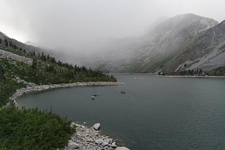
2024-08-24 A week after the challenge and we were somewhat recovered. We planned to climb some peaks up out of Lake Sabrina and Jim Burd said he wanted to come. We got up early and met Jim up there about 6:30. The forecast was for chilly and we didn't know what all we would encounter so we had crampons and ice axes with us. We hiked the usual trail up to Blue Lake and then continued on to the Baboon Lakes. There were a few snow flurries.
| |
|---|
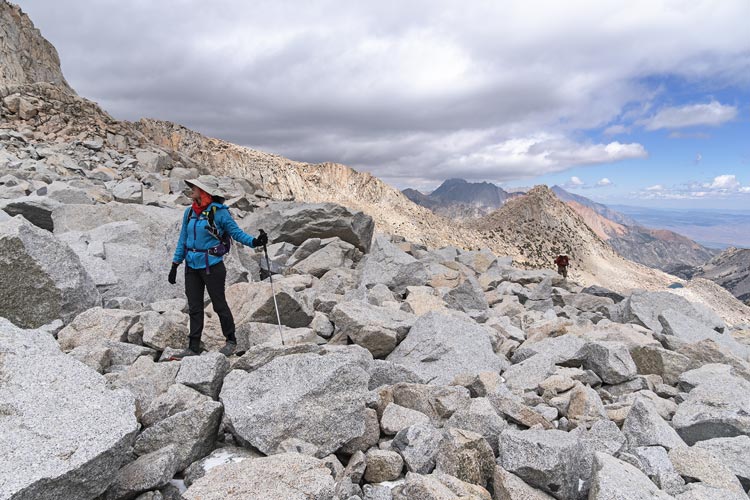
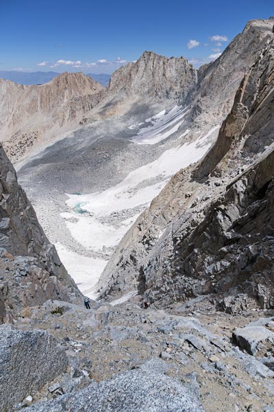
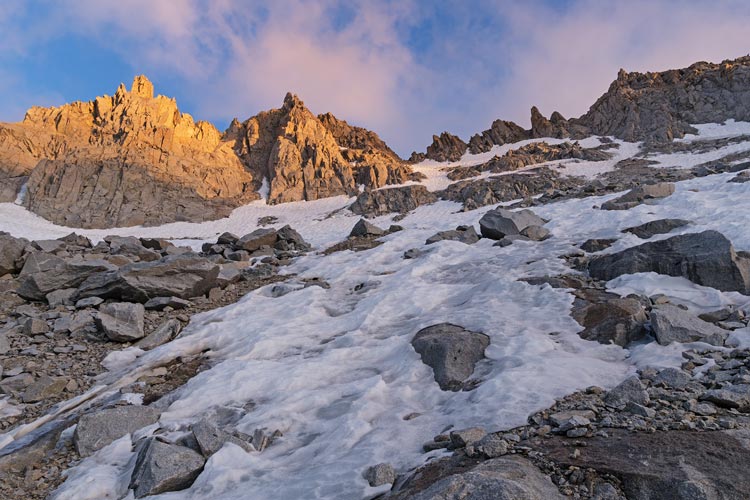
After Baboon Lakes the trail sort of disappeared, although sometimes we would find ourselves on a bit of a social trail. Then we crossed a drainage (with ice in it) and headed up the rocks. As we neared this a large rock dislodged itself from the morraine and tumbled down - apparently on its own. This just confirmed our desire to stick to the rock ridge rather than head up the horrible looking morraine. At the top of this ridge we set off across the at least flattish jumble of talus/morraine to the base of the glacier - or at least the snowfield. There we put on crampons (not ideal as the toe of the altras I was wearing didn't really match the front of the crampons - they were more strapped onto the big toe and the next 2 or 3 instead of all my toes. Iris had new crampons so had some difficulty getting them strapped on securely too). Then we tromped off across the hard snow and ice.
 |
|---|
 |
|---|
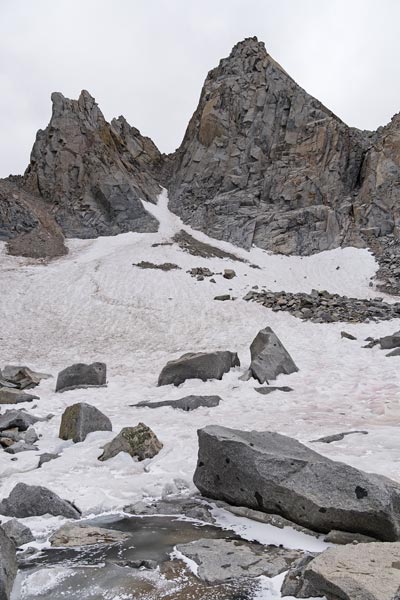
At first the snow was easy to travel on, but as we neared the gully things got steeper and required more care. Fortunately the snow was not flat so it was possible to essentially slab climb with crampons - carefully stepping onto the lower angled bits and when necessary being much more secure with the ice axe and steps for the steeper parts. We worked our way up to the top of the snow avoiding blue ice and the steepest parts. Then took off our crampons and headed up the crappy chute. This featured lots of loose rocks of all sizes perched on bedrock or just piled up at the angle of repose. I tried to stick to the rock on the sides to avoid sending things down on those below. Still, a few things went down but didn't hit anyone. It was slow going, but we made it up to some more secure spots to wait for Jim to come up. Then we continued on up to the plateau above. It was quite windy up there, so we backtracked out of the wind for a short break and snack.
 |
|---|
 |
|---|
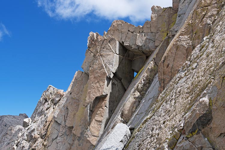
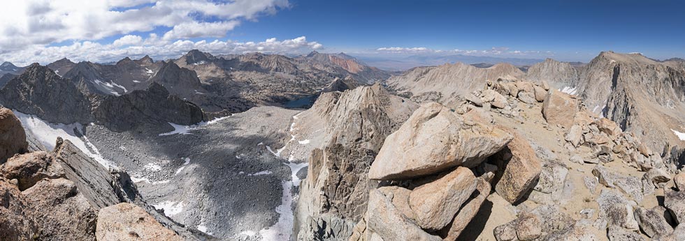
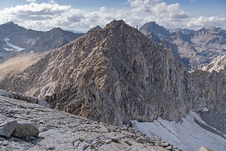
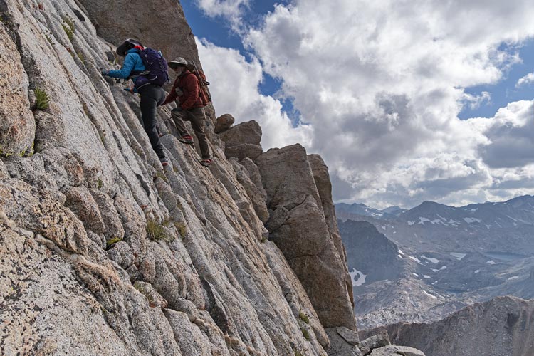
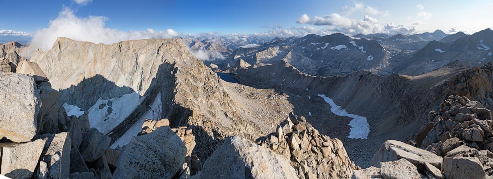
From the plateau it was a short walk and then scramble to the high point of 13360 ft Point Powell. We went to both possible high points and then decided to go to peak 13200 - it didn't have much prominence, but a dot is a dot and we were there. Jim declined to hike up to this extra pointless point. From there we cut across the bowl and up the ridge that led to Point Wesley - only a few feet short of Point Powell at 13356 ft it was a small pinnacle on the ridge and another dot to turn green. The scramble up was probably 4th class, and Jim declined again. It did have a nice little summit block. Then we probably should have figured out a way to go around the NW side - that dropped off precipitously, but evidently had a way through. Instead we went down to the SW and around on the W side to continue down the ridge. This had some scrambling - probably class 4 but at least solid 3, especially with gloves and a cold wind.
 |
|---|
 |
|---|
 |
|---|
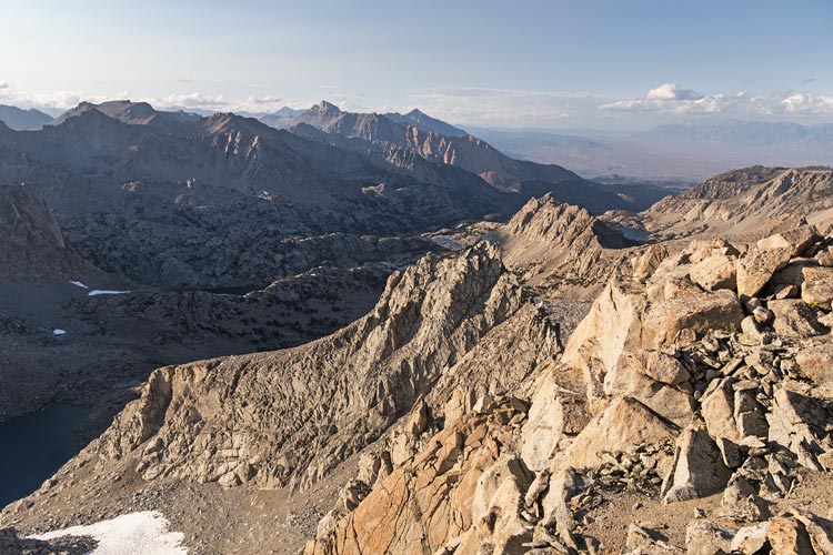
We worked our way down the ridge avoiding a few gendarmes but mostly on or just S of the ridge and then up the other side to 13364 ft Mount Powell. It was getting late now, but at least we just needed to go down (we declined to try to get a point that was west on the jagged ridge). We worked our way down to the saddle to the west and then headed down the slope. On the topo map this is a glacier or permanent snowfield, but there were just patches of snow and ice. We stopped a bit down and put on crampons and used them to head down the snow for a while, then back to the rock/dirt which we were able to piece together a mostly snow-free way down to the drainage SW of Echo Peak. We followed that down eventually picking up a bit of a use trail down to Echo Lake. By now it was pretty much dark and we got water and our headlamps.
 |
|---|
 |
|---|
 |
|---|
 |
|---|
We worked our way around to the outlet of the lake and crossed to the W side of the drainage. Then headed downhill finding and losing the use trail past Moonlight Lake where we cut across the talus field and eventually joined with the trail by Sailor Lake. From there it was just a matter of following the trail back to the road. That sounds simple enough, but it was still a long way to go with lots of down and dust and sand on steep rock and excessive switchbacks (and some useful switchbacks too). You can also see the light on the N end of Lake Sabrina for miles - which is a bit frustrating. We finally made it back much later than we planned or wanted to. It was somewhere around a 17 hour effort with a lot of cold wind and less than easy cross country travel. Also my knee didn't feel great - still not recovered from the last day of the Sierra Challenge.