Tom Grundy's Desert December 2021 Page
We took another extended trip to the desert combined with some friends as well as Iris flying out of Vegas for work. A lot of driving, but also a lot of peaks.
Dec 8, 2021 after a day of packing, working, and final errands we drove south and then east late into the night. We drove through a Christmas-decorated old west town of Oatman complete with green laser lights. Soon after that we got to the camp spot around midnight. That night it was very windy and our spot on a ridge offered little protection - fortunately the metal tent (truck) is pretty secure.
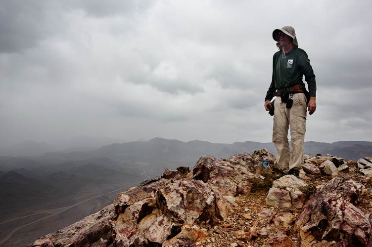
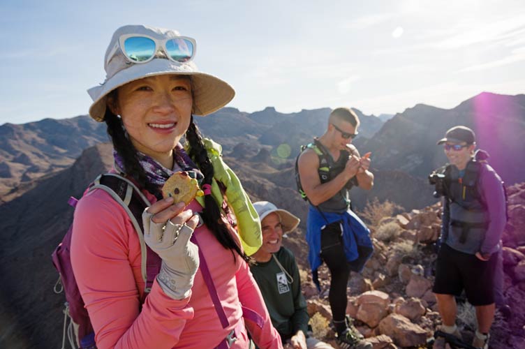
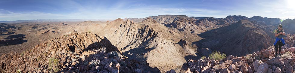
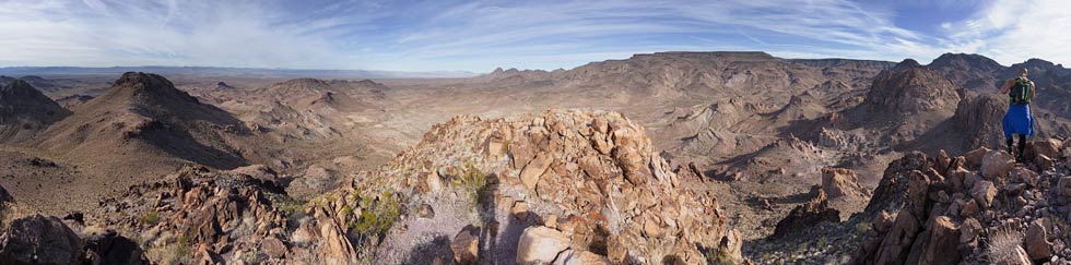
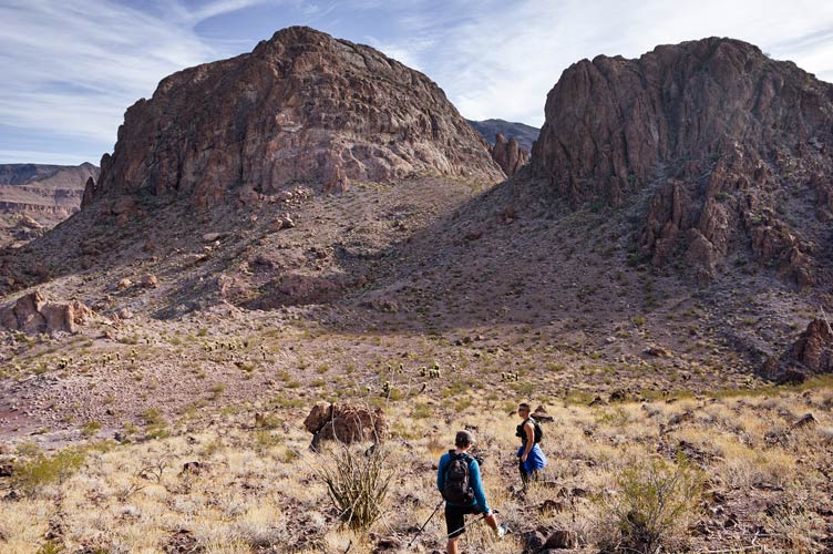
Dec 9, 2021 We decided on a half day to start since the rain was supposed to hold off for that long. We rode in Bob's Jeep as far as seemed prudent (and to near the start of the wilderness) and then walked up the wash for a while past a messy spring (lots of burros come here) and then we headed up the hill. There seemed to be more hostile plant life than normal and I think everyone got spiked a few times. I got a cholla in my calf, and Iris hit one with her knuckles among other things. The pack rats would rip the cholla apart and strew bits all over - this was especially egregious when they fell down the scrambles landing on all the ledges (handholds). We hiked up to a saddle and then up the ridge to the summit of Battleship Mountain (4165'). It was cold and windy up there without much sun. We headed back to the saddle. On the way down I saw a cairn on a small pinnacle, so I took a detour to scramble up that - maybe 5.4 or so? Hard to tell with a camera strapped to my chest and floppy running shoes. I did take the camera off for the descent. Then we continued up to another peak, Peak 4080. We took a different route for much of the descent past some interesting (and chossy) looking cliffs. Then back to the jeep just in time before the rain started.
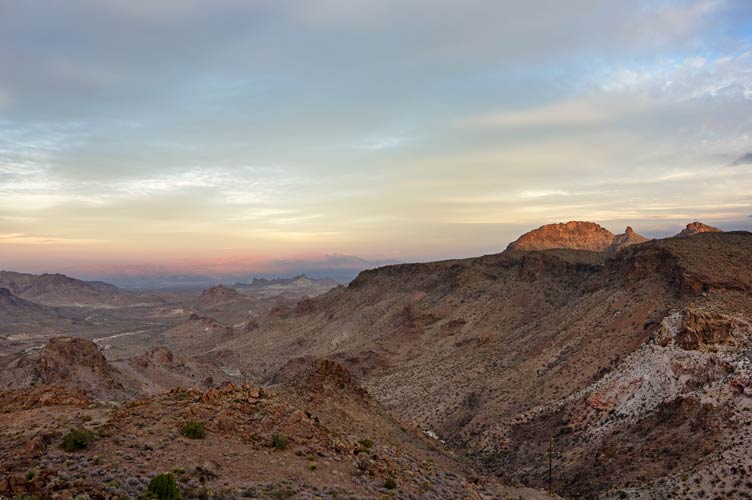
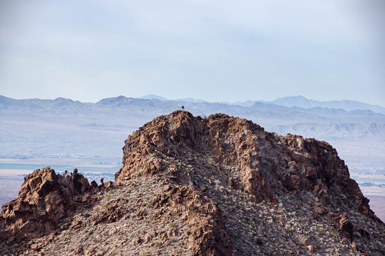
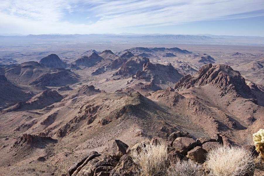
view from where we camped, Battleship, the spire, and peak 4080 on the right in the sun
 |
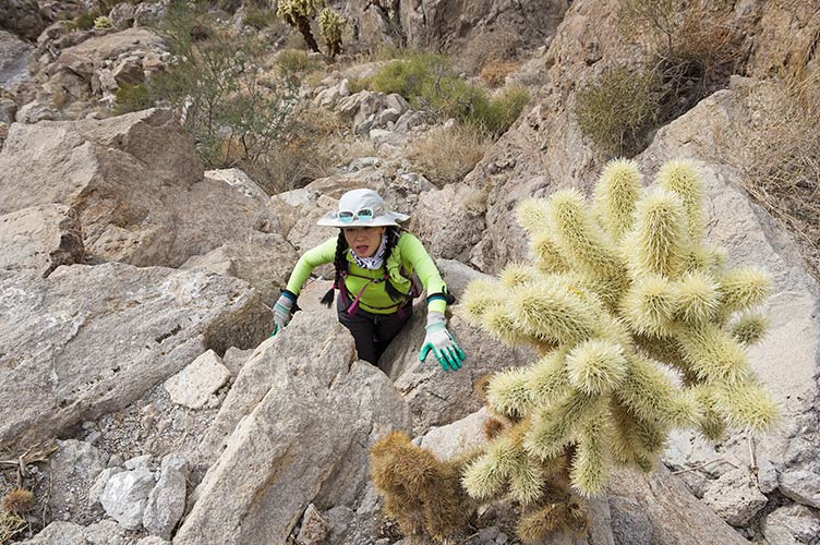
Iris scrambles up - trying to avoid the cholla
 |
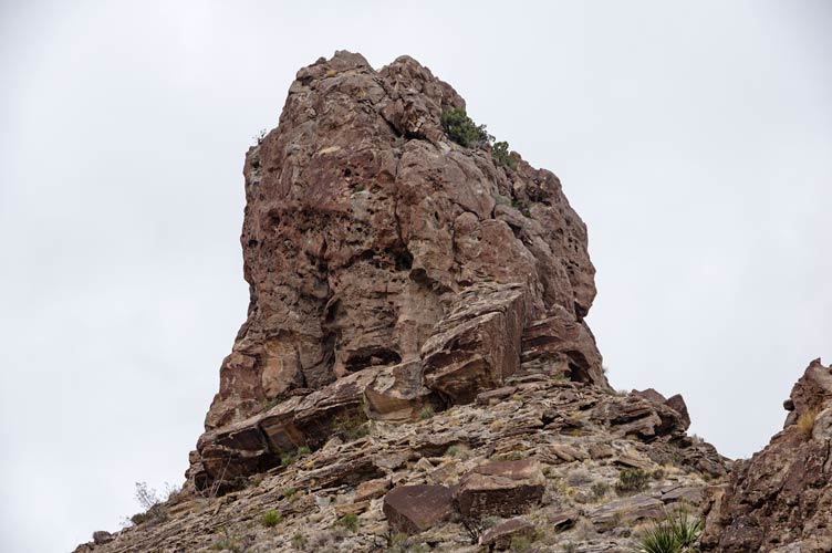
the spire from the eastish, I went up the middle right side
 |
Strava page for The Battleship plus. 12-09-2021
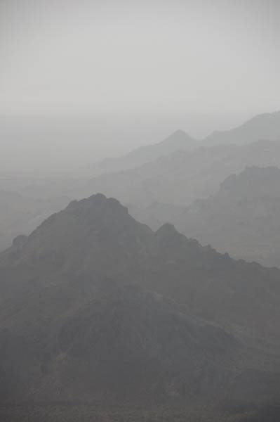
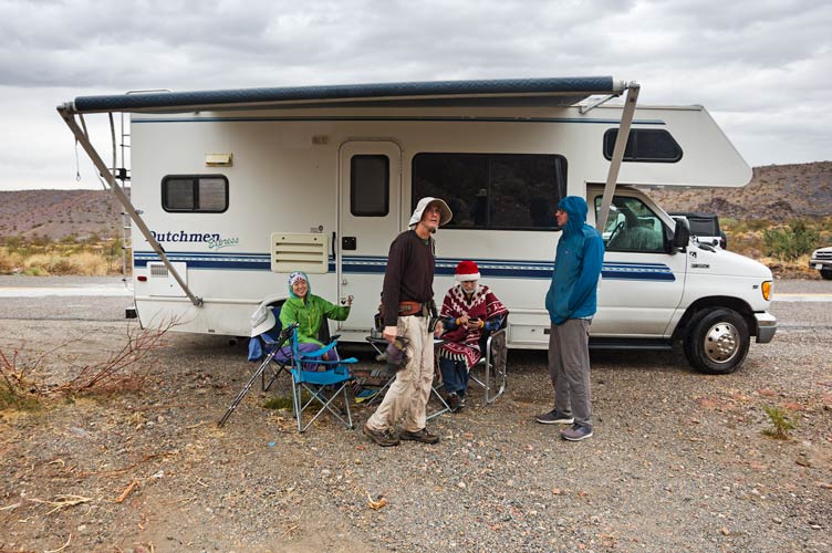
We went back to the rest of the vehicles and Bob and I decided that we weren't done for the day even though there was a drizzly rain. We decided on Boundary Cone and left the others at the side of the road and headed up. Meanwhile Iris washed up in the rain and then hung out under the awning of Jim's RV. The hike up was pretty nice but marred by slippery wet rock, spray painted crosses and arrows, rain, and lower visibility. It was mostly just soft weather, but as it picked up I put on my raincoat. The summit was suitably cone like and the S side was very precipitous. The rain was much more steady on the descent and my legs got pretty wet. After a cup of hot chocolate under the awning we drove off to the next sleep spot, cranking the heat to dry things off and warm up. I washed off a bit in the hot cab of the truck. The rain didn't stop, so we cooked dinner under the awning. As the wind picked up the dry area under the tarp got smaller and we all went to bed.
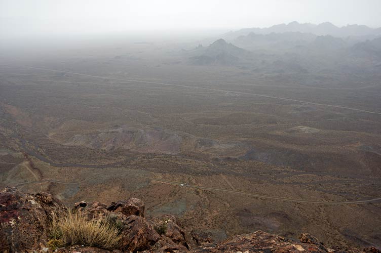
view from near the top of Boundary Cone - rv is little white dot near the center bottom
 |
Bob on top of Boundary Cone
 |
misty mountains from Boundary Cone
 |
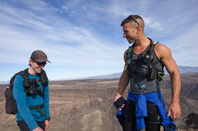
Iris, Bob, Jim, and Eric under the awning after Boundary Cone
 |
Strava page for Boundary Cone in the rain. 12-09-2021
Bob Burd's trip report for Battleship and Boundary Cone. 12-09-2021
view of Bounday Cone the next morning - we went up the opposite side
 |
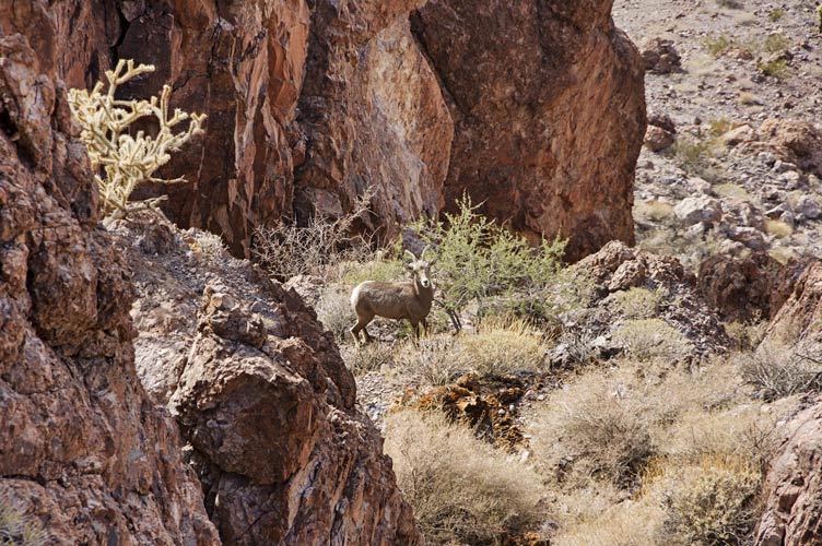
Dec 10, 2021 We met up with Chris and Stav on the side of the road and piled into jeeps and headed off up the pretty bad road. At the end we parked and headed off into the warm springs wilderness. Chris had planned a pretty big loop to be joined by Stav and I was going to try to keep up. First up was peak 2550, a nicely pointy peak. We even saw some bighorn sheep on the way up. The original plan was to descend to the SE, but that looked like it dropped off a bit much so we headed back to the west and then dropped down to the north towards the next peak, 2620. We then headed down and off to the next peak, 2645 heading up and over to the next peak, 2700 and my favorite for the day. This one had an improbable but pretty easy zig zag route up the very steep west face. We texted to the others (that were a peak or 2 behind us by now) that this route went before trying to find a way down the other side. Stav dropped down and traversed around a bit on the NE side before giving up and heading down behind me on the SE side to a notch (where I saw a bighorn sheep) and down a steep gully. They knocked some pretty big rocks down towards me, but fortunately I had a much bigger rock to hide behind as a few rocks went past.
Iris, Bob, Stav, and Chris on the summit of 2550
 |
panorama from the top of Peak 2550, Stav on the right
 |
panorama of Stav on the summit of 2645 - 2620 near the left side, the other peaks out of view or near the right side
 |
Stav and Chris on the way to 2700 - note steep face on the peak to the left
 |
Bob gets to the summit of peak 2645
 |
bighorn sheep on the way we descended 2700
 |
we descended 2700 through the notch in the middle and down the ramp
 |
Stav descending the gully on 3042 with 3714 above
 |
Down on the lower angle terrain they caught up quickly and then we continued over 2753 and 3042 (with a little nice scrambling and some less pleasant brushy gully descending) before the long slog up to 3714, a P1K (it had over 1000 feet of prominance). The at least partial overcast helped keep me from overheating as I was wearing some thicker pants than normal. They were good for cactus protection, but a little too hot hiking uphill in the sun. Then we traversed across a saddle to what would be the last peak, 3418 where I surprised a small group of sheep as I came over the ridge. We managed to find a nice route down through some steep cliffs to the south and then over a saddle surprising some burros and passing a rather precarious little rock pinnacle and then followed the wash back to the jeep (we could have done a few more peaks to the south on the way, but the short days and my tired legs helped convince us to skip them).
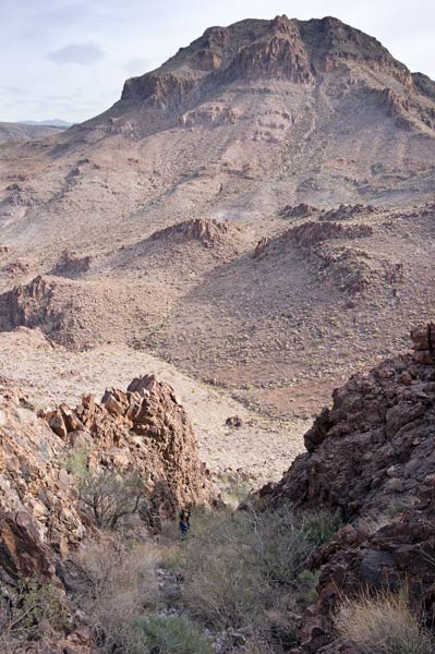
looking down on the first 6 peaks of the day from 3714
(mouseover for peak numbers)
 |
Chris and Stav comparing and laughing about their nearly identical P indexes (peakbagger nerding at it's finest)
somehow we all were carrying nice and heavy cameras
 |
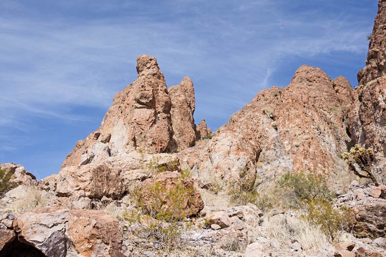
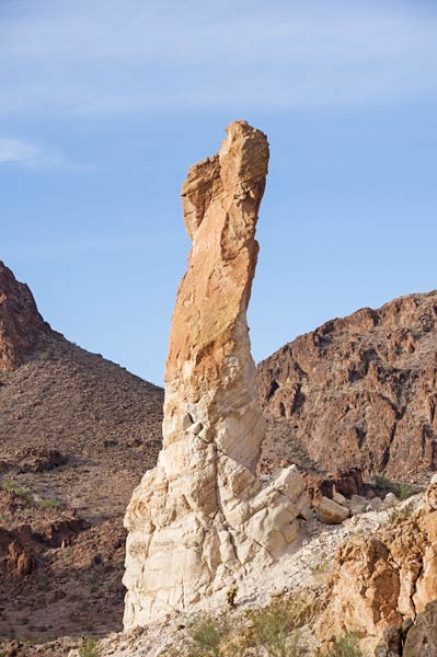
a rather precarious little rock pinnacle
 |
After driving back to the paved road Stav headed off to join another friend for a bit of a mountain deathmarch (with cacti) and I headed south to find cell reception and the others (and Chris explored some roads by the Bill Williams Wilderness to see if they would be feasible for a big day there. I was too late to catch up with Iris et al. at dinner, but I did see part of London Bridge as I drove past and got the cab good and hot before stopping at an overlook (in the dark) to wash up before continuing on over Parker Dam to where the others were. Jim had to detour farther south because RVs are too dangerous to drive over Parker Dam these days. I guess you could maybe do something to prevent Southern Ca from sucking up so much water from the river.
I had a pretty abbreviated dinner and there was a smoky fire (the wind was blowing all sorts of directions and some of the wood was somewhat damp from all the rain) before going to bed.
Stav's trip report for Warm Springs Wilderness Loop
Sorry, no Strava link, I forgot to bring my phone, but you can look at the map on Stav's page (plus more pics) or check out
Chris' Strava page for Warm Springs Wilderness Loop or
Bob Burd's trip report for the first 5 peaks
continued in December Desert Peakbagging Part II
No material on this page may be copied or used without permission.