Tom Grundy's Desert December 2021 Page
This is part II of this trip, you can see Part I of December Desert Peakbagging here.
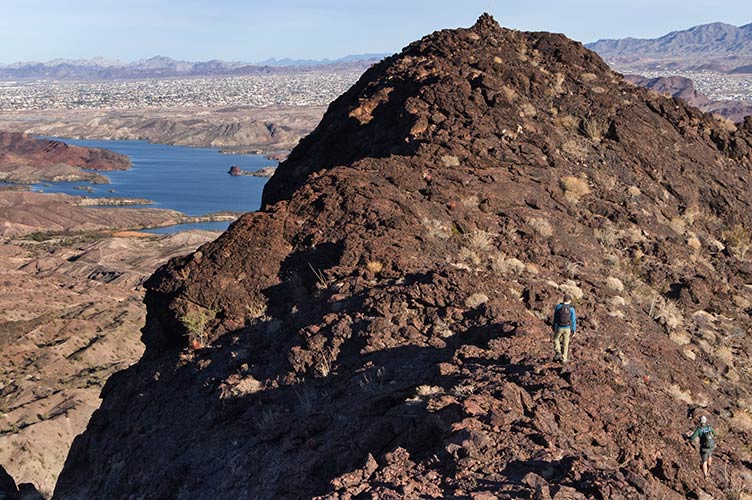
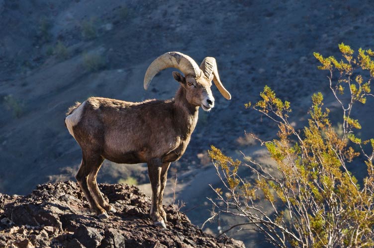
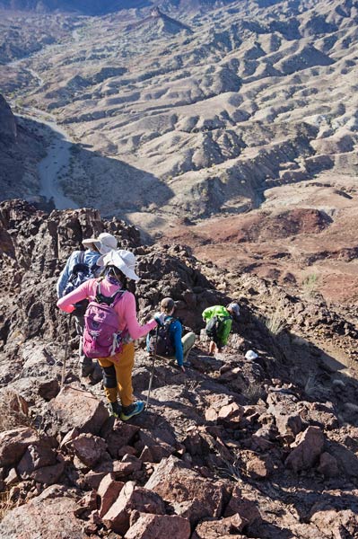
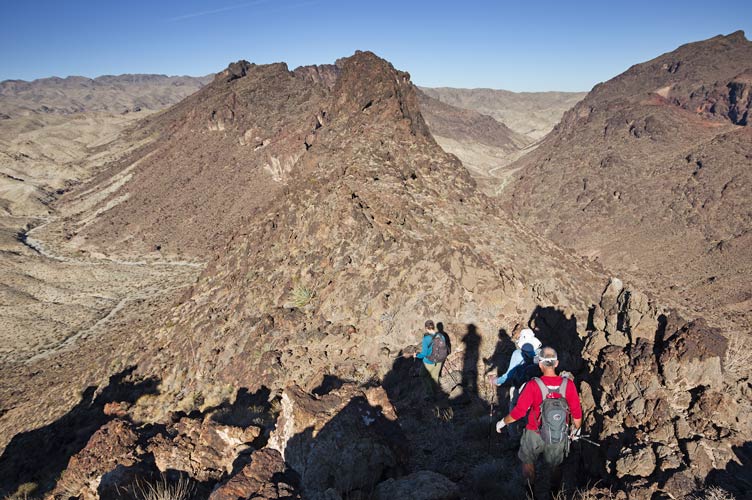
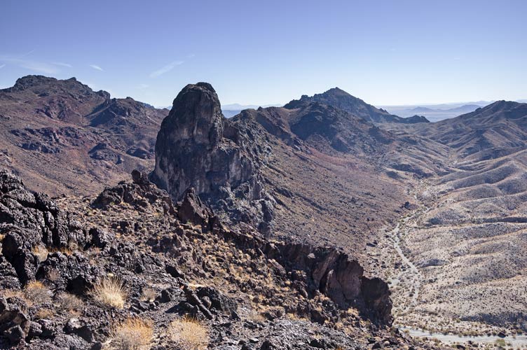
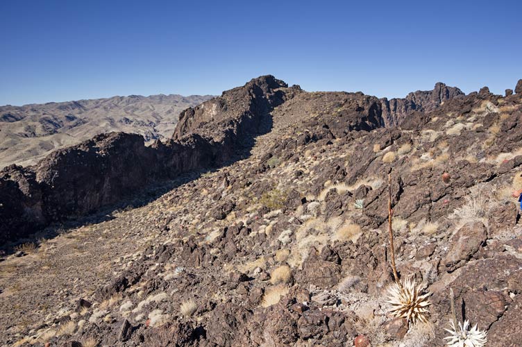
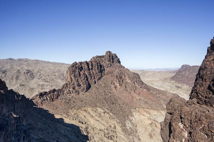
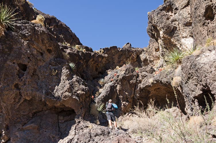
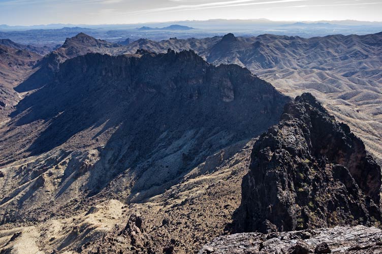
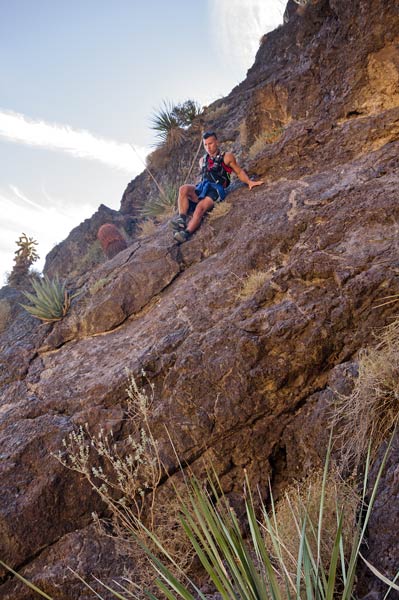
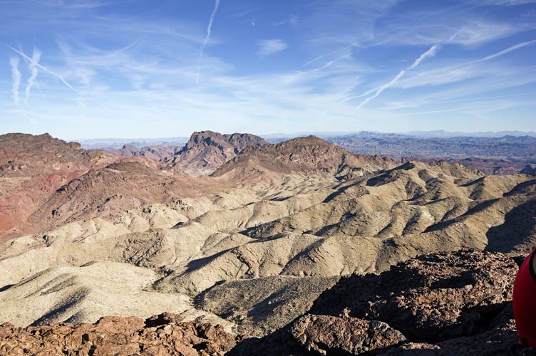
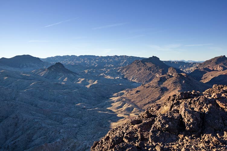
Dec 11, 2021. We were joined by Tom B who had done another peak on the way out and met up with us at camp the night before. Chris had another big loop planned, but the first peak we would do with everyone. First we drove the jeeps (3 this time) down and into some washes among some improbably spiky looking peaks. We probably didn't pick the easiest way up the first peak, starting with some steep crud out of a wash and then up some rocks before going over a ridge to an easier slope. There was some fun scrambling though, and there was a bighorn sheep near the top that just stood there watching us head up to the summit. This peak (Easy Bake Peak (1480')) had some nice views as 3 of the sides were nearly cliffs. After the descent we went on ahead along our planned circle of peaks. The others followed us up the next one, and then did what would be our last peak. they were kind enough to send their track for that one. We worked our way around the circle with 1540, 1660, 1610, and then 1140. From there we crossed the wash and headed up a road (to build power lines) before cutting across a saddle and around to find a way up the very steep Peak 1860. This one had some scrambling and I found what I first thought was another mylar balloon (a common bit of trash in the desert) but was actually a space blanket bivy sack that someone had dropped. Sadly it was in horrible shape and falling apart (and left little glitter like bits all over my pack). This peak was most impressive. Then we had hoped to find a way up the E side of the last peak but abandoned that hope and circled around it to follow the route the others had taken up Peak 1260. It mostly went pretty well with a bit of scrambling near the beginning and the end. It didn't look like there was an easy way up from the east. We managed to descend back to the wash/road just about when I would have been pulling out my headlamp if we were still bushwhacking. We headed back to the rest of the vehicles and then out to drive around to the other side of the range where we had a fire and roasted sausages and hot dogs in a mini birthday celebration for Bob (who had actually had his birthday a few days earlier, but we weren't there then).
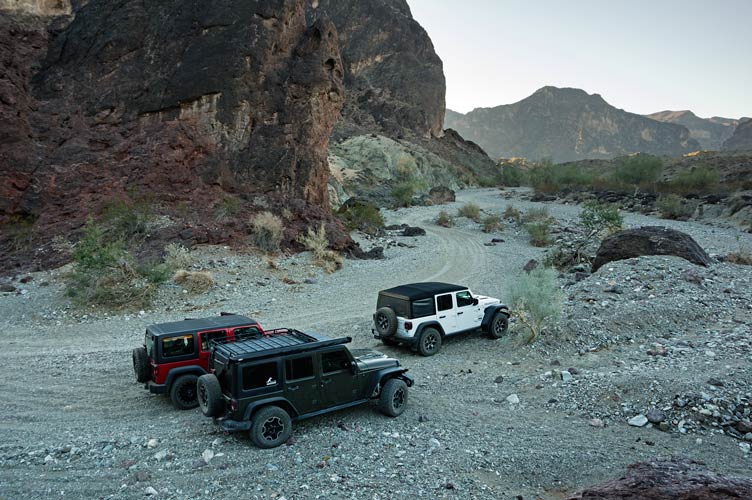
a bit of a Jeep ad at the start of the day
 |
Iris starts scrambling up while Chris take pics
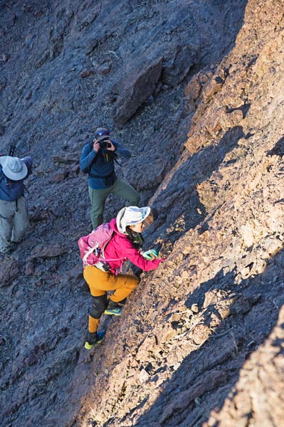 |
Tom B scrambles up and around the corner
peak 1610 is upper right center
 |
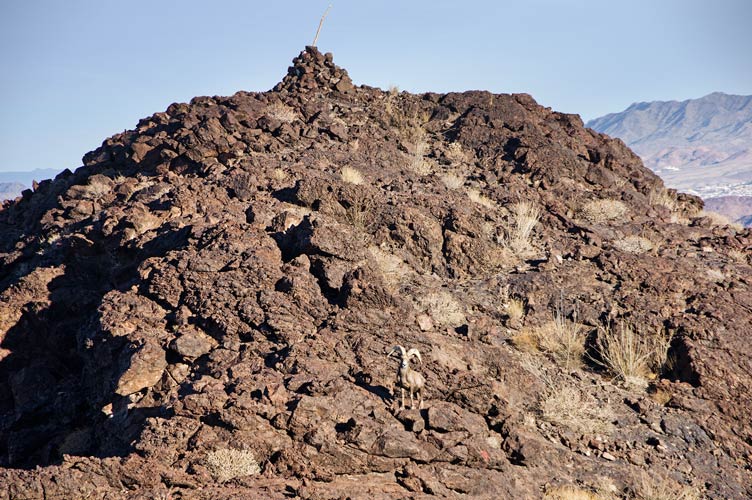
bighorn sheep below the summit
 |
Chris and Tom B approach the sheep on the way to the summit
 |
zoomed in on the previous pic
you might be able to see the sheep 2/3 of the way from Chris to the summit cairn
 |
bighorn sheep down below out of our way
 |
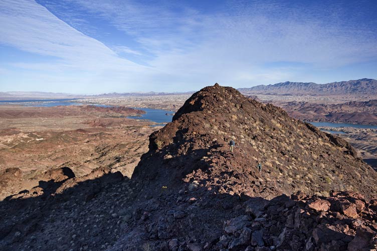
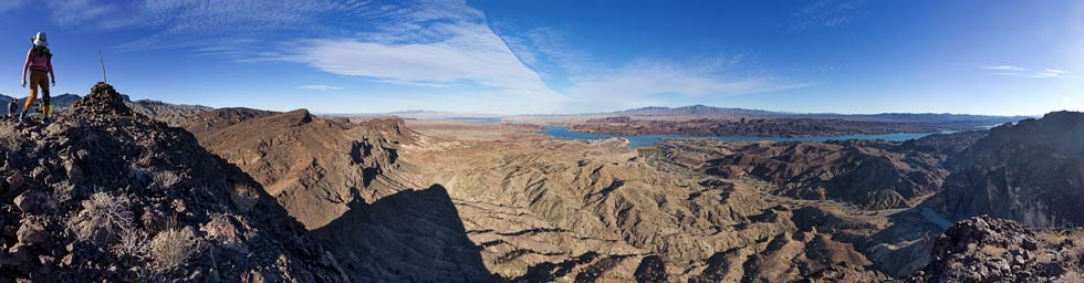
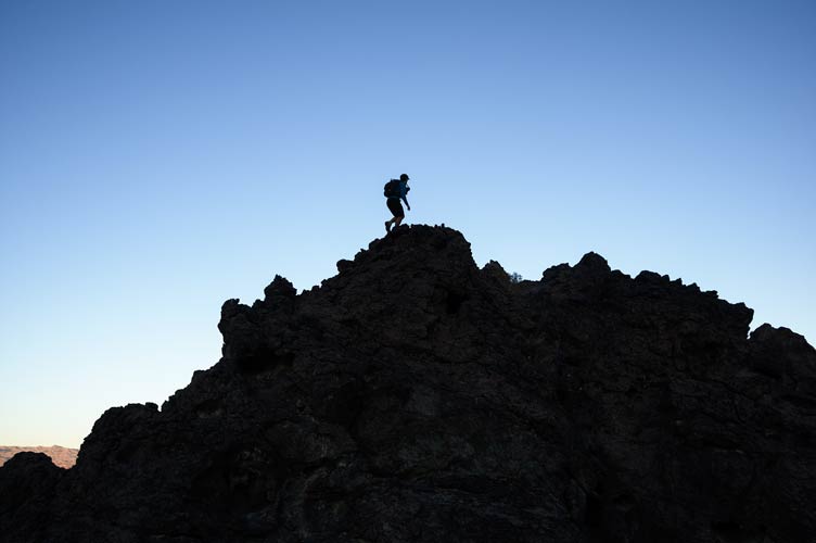
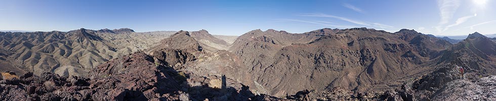
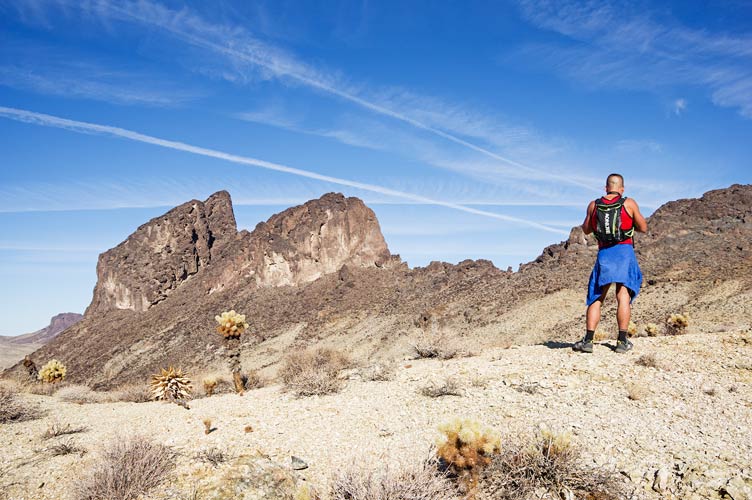
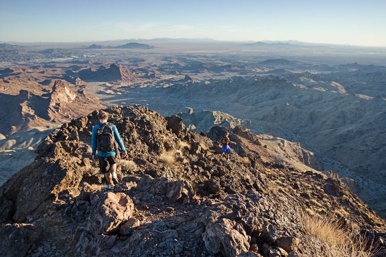
panorama of Iris et al. on the summit of Easy Bake Peak
 |
descending Easy Bake Peak
 |
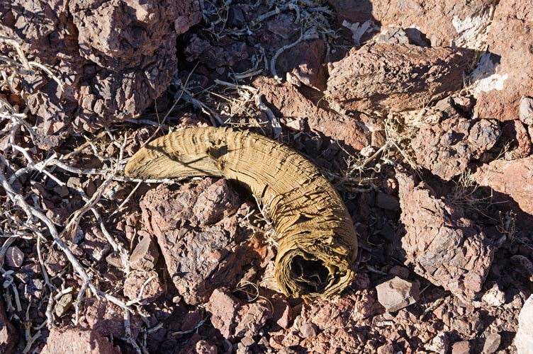
bighorn sheep horn
 |
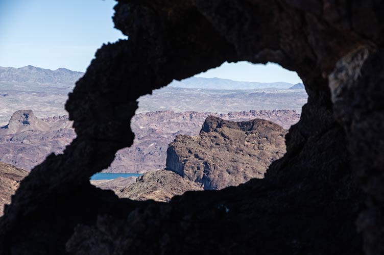
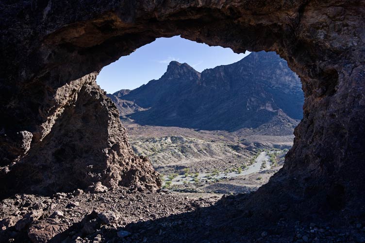
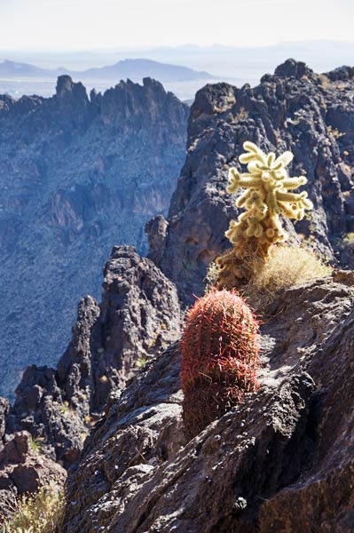
one of many rock arches - Easy Bake Peak through the hole
 |
looking up at peak 1140 - fortunately there was an easier way up
 |
another rock arch - this one a window on a cliff
 |
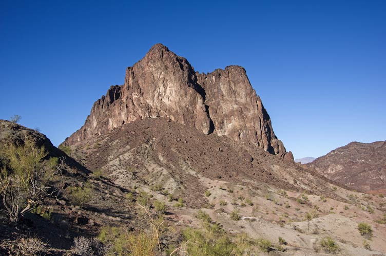
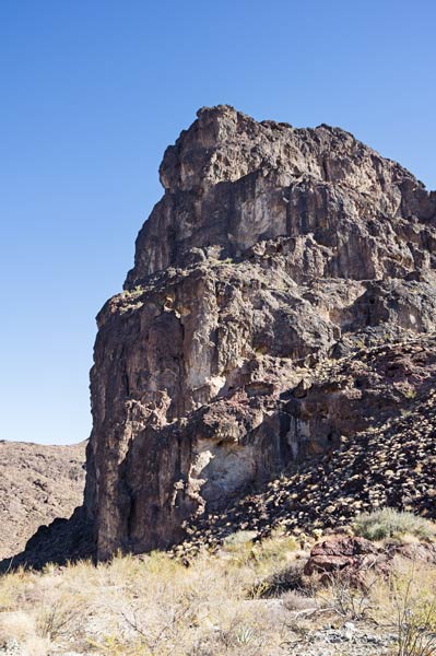
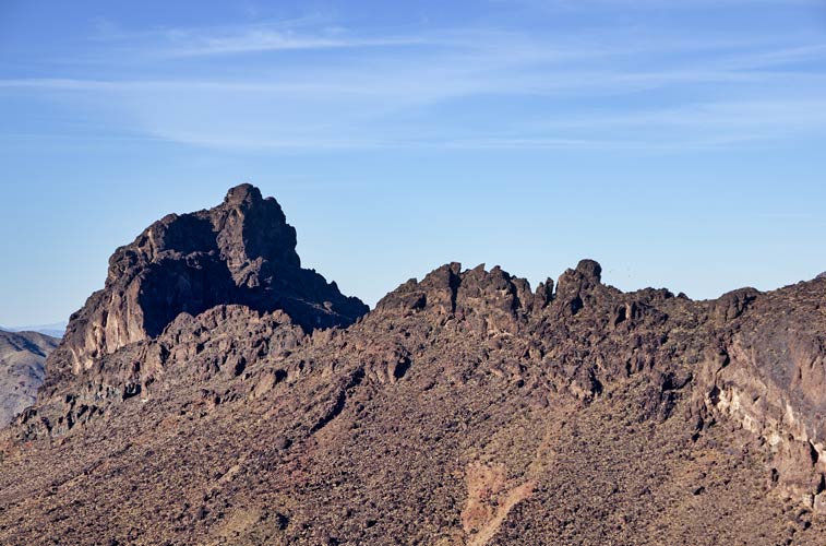
the imposing south face of peak 1860
 |
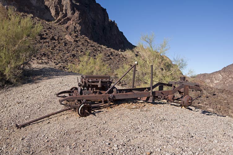
an old vehicle repurposed to pull a cable or something
 |
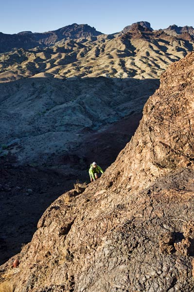
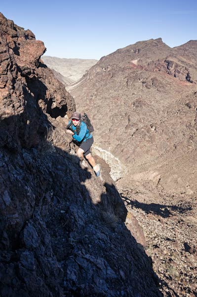
Chris looks over a ledge on Peak 1860
 |
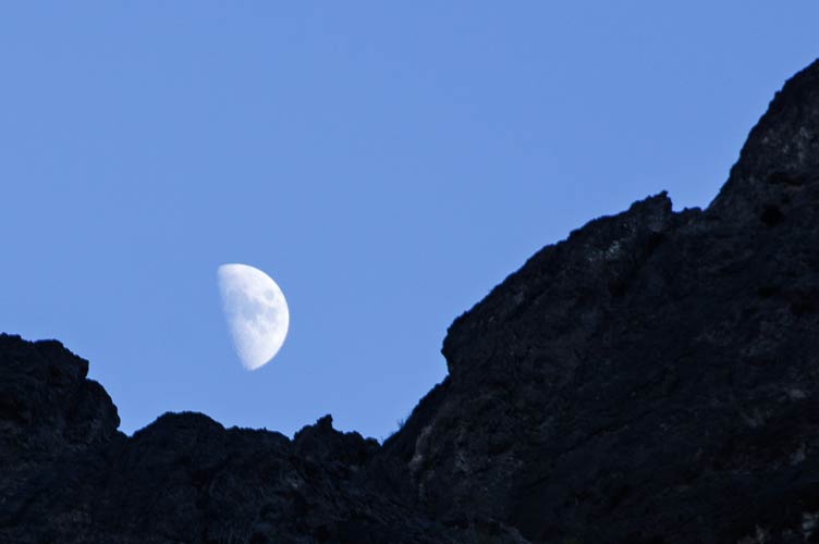
half moon rise over the mountains
 |
Chris gets to the top of 1260
 |
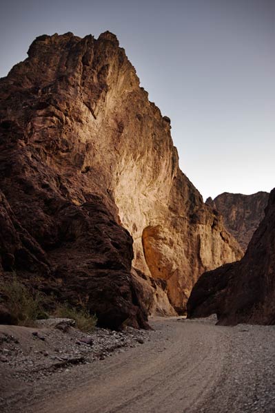
the canyon on the way back - it was really much darker by then
 |
Strava page for Whipple Mountains loop. 12-11-2021
Bob Burd's Trip Report for Easy Bake et al.
Dec 12, 2021 Stav joined us again, and we headed out by jeep up the road/wash (surprisingly bumpy with alternating left right washboard bumps to ensure a thorough shaking). Once again Chris had a circle of peaks planned. Stav headed out ahead of us to pick off 2 extra peaks on the way to the first peak while the rest of us headed up the road at a more civilized pace. We ended up going past a lot of mining stuff.
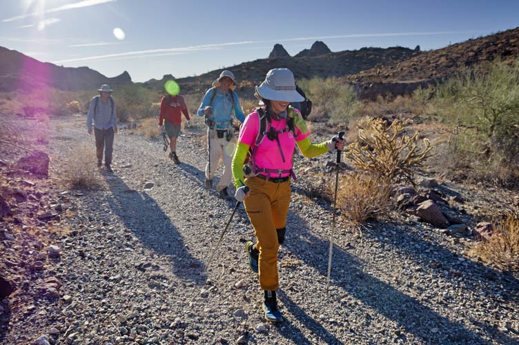
L-R Eric, Tom B (obscured by lens flare), Bob, Iris (and Chris hiding behind her) hiking up the old mining road
 |
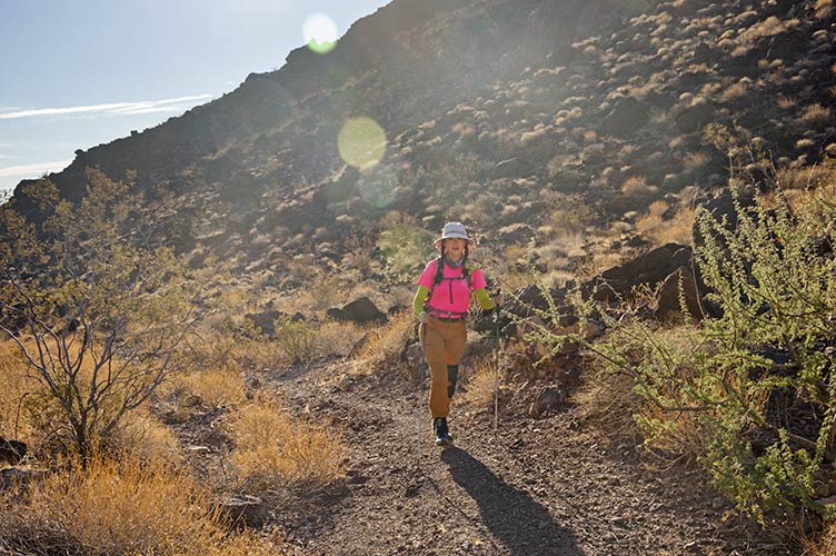
more Iris hiking
 |
The first peak (2380) wasn't actually all that much of a peak, more of a higher point near the end of a ridge. But it had some really fun scrambling to get there and serious exposure on 3 sides. Supposedly there is some sort of measure of a peak's steepness and this peak ranks highly according to that. After this first peak we broke up the team with Bob, Chris, Stav, and myself heading down to the S and farther west to the next peak, others went back to climb some peaks back that way.
heading out towards peak 2380, peak 2660 to the left of it
 |
panorama from peak 2380
 |
we headed back east a bit before dropping down to the S which looked maybe like it would cliff out. Bob braved heading down and the rest of us went a bit more east before dropping down. Both ways worked and we-reconvened in the wash below. There we crossed the gap between the first peak and the next one and headed up. It was quite a cliff to get up to the first peak from here.
Chris takes the quicker but spicier route on the N side on the descent
 |
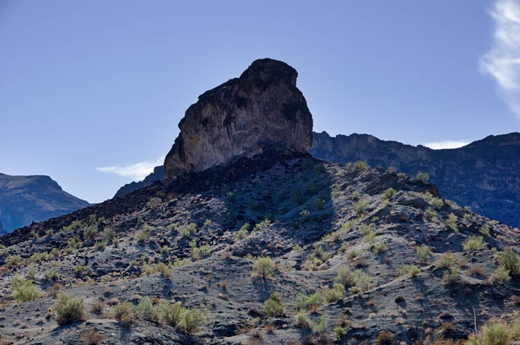
the impressive SW side of Peak 2380
 |
looking back at the upper part of peak 2380 from the west
 |
We headed quickly up the next peak only to discover it was a serious false summit with a long traverse in a hanging rift valley to get to the summit - except this wasn't the summit either - probably, it was a little hard to tell. It wasn't really clear if we could get to the summit - a maybe slightly higher point along a serrated ridge. We dropped down to the S and traversed around and back up towards the peak. Stav went a bit farther west and found a better way up which we would use for the descent. This way worked and soon we were on the summit of peak 2660.
the long rift valley towards the summit of Peak 2660
 |
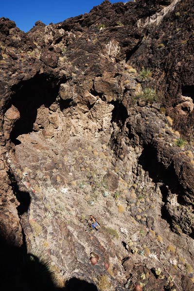
The next peak (2940) looked pretty formidable and it wasn't clear that we could make it. I thought I saw a route, but it wasn't a sure thing. Bob was put off by the chance of getting stopped and maybe a little worried with keeping up, so he headed back to pick up some other peaks on the return and Stav, Chris, and I headed on. We dropped down a gully to the N and traversed along that side of the ridge dodging catclaw and maintaining elevation as best we could. Then we cut back to the other side of the ridge at a saddle and went along the now west side of the ridge to a deep notch Chris had identified from the satellite photos. We headed up this and it cut to the left and ended at a cliff. We were able to scramble around the first cliff and then cut back to the left to dodge the overhanging top of the valley. This ended up being easier that it looked from below and then we could just walk around the top of the gully and up to the summit. There was a cairn up there, so it wasn't a first ascent. We were pretty excited that the route worked so well and joked about calling it "Bob's regret".
view of Peak 2940 through a notch in the ridge
 |
Chris gets to the lower crux
 |
cholla and barrel cacti on the cliff side
the twin peaks of 2660 are left
 |
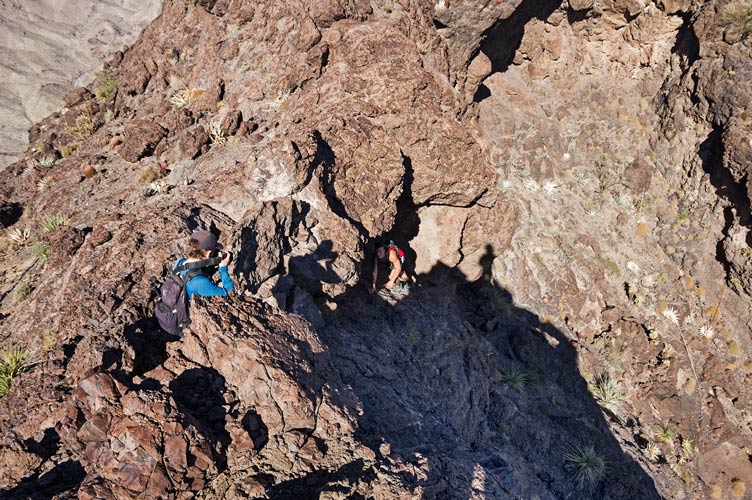
Stav gets to the upper bowl above the lower crux
 |
Stav scrambles the upper crux
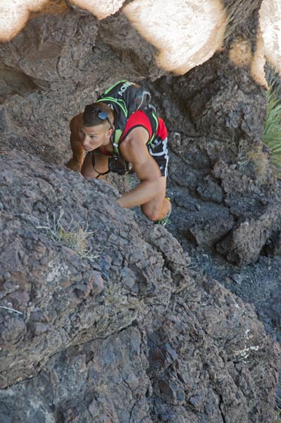 |
Chris takes pics while Stav squeezes above the upper crux
 |
view from the summit - the ridge up and left has peak 2660 (center), 2380 (left),
and then 2525 (left lower horizon line) with peak 2573 slightly to the right
 |
Stav scrambles down avoiding the lower crux
note the barrel and cholla cacti from earlier pic left of him
 |
We did have to descend still, the upper crux was pretty easy although a bit exposed. The lower crux was much harder involving some delicate moves around cacti and maybe a bit less exposure but you still definitely did not want to fall. I carefully worked my way down this while Stav cleverly worked out a better path that went skiers right of where I was. Back out of the gully we had to decide where to go next. There was another nearly P1K peak (997 feet of prominence) about a mile to the west that was on the original itinerary but we decided to skip it and instead headed to peak 2573. This one looked hard to summit as we looked at it from the first 2 peaks, but it was easy on the S side once you walked all the way there.
Stav takes a pic of 2940 from the S
 |
view N from 2573, 2940 on the left, 2660 center and right
 |
view east from 2573, 2525 just right of center, we looped around to the right on ridgelines
Copper is just left of center
 |
After this peak we had one more peak, and a decision for how to get there. We decided to traverse around on the ridges rather than dropping way down into the wash and back up. I am not sure if this was any faster, but it was cool following the burro (or sheep) trails along the ridgelines. There ended up being a lot more traversing to get up to the final peak (2525), but we made it. The meta?volcanics were pretty weird with a number of hollowed out bumps. We never broke through, but it was disconcerting to see a hole by your feet and realize you were standing on only a few inches thick rock. We could see Iris and Tom B down by the jeeps from the summit, but they had left by the time we got down to there.
view northwest from 2525, most of the peaks are along the right ridge, 2573 is middle left
 |
Chris and Stav descend to the S
 |
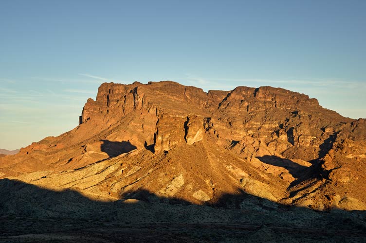
Copper Mtn - AKA Monument Peak High Point and Peak 1982 in evening light
these were our first peaks the next day
 |
Back at camp we had a fire again with more roasting of processed meat on sticks plus more Bob birthday celebrations (cupcakes, thanks Stav). As usual and much to the disappointment of Stav everyone was ready to turn in by 9 pm.
Strava page for more peaks in the Whipple Mountains. 12-12-2021
Chris' Strava page for more peaks in the Whipple Mountains. 12-12-2021
Stav's page for peaks in the Whipple Mountains from Copper Basin. 12-12-2021
Bob Burd's Trip Report for 2380 et al.
to be continued in Desert December Peakbagging Part III when I get around to it
No material on this page may be copied or used without permission.