Tom Grundy's 2023 November Nevada Peak Bagging Page
Iris had a break from work before another rush and we decided on a trip to Nevada. Originally we planned to head north and then to Reno, but the weather forecast for that area started looking pretty bad so we started to plan on heading closer to Vegas, then the northern forecast looked better so we went back to that plan.
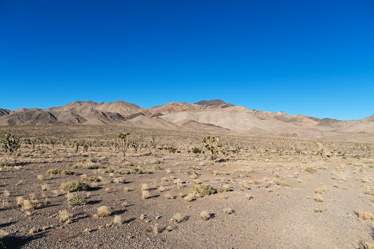
2023-11-3 We drove out of Bishop and headed over Montgomery pass to Tonopah for gas, then headed out on dirt roads to our first objective - Lone Mountain. We mostly followed the way Bob Burd went in earlier with a little detour when we missed one turn. Mostly it wasn't too bad, just long and tedious with a few sections of looser sand and a few places where the tire tracks were a little too deep to drive in. It required attention, but was quite doable with the little 2wd truck. We stopped just a little short of the end of the road and set up camp. There was a chilly wind blowing and we had to build a windscreen to cook behind. It was warm enough in the back of the truck where we had dinner.
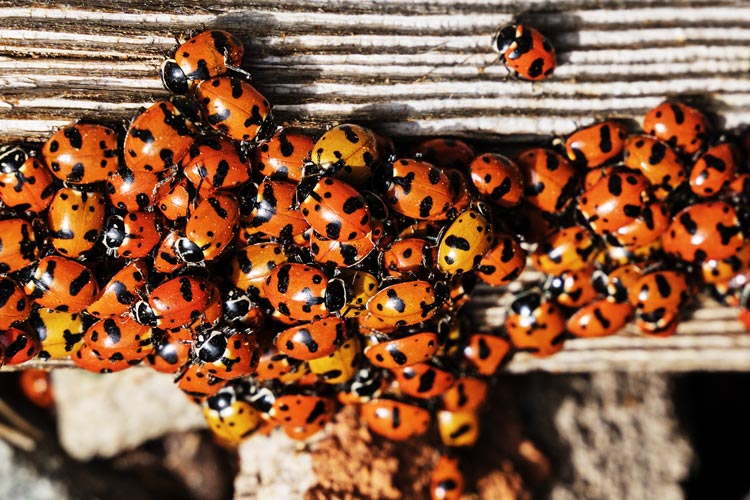
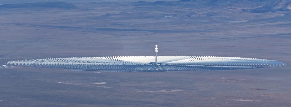
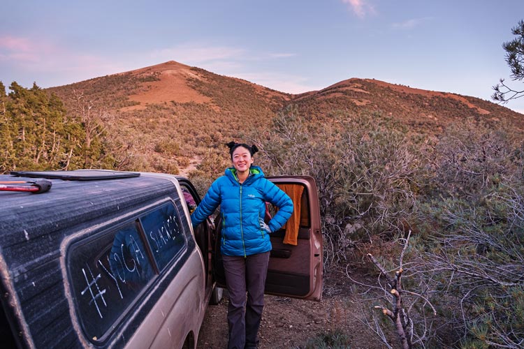
2023-11-4 we got up pretty early to get ourselves into that mode for bigger days ahead. Then got ready to hike and headed off up the road. We only skipped driving the last little bit of road and soon we were just hiking up the wash past some old mining? ruins and on up towards the peak. Things got steeper as we got higher, but it was steady walking. We got good enough cell service to join the family zoom call on the way up. Lone mountain is 9,108 feet high and has 3,800 feet of prominence - it is somewhat aptly named with big views in every direction including Tonopah to the east and the Crescent Dunes solar plant to the north. This solar thermal power plant has had a difficult financial history but is back in operation again and now heats up molten salt all day and then uses the heat to generate electricity at night. It can't compete with the solar photovoltaic farms for total power production but it is able to provide power at night without lithium batteries - potentially a very useful trait. There were hundreds of ladybugs at the summit.
sunrise from the side of Lone Mountain
 |
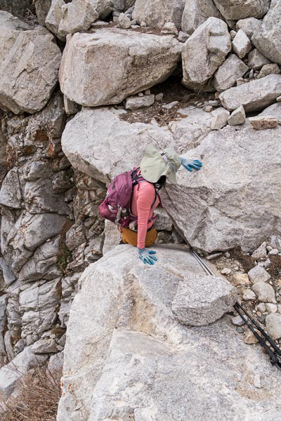
Iris scrambles up some boulders
 |
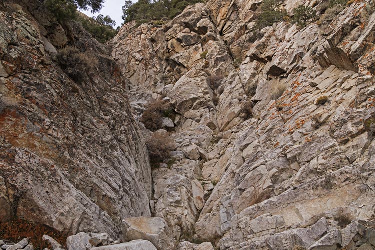
some of the canyon was pretty rocky
 |
ladybugs on top of Lone Mountain
 |
Crescent Dunes Solar Plant
 |
The descent was not much faster but it was less tiring. Back at the truck we decided to try to go out a different way - to the north. The first part was quite rocky and bushy and I was glad to be going down instead of up. Then we hit a better road and it was just slow going with a few bits going into a wash requiring some extra attention. By now the forecasts for the next few days were looking pretty grim - highs in the 30s with 25 mph wind, chance of snow, and gusts to 45 mph. This was looking less fun, so we turned our sights south again. Iris was able to change her flight to flying out of Las Vegas and Bob was much happier about meeting us near Pahrump later in the week. We topped up the tank in Tonopah and then headed south. We found a nice little hill off a road near Montezuma and camped there for the night. There was plenty of firewood here, but also a chill gusty wind so once again we just retreated to the back of the truck to eat dinner.
some of the "road" back
 |
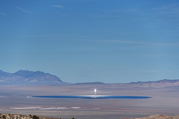
another view of the solar plant
 |
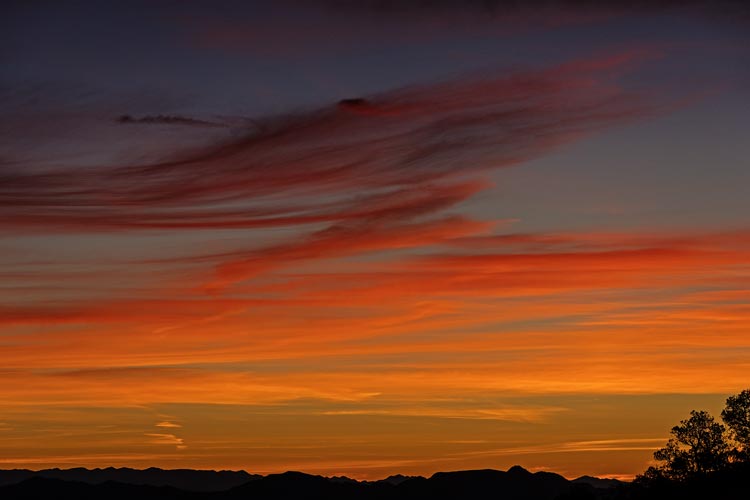
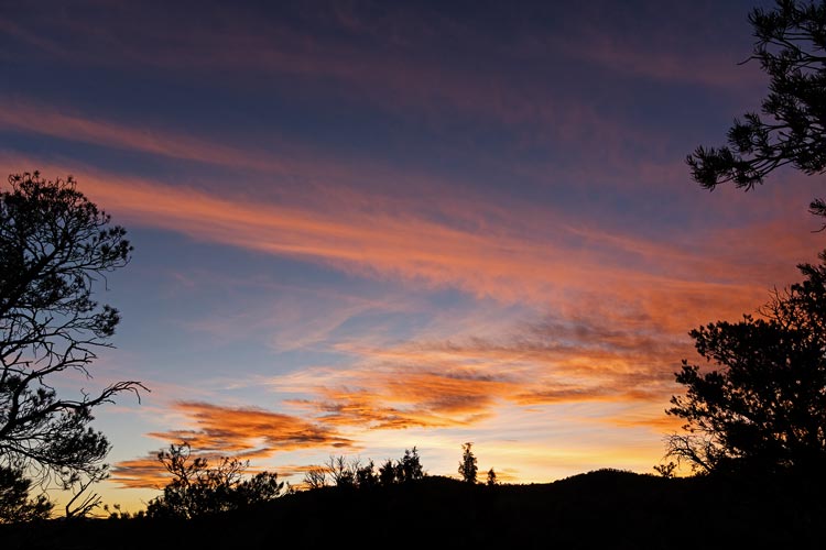
another nice sunset
 |
and looking the other way with Montezuma behind Iris
 |
Strava Page for Lone Mtn. 11-04-2023
2023-11-05 We didn't get up quite so early as the time change changed the phone alarm to essentially be an hour later and it was chilly and we felt less urgency. Then we headed off towards Montezuma. This was a straightforward hike up a slope to the top. There was a chill wind up there and we put on windbreakers before continuing on to Carroll Peak (a sub peak). It seems like almost every flat spot around here had a profusion of obsidian and chert or flint chips. Most didn't look very worked, but clearly someone spent some time knapping tools in the area. We side-hilled on a burro trail back around Montezuma and went back past the truck and started towards Peak 7780. We could have driven up this peak but there was a private property no trespassing sign by the road. Instead we just walked cross country towards it. This might have been best since we saw a truck driving down the road as we walked up cross country.
view from Montezuma summit - 7780 in the center
 |
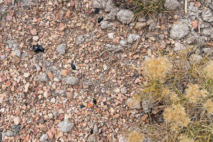
ground with obsidian and burro or horse droppings
 |
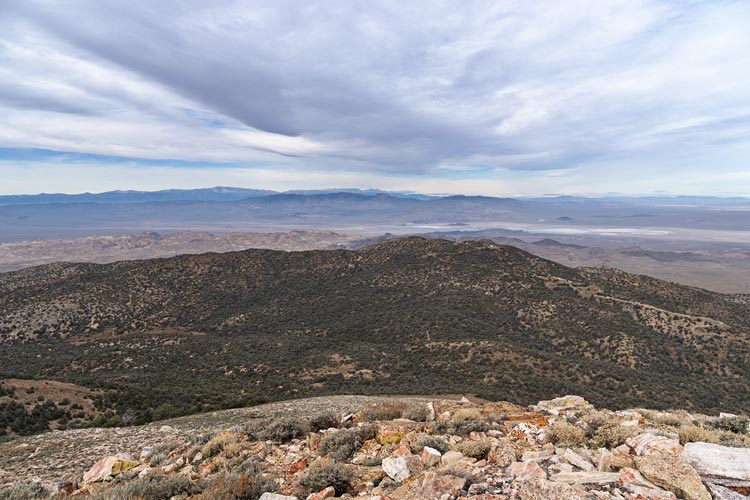
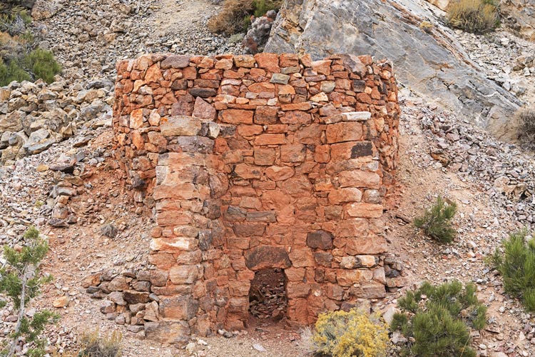
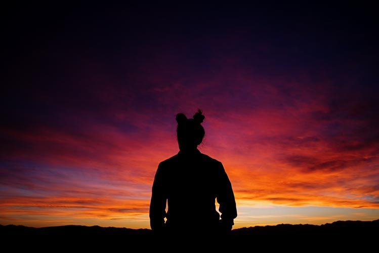
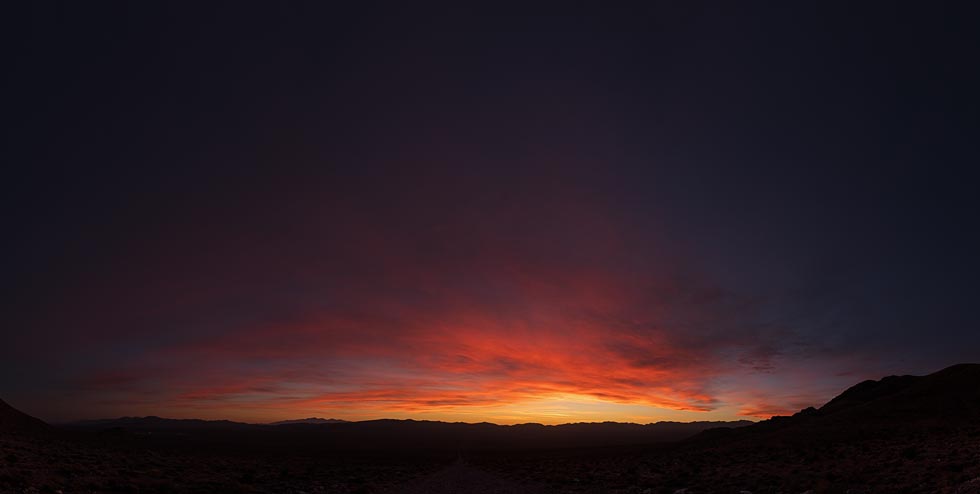
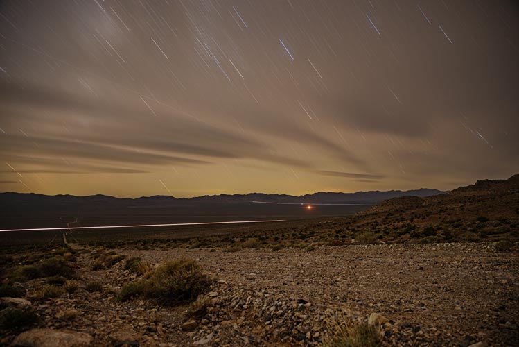
We headed up a ridge and then did the last few hundred feet on the road. We had a sandwich on the summit and enjoyed the views of the distant White Mountains and Sierra before heading down to the truck and driving off. On the drive down we stopped to check out a small stone structure that looked a bit like a castle turret. Our best guess was it was some sort of charcoal or cement kiln - with the thick layer of ash in the creek bank by it supporting that guess. We passed a number of burros on the drive back to 95 to drive down to Beatty to get just enough gas to get us to Pahrump where it is significantly cheaper for some reason or other. Then we drove up a good mine road almost to Secret Pass. We were going to do Bare Mountain from there, but Iris found a more interesting route from closer to 95 so we drove back down and bumped up the old mining road most of the way to where we wanted to get. Things got pretty washed out and rocky near the end so we turned around and leveled the truck off on the side of the road. We were at a much lower elevation here, but that was good as the cold front was coming in.
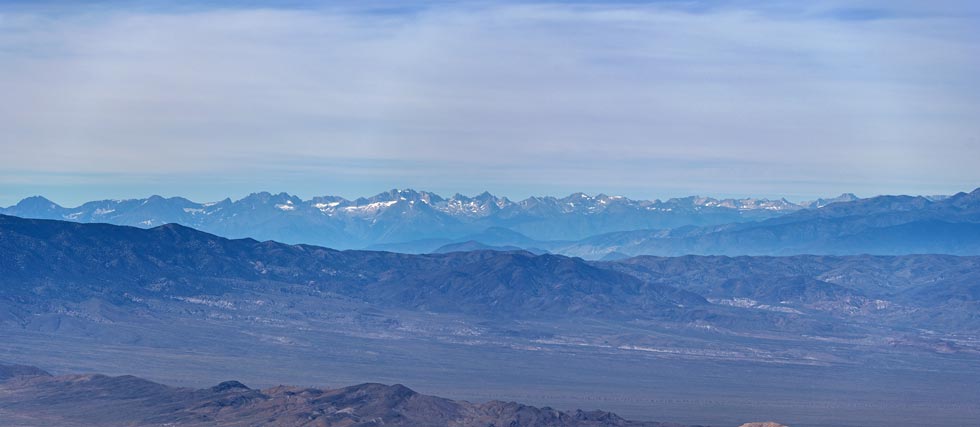
distant Sierra panorama - from about Split Mountain to Darwin?
 |
old kiln (or other structure)
 |
Iris admires another nice sunset
 |
it really was pretty nice
 |
long exposure night shot looking west
 |
Strava Page for Montezuma, Carroll, and 7804. 11-05-2023
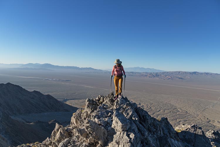
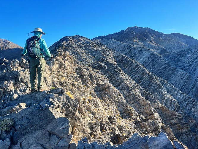
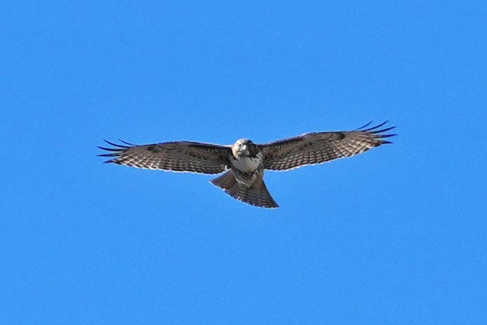
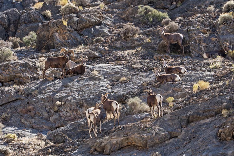
2023-11-06 We got up pretty early again and headed up the mining roads towards the west ridge. This proved to be a pretty fun scramble up on grippy (razor sharp spikes) limestone. I'm not sure what they were mining here - probably gold (web search says gold), but it was a pretty extensive operation. We scrambled up the ridge or walked along on the steep rock or talus - whatever seemed easiest. We joined the summit ridge just a few hundred feet south of the summit. Once again there were plenty of views in all directions and a hawk and ravens flying around. On the descent we saw 2 bighorn sheep up high. We also passed a lone woman scrambling up the west ridge - we were both quite surprised to see anyone else out there.
Iris heading up the W Ridge
 |
I head up the W Ridge (Iris pic)
 |
red-tailed hawk
 |
We detoured off of the ridge to go down the canyon S of the west ridge. This worked out well with a few dryfalls to downclimb or detour around. Right at the base of the canyon we saw another 9 bighorn sheep on a small ridge to the south. There was a breeze back at the truck, but the air and water were warm enough for a pretty satisfying rinse - especially as we were expecting to get more water so were able to use a good bit.
bighorn sheep
 |
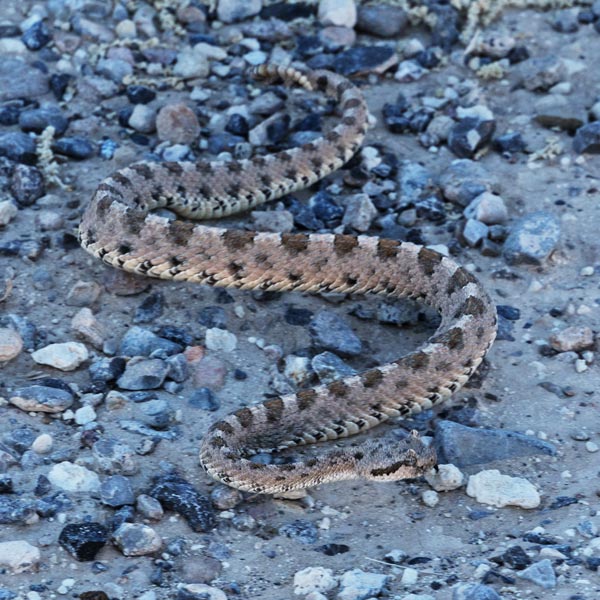
Then we had to drive south. We stopped to refill our empty water bottles and then turned off to the wildlife refuge - I saw something crossing the road - I thought lizard, but as I went by I realized it was a sidewinder. I quickly turned around and parked and got out to take some pics - and ensure a park ranger driving the other way didn't run it over. I had also seen a few tarantulas on the road, but I didn't stop for them. Then we had the joy of the long tedious Alamo dirt road. It was rocky enough that my speed was usually between 10-15 mph with a few forays up to 20. The center berm was just high enough that I couldn't safely straddle it if there were any bigger rocks in it - which was fairly often. So it was slow and tedious going. I think it took close to an hour and a half to get to the trailhead at the end of the road where we would sleep for the night. By then it was dark and cold. We managed to build a bit of a windbreak to cook and then ate in the back of the truck again. We tried to get to sleep early because tomorrow would be a big day.
sidewinder
 |
Strava Page for Bare Mtn. 11-06-2023
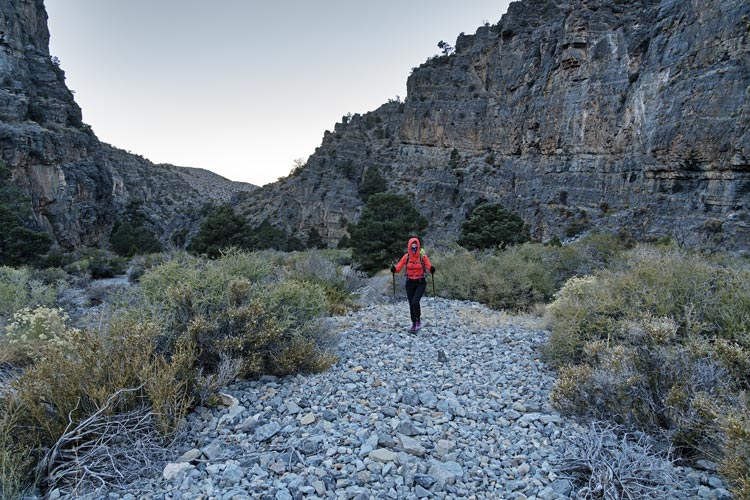
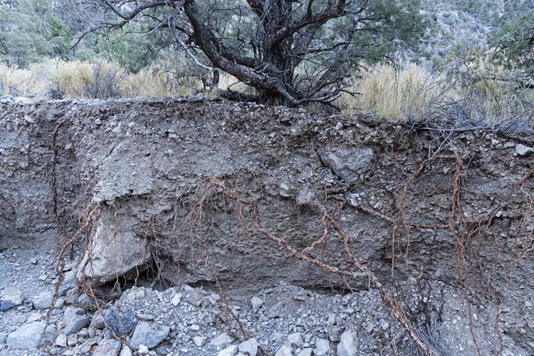
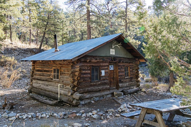
2023-11-07 We got up even earlier today, it was fully dark when I got up. By the time we left we didn't really need headlamps, but we used them for the first bit to avoid surprises from the loose rocky "trail". It was really more of a stream bed and wash out than trail much of the way. This made for pretty tiring hiking. At one point we ended up in an erosion channel over 6 feet deep. Fortunately there was an easy way out and not much of a bushwhack back to the wash/trail. Probably half the time there was a trail and usually where it left the wash it was marked by cairns - usually. It was also cold. Iris swapped out for warmer gloves and we were both glad for the sun to finally clear the canyon rim. At the cabin the spring water was still flowing out of the pipe there - so I could have carried a lot less. oh well. Then we took the ridge route up. For the most part this followed a pretty obvious trail that was much nicer than the washed out stream bed we were on a lot earlier. The main downside to the ridge route was dropping a bunch of elevation down to a saddle before the final climb up to the 9912' summit of Hayford. This is an "ultra" peak - with over 5000 feet of prominence and has a bunch of antennas and some solar panels in various states of decay on top. I think all these are now maintained by helicopter - if at all. There were enough trees to prevent sweeping vistas, but there were still plenty of views out over the mountains, especially to the S. The natives from Creech or Nellis AFB were getting restless with some deep booms coming from that direction - I couldn't see anything blowing up though. We had sandwiches and a pretty sad (old and dried) fat pill sitting on the helipad. Then Iris discovered her little salve jar was missing. We looked where we had sat but could not find it. I also climbed up one of the towers for a better view over the trees. Then we headed down.
Iris hiking up the "trail" in the morning
 |
severe erosion on the way in
 |
hidden forest cabin
 |
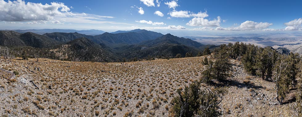
panorama looking southish from Hayford - the bonus peak I did is right of center
 |
On the descent Iris found her salve, so she was pretty psyched about that. Back at the saddle Iris decided to head down the canyon route back to the cabin and I decided to head on along the ridge to a bonus peak. We planned a meeting spot and time (2:45 back along the trail). At that point we would stop waiting and head back to the truck. I made good time along the ridge going over or around the mini peaks along it until about the last half mile when it got steeper and rockier. This wouldn't have been a problem except for the prickly bushes growing out of the cracks in the rocks. So things got a lot slower. I got to the summit of my bonus peak (Hidden Forest Ridge) at 2:30 and the descent did not look good - so I wasn't going to make the cutoff time.
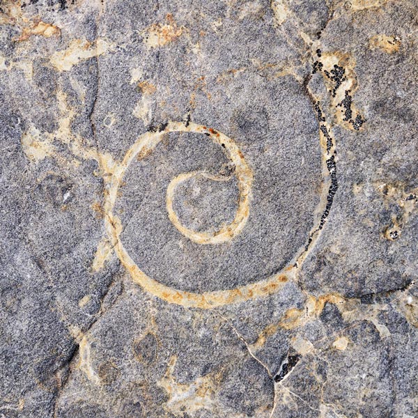
shell fossils
 |
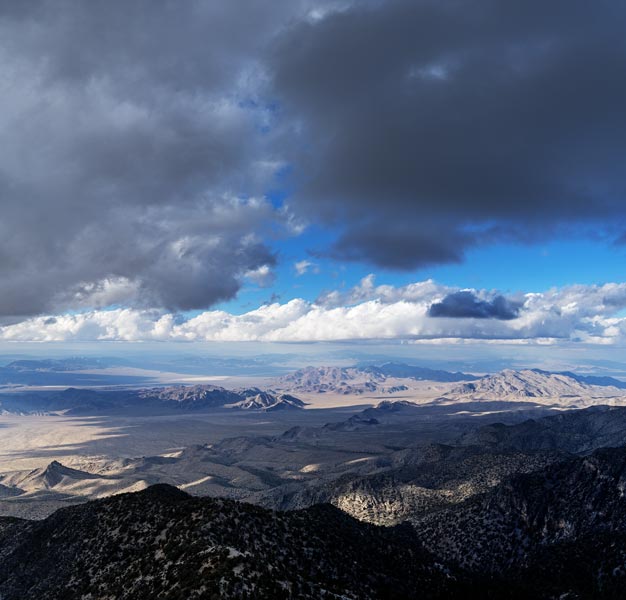
sheep range overlook to the north and west
 |
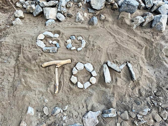
It was hard to tell what the best way down was. The way was steep with numerous cliffs and towers as well as brush and loose scree and talus. I picked my way down as best I could zig-zagging down the slope to avoid the worst of it and hopefully follow the easiest terrain. I slipped a few times and was very glad to be wearing gloves as the limestone was quite sharp (and full of fossils). Gradually the terrain eased and I made it back to the trail at 3:30 - still not at the meeting place, but I figured I was only about an hour behind Iris. I headed down the trail noting her Altra footprints in the finer dirt. I jogged when the terrain allowed and eventually got to the area with some no fire signs - they all had rocks on top of them as the first of us planned to do if we were hiking out separately. I also found a "go Tom" note in the trail made of sticks and rocks. Iris was definitely ahead of me. I kept jogging when I could and fast walking when the rocks were too big for jogging. It looked like there would be a nice sunset so I hoped to clear the canyon to see it. This was not to be. I did make it back without having to get out my headlamp though. I quickly washed off before it got any colder and then cooked up dinner before retreating back into the truck. It turned out Iris had hit her 2:45 time exactly and made it back out in time for a lovely sunset.
"Go Tom" sign (Iris pic)
 |
Strava Page for Hayford and hidden forest ridge. 11-07-2023
2023-11-08 We slept in a bit and then packed up and drove back to the Alamo road and turned right - it was actually in better shape here and we made slightly better time up to the pulloff for the hike to Target Benchmark. We started off on an old closed road but then headed cross country northwest and then up the east ridge to the summit. It was cold in the north wind but much much warmer out of the wind on the south side of the ridge. The natives weren't so restless today and we didn't hear any explosion on the base just to our north and west. We opted to head south and then down the face - not exactly easy or pleasant, but not bad, then down the wash and across and down the Bajada back to the truck. Then we got to bump our way back down the Alamo road, refilled water at the closed visitor center, and drove to Pahrump to gas up at the much cheaper gas (not as cheap as the national average, but over 2$ a gallon cheaper than in Bishop). Then we drove out to meet up with Bob - at a place people shoot guns. The last of the shooters were finishing up for the evening just a bit down the road, and then we had the place to ourselves. We had a bit of a windbreak from a gravel berm, but it was still pretty chilly by the time we went to bed.
target from the parking spot
 |
Iris heading up Target
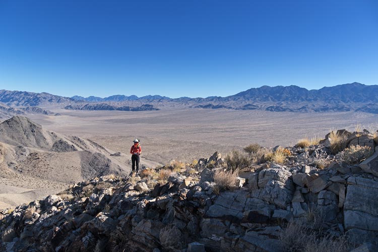 |
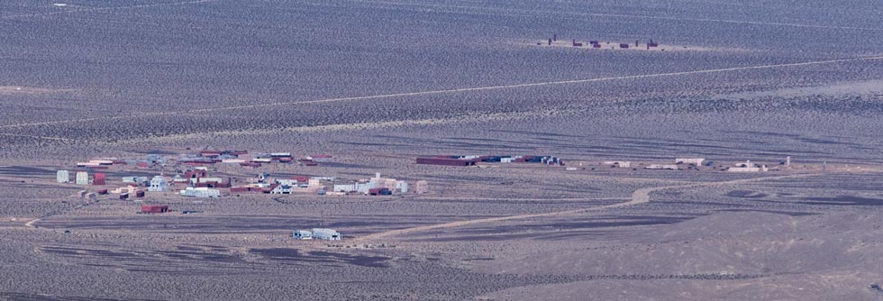
a model "village" in the Air Force Range
 |
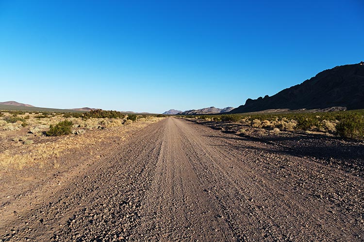
the Alamo gravel road heads off into the distance
 |
Strava Page for Target BM. 11-08-2023
This trip report continues, for part 2 go here
No material on this page may be copied or used without permission.