Tom Grundy's 2023 November Nevada Peak Bagging Page (part 2)
This page is the second half of the November Nevada trip report, for part 1 go here.
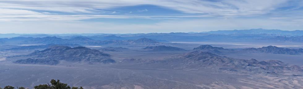
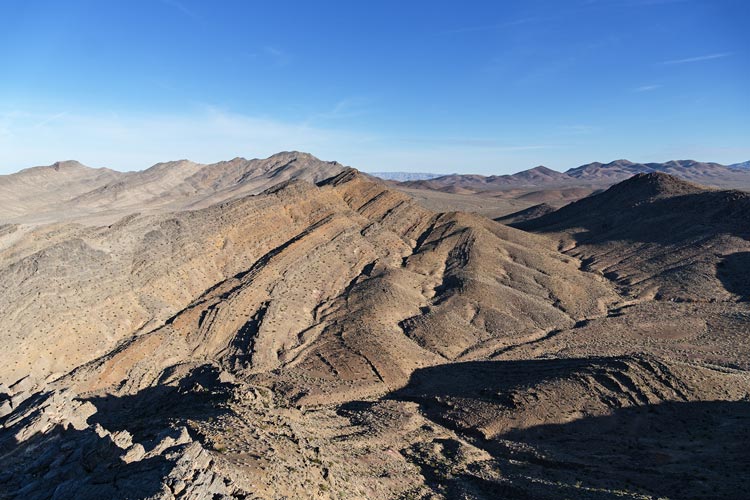
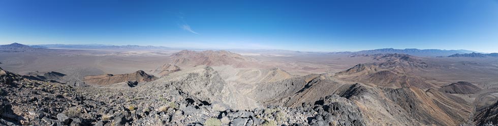
view of Pahrump area peaks from Mt Stirling- (mouseover for letters)
A: High Peak, B: 3362, C: Chance BM
D: 3343, E: 3404, F: 3753, G: 4140/Rocky BM
H: 3712, I: Pupfish, J: 4112
K: Johnnie Range HP, L: 3986, M: Last Chance Range HP, N: North Chance Pk
O: Skull Peak
 |
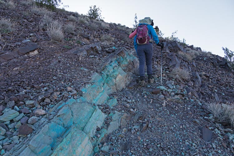
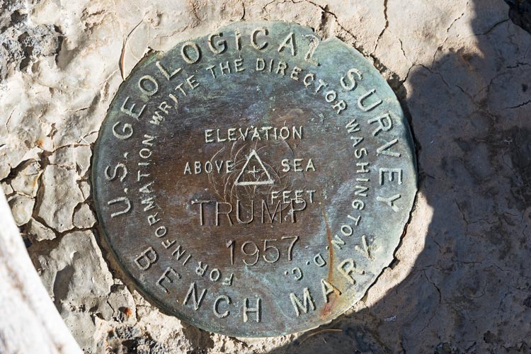
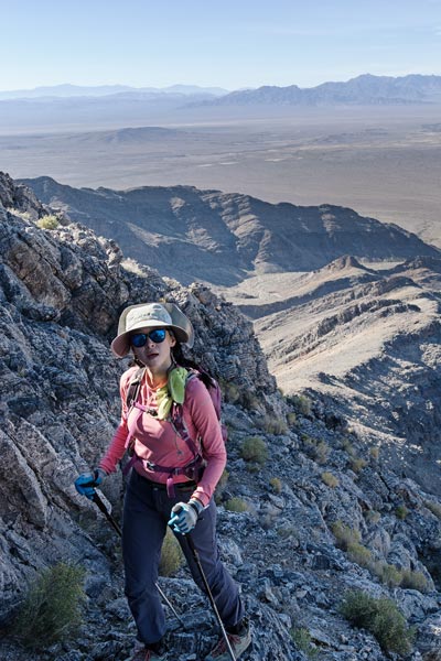
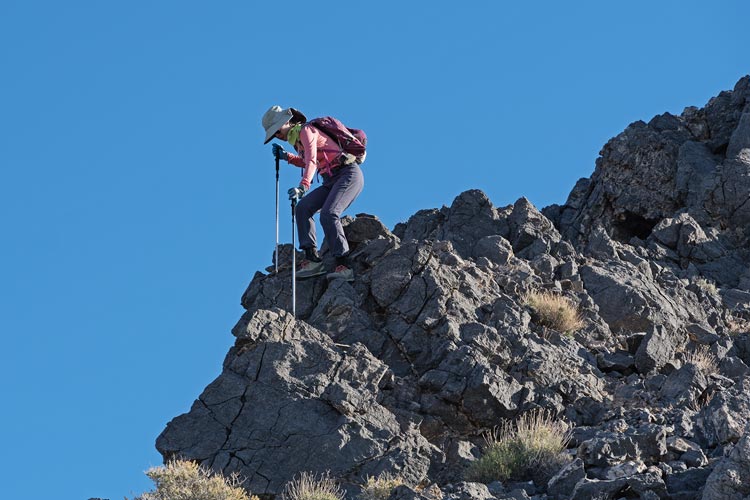
2023-11-09 By 7 we were ready to go and we piled into the Jeep for the day's foray - we parked on the side of the road and then headed cross country and up a steep hill to the summit of peak 3625. There were some prospects on the way up along a layer that had some sort of blue mineral in it. Then we dropped down to the north and headed up the higher peak - aptly named "High Peak" at 4031 ft. This had some easy scrambling up the very grippy limestone. The summit benchmark was stamped "TRUMP" and not surprisingly there was a bit of a discussion in the register both for and against the 45th president. Next up was a peak at the far end of this little range - the end without the Jeep. Bob offered to let Iris and I hike over while he went back for the car. I took him up on this offer but Iris headed back with him and we parted ways.
Iris and the layer of bluegreen rock
 |
view over to High Peak from 3625
 |
Iris scrambles up High Peak
 |
Trump Benchmark
 |
view eastish from High - the way I hiked
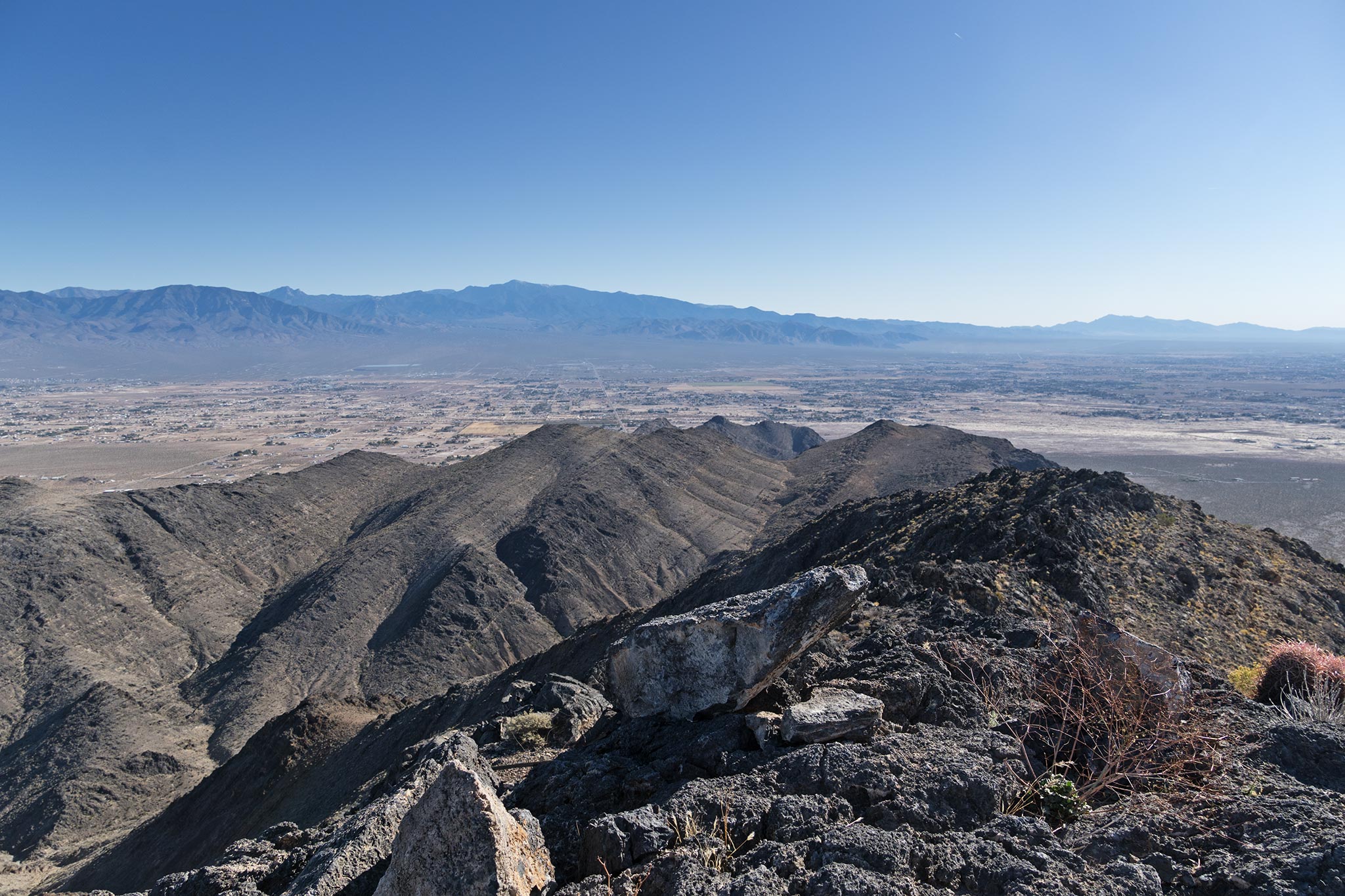 |
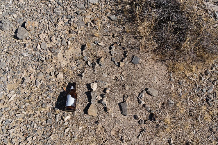
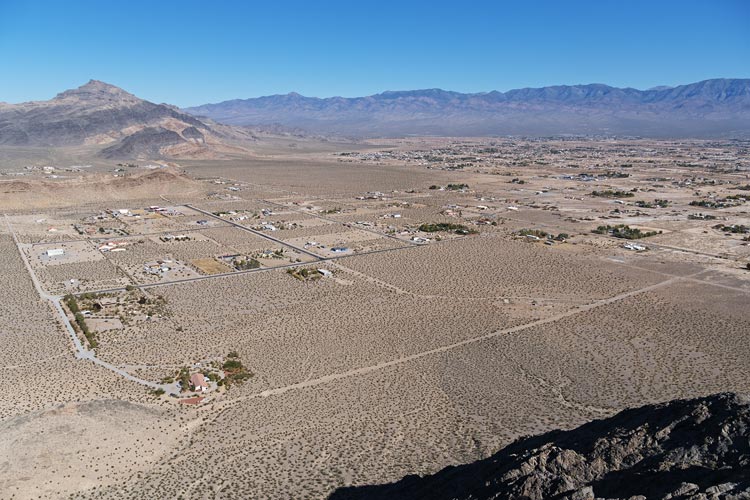
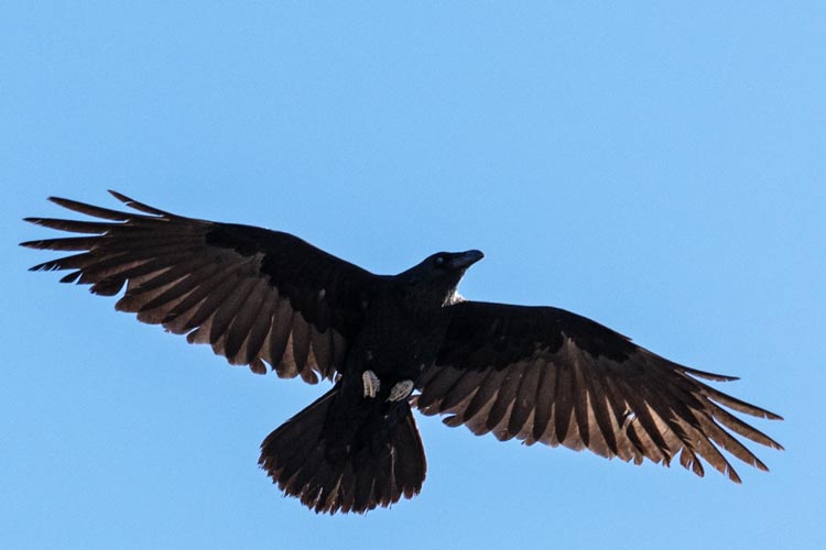
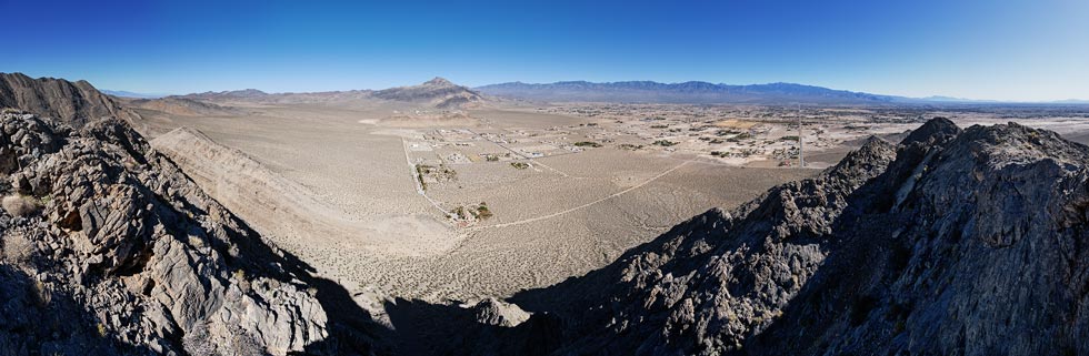
It looked like a fair bit of up and down to get to this peak, but there was really only one big drop off near the end. I headed down the ridge working my way over or around little bumps along the way. It looked like some might have enough prominence to count as peaks on their own, but according to the topo map none were more than about 200 feet. I dropped off into a steep gully to get down to the low saddle. This still went pretty quickly and soon I was crossing the dirt road there (with enough time to make a "go Iris" sign) and heading up the ridge to peak 3362 overlooking a number of homes in the very sprawling greater Pahrump area. I got there long before Iris and Bob, although they were back at the Jeep by then and driving around and through town. I watched and photographed the ravens while I waited. I saw them drive up down below and tried to direct them to the saddle I had crossed, but they were already out of the Jeep and heading up so they didn't go past my sign. It didn't take them long to make it up. For the descent we headed down a steep gully that unfortunately was full of somewhat stuck together cobbles instead of entirely solid talus or delicious loose scree. Bob and I both made pretty good time descending this, but it is the sort of terrain that is not good for a somewhat tenuous knee like Iris has. She picked her way down more carefully and then we went back to the Jeep.
"Go Iris" sign
 |
view down from peak 3362 - Jeep is dot S of road rt of center
Chance Mtn is left top and Stirling is on the horizon rt of that
 |
raven flying overhead
 |
panorama from the summit of 3362
 |
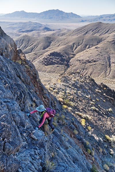
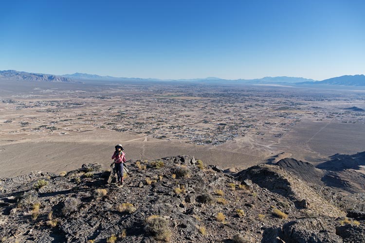
The last peak for the day was the highest, Chance Benchmark at 4862 ft. We drove in on some 4wd roads and then headed up the slope figuring we could find a way through the cliffs - which we did up a gully - although we probably could have taken any of the gullies in front of us. Then we more or less joined a track up through another cliff band or 2 up to the final summit ridge. This was more work than expected and also sheltered from the wind and quite warm much of the time. Still, the views were nice and we made better time coming back down. Iris was dancing to her music as she finished the hike. We made it back to camp to rinse of with nicely warmed water just as the sun was setting.
Iris near the top of Chance with Pahrump sprawled behind her
 |
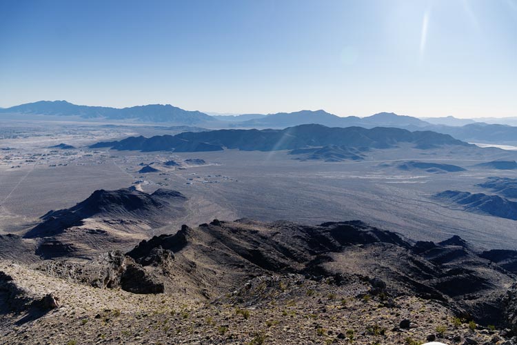
looking SW towards High Peak - the long dark ridge below the horizon
 |
Strava Page for High and Chance. 11-09-2023
Bob Burd's trip report for High and Chance. 11-09-2023
2023-11-10 We both drove a bit until piling into the Jeep to get to the first start. We started off with a loop of little peaks. 3343, 3404, and 3372. Each one seemed to have slightly different geology, limestone, a mix of Shale, Limestone, and quartzite, and the last peak was quartzite. Then we drove a bit until we were at a suitable camping site and Bob couldn't take watching me dodge every little rock that he could just drive right over. We piled into the Jeep to go up the road farther and then hiked up to tag Peak 3753 on the way up to 4140 (or maybe it was 4150 - depending on how you interpreted the contour lines)and Rocky Benchmark - these were 4140 and 4144 feet high, but maybe they had the numbers reversed since the first one seemed higher. They way from 3753 up to these was interesting with steep limetone to negotiate. Then we traversed a long way to the last peak of the day - Point of Rocks Peak at 3977 ft. This involved quite a lot of following sheep paths and trying to decide if it was easier to follow the ridge up and down or traverse around on the N side - the S side was usually a pretty massive cliff.
view N from the first peak
the second peak just touches the horizon on the center left with Peak 4112 behind and left of it
the third peak is below the horizon on the right
 |
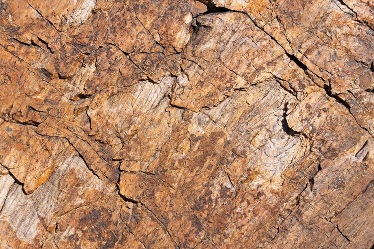
quartzite on the 3rd peak
 |
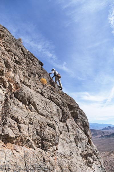
Bob scrambles up the limestone ridge
 |
view towards Pk 4150 on the way up
 |
prickly desert limestone on the way to Point of Rocks Peak
 |
From the summit we backtracked a bit and then dropped down a steep gully that went pretty well except for the bottom that featured steep consolidated scree with cobbles. You never knew when you put your foot down if it would stick or slide, and if it slid you didn't know how far it would slide. I find the easiest way to negotiate this is semi-dynamically preparing to take a few steps if you start sliding. This isn't a very good plan if your knee is messed up, and we might have heard some cursing and general terrain insults as Iris carefully picked her way down. Then Bob went ahead to loop around back to his Jeep and Iris and I cut straight across the desert towards where my truck was parked. We couldn't see it for much of the way as we crossed a series of gullies and I was quite pleased that it was almost directly in front of us when I finally sighted it again. We prepared for another hot water with sunshine rinse as Bob drove up with his Jeep. I walked his gallon of hot water (that had been sitting in my front window all day) and he rinsed a bit up the road. That night we saw a string of satellites above the N horizon, sadly they winked out before I got my camera and tripod out. We also saw a number of shooting stars that night - perhaps early Leonids. One surprising downside to this location was mosquitoes. I suppose they wafted over from wet spot relatively nearby (maybe associated with the Devil's Hole where the pupfish live?). I got a few bites on my ankles, but Iris got more on her face.
Strava Page for Rocky benchmark, point of rocks peak, plus. 11-10-2023
Bob Burd's page for Rocky benchmark, point of rocks peak, plus. 11-10-2023
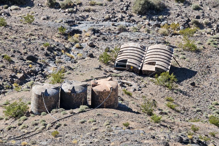
2023-11-11 Happy Memorial Day. We started off driving back up the road we went up the day before past where we parked and followed the wash and occasional roadway up until we were close to another peak. It was chilly hiking up this one, but eventually the uphill exercise and sun helped warm us up. Peak 3712 had a pretty sharp ridge at the summit. We could also see the next peak - Pupfish Peak (named for the Devil's Hole pupfish which lives not far from here). We decided on the center rib up through the limestone cliffs. Then we hiked back past the Jeep and headed up to the ridge. It was pretty easy to find a path past the little cliffs on the way up. Bob and Iris also saw a sheep hoof that I hiked right past paying attention to the route and terrain rather than pieces of sheep. This went up to a ridge which we followed up and around to the summit - with great views. Iris and I followed that ridge back around to the north and then west and back to near where we started the day before. Bob went down a different rib that he said turned out to be easier than the way up to recover the Jeep. He beat us down. Below the ridge there was a big watering station for presumably sheep with big tanks and a mostly covered pool for the animals or birds. I took some pics, but we didn't hike down to it. We went back down to the truck and then drove to the start of another Jeep road. I parked facing the sun again to heat water and then we went up the road to a suitable starting place.
Pupfish summit panorama, the center is northish
 |
water collecting and dispensing infrastructure on Pupfish
 |
Strava Page for pupfish - messed up tracking. 11-11-2023
Our afternoon peaks were 4112 and 3783. The former had 1,132 feet of prominence. We weren't sure which peak it was from the ground. I thought it was a closer peak than Bob did. It was pretty hot hiking up in the sun without much breeze. I tried to savor every little bit of shade available. Fortunately as we got up a lot higher we could see that what I thought was the peak actually was the peak. It still took us a while to get up, but at least things were a little cooler up there. Then we traversed along the ridge and around some bumps trying to follow sheep tracks where we could down to the saddle and then up to 3783. From here we were able to drop down the N ridge down into the wash. As we headed down Bob surged ahead saying he would get the Jeep and meet us where the wash hit the road. We saw a number of bones in this wash including some skull pieces. Then we drove back to the truck where Bob took his warm water and headed up the road and we rinsed there - finishing before anyone else drove up the road. Then we drove back to town to search for water - finally finding a spigot where the feed pipe for a coin operated water filter was in front of a gas station. We filled up our empty bottles and 2 of Bob's before heading out of town to meet up where we had camped last year when I did Last Chance High Point while Iris worked.
Iris hiking up 4112
 |
Iris carefully descending the ridge
 |
Strava Page for 4112 and 3783. 11-11-2023
Bob Burd's Page for pupfish, 4112, and 3783. 11-11-2023
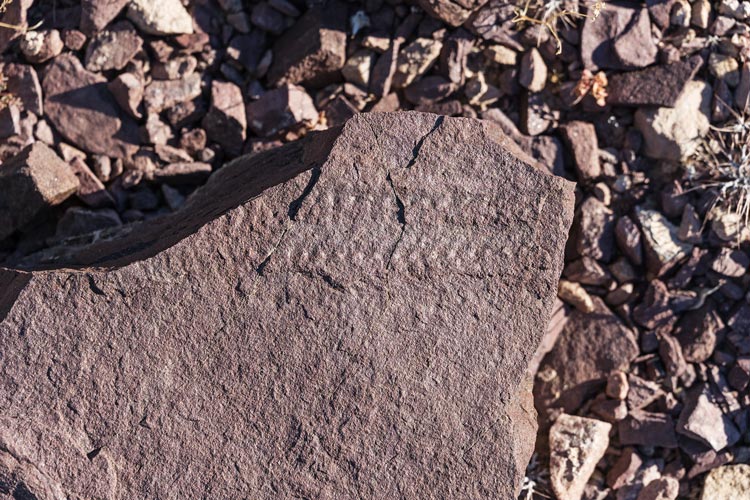
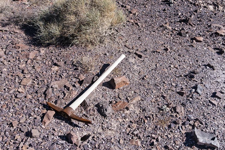
2023-11-12 We started off driving up an increasingly vague road towards Johnnie Range High Point. We actually got pretty close and then hiked up the ridge above where we parked and then the E ridge to the summit. Iris set a pretty fast pace up to the summit. This peak was another P1K and was mostly reddish quartzite. I found one set of tracks in it - perhaps a trilobite or something with a lot of legs. Then we had a long way to go to the next peak - we dropped down to the SW and followed the ridges and sheep paths down to the saddle and then up Peak 3986. This one had a mix of sandstone, quartzite, and shale. On the way down we saw 4 sheep running away from us and then a bit lower found a pickaxe that had been left by prospectors (we saw a number of test pits along this hike). Then we had to decide how to get back since we were now cutting across the drainages. We opted to go up for a bit before dropping down another ridge and then crossing a drainage and the last bit back to the Jeep.
fossil tracks
 |
things you find in the desert - a pickaxe
 |
Next up was the one peak on this trip I had already done - Last Chance Range Highpoint. I decided to join the others for that and then hopefully follow a different ridge down and over a bump that Bob had already done. The hiking across the desert towards the peak was pretty tedious (it was a little soft like sand, but maybe a caliche layer that collapsed when you stepped on it). We did see a tarantula walking along. I tried to get it to walk across my gloved hand, but it stopped when it got to it. Then when Iris goosed it with her trekking pole from behind it jumped over my hand - startingly quickly. Iris tried to get it to crawl onto her trekking pole until I reminded her of the canyon treefrog in Zion that jumped from her pole onto her.
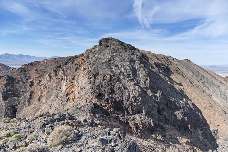
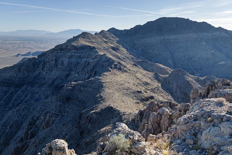
It was pretty hot hiking up the slope and there was a false summit on the way. The final ridge to the 4985 ft summit was pretty nice though. After signing the register and summitcookies we parted ways. I tried to go quickly descending a very steep slope/ridge finding sheep paths for much of it. Then I traversed around and in between peaks and cliffs trying to follow sheep paths. I surprised one sheep below a ridge - it looked at me for a bit and then took off running and I never saw it again. I kept looking back hoping to see Bob and Iris descending the ridge but I never did. Then I powered my way up North Chance Peak at 4610 ft. I looked for a register for a bit and then headed down the ridge. I followed sheep paths as best I could past some limestone cliffs with embedded chert nodules that looked like it would be fun to climb. Then headed down towards the road. I could see the Jeep off in the distance but couldn't see Bob or Iris. I decided to traverse around a bowl to a more gentle slope back to the road. I was only half a mile from the road or so when I could see dust from someone driving on the road - I calculated how fast I could run down to the road but didn't think I'd make it in time. I did hike fast though and it was pretty easy going. I managed to make it down to the road and just a few seconds later they came around the corner. It turns out the plume of dust was someone else driving around. We headed back for a hot water rinse, although the sun had set.
looking back at Last Chance Range High Point
 |
Bob's plans had changed so he had to head back this evening, so off he went. We burned the little firewood we had while eating a fairly massive dinner. I was able to partially melt some brass shells in the coals with the electric inflator blower and it felt much warmer that night - probably because we were warm when we went to bed.
Strava Page for Last Chance High Point Plus. 11-12-2023
Bob Burd's Page for Last Chance High Point Plus. 11-12-2023
2023-11-13 With Bob gone we did 2 more peaks he had already done. We weren't feeling very ambitious, so these worked out well. First up was Skull Peak rising some 500 feet above 95. Then we drove around past people shooting and hiked up Peak 3370. We tried to keep a ridge between us and the shooters, but weren't always successful. We rinsed off and then headed through Pahrump and to Vegas. There we headed to the Krazy Buffet to stuff ourselves with Asian food. It fit the bill perfectly and we managed not to cause ourselves too much pain - although I didn't need to eat until a late lunch the next day. Then we drove to the airport and I dropped Iris off to fly off for work. I headed back out of town and camped near Beatty a little bit up a lousy road.
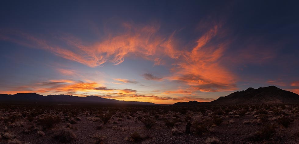
there was a nice sunrise
 |
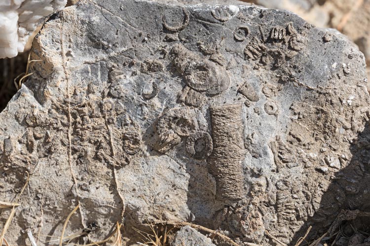
crinoid fossils on Skull Mountain
 |
Strava Page for Skull Peak and 3370. 11-13-2023
view of Pahrump area peaks from Mt Stirling (again for review)- (mouseover for letters)
A: High Peak, B: 3362, C: Chance BM
D: 3343, E: 3404, F: 3753, G: 4140/Rocky BM
H: 3712, I: Pupfish, J: 4112
K: Johnnie Range HP, L: 3986, M: Last Chance Range HP, N: North Chance Pk
O: Skull Peak
| |
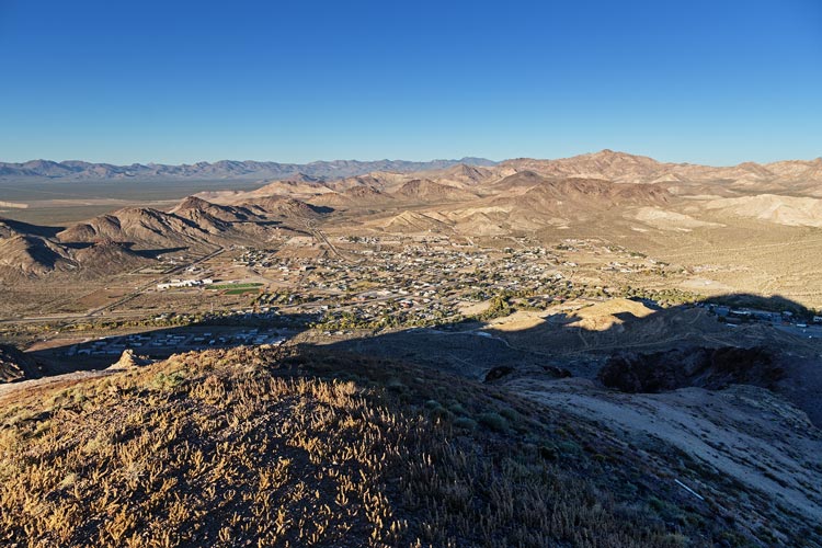
2023-11-14 I got up around sunrise and hiked up Beatty Peak. This had some nice views and was pretty chilly at first before I was in the sun. On the descent I looked at some old mining stuff and did a little work on the washed out road for the drive out (throwing a few rocks out of the way and breaking down some wash edges). It went smoother than the drive in, but I think I plowed at least a little with my hitch. Then I got NV gas and drove back to Bishop.
looking down over Beatty from Beatty Mountain
 |
Strava Page for Beatty Mountain. 11-14-2023
No material on this page may be copied or used without permission.